43:
31:
389:, who died in the year before the church was consecrated. The church is built in gritstone ashlar, using the Early English style; it consists of a chancel, nave, south porch and western bell-turret. The bell-turret is described in 1891 as containing a bell from the former church, showing a monogram and date: 1595 The church is currently Grade II listed.
181:
338:
of 1891 describes the village as a scattering of farmhouses and cottages in a parish of 1,214 acres, with a population of 138, and a rateable (taxable) value of £1,649. The land is described as "clayey, loamy and limely", mainly dairy pasture, but reports that most of the parish lies atop a bed of
385:, in May 1874 and is dedicated to Saint Philip and Saint James. It was built to replace an earlier parish church, dedicated to All Saints, and was built on a plot of land between the site of the old church, and the road (recorded as Church Lane, now called Atlow Lane). The church was designed by
331:"It is situated in a pleasant district on the river Dove, and from a lofty hill, called Magger's Bush, not far from the village, there is a fine prospect. The living is a perpetual curacy in the diocese of Lichfield, of the value of £148, in the patronage of C. H. Oakover, Esq."
307:
On 10 February 1629, six villagers from Atlow, including
William Cokayne and Valentine Jackson, were taken to the Chancery court by two church wardens of Bradbourne. The two men claimed it an ancient custom for all the parishioners of Atlow to pay for the repair of
366:. It became an independent civil parish in 1866, at which time the rectory had a net yearly value of £150, an average tithe rent-charge of £89. The rectory (residence) itself was in gift from H.C. Okeover esq. (of
95:
269:. According to the 2001 census the parish had a population of 98. At the 2011 Census the population remained less than 100. Details are included in the civil parish of
711:
205:
354:
The
National Mixed School was built in 1863 for a maximum of 60 children, but in 1891 had an average attendance of 33. The head was William Frederick Walker.
347:
were "very abundant". Kelly records the rector as Rev. James
Sheldon (who had held the position since 1885), the Lord of the Manor as H.C. Okeover esq. (of
316:), but that the villagers had not been paying it. The following year the court decided that the inhabitants of Atlow were to pay annually 5s. 6d. per
68:
716:
382:
351:, Stafforshire -approx 5 miles away), as the principal land owners as Mr. Twigge, a Mr. Melland, a Mr. Grundy, and a Mr. T. Tomlinson.
297:. The village is recorded as containing ploughland for 2, 4 acres of meadow, 0.5 leagues of woodland, and 3 furlongs of mixed measures.
193:
628:
198:
482:
309:
623:
229:
706:
210:
165:
131:
495:
61:
239:
426:
42:
721:
398:
234:
430:
145:
30:
186:
667:
77:
386:
289:
lists Atlow as in the possession of
Aelfric of Bradbourne in 1066 with a value of £1. By 1086 the
462:
113:
320:(15 acres) to Bradbourne for repairs; but they were not to be charged for any previous arrears.
526:
478:
313:
619:
294:
258:
170:
85:
418:
700:
658:
378:
290:
286:
121:
367:
348:
254:
282:
653:
503:
596:
454:
363:
301:
262:
103:
682:
669:
293:
records the village's value had fallen to £0.1, and was in the possession of
344:
340:
270:
155:
580:
Kelly's
Directory of the Counties of Derby, Notts, Leicester and Rutland
442:
No burial mound is known here, but the reference may be to a nearby hill
458:
370:, Staffordshire, approximately 5 miles away) and came with 15 acres of
137:
317:
266:
371:
453:
Henry was given a large number of manors in
Derbyshire including
624:"Church of St Phillip and St James (Grade II) (1335199)"
550:
The
National Gazetteer of Great Britain and Ireland
204:
192:
180:
164:
154:
144:
130:
112:
94:
76:
60:
52:
23:
325:National Gazetteer of Great Britain and Ireland
362:Atlow was historically part of the parish of
300:Atlow was, until 1866, part of the parish of
8:
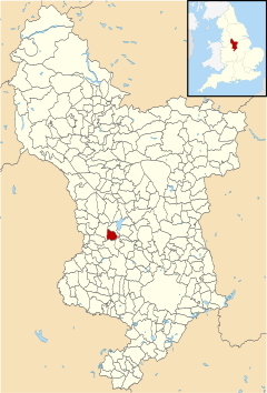
47:Atlow parish highlighted within Derbyshire
20:
614:
612:
610:
285:for "Eatta's burial mound or hill". The
712:Towns and villages of the Peak District
573:
571:
569:
567:
565:
563:
561:
559:
410:
175:
153:
129:
59:
39:
27:
591:
589:
475:Domesday Book: A Complete Translation
265:, England, about eight miles west of
203:
191:
179:
163:
143:
111:
93:
75:
7:
528:Churches of Derbyshire: Bradbourne:
629:National Heritage List for England
429:/Institute of Name Studies at the
383:George Selwyn, Bishop of Lichfield
14:
41:
29:
310:the parish church at Bradbourne
281:The name Atlow is derived the
1:
717:Civil parishes in Derbyshire
62:OS grid reference
18:Human settlement in England
738:
427:English Place Name Society
423:Key to English Place-names
327:, Atlow is described thus:
477:. London: Penguin, 2003.
399:Listed buildings in Atlow
220:
216:
176:
40:
28:
431:University of Nottingham
707:Villages in Derbyshire
333:
166:Postcode district
329:
339:Coal, and that both
146:Sovereign state
679: /
381:was consecrated by
578:Kelly (May 1891).
582:. pp. 32–33.
336:Kelly's Directory
314:Bradbourne Priory
253:is a village and
248:
247:
96:Shire county
729:
722:Derbyshire Dales
694:
693:
691:
690:
689:
684:
683:53.037°N 1.657°W
680:
677:
676:
675:
672:
641:
640:
638:
636:
620:Historic England
616:
605:
604:
593:
584:
583:
575:
554:
553:
546:
540:
539:
537:
535:
525:Cox, J. (1875).
522:
516:
515:
513:
511:
502:. Archived from
492:
486:
472:
466:
451:
445:
444:
439:
437:
415:
295:Henry de Ferrers
259:Derbyshire Dales
226:
140:
86:Derbyshire Dales
72:
71:
45:
33:
21:
737:
736:
732:
731:
730:
728:
727:
726:
697:
696:
687:
685:
681:
678:
673:
670:
668:
666:
665:
650:
645:
644:
634:
632:
618:
617:
608:
595:
594:
587:
577:
576:
557:
548:
547:
543:
533:
531:
524:
523:
519:
509:
507:
494:
493:
489:
473:
469:
452:
448:
435:
433:
417:
416:
412:
407:
395:
360:
279:
244:
224:
136:
126:
108:
90:
67:
66:
48:
36:
19:
12:
11:
5:
735:
733:
725:
724:
719:
714:
709:
699:
698:
688:53.037; -1.657
663:
662:
649:
648:External links
646:
643:
642:
606:
585:
555:
541:
517:
506:on 26 May 2013
487:
467:
446:
409:
408:
406:
403:
402:
401:
394:
391:
359:
356:
278:
275:
246:
245:
243:
242:
237:
232:
227:
225:List of places
221:
218:
217:
214:
213:
208:
202:
201:
196:
190:
189:
184:
178:
177:
174:
173:
168:
162:
161:
158:
152:
151:
150:United Kingdom
148:
142:
141:
134:
128:
127:
125:
124:
118:
116:
110:
109:
107:
106:
100:
98:
92:
91:
89:
88:
82:
80:
74:
73:
64:
58:
57:
56:98 (2001)
54:
50:
49:
46:
38:
37:
34:
26:
25:
17:
13:
10:
9:
6:
4:
3:
2:
734:
723:
720:
718:
715:
713:
710:
708:
705:
704:
702:
695:
692:
661:
660:
659:Domesday Book
655:
652:
651:
647:
631:
630:
625:
621:
615:
613:
611:
607:
602:
598:
592:
590:
586:
581:
574:
572:
570:
568:
566:
564:
562:
560:
556:
551:
545:
542:
530:
529:
521:
518:
505:
501:
497:
491:
488:
484:
483:0-14-143994-7
480:
476:
471:
468:
464:
460:
456:
450:
447:
443:
432:
428:
424:
420:
414:
411:
404:
400:
397:
396:
392:
390:
388:
387:H. I. Stevens
384:
380:
379:parish church
375:
373:
369:
365:
358:Parish church
357:
355:
352:
350:
346:
342:
337:
332:
328:
326:
321:
319:
315:
311:
305:
303:
298:
296:
292:
291:Domesday book
288:
287:Domesday book
284:
276:
274:
272:
268:
264:
260:
256:
252:
241:
238:
236:
233:
231:
228:
223:
222:
219:
215:
212:
211:East Midlands
209:
207:
200:
197:
195:
188:
185:
183:
172:
169:
167:
159:
157:
149:
147:
139:
135:
133:
123:
122:East Midlands
120:
119:
117:
115:
105:
102:
101:
99:
97:
87:
84:
83:
81:
79:
70:
65:
63:
55:
51:
44:
32:
22:
16:
664:
657:
633:. Retrieved
627:
600:
579:
549:
544:
532:. Retrieved
527:
520:
508:. Retrieved
504:the original
500:Domesday Map
499:
490:
474:
470:
449:
441:
434:. Retrieved
422:
413:
377:The current
376:
368:Okeover Hall
361:
353:
349:Okeover Hall
335:
334:
330:
324:
323:In the 1868
322:
312:(the former
306:
299:
280:
261:district of
255:civil parish
250:
249:
35:Atlow church
15:
686: /
283:Old English
701:Categories
671:53°02′13″N
635:8 November
455:Tissington
405:References
364:Bradbourne
302:Bradbourne
263:Derbyshire
240:Derbyshire
199:Derbyshire
187:Derbyshire
104:Derbyshire
53:Population
674:1°39′25″W
436:22 August
345:Ironstone
341:Limestone
271:Hognaston
206:Ambulance
160:ASHBOURNE
156:Post town
393:See also
78:District
69:SK230489
656:in the
597:"Atlow"
552:. 1868.
534:6 April
496:"Atlow"
459:Shottle
419:"Atlow"
277:History
257:in the
235:England
138:England
132:Country
601:Genuki
481:
463:Cowley
374:land.
318:oxgang
267:Belper
182:Police
114:Region
654:Atlow
510:4 May
485:p.745
372:Glebe
251:Atlow
24:Atlow
637:2023
536:2013
512:2013
479:ISBN
461:and
438:2013
343:and
194:Fire
171:DE6
703::
626:.
622:.
609:^
599:.
588:^
558:^
498:.
457:,
440:.
425:.
421:.
304:.
273:.
230:UK
639:.
603:.
538:.
514:.
465:.
Text is available under the Creative Commons Attribution-ShareAlike License. Additional terms may apply.