384:
a low, round cairn, retained by a kerb. A tall stone at W, splits the entry to the gallery which seems to have been divided into a short portico and main chamber. There are buttress stones along both sides of the gallery. During the excavation both inhumed and cremated bone, in association with beaker and food-vessel pottery, were recovered from below the cairn and inside the gallery under a rough paving. Three cist burials were found at the inner edge of the kerb. (de Valera and Ó Nualláin 1972, 115-6, No. 14; Channing 1993, 4; O'Donovan 1995, 2, no. 7)
46:
148:
The occupiers of the townland in 1586 were
Garrett McGovern, son of Edmund McGovern and grandson of Sean Glas McGovern and also Giolla Ruadh McGovern, son of the above Garrett McGovern, both receiving a pardon for fighting against the Queen's forces in the Fiants of Queen Elizabeth I (No. 4813) dated
383:
Originally sited on Church Hill at the SE flank of Slieve Rushen (see CV010-005----), this tomb was excavated in 1992 in advance of quarrying operations and re-erected in the grounds of the Slieve
Russell Hotel near Ballyconnell. It consists of a ruined gallery, some 6m long, aligned WSW-ENE, set in
161:
which was granted to Hugh Culme in 1610). By
Letters Patent dated 25 January 1627 Aughrim was granted to Martin Baxter, the first Church of Ireland rector of Tomregan parish and since then it passed down as part of the glebe lands belonging to the Rectory of Tomregan. A hill in the townland is named
201:
School's
Collection at a story by Mr J. McCabe in 1938 relates a fairytale that occurred in Aughrim. Another such story in the same collection by Mr P. Gallen, Aughrim at and about a hidden treasure at. The collection also relates stories of Mass being said in the caves of Aughrim under the
193:
of 1857 lists the landlord of the townland as the
Reverend Henry James Erskine and the tenants as Drum, Reilly, Prior, O’Donnell, Donohoe, McTeague and Heavy. The Rev. Erskine was rector of Tomregan at the time which shows the townland still belonged to Tomregan Church.
451:
584:
149:
19 January 1586. However the land seemed to belong to the Roman
Catholic church as it did not form part of the original Ulster Plantation grants and was reserved for the Protestant Church, (The lands of
133:
mountain, on whose south-eastern slope it lies, reaching an altitude of 1,005 feet above sea-level. The townland is traversed by
Aughrim Lane. Aughrim covers an area of 247 statute acres.
447:
535:
381:
townland due to quarrying operations, (Site number 7, page 2, Aughrim townland, in "Archaeological
Inventory of County Cavan", Patrick O’Donovan, 1995, where it is described as-
743:
136:
A quarry serving the Quinn
Building Products company is located approximately in the centre of the townland and extends across the border to Northern Ireland into
61:
which means 'Horse Hill'. The oldest surviving mention of the name is in the Fiants of Queen
Elizabeth I (No. 4813) dated 19 January 1586 where it is spelled
377:
The only historic site in the townland was a prehistoric wedge tomb but this was excavated in 1992 and moved to the grounds of the Slieve Russell hotel in
184:
The Tithe Applotment Books for 1827 list the following tithepayers in the townland- Donohoe, Francis, Prior, Reilly, Cusker, Heavey, Clerk, Drum.
162:'Church Hill', either in honour of this ownership or because it originally belonged to the medieval Catholic church in the adjoining townland of
782:
129:
townland. Its chief geographical features are swallow holes, limestone caves containing stalactites including Pollnagollum Cave and
501:
Calendar of the Patent and Close Rolls of Chancery in Ireland, of the Reign of Charles the First: First to Eighth Year, Inclusive--
386:). It was one of only two megalithic structures in Tomregan parish; the only one now remaining in situ is the court-cairn in
572:
560:
548:
708:
665:
652:
406:
359:
366:
190:
420:
625:
680:
694:
514:'Churches and Priests of Knockninny' in Breifne Journal 1959 (Vol.1, no. 2), p.147 Rev. Terence Small
203:
39:
387:
470:
A Directory to the Market Towns: Villages, Gentlemen's Seats, and Other Noted Places in Ireland
499:
468:
177:
In the Hearth Money Rolls compiled on 29 September 1663 there were four Hearth Tax payers in
66:
526:, edited by Rev. Francis J. McKiernan, in Breifne Journal. Vol. I, No. 3 (1960), pp. 247-263
455:
434:
45:
776:
130:
90:
163:
35:
166:. The 1652 Commonwealth Survey lists the townland as belonging to the Cromwellian
639:
524:
The Hearth Money Rolls for the Baronies of Tullyhunco and Tullyhaw, County Cavan
126:
78:
611:
597:
179:
Aghrym- Owen McGillehooly, Cormucke Magawran, Manus McCanany and Patricke White
154:
137:
758:
745:
484:
378:
114:
198:
187:
The Aughrim Valuation Office Field books are available for February 1840.
122:
118:
31:
27:
23:
113:
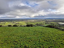
It is bounded on the north and east by the international border with
485:"Deputy Keeper of Public Records in Ireland : Fifteenth report"
735:
153:
granted to the Culme family referred to the townland of Aughrim in
448:
A list of the several baronies and parishes in the county of Cavan
158:
44:
57:
The townland name is an anglicisation of the Gaelic placename
709:"AUGHRIM WEDGE TOMB/MEGALITHIC MONUMENTS OF IRELAND.COM"
612:"Béal Átha Conaill (C.) | the Schools' Collection"
598:"Béal Átha Conaill (C.) | the Schools' Collection"
157:
parish which formed part of the Dougbally Manor beside
681:"Unpublished Excavations: BRONZE AGE BURIAL PRACTICES"
174:
who was probably a descendant of the 1586 occupiers.
362:, there are seven families listed in the townland.
101:. Ambrose Leet's 1814 Directory spells the name as
640:"Ballyconnell (B.) | the Schools' Collection"
97:. The 1790 Cavan Carvaghs list spells the name as
435:"Down Survey Maps | the Down Survey Project"
421:"Down Survey Maps | the Down Survey Project"
369:, there are ten families listed in the townland.
8:
587:Griffith's Valuation 1857 askaboutireland.ie
73:. The 1652 Commonwealth Survey spells it as
695:"Prehistoric and Early Ireland @ / - Home"
85:. The 1663 Hearth Money Rolls spell it as
213:
398:
504:. H.M. Stationery Office. p. 187.
117:and Northern Ireland, on the south by
7:
713:www.megalithicmonumentsofireland.com
14:
16:Townland in County Cavan, Ireland
736:The IreAtlas Townland Data Base
181:, all of whom had one hearth.
140:townland in County Fermanagh.
1:
407:"The Baronie of Tollagh Aghe"
125:townlands and on the west by
537:Tithe Applotment Books 1827
799:
783:Townlands of County Cavan
93:'s 1685 map spells it as
473:. B. Smith. p. 131.
168:Commonwealth of England
69:map spells the name as
667:Census of Ireland 1911
654:Census of Ireland 1901
367:1911 census of Ireland
360:1901 census of Ireland
49:
498:James Morrin (1863).
467:Ambrose Leet (1814).
48:
759:54.13806°N 7.58611°W
454:6 April 2016 at the
204:Penal Laws (Ireland)
191:Griffith's Valuation
755: /
764:54.13806; -7.58611
170:and the tenant as
50:
626:"Hidden Treasure"
575:National Archives
563:National Archives
551:National Archives
356:
355:
81:map spells it as
67:Ulster Plantation
26:in the Parish of
790:
770:
769:
767:
766:
765:
760:
756:
753:
752:
751:
748:
724:
723:
721:
719:
705:
699:
698:
691:
685:
684:
677:
671:
663:
657:
650:
644:
643:
636:
630:
629:
622:
616:
615:
608:
602:
601:
594:
588:
582:
576:
570:
564:
558:
552:
546:
540:
533:
527:
521:
515:
512:
506:
505:
495:
489:
488:
481:
475:
474:
464:
458:
445:
439:
438:
431:
425:
424:
417:
411:
410:
403:
214:
798:
797:
793:
792:
791:
789:
788:
787:
773:
772:
763:
761:
757:
754:
749:
746:
744:
742:
741:
732:
727:
717:
715:
707:
706:
702:
693:
692:
688:
679:
678:
674:
664:
660:
651:
647:
638:
637:
633:
624:
623:
619:
610:
609:
605:
596:
595:
591:
583:
579:
571:
567:
559:
555:
547:
543:
534:
530:
522:
518:
513:
509:
497:
496:
492:
483:
482:
478:
466:
465:
461:
456:Wayback Machine
446:
442:
433:
432:
428:
419:
418:
414:
405:
404:
400:
396:
375:
212:
146:
111:
55:
17:
12:
11:
5:
796:
794:
786:
785:
775:
774:
739:
738:
731:
730:External links
728:
726:
725:
700:
686:
672:
658:
645:
631:
617:
603:
589:
577:
565:
553:
541:
528:
516:
507:
490:
476:
459:
450:Cavan Library
440:
426:
412:
409:. 14 May 2018.
397:
395:
392:
374:
371:
354:
353:
350:
347:
344:
341:
338:
334:
333:
330:
327:
324:
321:
318:
314:
313:
310:
307:
304:
301:
298:
294:
293:
290:
287:
284:
281:
278:
274:
273:
270:
267:
264:
261:
258:
254:
253:
250:
247:
244:
241:
238:
234:
233:
230:
227:
224:
221:
218:
211:
208:
145:
142:
110:
107:
54:
51:
15:
13:
10:
9:
6:
4:
3:
2:
795:
784:
781:
780:
778:
771:
768:
737:
734:
733:
729:
714:
710:
704:
701:
696:
690:
687:
682:
676:
673:
670:
668:
662:
659:
656:
655:
649:
646:
641:
635:
632:
627:
621:
618:
613:
607:
604:
599:
593:
590:
586:
581:
578:
574:
569:
566:
562:
557:
554:
550:
545:
542:
539:
538:
532:
529:
525:
520:
517:
511:
508:
503:
502:
494:
491:
486:
480:
477:
472:
471:
463:
460:
457:
453:
449:
444:
441:
436:
430:
427:
422:
416:
413:
408:
402:
399:
393:
391:
389:
385:
380:
372:
370:
368:
363:
361:
351:
348:
345:
342:
339:
336:
335:
331:
328:
325:
322:
319:
316:
315:
311:
308:
305:
302:
299:
296:
295:
291:
288:
285:
282:
279:
276:
275:
271:
268:
265:
262:
259:
256:
255:
251:
248:
245:
242:
239:
236:
235:
231:
229:Total Houses
228:
225:
222:
219:
216:
215:
209:
207:
205:
200:
195:
192:
188:
185:
182:
180:
175:
173:
169:
165:
160:
156:
152:
143:
141:
139:
134:
132:
131:Slieve Rushen
128:
124:
120:
116:
108:
106:
104:
100:
96:
92:
91:William Petty
88:
84:
80:
76:
72:
68:
64:
60:
52:
47:
43:
41:
37:
33:
29:
25:
21:
740:
716:. Retrieved
712:
703:
689:
675:
666:
661:
653:
648:
634:
620:
606:
592:
580:
568:
556:
544:
536:
531:
523:
519:
510:
500:
493:
479:
469:
462:
443:
429:
415:
401:
382:
376:
364:
357:
232:Uninhabited
196:
189:
186:
183:
178:
176:
172:Dun Magawran
171:
167:
164:Knockateggal
150:
147:
135:
112:
102:
98:
94:
86:
82:
74:
70:
62:
58:
56:
36:County Cavan
30:, Barony of
19:
18:
762: /
373:Antiquities
220:Population
127:Snugborough
79:Down Survey
77:. The 1659
65:. The 1609
747:54°08′17″N
718:12 January
394:References
390:townland.
155:Drumreilly
138:Gortmullan
59:Each Druim
750:7°35′10″W
379:Cranaghan
115:Fermanagh
109:Geography
53:Etymology
777:Category
452:Archived
226:Females
123:Mucklagh
119:Gortawee
63:Augherym
32:Tullyhaw
28:Tomregan
24:townland
585:Aughrim
487:. 1883.
365:In the
358:In the
197:In the
151:Aughrin
144:History
95:Agharin
83:Agharim
40:Ireland
20:Aughrim
573:Census
561:Census
549:Census
223:Males
210:Census
199:Dúchas
121:&
103:Aharim
99:Aghrim
87:Aghrym
75:Aghrom
71:Aghrim
217:Year
159:Dowra
22:is a
720:2024
388:Doon
337:1891
317:1881
297:1871
277:1861
257:1851
237:1841
779::
711:.
352:0
346:20
343:21
340:41
332:0
326:19
323:26
320:45
312:0
306:20
303:17
300:37
292:0
289:10
286:17
283:20
280:37
272:0
266:18
263:26
260:44
252:0
249:10
246:29
243:45
240:74
206:.
105:.
89:.
42:.
38:,
34:,
722:.
697:.
683:.
669:.
642:.
628:.
614:.
600:.
437:.
423:.
349:8
329:9
309:8
269:9
Text is available under the Creative Commons Attribution-ShareAlike License. Additional terms may apply.