643:
589:
603:
627:
615:
47:
33:
75:
525:. Shortly thereafter the Barnes family took up residence around Bell Shoals. These early settlers were able to claim land under the "Armed Occupation Act of Florida" which was passed in 1842 and granted 160 acres of land to any head of family or any single man who would bear arms and live on the land in a house for five years. By 1867, a ferry was operated by a Methodist preacher Reverend LeRoy Lesley. A second ferry near Lithia Springs was operated by John Carney.
1797:
82:
54:
436:
521:. The 'Alafia' is a native word meaning "River of Fire", likely due to the river glowing at night due to high phosphoric content. After the end of the Second Seminole War, white settlers began to arrive, starting with Benjamin Moody in 1843. They settled on the South side of the river around what is now US Highway 301 at the site that later became known as
482:, which opened in 2005. The river is formed by two prongs. The north prong starts south of Mulberry and runs for 23.9 miles until it meets the south prong in Lithia. The south prong begins south of Bradley Junction and continues for 28.7 miles. The combined river then flows 24.7 miles west into Tampa Bay.
569:
took over maintenance of the stack. In 2007, the cost of closing both stacks was estimated to be $ 48 million, which will be paid to Mosaic by the
Florida Department of Environmental Protection. After closure, Mosaic will be responsible for maintaining the stacks for the next 50 years. In 2016 an
564:
In 1997 a dam atop a gypsum stack at a
Mulberry Phosphates fertilizer plant broke, spilling 56 million gallons of acidic wastewater into the North Fork of the Alafia. Virtually everything in the 42 miles between Mulberry and Hillsborough Bay was killed. In addition to killing millions of fish and
570:
additional 215 million gallons entered the aquifer through the stack through a sinkhole. Mosaic publicly stated that no additional water would be released into the Alafia, but soon thereafter started diluting and releasing additional water contaminated with phosphates into the river.
565:
hundreds of acres of vegetation, the spill dumped 350 tons of nitrogen into Tampa Bay. Rather than pay fines, Mulberry
Phosphates declared bankruptcy. Five years later, only $ 3.7 million was recovered from the company's insurance company. In 2002,
642:
517:
and visited the
Indians, making the first written account and charting the first maps of the Alafia River. On an early map the name 'Alafia' does not appear, but rather the translation,
1838:
1923:
528:
Due to the river's tendency to undergo moderate to high-level flooding approximately twice a year, numerous residences in the vicinity have been constructed on stilts.
1908:
1599:
1164:
920:
602:
626:
1884:
880:
1831:
1028:
1426:
673:
614:
1913:
1604:
582:. He described the moon shot taking place from 1,800-foot bluffs overlooking the Alafia, around what is now today's Bell Shoals Nature Preserve.
1824:
1471:
1154:
494:. From their settlement at the mouth of the river to their hunting camps upstream, the Indians left traces of their lives and activities. The
46:
1654:
171:
1476:
588:
248:
74:
1466:
1235:
548:, the Alafia Scrub Nature Preserve and the Riverview Civic Center. Williams Park and Mosaic Park are on the river near its mouth. The
1776:
1771:
1731:
1700:
479:
1918:
1371:
762:
1877:
1756:
1609:
541:
906:
1021:
699:
859:
1169:
990:
1928:
1804:
1431:
1174:
1099:
545:
451:
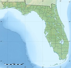
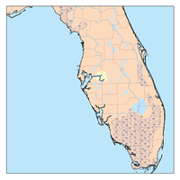
130:
1870:
1421:
927:
789:
510:
1903:
1064:
1014:
968:
1751:
1675:
1310:
1416:
1144:
506:
1644:
1366:
1361:
1270:
1195:
803:
537:
32:
1511:
1486:
1396:
1205:
1104:
1741:
1670:
1614:
1594:
1546:
1506:
1491:
1461:
1260:
1220:
1210:
1134:
1089:
841:
1436:
1376:
1356:
1084:
1069:
553:
549:
1761:
1746:
1629:
1531:
1441:
1305:
1074:
953:
1715:
1566:
1536:
1406:
1336:
1054:
817:
566:
234:
775:
498:
occupied the area around the mouth of the Alafia in the 16th century and were believed to speak
1446:
1411:
1300:
1295:
1200:
1119:
758:
1854:
1808:
1766:
1624:
1589:
1551:
1386:
1351:
1275:
728:
594:
355:
336:
323:
222:
1705:
1685:
1639:
1526:
1521:
1516:
1401:
1265:
1255:
1149:
1124:
1109:
1695:
1680:
1619:
1456:
1391:
1381:
1245:
1230:
1159:
578:
Jules Verne used the Alafia as the site of the fictional moon launch in his 1865 novel
447:
371:
363:
1897:
1710:
1649:
1561:
1556:
1501:
1496:
1451:
1341:
1285:
1280:
1139:
1094:
1079:
1059:
1049:
522:
110:
1796:
1634:
1571:
1541:
1346:
1290:
1250:
1225:
1114:
1006:
881:"Less than one year after historic flooding, Alafia River spills its banks again"
1690:
1481:
1215:
1190:
217:
1736:
1240:
429:
S County Road 39, Lithia
Pinecrest Road, Bell Shoals Road, US 301, I-75, US 41
263:
250:
186:
173:
1315:
1129:
633:
514:
455:
435:
359:
490:
For centuries the Alafia was home to various native tribes, including the
499:
491:
120:
495:
471:
753:
Lamm, Greg. 1990. Alafia River. in Marth, Del and Marty Marth, eds.
475:
467:
463:
860:"PIONEERING ON THE LOWER ALAFIA AND THE EARLY SETTLEMENT OF PERU"
459:
1010:
478:. During the rainy season, excess water is pumped to the new
969:"Mosaic's Contaminated Water Discharged into Alafia River"
926:. Polk County Environmental Lands Program. Archived from
335:
315.84 cu ft/s (8.944 m/s) at mouth with
1858:
1812:
954:"Alafia River Appears to Have Healed After Acid Spill"
159:
about 1.5 miles north-northeast of
Pinecrest, Florida
790:"Alafia River - South Prong - Tampa Bay Water Atlas"
776:"Alafia River - North Prong - Tampa Bay Water Atlas"
536:
149:
Confluence of North and South Prongs of Alafia River
1724:
1663:
1580:
1324:
1183:
1042:
425:
411:
389:
381:
369:
351:
346:
329:
317:
309:
297:
289:
279:
240:
228:
216:
202:
163:
153:
145:
136:
126:
116:
106:
101:
21:
991:"Facts And Legends From The Shores Of The Alafia"
1853:This article related to a river in Florida is a
1878:
1832:
1022:
505:In the sixteenth century, the expeditions of
8:
1924:Hillsborough County, Florida geography stubs
608:On the Alafia River near Lithia Springs Park
757:. Sarasota, Florida: Pineapple Press, Inc.
723:
721:
1885:
1871:
1839:
1825:
1029:
1015:
1007:
853:
851:
842:"The History of Native Americans in Tampa"
434:
658:
584:
1909:Rivers of Hillsborough County, Florida
804:"Alafia River - Tampa Bay Water Atlas"
668:
666:
664:
662:
446:is 25 miles (40 km) long, with a
18:
674:"Geographic Names Information System"
450:of 335 square miles (870 km) in
301:400.84 square miles (1,038.2 km)
7:
1850:
1848:
1793:
1791:
967:Andrews, Steve (December 17, 2016).
81:
53:
458:. The watershed contains ten named
1857:. You can help Knowledge (XXG) by
1811:. You can help Knowledge (XXG) by
1701:St. Johns-Indian River Barge Canal
907:"Canoe Trip Down the Alafia River"
480:C.W. Bill Young Regional Reservoir
14:
989:Nelson, Charles (March 8, 2021).
648:Lithia Springs Park swimming area
1795:
1757:List of major springs in Florida
1037:Significant waterways of Florida
952:Palmer, Tom (December 9, 2007).
641:
625:
613:
601:
587:
89:Alafia River (the United States)
80:
73:
52:
45:
31:
858:Frazier, Norma Goolsby (1992).
729:"Alafia River Watershed Report"
620:Hurrah Lake on the Alafia River
16:River in Florida, United States
1914:Rivers of Polk County, Florida
818:"Alafia River Watershed, 2001"
636:near the State Park campground
513:explored the coastal areas of
454:, United States, flowing into
242: • coordinates
165: • coordinates
61:Location of Alafia River mouth
1:
542:Alderman's Ford Regional Park
293:48.49 mi (78.04 km)
137:Physical characteristics
92:Show map of the United States
25:Tributary to Hillsborough Bay
1805:Hillsborough County, Florida
546:Lithia Springs Regional Park
452:Hillsborough County, Florida
281: • elevation
204: • elevation
319: • location
230: • location
155: • location
1945:
1847:
1790:
1772:Outstanding Florida Waters
580:From the Earth to the Moon
331: • average
1732:Coastal waters of Florida
1676:Cross Florida Barge Canal
1600:Blackwater (Hillsborough)
342:
305:
212:
141:
39:
30:
1919:Tributaries of Tampa Bay
700:"ArcGIS Web Application"
417:North Prong Alafia River
413: • right
395:South Prong Alafia River
538:Alafia River State Park
391: • left
1807:location article is a
1752:List of Florida rivers
1432:Little Econlockhatchee
921:"Alafia River Reserve"
680:. US Geological Survey
439:
208:38 ft (12 m)
1742:Intracoastal Waterway
1671:Canaveral Barge Canal
1422:Little (Biscayne Bay)
1170:Withlacoochee (South)
1165:Withlacoochee (North)
755:The Rivers of Florida
678:edits.nationalmap.gov
438:
401:Little Fishhawk Creek
264:27.85306°N 82.40028°W
187:27.86278°N 82.13889°W
1427:Little (Ochlockonee)
550:Alafia River Reserve
285:0 ft (0 m)
1929:Florida river stubs
1762:Okeechobee Waterway
1747:Indian River Lagoon
704:epa.maps.arcgis.com
347:Basin features
269:27.85306; -82.40028
260: /
192:27.86278; -82.13889
183: /
64:Show map of Florida
1716:Tampa Bypass Canal
507:Pánfilo de Narváez
440:
235:Gibsonton, Florida
1904:Rivers of Florida
1866:
1865:
1820:
1819:
1785:
1784:
1605:Blackwater (Lake)
1206:East Tohopekaliga
733:watersgeo.epa.gov
433:
432:
399:McCollough Branch
1936:
1887:
1880:
1873:
1849:
1841:
1834:
1827:
1799:
1792:
1767:Okefenokee Swamp
1031:
1024:
1017:
1008:
1002:
1001:
999:
997:
986:
980:
979:
977:
975:
964:
958:
957:
949:
943:
942:
940:
938:
933:on March 4, 2016
932:
925:
917:
911:
910:
903:
897:
896:
894:
892:
877:
871:
870:
868:
866:
855:
846:
845:
838:
832:
831:
829:
828:
814:
808:
807:
800:
794:
793:
786:
780:
779:
772:
766:
751:
745:
744:
742:
740:
725:
716:
715:
713:
711:
696:
690:
689:
687:
685:
670:
645:
629:
617:
605:
595:Great blue heron
591:
560:Phosphate spills
511:Hernando de Soto
414:
392:
374:
356:Hillsborough Bay
337:Hillsborough Bay
332:
324:Hillsborough Bay
320:
275:
274:
272:
271:
270:
265:
261:
258:
257:
256:
253:
223:Hillsborough Bay
205:
198:
197:
195:
194:
193:
188:
184:
181:
180:
179:
176:
166:
156:
93:
84:
83:
77:
65:
56:
55:
49:
35:
19:
1944:
1943:
1939:
1938:
1937:
1935:
1934:
1933:
1894:
1893:
1892:
1891:
1846:
1845:
1788:
1786:
1781:
1720:
1706:St. Lucie Canal
1686:Hillsboro Canal
1659:
1582:
1576:
1492:Pithlachascotee
1472:New (Carabelle)
1320:
1179:
1090:Econlockhatchee
1038:
1035:
1005:
995:
993:
988:
987:
983:
973:
971:
966:
965:
961:
951:
950:
946:
936:
934:
930:
923:
919:
918:
914:
905:
904:
900:
890:
888:
885:Tampa Bay Times
879:
878:
874:
864:
862:
857:
856:
849:
844:. 18 July 2017.
840:
839:
835:
826:
824:
816:
815:
811:
802:
801:
797:
788:
787:
783:
774:
773:
769:
752:
748:
738:
736:
727:
726:
719:
709:
707:
698:
697:
693:
683:
681:
672:
671:
660:
656:
649:
646:
637:
630:
621:
618:
609:
606:
597:
592:
576:
562:
556:near Mulberry.
534:
488:
466:, and 29 named
420:
418:
412:
406:
404:
402:
400:
398:
397:McDonald Branch
396:
390:
370:
330:
318:
282:
268:
266:
262:
259:
254:
251:
249:
247:
246:
243:
231:
203:
191:
189:
185:
182:
177:
174:
172:
170:
169:
164:
154:
97:
96:
95:
94:
91:
90:
87:
86:
85:
68:
67:
66:
63:
62:
59:
58:
57:
26:
23:
17:
12:
11:
5:
1942:
1940:
1932:
1931:
1926:
1921:
1916:
1911:
1906:
1896:
1895:
1890:
1889:
1882:
1875:
1867:
1864:
1863:
1844:
1843:
1836:
1829:
1821:
1818:
1817:
1800:
1783:
1782:
1780:
1779:
1777:Paynes Prairie
1774:
1769:
1764:
1759:
1754:
1749:
1744:
1739:
1734:
1728:
1726:
1722:
1721:
1719:
1718:
1713:
1708:
1703:
1698:
1696:Mud Lake Canal
1693:
1688:
1683:
1681:Haulover Canal
1678:
1673:
1667:
1665:
1661:
1660:
1658:
1657:
1652:
1647:
1642:
1637:
1632:
1627:
1622:
1617:
1612:
1607:
1602:
1597:
1592:
1586:
1584:
1578:
1577:
1575:
1574:
1569:
1564:
1559:
1554:
1549:
1544:
1539:
1534:
1529:
1524:
1519:
1514:
1509:
1504:
1499:
1494:
1489:
1484:
1479:
1477:New (Santa Fe)
1474:
1469:
1464:
1459:
1454:
1449:
1444:
1439:
1437:Little Manatee
1434:
1429:
1424:
1419:
1414:
1409:
1404:
1399:
1394:
1389:
1384:
1379:
1374:
1369:
1364:
1359:
1357:Chassahowitzka
1354:
1349:
1344:
1339:
1334:
1328:
1326:
1325:Smaller rivers
1322:
1321:
1319:
1318:
1313:
1308:
1303:
1298:
1293:
1288:
1283:
1278:
1273:
1268:
1263:
1258:
1253:
1248:
1243:
1238:
1233:
1228:
1223:
1218:
1213:
1208:
1203:
1198:
1193:
1187:
1185:
1181:
1180:
1178:
1177:
1172:
1167:
1162:
1157:
1152:
1147:
1142:
1137:
1132:
1127:
1122:
1117:
1112:
1107:
1102:
1097:
1092:
1087:
1085:Choctawhatchee
1082:
1077:
1072:
1070:Caloosahatchee
1067:
1062:
1057:
1052:
1046:
1044:
1040:
1039:
1036:
1034:
1033:
1026:
1019:
1011:
1004:
1003:
981:
959:
944:
912:
898:
887:. May 21, 2018
872:
847:
833:
809:
795:
781:
767:
746:
717:
691:
657:
655:
652:
651:
650:
647:
640:
638:
631:
624:
622:
619:
612:
610:
607:
600:
598:
593:
586:
575:
572:
561:
558:
533:
530:
487:
484:
431:
430:
427:
423:
422:
421:Buckhorn Creek
415:
409:
408:
403:Fishhawk Creek
393:
387:
386:
383:
379:
378:
375:
367:
366:
364:Gulf of Mexico
353:
349:
348:
344:
343:
340:
339:
333:
327:
326:
321:
315:
314:
311:
307:
306:
303:
302:
299:
295:
294:
291:
287:
286:
283:
280:
277:
276:
244:
241:
238:
237:
232:
229:
226:
225:
220:
214:
213:
210:
209:
206:
200:
199:
167:
161:
160:
157:
151:
150:
147:
143:
142:
139:
138:
134:
133:
128:
124:
123:
118:
114:
113:
108:
104:
103:
99:
98:
88:
79:
78:
72:
71:
70:
69:
60:
51:
50:
44:
43:
42:
41:
40:
37:
36:
28:
27:
24:
15:
13:
10:
9:
6:
4:
3:
2:
1941:
1930:
1927:
1925:
1922:
1920:
1917:
1915:
1912:
1910:
1907:
1905:
1902:
1901:
1899:
1888:
1883:
1881:
1876:
1874:
1869:
1868:
1862:
1860:
1856:
1851:
1842:
1837:
1835:
1830:
1828:
1823:
1822:
1816:
1814:
1810:
1806:
1801:
1798:
1794:
1789:
1778:
1775:
1773:
1770:
1768:
1765:
1763:
1760:
1758:
1755:
1753:
1750:
1748:
1745:
1743:
1740:
1738:
1735:
1733:
1730:
1729:
1727:
1723:
1717:
1714:
1712:
1711:Tamiami Canal
1709:
1707:
1704:
1702:
1699:
1697:
1694:
1692:
1689:
1687:
1684:
1682:
1679:
1677:
1674:
1672:
1669:
1668:
1666:
1662:
1656:
1653:
1651:
1648:
1646:
1643:
1641:
1638:
1636:
1633:
1631:
1630:Myakkahatchee
1628:
1626:
1623:
1621:
1618:
1616:
1613:
1611:
1608:
1606:
1603:
1601:
1598:
1596:
1593:
1591:
1588:
1587:
1585:
1579:
1573:
1570:
1568:
1565:
1563:
1560:
1558:
1555:
1553:
1550:
1548:
1545:
1543:
1540:
1538:
1535:
1533:
1532:St. Sebastian
1530:
1528:
1525:
1523:
1520:
1518:
1515:
1513:
1510:
1508:
1505:
1503:
1500:
1498:
1495:
1493:
1490:
1488:
1485:
1483:
1480:
1478:
1475:
1473:
1470:
1468:
1467:New (Broward)
1465:
1463:
1460:
1458:
1455:
1453:
1450:
1448:
1445:
1443:
1442:Little Wekiva
1440:
1438:
1435:
1433:
1430:
1428:
1425:
1423:
1420:
1418:
1415:
1413:
1410:
1408:
1405:
1403:
1400:
1398:
1395:
1393:
1390:
1388:
1385:
1383:
1380:
1378:
1375:
1373:
1370:
1368:
1365:
1363:
1360:
1358:
1355:
1353:
1350:
1348:
1345:
1343:
1340:
1338:
1335:
1333:
1330:
1329:
1327:
1323:
1317:
1314:
1312:
1309:
1307:
1304:
1302:
1299:
1297:
1294:
1292:
1289:
1287:
1284:
1282:
1279:
1277:
1274:
1272:
1269:
1267:
1264:
1262:
1259:
1257:
1254:
1252:
1249:
1247:
1244:
1242:
1239:
1237:
1234:
1232:
1229:
1227:
1224:
1222:
1219:
1217:
1214:
1212:
1209:
1207:
1204:
1202:
1199:
1197:
1194:
1192:
1189:
1188:
1186:
1182:
1176:
1173:
1171:
1168:
1166:
1163:
1161:
1158:
1156:
1153:
1151:
1148:
1146:
1143:
1141:
1138:
1136:
1133:
1131:
1128:
1126:
1123:
1121:
1118:
1116:
1113:
1111:
1108:
1106:
1103:
1101:
1098:
1096:
1093:
1091:
1088:
1086:
1083:
1081:
1078:
1076:
1075:Chattahoochee
1073:
1071:
1068:
1066:
1063:
1061:
1058:
1056:
1053:
1051:
1048:
1047:
1045:
1043:Larger rivers
1041:
1032:
1027:
1025:
1020:
1018:
1013:
1012:
1009:
992:
985:
982:
970:
963:
960:
955:
948:
945:
929:
922:
916:
913:
908:
902:
899:
886:
882:
876:
873:
861:
854:
852:
848:
843:
837:
834:
823:
819:
813:
810:
805:
799:
796:
791:
785:
782:
777:
771:
768:
764:
763:0-910923-70-1
760:
756:
750:
747:
734:
730:
724:
722:
718:
705:
701:
695:
692:
679:
675:
669:
667:
665:
663:
659:
653:
644:
639:
635:
628:
623:
616:
611:
604:
599:
596:
590:
585:
583:
581:
573:
571:
568:
559:
557:
555:
551:
547:
543:
539:
531:
529:
526:
524:
520:
519:Hunting River
516:
512:
508:
503:
501:
497:
493:
485:
483:
481:
477:
473:
469:
465:
461:
457:
453:
449:
445:
437:
428:
424:
416:
410:
394:
388:
384:
380:
376:
373:
368:
365:
361:
357:
354:
350:
345:
341:
338:
334:
328:
325:
322:
316:
312:
308:
304:
300:
296:
292:
288:
284:
278:
273:
245:
239:
236:
233:
227:
224:
221:
219:
215:
211:
207:
201:
196:
168:
162:
158:
152:
148:
144:
140:
135:
132:
129:
125:
122:
119:
115:
112:
111:United States
109:
105:
100:
76:
48:
38:
34:
29:
20:
1859:expanding it
1852:
1813:expanding it
1802:
1787:
1567:Weeki Wachee
1537:Steinhatchee
1407:Hontoon Dead
1337:Alapahoochee
1331:
1301:Tsala Apopka
1296:Tohopekaliga
1201:Blue Cypress
1105:Indian River
1100:Hillsborough
1055:Apalachicola
994:. Retrieved
984:
972:. Retrieved
962:
947:
935:. Retrieved
928:the original
915:
901:
889:. Retrieved
884:
875:
863:. Retrieved
836:
825:. Retrieved
822:fcit.usf.edu
821:
812:
798:
784:
770:
754:
749:
737:. Retrieved
732:
708:. Retrieved
703:
694:
682:. Retrieved
677:
579:
577:
563:
535:
527:
518:
504:
489:
444:Alafia River
443:
441:
419:Turkey Creek
377:Alafia River
372:River system
131:Hillsborough
22:Alafia River
1691:Miami Canal
1447:Loxahatchee
1412:Ichetucknee
1120:Ochlockonee
554:Polk County
382:Tributaries
352:Progression
267: /
190: /
1898:Categories
1737:Everglades
1625:Fisheating
1581:Creeks and
1552:Waccasassa
1387:Eau Gallie
1352:Carrabelle
1311:Washington
1266:Okeechobee
1256:Miccosukee
1065:Blackwater
974:12 January
827:2021-07-06
739:26 October
710:26 October
684:26 October
654:References
574:Literature
407:Rice Creek
405:Bell Creek
298:Basin size
252:27°51′11″N
178:82°08′20″W
175:27°51′46″N
1640:Pottsburg
1527:St. Marks
1522:St. Lucie
1517:Sopchoppy
1402:Homosassa
1246:Kissimmee
1231:Istokpoga
1155:St. Marys
1150:St. Johns
1125:Ocklawaha
1110:Kissimmee
634:alligator
515:Tampa Bay
456:Tampa Bay
448:watershed
360:Tampa Bay
310:Discharge
255:82°24′1″W
1725:See also
1620:Econfina
1457:Matanzas
1417:Imperial
1392:Econfina
1382:East Bay
1286:Seminole
1281:Rousseau
1271:Poinsett
1196:Crescent
1160:Suwannee
1145:Santa Fe
1095:Escambia
735:. US EPA
706:. US EPA
500:Timucuan
492:Tocobaga
102:Location
1650:Snapper
1645:Shingle
1590:Billy's
1583:streams
1562:Wakulla
1557:Wacissa
1502:Ribault
1497:Rainbow
1452:Manatee
1367:Crystal
1362:Crooked
1342:Anclote
1291:Talquin
1251:Manatee
1236:Jackson
1226:Iamonia
1140:Perdido
1080:Chipola
1060:Aucilla
1050:Alapaha
937:May 24,
891:9 March
486:History
472:streams
426:Bridges
121:Florida
107:Country
1664:Canals
1655:Turkey
1635:Orange
1572:Wekiva
1542:Tomoka
1512:Silver
1487:Orange
1397:Estero
1347:Braden
1332:Alafia
1276:Rodman
1261:Monroe
1221:Harris
1216:Harney
1211:George
1191:Apopka
1175:Yellow
1115:Myakka
996:25 May
865:25 May
761:
567:Mosaic
552:is in
496:Mocoso
476:canals
468:rivers
385:
313:
290:Length
146:Source
127:County
1803:This
1615:Cross
1610:Crane
1595:Black
1547:Trout
1507:Shark
1482:Oleta
1462:Miami
1241:Jesup
1184:Lakes
1135:Peace
931:(PDF)
924:(PDF)
532:Parks
464:ponds
460:lakes
218:Mouth
117:State
1855:stub
1809:stub
1377:East
1372:Dead
1316:Weir
1306:Ward
998:2021
976:2022
939:2021
893:2021
867:2021
759:ISBN
741:2022
712:2022
686:2022
523:Peru
509:and
474:and
462:and
442:The
1130:Pea
632:An
1900::
883:.
850:^
820:.
731:.
720:^
702:.
676:.
661:^
544:,
540:,
502:.
470:,
362:→
358:→
1886:e
1879:t
1872:v
1861:.
1840:e
1833:t
1826:v
1815:.
1030:e
1023:t
1016:v
1000:.
978:.
956:.
941:.
909:.
895:.
869:.
830:.
806:.
792:.
778:.
765:.
743:.
714:.
688:.
Text is available under the Creative Commons Attribution-ShareAlike License. Additional terms may apply.