269:
803:
148:
822:
644:
214:
24:
155:
339:
Ngbilebiri/Main: include the following neighbourhoods; Agbodobiri, Akparegmobini, Amasuomo, Biokorgha, Egodor, Egologbene, Gbekebor, Kiagbo, New Town, Ngbilebiri, Ogbeingbene, Ogbolugbiri, Okrika, Yayogbene,
523:"An Ocean-going Vessel Alongside the Main Wharves of the United Africa Company's Private Port at Burutu, in Nigeria." Financial Times, 1 June 1954, p. 8. The Financial Times Historical Archive
370:
but when the water channel that opens to the sea became silted, the company moved operations
Westward to Burutu close to Forcados. Burutu then served as a port terminal for
891:
896:
867:
886:
349:
Toumo: Bolua-Tamigbe, Botu-Mangbebe, Bolu-Tebegbe, Douebido-zion, Founkoro-Gbene, Isreallo-zion, Ogbogbabene, Toru-Temigbe, Torugbene, Toubo Town.
632:
397:
Rarely does the region's year-round temperature fall below 64 °F or rise over 89 °F, with the warm and partly cloudy rainy season.
901:
374:
and UAC, discharging goods from ships for onward water transport to river ports in
Northern Nigeria and French territories through rivers
268:
802:
343:
Operemor: include the following neighbourhoods; Abadiama, Bolu-Ojobo, Bolou Ndoro, Egrangbene, Ekogbene, Ekumugbene, Ojobo, Rougbene.
134:
107:
505:
Report (Report). Lagos: Commission of
Enquiry into the Disturbances Which Occurred at Burutu on 21 June 1947. 1948. p. 1.
860:
566:
45:
176:
532:
Buxton, James. "Cargocats
Revitalise Burutu." Financial Times, 18 Feb. 1976, p. 4. The Financial Times Historical Archive
147:
358:
In the first half of the twentieth century the town expanded as a result of activities of the Niger
Company and later
366:
and its assets at Burutu. Prior to the beginning of the twentieth century, the main port of the Niger
Company was at
88:
610:
60:
34:
853:
625:
406:
542:
336:
Obatebe: include the following neighbourhoods; Abadima, Okorogbene, Kalagfionene, Kenlogbene, Obotebe, Opuapale
67:
41:
386:
346:
Seimibiri: has the following localities; Dunu-Ogusu, Edegbene, Nikorogha, Oboro, Ogbene, Okpokunon, Okuamo
359:
280:
74:
618:
363:
308:
56:
311:
established a base there in the late 19th century. People living in this region are mostly of the
506:
226:
837:
792:
255:
752:
747:
590:
742:
737:
702:
658:
304:
296:
333:
Ogulagha: include the following neighbourhoods; Benibayo, Ogulagha, Yobebe, Yokrisobo
880:
767:
762:
677:
672:
371:
81:
821:
757:
697:
692:
543:"Burutu Climate, Weather By Month, Average Temperature (Nigeria) - Weather Spark"
829:
787:
782:
727:
722:
717:
712:
648:
429:
379:
375:
312:
300:
292:
284:
231:
23:
407:
http://cas.umkc.edu/GeoSciences/LCAM/NIGER_DELTA/PAGES/N_Burutu_FocusGroup.htm
330:
Iduwun: include the following neighbourhoods; Ofougbene, Odimodi, Osamayigben
191:
178:
707:
510:
246:
272:
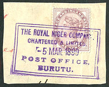
British stamps used at the Royal Niger
Company base at Burutu in the 1890s.
453:
833:
772:
478:
307:. It has served as a link between river transport and the sea when the
288:
219:
682:
367:
323:
Burutu Local
Governments comprises the following towns and villages:
251:
777:
479:"Towns & Villages in Burutu « Delta State « Nigeria"
267:
732:
614:
430:"Burutu, Delta, Nigeria - City, Town and Village of the world"
385:
The port of Burutu was owned by UAC but was later acquired by
17:
567:"Simulated historical climate & weather data for Burutu"
841:
665:
245:
237:
225:
207:
125:
48:. Unsourced material may be challenged and removed.
591:"Yearly & Monthly weather - Burutu, Nigeria"
861:
626:
303:, 30 kilometres (20 miles) upstream from the
8:
362:which acquired the trading interest of the
868:
854:
633:
619:
611:
327:Burutu-Forcados: Burutu, Forcados, Keremo2
122:
108:Learn how and when to remove this message
500:
498:
424:
422:
418:
244:
236:
206:
171:
140:
892:Local Government Areas in Delta State
224:
7:
818:
816:
46:adding citations to reliable sources
897:Populated coastal places in Nigeria
840:. You can help Knowledge (XXG) by
14:
887:Port cities and towns in Nigeria
820:
801:
642:
212:
153:
146:
22:
454:"Burutu | Nigeria | Britannica"
33:needs additional citations for
291:. It lies on the coast of the
154:
1:
902:Delta State geography stubs
120:LGA in Delta State, Nigeria
918:
815:
799:
655:
319:Burutu towns and villages
262:
172:
141:
132:
836:location article is a
666:Local government areas
387:Nigeria Port Authority
273:
281:Local Government Area
271:
483:Towns & Villages
295:on two sides of the
42:improve this article
354:Economic activities
309:Royal Niger Company
299:, a channel of the
188: /
458:www.britannica.com
274:
849:
848:
810:
809:
266:
265:
118:
117:
110:
92:
909:
870:
863:
856:
824:
817:
805:
793:Warri South West
647:
646:
645:
635:
628:
621:
612:
605:
604:
602:
601:
587:
581:
580:
578:
577:
563:
557:
556:
554:
553:
547:weatherspark.com
539:
533:
530:
524:
521:
515:
514:
502:
493:
492:
490:
489:
474:
468:
467:
465:
464:
450:
444:
443:
441:
440:
426:
218:
216:
215:
203:
202:
200:
199:
198:
193:
189:
186:
185:
184:
181:
157:
156:
150:
123:
113:
106:
102:
99:
93:
91:
50:
26:
18:
917:
916:
912:
911:
910:
908:
907:
906:
877:
876:
875:
874:
813:
811:
806:
797:
661:
657:State capital:
651:
643:
641:
639:
609:
608:
599:
597:
589:
588:
584:
575:
573:
565:
564:
560:
551:
549:
541:
540:
536:
531:
527:
522:
518:
504:
503:
496:
487:
485:
476:
475:
471:
462:
460:
452:
451:
447:
438:
436:
428:
427:
420:
415:
403:
395:
356:
321:
213:
211:
196:
194:
192:5.350°N 5.517°E
190:
187:
182:
179:
177:
175:
174:
168:
167:
166:
165:
164:
163:
162:
158:
137:
128:
121:
114:
103:
97:
94:
51:
49:
39:
27:
12:
11:
5:
915:
913:
905:
904:
899:
894:
889:
879:
878:
873:
872:
865:
858:
850:
847:
846:
825:
808:
807:
800:
798:
796:
795:
790:
785:
780:
775:
770:
765:
760:
755:
750:
745:
743:Oshimili South
740:
738:Oshimili North
735:
730:
725:
720:
715:
710:
705:
703:Ika North East
700:
695:
690:
685:
680:
675:
669:
667:
663:
662:
656:
653:
652:
640:
638:
637:
630:
623:
615:
607:
606:
582:
558:
534:
525:
516:
494:
469:
445:
434:en.db-city.com
417:
416:
414:
411:
410:
409:
402:
401:External links
399:
394:
391:
355:
352:
351:
350:
347:
344:
341:
340:Zion-Oyagbene.
337:
334:
331:
328:
320:
317:
305:Bight of Benin
297:Forcados River
264:
263:
260:
259:
249:
243:
242:
239:
235:
234:
229:
223:
222:
209:
205:
204:
170:
169:
160:
159:
152:
151:
145:
144:
143:
142:
139:
138:
133:
130:
129:
126:
119:
116:
115:
98:September 2009
30:
28:
21:
13:
10:
9:
6:
4:
3:
2:
914:
903:
900:
898:
895:
893:
890:
888:
885:
884:
882:
871:
866:
864:
859:
857:
852:
851:
845:
843:
839:
835:
831:
826:
823:
819:
814:
804:
794:
791:
789:
786:
784:
781:
779:
776:
774:
771:
769:
768:Ughelli South
766:
764:
763:Ughelli North
761:
759:
756:
754:
751:
749:
746:
744:
741:
739:
736:
734:
731:
729:
726:
724:
721:
719:
716:
714:
711:
709:
706:
704:
701:
699:
696:
694:
691:
689:
686:
684:
681:
679:
678:Aniocha South
676:
674:
673:Aniocha North
671:
670:
668:
664:
660:
654:
650:
636:
631:
629:
624:
622:
617:
616:
613:
596:
595:Weather Atlas
592:
586:
583:
572:
568:
562:
559:
548:
544:
538:
535:
529:
526:
520:
517:
512:
508:
501:
499:
495:
484:
480:
473:
470:
459:
455:
449:
446:
435:
431:
425:
423:
419:
412:
408:
405:
404:
400:
398:
392:
390:
388:
383:
381:
377:
373:
372:Niger Company
369:
365:
364:Niger Company
361:
353:
348:
345:
342:
338:
335:
332:
329:
326:
325:
324:
318:
316:
314:
310:
306:
302:
298:
294:
290:
286:
282:
278:
270:
261:
257:
253:
250:
248:
240:
233:
230:
228:
221:
210:
201:
173:Coordinates:
149:
136:
131:
124:
112:
109:
101:
90:
87:
83:
80:
76:
73:
69:
66:
62:
59: –
58:
54:
53:Find sources:
47:
43:
37:
36:
31:This article
29:
25:
20:
19:
16:
842:expanding it
827:
812:
698:Ethiope West
693:Ethiope East
687:
598:. Retrieved
594:
585:
574:. Retrieved
570:
561:
550:. Retrieved
546:
537:
528:
519:
486:. Retrieved
482:
472:
461:. Retrieved
457:
448:
437:. Retrieved
433:
396:
384:
357:
322:
276:
275:
238:Headquarters
197:5.350; 5.517
104:
95:
85:
78:
71:
64:
52:
40:Please help
35:verification
32:
15:
830:Delta State
788:Warri South
783:Warri North
728:Ndokwa West
723:Ndokwa East
718:Isoko South
713:Isoko North
649:Delta State
315:ethnicity.
301:River Niger
293:Niger Delta
285:Delta State
241:Burutu Town
232:Delta State
195: /
881:Categories
600:2023-09-15
576:2023-09-15
552:2023-09-15
488:2022-01-31
463:2022-01-31
439:2023-09-15
413:References
68:newspapers
708:Ika South
571:meteoblue
247:Time zone
511:34553671
477:places.
57:"Burutu"
834:Nigeria
773:Ukwuani
393:Climate
289:Nigeria
220:Nigeria
208:Country
82:scholar
753:Sapele
748:Patani
688:Burutu
683:Bomadi
509:
368:Akassa
279:is a
277:Burutu
217:
183:5°31′E
180:5°21′N
161:Burutu
127:Burutu
84:
77:
70:
63:
55:
828:This
778:Uvwie
659:Asaba
380:Benue
376:Niger
252:UTC+1
227:State
89:JSTOR
75:books
838:stub
733:Okpe
507:OCLC
378:and
313:Izon
61:news
758:Udu
360:UAC
283:in
256:WAT
135:LGA
44:by
883::
832:,
593:.
569:.
545:.
497:^
481:.
456:.
432:.
421:^
389:.
382:.
287:,
869:e
862:t
855:v
844:.
634:e
627:t
620:v
603:.
579:.
555:.
513:.
491:.
466:.
442:.
258:)
254:(
111:)
105:(
100:)
96:(
86:·
79:·
72:·
65:·
38:.
Text is available under the Creative Commons Attribution-ShareAlike License. Additional terms may apply.