51:
386:
68:
435:
Points. The bottom rises to a maximum depth of 22.8 metres (75 ft) between these points. There is 8 metres (26 ft) draught in the navigation channel through the bridge openings. The tidal stream through the Barra Strait runs the strongest at mid-flood and mid-ebb, and attain a rate of 3 knots. The tidal streams set 010°/190° through the strait, except in the vicinity of the swing bridge span where they are deflected NW and SW by Kelly Point.
104:
111:
75:
434:
The Barra Strait is over 50 metres (160 ft) deep at its southern entrance between
Hectors Point to the west and Derby Point to the east. The strait continues 2.2 km (1.4 mi) to the north-east where it narrows to slightly more than 500 metres (1,600 ft) between Uniacke and Kelly
381:
Boat traffic through the Barra Strait has been logged since 1991, and has consistently ranged between 1700 and 2100 boats passing through the swing and bascule bridges each year, with a peak of 2100 passages recorded for 2002. Of these movements, an estimated 2% are commercial activity, 8% are
344:
name for the strait was
Taawitk, "where the water flows out." An early descriptive name for the strait, Grand Narrows, has persisted as the name of the neighbouring community on the east bank and as the name of the railroad bridge over the Strait. "Grand" to distinguish it from the "Little
373:
for sailing and steam powered vessels. Vessels transiting this route are only limited by the size of the lock in the St. Peters Canal, which measures 91.44 metres (300.0 ft) long, 14.45 metres (47.4 ft) wide, and 4.88 metres (16.0 ft)
406:(also known as the Barra Strait Railway Bridge), the longest railway bridge in the province, crossing between Uniacke Point to the west and Kelly Point to the east. This railway bridge incorporates a
642:
477:
637:
345:
Narrows," on the same Bras d'Or Lake. The Grand
Narrows was also known, as far as the Strait is concerned, as the "Barra Strait." This after the Sound of Barra on the
389:
Approaching the Barra Strait and its bridges from the north. In the foreground is Barra Strait Bridge. Behind it (with the arched spans) is the Grand
Narrows Bridge.
154:
414:
operated a small ferry service for motor vehicles across the strait for much of the 20th century. It was replaced in
October 1993 with a double leaf
647:
67:
353:, where most of the settlers in this neighbourhood came from about the year 1802. The name, "Barra Strait" was approved November 2, 1950.
632:
399:
321:
103:
608:
544:
329:
317:
270:
601:
411:
569:
50:
618:
ATL 104E Cape North to Cape Canso (including Bras d’Or Lake), 2010 (Corrected to
Monthly Edition No. 12/2019)
211:
617:
521:
423:
385:
403:
316:. The border between two of Cape Breton Island's counties runs through the strait; the community of
419:
366:
297:
40:
614:
452:
313:
284:
139:
472:
470:
341:
325:
309:
274:
199:
499:
362:
370:
598:
415:
365:
in 1869 saw the Barra Strait become part of a sheltered coastal shipping route between
350:
222:
215:
626:
186:
407:
375:
478:"Nova Scotia Geographical Names Database entry for "Barra Strait" (includes map)"
305:
88:
545:"Ecosystem Overview and Assessment Report for the Bras d'Or Lakes, Nova Scotia"
169:
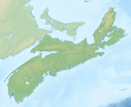
156:
410:
to permit the continued passage of marine traffic through the strait. The
604:
GREAT BRAS D'OR AND / ET ST PATRICKS CHANNEL (IONA AND / ET GRAND NARROWS)
522:"Place-names of the province of Nova Scotia (1922), by Thomas J Brown"
301:
228:
573:
550:. Dartmouth, Nova Scotia: Fisheries and Oceans Canada. p. 182
384:
346:
206:
324:, is situated on the eastern shore while the community of
312:, an inland saltwater body that dominates the centre of
308:. It connects the northern and southern basins of
280:
266:
262:
254:
246:
238:
234:
221:
205:
195:
185:
146:
135:
21:
643:Landforms of the Cape Breton Regional Municipality
32:
250:0.66 nautical miles (1.22 km; 0.76 mi)
147:
500:"Place-Names and Places of Nova Scotia (1967)"
543:M. Parker; M. Westhead; P. Doherty; J. Naug.
453:"Geographical Names of Canada - Barra Strait"
242:1.2 nautical miles (2.2 km; 1.4 mi)
8:
285:Geographical Names of Canada - Barra Strait
18:
16:Channel in Cape Breton Island, Nova Scotia
638:Landforms of Victoria County, Nova Scotia
524:. Royal Print & Litho., Halifax, N.S
444:
55:Barra Strait and Bridges from the North
296:is a 1.22 km (0.76 mi) wide
382:government and 90% are recreational.
7:
110:
74:
332:is situated on the western shore.
14:
502:. Public Archives of Nova Scotia
109:
102:
73:
66:
49:
648:Landforms of Cape Breton County
400:Intercolonial Railway of Canada
253:
245:
237:
1:
609:Canadian Hydrographic Service
134:
402:bridged the strait with the
480:. Government of Nova Scotia
664:
572:. CMNS Inc. Archived from
412:Government of Nova Scotia
60:
48:
31:
26:
258:50 metres (160 ft)
93:Show map of Nova Scotia
33:
633:Straits of Nova Scotia
570:"Grand Narrows Bridge"
455:. Government of Canada
398:In the late 1880s the
390:
212:Gulf of Saint Lawrence
388:
170:45.95250°N 60.80417°W
123:Barra Strait (Canada)
404:Grand Narrows Bridge
420:Barra Strait Bridge
361:The opening of the
175:45.95250; -60.80417
166: /
615:Sailing Directions
391:
322:Cape Breton County
314:Cape Breton Island
140:Cape Breton Island
126:Show map of Canada
351:Scottish Hebrides
290:
289:
207:Ocean/sea sources
655:
611:, 26 August 2016
586:
585:
583:
581:
576:on July 10, 2012
566:
560:
559:
557:
555:
549:
540:
534:
533:
531:
529:
518:
512:
511:
509:
507:
496:
490:
489:
487:
485:
474:
465:
464:
462:
460:
449:
363:St. Peters Canal
208:
181:
180:
178:
177:
176:
171:
167:
164:
163:
162:
159:
149:
127:
113:
112:
106:
94:
87:Barra Strait in
77:
76:
70:
53:
44:
36:
19:
663:
662:
658:
657:
656:
654:
653:
652:
623:
622:
607:, published by
590:
589:
579:
577:
568:
567:
563:
553:
551:
547:
542:
541:
537:
527:
525:
520:
519:
515:
505:
503:
498:
497:
493:
483:
481:
476:
475:
468:
458:
456:
451:
450:
446:
441:
432:
396:
371:Strait of Canso
359:
338:
330:Victoria County
300:located in the
225: countries
174:
172:
168:
165:
160:
157:
155:
153:
152:
131:
130:
129:
128:
125:
124:
121:
120:
119:
118:
114:
97:
96:
95:
92:
91:
85:
84:
83:
82:
78:
56:
38:
17:
12:
11:
5:
661:
659:
651:
650:
645:
640:
635:
625:
624:
621:
620:
612:
599:Nautical chart
595:
594:
588:
587:
561:
535:
513:
491:
466:
443:
442:
440:
437:
431:
428:
416:bascule bridge
395:
392:
358:
357:Transportation
355:
337:
334:
310:Bras d'Or Lake
288:
287:
282:
278:
277:
268:
264:
263:
260:
259:
256:
252:
251:
248:
244:
243:
240:
236:
235:
232:
231:
226:
219:
218:
216:Atlantic Ocean
209:
203:
202:
200:Bras d'Or Lake
197:
193:
192:
189:
183:
182:
150:
144:
143:
137:
133:
132:
122:
116:
115:
108:
107:
101:
100:
99:
98:
86:
80:
79:
72:
71:
65:
64:
63:
62:
61:
58:
57:
54:
46:
45:
29:
28:
24:
23:
15:
13:
10:
9:
6:
4:
3:
2:
660:
649:
646:
644:
641:
639:
636:
634:
631:
630:
628:
619:
616:
613:
610:
606:
605:
600:
597:
596:
592:
591:
575:
571:
565:
562:
546:
539:
536:
523:
517:
514:
501:
495:
492:
479:
473:
471:
467:
454:
448:
445:
438:
436:
429:
427:
425:
421:
417:
413:
409:
405:
401:
393:
387:
383:
379:
377:
372:
368:
364:
356:
354:
352:
348:
347:Isle of Barra
343:
336:Grand Narrows
335:
333:
331:
327:
323:
319:
318:Grand Narrows
315:
311:
307:
303:
299:
295:
286:
283:
279:
276:
272:
271:Grand Narrows
269:
265:
261:
257:
249:
241:
233:
230:
227:
224:
220:
217:
213:
210:
204:
201:
198:
194:
190:
188:
184:
179:
151:
145:
142:, Nova Scotia
141:
138:
105:
90:
69:
59:
52:
47:
42:
35:
30:
27:Grand Narrows
25:
20:
603:
578:. Retrieved
574:the original
564:
552:. Retrieved
538:
526:. Retrieved
516:
504:. Retrieved
494:
482:. Retrieved
457:. Retrieved
447:
433:
397:
380:
360:
339:
304:province of
294:Barra Strait
293:
291:
196:Part of
117:Barra Strait
81:Barra Strait
22:Barra Strait
422:, carrying
394:The bridges
306:Nova Scotia
267:Settlements
239:Max. length
173: /
148:Coordinates
89:Nova Scotia
627:Categories
439:References
430:Bathymetry
408:swing span
281:References
255:Max. depth
247:Max. width
161:60°48′15″W
158:45°57′09″N
424:Route 223
369:and the
302:Canadian
136:Location
528:May 16,
506:May 16,
459:Oct 27,
376:draught
349:in the
342:Mi'kmaq
298:channel
191:Channel
41:Mi'kmaq
34:Taawitk
602:#4278
580:May 6,
554:5 July
484:May 6,
418:, the
367:Sydney
273:&
229:Canada
37:
593:Notes
548:(PDF)
328:, in
320:, in
223:Basin
582:2012
556:2020
530:2012
508:2012
486:2012
461:2016
340:The
326:Iona
292:The
275:Iona
187:Type
629::
469:^
426:.
378:.
214:,
584:.
558:.
532:.
510:.
488:.
463:.
43:)
39:(
Text is available under the Creative Commons Attribution-ShareAlike License. Additional terms may apply.