43:
518:
434:
346:, Bouvard had a population of 821 people living in 483 dwellings, just under 20 percent of whom were elderly, and nearly all of whom were from Australia, the United Kingdom, New Zealand, the Netherlands or South Africa. The 2011 figure represented an increase of 29 people from the 2006 census.
338:
and the Harvey
Estuary. The western part consists of sparsely populated rural residential land with large lots separated by bushland buffers, while the eastern part follows more traditional coastal suburban development patterns along the estuary.
313:
The Park Ridge estate was developed in the 1990s, and other estates have been built or proposed. Bouvard
Coastcare, a volunteer group dedicated to maintaining the fragile coastal and dune environment, has won awards and grants for its work.
349:
There are walking trails and a couple of small roadside shops and a fuel station along the Old Coast Road. There are schools within easy reach of
Bouvard, and the nearest shopping centre is at IGA Dawesville
362:
school bus stops at the
Bouvard Tavern. Private operator South West Coach Lines stops upon request at the Bouvard Tavern on its Perth to Bunbury service operating several times a day.
182:
170:
64:
1048:
275:
158:
620:
175:
383:
482:
1203:
1147:
1041:
975:
935:
930:
755:
576:
433:
1005:
950:
371:
1162:
990:
900:
880:
875:
770:
524:
496:
411:
447:
1188:
1117:
1102:
1000:
955:
920:
905:
850:
795:
722:
707:
1213:
1193:
1137:
1122:
1097:
980:
965:
945:
845:
835:
815:
742:
727:
702:
648:
375:
210:
205:
1234:
1208:
1152:
1132:
1034:
1010:
915:
885:
865:
810:
800:
760:
737:
598:
57:
1183:
1157:
1092:
1015:
985:
890:
860:
830:
820:
805:
765:
697:
661:
613:
391:
267:
149:
29:
554:
1198:
1107:
1087:
995:
960:
925:
870:
840:
712:
692:
666:
379:
327:
299:
233:
528:
500:
1127:
1112:
940:
895:
825:
732:
717:
243:
238:
1062:
970:
910:
855:
630:
263:
143:
1026:
606:
415:
387:
335:
220:
119:
103:
42:
331:
343:
187:
290:
Bouvard is named after Cape
Bouvard some 5 kilometres (3 mi) to the west, which was named by
370:
Bouvard is difficult to measure as it did not have a polling place at the election, but at the
1066:
747:
634:
478:
307:
33:
1074:
580:
279:
163:
323:
295:
517:
358:
Selected 594 services from
Mandurah Station started servicing Bouvard in May 2011, and a
303:
291:
1228:
451:
386:, the Liberals received 43.8% of the vote compared to 36.8% for the centre-left
359:
302:
in 1802-1803, either after
Charles Bouvard (1572-1658), a French chemist, or
79:
66:
1167:
1142:
1058:
775:
676:
653:
477:(54th ed.). West Australian Newspapers Ltd. pp. Maps 818, 848.
322:
Bouvard consists of a narrow strip of land along both sides of the
271:
270:, and is 97 kilometres (60 mi) south of the state capital,
1030:
602:
446:
Marine Life
Society of South Australia Inc. (December 2001).
575:
Western
Australian Electoral Commission (30 November 2005).
501:"2011 Community Profiles: 2011 Census Quickstats: Bouvard"
553:
Australian
Electoral Commission (AEC) (9 November 2005).
529:"Community Profile Series: Bouvard - Bal (State Suburb)"
378:
recorded a 60.59% primary vote for the centre-right
1176:
1073:
784:
675:
641:
181:
169:
157:
136:
128:
118:
110:
95:
56:
23:
577:"District of Dawesville - Polling Place Results"
194:
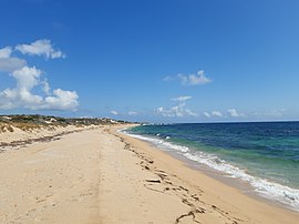
47:Tims Thicket Beach in the north-west of Bouvard
1042:
614:
8:
306:(1767-1843), an astronomer and director of
100:
1049:
1035:
1027:
621:
607:
599:
516:
432:
41:
20:
403:
555:"Polling Place - Dawesville (Canning)"
326:, the main route between Mandurah and
629:Cities, towns, and localities in the
533:2006 Census of Population and Housing
505:2011 Census of Population and Housing
231:
218:
203:
196:
18:Suburb of Mandurah, Western Australia
7:
294:, who sighted the cape en route to
132:40.9 km (15.8 sq mi)
475:StreetSmart Perth Street Directory
14:
420:Australian Census 2021 QuickStats
473:Department of Land Information.
525:Australian Bureau of Statistics
497:Australian Bureau of Statistics
416:"Bouvard (suburb and locality)"
412:Australian Bureau of Statistics
374:, the nearest polling place at
148:22 km (14 mi) SSW of
142:97 km (60 mi) SSW of
1:
268:Mandurah, Western Australia
262:is the second southernmost
1251:
249:
197:
193:
52:
40:
199:Suburbs around Bouvard:
388:Australian Labor Party
336:Yalgorup National Park
372:2004 federal election
276:local government area
1235:Suburbs of Mandurah
527:(25 October 2007).
499:(31 October 2012).
384:2005 state election
183:Federal division(s)
171:State electorate(s)
76: /
454:on 15 October 2009
332:National Highway 1
1222:
1221:
1067:Western Australia
1024:
1023:
635:Western Australia
583:on 29 August 2007
483:978-0-909439-67-5
390:and 9.2% for the
308:Paris Observatory
298:from what is now
257:
256:
253:
252:
176:Murray-Wellington
80:32.682°S 115.62°E
34:Western Australia
1242:
1075:City of Mandurah
1059:Greater Mandurah
1051:
1044:
1037:
1028:
623:
616:
609:
600:
593:
592:
590:
588:
579:. Archived from
572:
566:
565:
563:
561:
550:
544:
543:
541:
539:
520:
515:
513:
511:
493:
487:
486:
470:
464:
463:
461:
459:
450:. Archived from
443:
437:
436:
430:
428:
426:
414:(28 June 2022).
408:
280:City of Mandurah
195:
164:City of Mandurah
102:
91:
90:
88:
87:
86:
81:
77:
74:
73:
72:
69:
45:
36:
26:
21:
1250:
1249:
1245:
1244:
1243:
1241:
1240:
1239:
1225:
1224:
1223:
1218:
1172:
1069:
1055:
1025:
1020:
788:
786:
780:
681:
679:
671:
637:
627:
597:
596:
586:
584:
574:
573:
569:
559:
557:
552:
551:
547:
537:
535:
523:
521:
509:
507:
495:
494:
490:
472:
471:
467:
457:
455:
445:
444:
440:
424:
422:
410:
409:
405:
400:
382:, while at the
368:
356:
320:
296:Rottnest Island
288:
85:-32.682; 115.62
84:
82:
78:
75:
70:
67:
65:
63:
62:
48:
28:
27:
24:
19:
12:
11:
5:
1248:
1246:
1238:
1237:
1227:
1226:
1220:
1219:
1217:
1216:
1211:
1206:
1204:North Yunderup
1201:
1196:
1191:
1186:
1180:
1178:
1177:Nearby suburbs
1174:
1173:
1171:
1170:
1165:
1160:
1155:
1150:
1148:Meadow Springs
1145:
1140:
1135:
1130:
1125:
1120:
1115:
1110:
1105:
1100:
1095:
1090:
1085:
1079:
1077:
1071:
1070:
1056:
1054:
1053:
1046:
1039:
1031:
1022:
1021:
1019:
1018:
1013:
1008:
1003:
998:
993:
988:
983:
978:
976:South Yunderup
973:
968:
963:
958:
953:
948:
943:
938:
936:North Yunderup
933:
931:North Dandalup
928:
923:
918:
913:
908:
903:
898:
893:
888:
883:
878:
873:
868:
863:
858:
853:
848:
843:
838:
833:
828:
823:
818:
813:
808:
803:
798:
792:
790:
789:and localities
782:
781:
779:
778:
773:
768:
763:
758:
756:Meadow Springs
753:
745:
740:
735:
730:
725:
720:
715:
710:
705:
700:
695:
690:
684:
682:
673:
672:
670:
669:
664:
659:
651:
645:
643:
639:
638:
628:
626:
625:
618:
611:
603:
595:
594:
567:
545:
488:
465:
448:"2001 Journal"
438:
402:
401:
399:
396:
367:
364:
355:
352:
324:Old Coast Road
319:
316:
304:Alexis Bouvard
292:Nicolas Baudin
287:
284:
255:
254:
251:
250:
247:
246:
241:
236:
230:
229:
228:Harvey Estuary
226:
223:
217:
216:
215:Harvey Estuary
213:
208:
202:
201:
191:
190:
185:
179:
178:
173:
167:
166:
161:
155:
154:
153:
152:
146:
138:
134:
133:
130:
126:
125:
122:
116:
115:
112:
108:
107:
97:
93:
92:
60:
54:
53:
50:
49:
46:
38:
37:
17:
13:
10:
9:
6:
4:
3:
2:
1247:
1236:
1233:
1232:
1230:
1215:
1212:
1210:
1207:
1205:
1202:
1200:
1197:
1195:
1192:
1190:
1187:
1185:
1182:
1181:
1179:
1175:
1169:
1166:
1164:
1161:
1159:
1156:
1154:
1151:
1149:
1146:
1144:
1141:
1139:
1136:
1134:
1131:
1129:
1126:
1124:
1121:
1119:
1116:
1114:
1111:
1109:
1106:
1104:
1101:
1099:
1096:
1094:
1091:
1089:
1086:
1084:
1081:
1080:
1078:
1076:
1072:
1068:
1064:
1060:
1052:
1047:
1045:
1040:
1038:
1033:
1032:
1029:
1017:
1014:
1012:
1009:
1007:
1006:West Pinjarra
1004:
1002:
999:
997:
994:
992:
989:
987:
984:
982:
979:
977:
974:
972:
969:
967:
964:
962:
959:
957:
954:
952:
951:Preston Beach
949:
947:
944:
942:
939:
937:
934:
932:
929:
927:
924:
922:
919:
917:
914:
912:
909:
907:
904:
902:
899:
897:
894:
892:
889:
887:
884:
882:
879:
877:
874:
872:
869:
867:
864:
862:
859:
857:
854:
852:
849:
847:
844:
842:
839:
837:
834:
832:
829:
827:
824:
822:
819:
817:
814:
812:
809:
807:
804:
802:
799:
797:
794:
793:
791:
783:
777:
774:
772:
769:
767:
764:
762:
759:
757:
754:
752:
749:
746:
744:
741:
739:
736:
734:
731:
729:
726:
724:
721:
719:
716:
714:
711:
709:
706:
704:
701:
699:
696:
694:
691:
689:
686:
685:
683:
678:
674:
668:
665:
663:
660:
658:
655:
652:
650:
647:
646:
644:
642:Council seats
640:
636:
632:
624:
619:
617:
612:
610:
605:
604:
601:
582:
578:
571:
568:
556:
549:
546:
534:
530:
526:
519:
506:
502:
498:
492:
489:
484:
480:
476:
469:
466:
453:
449:
442:
439:
435:
421:
417:
413:
407:
404:
397:
395:
393:
389:
385:
381:
380:Liberal Party
377:
373:
365:
363:
361:
353:
351:
347:
345:
340:
337:
333:
329:
325:
317:
315:
311:
309:
305:
301:
297:
293:
285:
283:
281:
277:
273:
269:
265:
261:
248:
245:
242:
240:
237:
235:
232:
227:
224:
222:
219:
214:
212:
209:
207:
204:
200:
192:
189:
186:
184:
180:
177:
174:
172:
168:
165:
162:
160:
156:
151:
147:
145:
141:
140:
139:
135:
131:
127:
123:
121:
117:
113:
109:
105:
98:
94:
89:
61:
59:
55:
51:
44:
39:
35:
31:
22:
16:
1163:Silver Sands
1082:
991:Upper Murray
881:Lower Hotham
876:Lake Clifton
787:settlements,
785:Other towns,
771:Silver Sands
750:
687:
656:
585:. Retrieved
581:the original
570:
558:. Retrieved
548:
536:. Retrieved
532:
508:. Retrieved
504:
491:
474:
468:
456:. Retrieved
452:the original
441:
423:. Retrieved
419:
406:
369:
357:
348:
341:
330:and part of
321:
312:
289:
259:
258:
198:
15:
1189:Furnissdale
1118:Greenfields
1103:Dudley Park
1057:Suburbs of
1001:West Coolup
956:Quindanning
921:Nanga Brook
906:Mount Wells
901:Mount Cooke
851:Furnissdale
796:Banksiadale
723:Greenfields
708:Dudley Park
344:2011 census
221:Yalgorup NP
120:Postcode(s)
111:Established
83: /
71:115°37′12″E
58:Coordinates
1214:Stake Hill
1194:Golden Bay
1138:Madora Bay
1123:Halls Head
1098:Dawesville
981:Stake Hill
966:Ravenswood
946:Point Grey
846:Fairbridge
836:Dwellingup
816:Blythewood
743:Madora Bay
728:Halls Head
703:Dawesville
649:Boddington
633:region of
458:28 October
398:References
376:Dawesville
360:Transperth
334:, between
211:Dawesville
206:Dawesville
96:Population
68:32°40′55″S
1209:Singleton
1153:Parklands
1133:Lakelands
1011:Whittaker
916:Nambeelup
886:Marradong
866:Inglehope
811:Birchmont
801:Bannister
761:Parklands
738:Lakelands
510:8 October
392:Nationals
354:Transport
318:Geography
1229:Category
1184:Barragup
1168:Wannanup
1158:San Remo
1143:Mandurah
1093:Coodanup
1065:region,
1016:Wuraming
986:Teesdale
891:Marrinup
861:Holyoake
831:Crossman
821:Carcoola
806:Barragup
776:Wannanup
766:San Remo
751:(suburb)
748:Mandurah
698:Coodanup
677:Mandurah
662:Pinjarra
654:Mandurah
366:Politics
150:Mandurah
137:Location
30:Mandurah
1199:Keralup
1108:Erskine
1088:Clifton
1083:Bouvard
996:Wagerup
961:Ranford
926:Nirimba
871:Keralup
841:Etmilyn
713:Erskine
693:Clifton
688:Bouvard
680:suburbs
667:Waroona
587:29 June
560:29 June
538:29 June
425:28 June
342:At the
328:Bunbury
300:Bunbury
286:History
278:is the
260:Bouvard
234:Clifton
225:Bouvard
188:Canning
32:,
25:Bouvard
1128:Herron
1113:Falcon
941:Oakley
896:Meelon
826:Coolup
733:Herron
718:Falcon
657:(city)
481:
431:
274:. Its
264:suburb
244:Herron
239:Herron
159:LGA(s)
971:Solus
911:Myara
856:Hamel
272:Perth
144:Perth
114:1980s
99:910 (
1063:Peel
631:Peel
589:2007
562:2007
540:2007
512:2012
479:ISBN
460:2006
427:2022
129:Area
124:6211
104:2021
266:of
101:SAL
1231::
1061:,
531:.
522:*
503:.
418:.
394:.
310:.
282:.
1050:e
1043:t
1036:v
622:e
615:t
608:v
591:.
564:.
542:.
514:.
485:.
462:.
429:.
106:)
Text is available under the Creative Commons Attribution-ShareAlike License. Additional terms may apply.