53:
256:
40:
60:
229:
Hernández Sabourín, Elsa Lázara; Sergio
Alfredo Torres Zamora; Herlinda F. Remón Castillo (2001). "Biodiversidad de la Reserva Natural de Cabo Cruz (provincia de Granma), Cuba".
297:
321:
163:
84:
326:
290:
52:
316:
195:
283:
155:
234:
267:
139:
131:
30:
143:
310:
151:
119:
175:
39:
255:
179:
238:
99:
86:
191:
159:
263:
147:
233:(Nº. 7). Centro Iberoamericano de la Biodiversidad: 11–13.
271:
115:
21:
174:The southernmost tip of Cape Cruz is marked by
158:. Cape Cruz is located in the municipality of
291:
8:
298:
284:
182:with a height of 32 metres (105 ft).
18:
142:that forms the western extremity of the
207:
45:
36:
114:
7:
252:
250:
154:and marks the eastern border of the
164:Desembarco del Granma National Park
270:. You can help Knowledge (XXG) by
14:
59:
254:
190:The cape is the endpoint of the
58:
51:
38:
1:
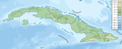
72:Location of Cape Cruz in Cuba
322:Geography of Granma Province
343:
249:
231:Cuadernos de biodiversidad
100:19.8418278°N 77.7278556°W
80:
46:
37:
28:
196:Circuito Sur de Oriente
178:, a nineteenth-century
105:19.8418278; -77.7278556
266:location article is a
150:. It extends into the
135:
116:Offshore water bodies
16:Cape in southern Cuba
327:Cuba geography stubs
162:and is part of the
156:Gulf of Guacanayabo
96: /
317:Headlands of Cuba
279:
278:
198:" (CSO) highway.
125:
124:
334:
300:
293:
286:
258:
251:
242:
215:
212:
111:
110:
108:
107:
106:
101:
97:
94:
93:
92:
89:
62:
61:
55:
42:
19:
342:
341:
337:
336:
335:
333:
332:
331:
307:
306:
305:
304:
247:
245:
228:
224:
219:
218:
213:
209:
204:
194:branch of the "
188:
172:
144:Granma Province
104:
102:
98:
95:
90:
87:
85:
83:
82:
76:
75:
74:
73:
70:
69:
68:
67:
63:
33:
24:
17:
12:
11:
5:
340:
338:
330:
329:
324:
319:
309:
308:
303:
302:
295:
288:
280:
277:
276:
259:
244:
243:
225:
223:
220:
217:
216:
214:Hernández 2001
206:
205:
203:
200:
187:
184:
171:
168:
123:
122:
117:
113:
112:
78:
77:
71:
65:
64:
57:
56:
50:
49:
48:
47:
44:
43:
35:
34:
29:
26:
25:
22:
15:
13:
10:
9:
6:
4:
3:
2:
339:
328:
325:
323:
320:
318:
315:
314:
312:
301:
296:
294:
289:
287:
282:
281:
275:
273:
269:
265:
260:
257:
253:
248:
240:
236:
232:
227:
226:
221:
211:
208:
201:
199:
197:
193:
185:
183:
181:
177:
169:
167:
165:
161:
157:
153:
152:Caribbean Sea
149:
145:
141:
137:
133:
129:
121:
120:Caribbean Sea
118:
109:
91:77°43′40.28″W
88:19°50′30.58″N
81:Coordinates:
79:
54:
41:
32:
27:
20:
272:expanding it
261:
246:
230:
210:
189:
173:
170:Architecture
146:in southern
127:
126:
176:Faro Vargas
103: /
311:Categories
222:References
180:lighthouse
239:1575-5495
186:Transport
136:Cabo Cruz
128:Cape Cruz
66:Cabo Cruz
23:Cabo Cruz
138:), is a
192:Niquero
160:Niquero
132:Spanish
237:
264:Cuban
262:This
202:Notes
268:stub
235:ISSN
148:Cuba
140:cape
31:Cape
130:, (
313::
166:.
134::
299:e
292:t
285:v
274:.
241:.
Text is available under the Creative Commons Attribution-ShareAlike License. Additional terms may apply.