655:, 1622. The inscription, translated, reads: Nieu Zeelandt, east of Ceram, sailed by Jaspar Janss. the Younger; Duyfjesland , opposite Key and Aru, Moddereyland (Mud-island), the Vuylebanken (the Shoals), the coast from 9 to 14 degrees, sailed by J. Rosingeyn; the north coast of the Papouas with its continuation to 246 Dutch miles east of Maba, navigated by J. le Maire, here placed as is delineated by the said discoverers, are looked together upon parts of Nova Guinea. What is found thereabouts in the Spanish maps and differs greatly from this and does not agree on these parts, is here omitted until we are better informed. Those who sailed with the yacht of Pedro Fernando de Quiros in the neighbourhood of Nueva Guinea to 10 degrees westward through many islands and shoals and over 2, 3 and 4 fathoms for as many as 40 days, estimated that New Guinea does not extend beyond 10 degrees to the south. If this be so, then the land from 9 to 14 degrees would be a separate land, different from the other N. Guinea.
637:
33:
190:
424:
123:, working for the Spanish Crown, sailed through the strait only four months later. However, Torres did not report seeing the coast of a major landmass to his south and is therefore presumed not to have seen Australia. Because the two separate observations of Janszoon and Torres were not matched, Dutch maps did not include the strait until after
468:
The
Europeans sailed along from overseas and put up a building at Cape Keerweer. A crowd of Keerweer people saw their boat sail up and went to talk with them. They said they wanted to put up a city. Well the Keerweer people said that was all right. They allowed them sink a well and put up huts. They
1456:
This is a translation of: "Nockhoda
Tingall a Cling-man from Banda, in a Java Juncke, laden with mace and 'nutmegs, which he sold to the Guzerats; he told me that the Flemmings Pinnasse which went upon discovery for Nova Ginny, was returned to Banda, having found the Iland: but in sending their men
691:
The Drooge bocht (shallow bay), where Nova-Guinea is surmised to be cut off from the rest of the
Southland by a passage opening into the great South-Sea, though our men have been unable to pass through it owing to the shallows, so that it remains uncertain whether this strait is open on the other
663:
published a map, which included the coastline of part of the west coast of Cape York. Although this map shows this coast as an extension of New Guinea, it includes a note that refers to
Spanish maps that differed from the Dutch understanding of the area. It noted that while the Spanish maps were
477:
According to this account, some of
Janszoon's crew angered the local people, by raping or coercing women into having sex and by forcing men to hunt for them. This led the locals to kill some of the Dutch and burn some of their boats. The Dutch are said to have shot and killed many of the Keerweer
436:
He found the land to be swampy and infertile, forcing the explorers eventually to give up and return to Bantam due to their lack of "provisions and other necessaries". Nevertheless, it appears that the killing of some of his men on various shore expeditions was the main reason for their return—he
622:
seeing that the United East-India
Company has repeatedly given orders for the discovering and exploring the land of Nova Guinea, and the islands east of the same, since, equally by our orders, such discovery was once tried about the year 1606 with the yacht de Duyve by Skipper Willem Jansz and
418:
that vast regions were for the greater part uncultivated, and certain parts inhabited by savage, cruel black barbarians who slew some of our sailors, so that no information was obtained touching the exact situation of the country and regarding the commodities obtainable and in demand
632:
Willem
Janszoon returned to the Netherlands apparently in the belief that the south coast of New Guinea was joined to the land along which he sailed, although his own chart did not verify his claim to have continuously followed the coastline where the Torres Strait is found.
469:
were at first happy there and worked together. The
Europeans gave them tobacco. They carried off the tobacco. They gave them flour—they threw that away. They gave them soap, and they threw away the soap. The Keerweer people kept to their own
288:
No original logs or charts of
Janszoon's voyage have been located and it is not known when or how they were lost. Nevertheless, a copy was apparently made in about 1670 from Janszoon's map of his expedition, which was sold to the
505:
in 1802. He then passed his original landfall at
Pennefather River and continued to the river now called Wenlock River. This river was formerly called the Batavia River, due to an error made in the chart made by the
513:. According to Carstenszoon, the Batavia River was a large river, which in 1606 "the men of the yacht Duijfken went up with the boat, on which occasion one of them was killed by the arrows of the natives".
1297:
This is a translation of: "The eighteenth, heere departed a small pinnasse of the Flemmings, for the discovery of the nand called Nova ginnea, which, as it is said, affordeth great store of Gold" (
574:; he told me that the Dutch pinnace that went to explore New Guinea had returned to Banda, having found it: but in sending their men on shore to propose trade, nine of them were killed by the
354:. This is the first recorded European landfall on the Australian continent. He proceeded over Albatross Bay to Archer Bay, the confluence of the Archer and the Watson Rivers, which he named
1809:
92:
In 1606, he sailed from Bantam to the south coast of New Guinea, and continued down what he thought was a southern extension of that coast, but was in fact the western coast of the
1110:
1457:
on shoare to intreate of Trade, there were nine of them killed by the Heathens, which are man-eaters: so they were constrained to returne, finding no good to be done there."(
1063:
734:
510:
1204:
1016:
828:
134:
Overall, his voyage was not immediately recognized as significant at the time, as the Dutch East India Company was primarily interested in finding a faster route to the
922:
1157:
969:
781:
1356:
875:
1784:
478:
people before escaping. However, events from a number of different encounters, over many years, with Europeans may have been combined in these oral traditions.
278:. Although all records of the voyage have been lost, Janszoon's departure was reported by Captain John Saris. He recorded that on 18 November 1605 "a small
104:
people and several of his men were killed. As a consequence, he was obliged to retrace his route up the coast towards Cape York and then returned to Banda.
1804:
1794:
230:) when it was established in 1602. After two trips back to the Netherlands, he returned to the East Indies for the third time in 1603 as captain of the
1737:
1350:
623:
sub-cargo Jan Lodewijs van Rosinghijn, who made sundry discoveries on the said coast of Nova Guinea, as is amply set forth in their journals.
255:
on 29 January 1644—he was ordered by VOC President Jan Willemsz Verschoor to explore the coast of New Guinea. In September 1605, he left for
151:
460:, written by members of the Wik-Mungkan people and edited by Janine Roberts, contains an account of this landing passed down in Aboriginal
705:
However, some Dutch maps, but not others like Gerritszoon's map of 1622, still showed Cape York and New Guinea as being contiguous, until
525:
486:
406:
According to the VOC's instructions to Tasman (1644), Janszoon and his crew travelled along 350 kilometres (220 mi) of coast, from
138:. However, Janszoon's voyage paved the way for further exploration of the Australian continent by the Dutch and other European powers.
1710:
1591:
1789:
1769:
1764:
449:
1644:
1618:
680:'s voyage through the strait named after him, which he completed in early October 1606, although the Dutch knew nothing of it.
1799:
1648:
1622:
1597:
543:
Janszoon then sailed back to Banda via the south coast of New Guinea. On 15 June 1606, Captain Saris reported the arrival of
199:
1681:
1518:
178:
173:
1669:
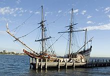
The First Discovery of Australia; With an Account of the Voyage of the "Duyfken" and the Career of Captain Willem Jansz
636:
285:
departed here for the discovery of the land called New Guinea, which, it is said, may yield a great amount of wealth".
1693:
168:
1774:
714:
128:
290:
1779:
517:
215:
66:
32:
697:
438:
101:
687:, but failed. Following these explorations, the Dutch continued to wonder whether there was a passage:
683:
Both Carstenszoon in 1623 and Tasman in 1644 were directed to attempt to find a passage in the area of
677:
664:
inconsistent with each other, they would, if confirmed, imply that New Guinea did not extend more than
120:
131:
through it, while early Spanish maps showed the coast of New Guinea correctly, but omitted Australia.
497:
After the alleged conflict, Janszoon retraced his route north to the north side of Vliege Bay, which
163:
710:
673:
665:
453:
411:
333:
329:
282:
231:
93:
676:
must be separate and different from the other New Guinea". The Spanish maps would have reflected
669:
482:
445:
407:
252:
48:
1733:
1716:
1706:
1673:
1515:
1622, Bibliothèque Nationale de France, Paris, département des Cartes et Plans, SH, Arch. 30
1346:
1340:
579:
351:
341:
207:
189:
82:
507:
498:
310:
614:. In 1618, it presented a memorandum in pursuit of this order that included the following:
1522:
660:
648:
611:
587:
571:
556:
489:, with the map showing a dotted trajectory line to that island, but not to Cape Keerweer.
44:
37:
537:
481:
There is documented evidence suggesting that during this voyage, the Dutch landed near
227:
135:
70:
1705:. The Mapoon Story. Vol. 3. Fitzroy, Victoria: International Development Action.
1587:
1758:
684:
502:
325:
256:
244:
108:
52:
423:
1663:
461:
298:
279:
1573:, Journal of the Australian and New Zealand Map Society, vol. 45, 2015, pp. 21–34.
659:
In 1622, prior to Jan Carstenszoon's 1623 exploration of the Gulf of Carpentaria,
263:—which the VOC had established as its first permanent trading in 1603—so that the
1667:
1638:
1612:
1516:
559:
529:
470:
321:
306:
302:
248:
240:
86:
1720:
1677:
706:
337:
275:
124:
100:. He travelled south as far as Cape Keerweer, where he battled with the local
97:
78:
1220:
1206:
1173:
1159:
1126:
1112:
1079:
1065:
1032:
1018:
985:
971:
938:
924:
891:
877:
844:
830:
797:
783:
750:
736:
17:
607:
597:
332:, and on 26 February 1606 made landfall at a river on the western shore of
575:
441:, which he subsequently called Kaap Keerweer, Dutch for "Cape Turnback".
116:
89:
in 1598, and became an officer of the VOC on its establishment in 1602.
429:
235:
194:
61:
297:
in 1737. It can be deduced from this map that Janszoon then sailed to
111:, which separates Australia and New Guinea. Unknown to the Dutch, the
81:
in search of economic opportunities. He had originally arrived in the
586:
A reference to the outcome of the expedition was made as a result of
567:
563:
552:
294:
600:. The VOC sought an order from the Dutch Government prohibiting the
1640:
The Part Borne by the Dutch in the Discovery of Australia 1606–1765
635:
582:: so they were forced to return, finding no good to be done there.
422:
188:
112:
260:
56:
77:
or VOC), Janszoon had been instructed to explore the coast of
528:), on which some of them landed. The expedition then passed
437:
turned back where his party had its greatest conflict with
1703:
The Cape York Aluminium Companies and the Native Peoples
320:
rounded Vals Point and crossed the eastern end of the
1571:
Mapping the Discoveries of Australia's First Mariners
47:
captained the first recorded European landing on the
516:
Janszoon then proceeded past Skardon, Vrilya Point,
376:) and then on to Dugally River, which he named the
1342:Beneath Another Sky: A Global Journey into History
524:("the high island", now called Muralug Island or
267:could be fitted out and supplied for its voyage.
1810:Maritime history of the Dutch East India Company
1500:The discovery of Australia by the Dutch in 1606
689:
616:
545:
466:
416:
1404:
1402:
700:, an officer of the VOC, some time after 1685.
596:from the Netherlands to the Spice Islands via
1701:Roberts, Janine P.; McLean, D., eds. (1975).
1408:
448:Aboriginal people, who today live in various
107:Janszoon did not detect the existence of the
8:
1732:, Blackburn, Victoria: Dove Communications,
1379:Sent Forth a Dove: Discovery of the Duyfken,
1381:Perth, University of WA Press, 1999, p. 35.
601:
591:
383:
377:
361:
355:
345:
274:sailed from Bantam to the coast of western
220:
709:, who was aware of Torres' voyage through
301:(the headquarters of the VOC), Banda, the
27:European voyage of discovery to Australia
1389:
1387:
1269:
1267:
610:and 100 miles (160 km) east of the
427:1670 copy of the map drawn on board the
247:, when—according to an account given to
31:
1420:
1258:
1251:
725:
316:After exploring the coast of Papua the
1557:
1474:
1432:
1345:. Penguin Books Limited. p. 330.
1273:
520:, Wallis Island, Red Wallis Island to
1785:17th century in the Dutch East Indies
1684:from the original on 14 February 2020
1545:
1533:
1486:
1462:
1458:
1444:
1393:
1326:
1314:
1302:
1298:
1285:
536:, the continuous coral reefs between
444:Cape Keerweer is on the lands of the
7:
1359:from the original on 9 February 2024
1502:, The Geographical Journal in 1899.
713:, sailed through the strait on his
1593:Australian Dictionary of Biography
222:Vereenigde Oost-Indische Compagnie
25:
1805:Maritime exploration of Australia
1795:European exploration of Australia
1588:"Janssen, Willem (fl. 1603–1628)"
309:and Deyong Point on the coast of
75:Vereenigde Oostindische Compagnie
51:continent in 1606, sailing from
1645:Royal Dutch Geographical Society
1619:Royal Dutch Geographical Society
1511:Hessel Gerritsz (c. 1581–1632),
590:'s 1615 voyage on behalf of the
1672:. Sydney: Thomas Davies Mutch.
1649:Project Gutenberg of Australia
1623:Project Gutenberg of Australia
1614:Abel Janszoon Tasman's Journal
1598:Australian National University
1:
350:, but it is now known as the
214:and became an officer of the
344:. Janszoon named the river
1728:Roberts, Janine P. (1981),
1694:Project Gutenberg Australia
414: 45' south, but found
179:GPX (secondary coordinates)
1826:
1617:, Amsterdam; Los Angeles:
340:, near the modern town of
206:Janszoon travelled to the
1513:Map of the Pacific Ocean,
1461:, pp. 19–20, citing
1409:Roberts & McLean 1975
291:Austrian National Library
270:On 18 November 1605, the
174:GPX (primary coordinates)
149:Map all coordinates using
1790:Dutch East India Company
1770:1606 in the Dutch Empire
1765:1605 in the Dutch Empire
1730:From Massacres to Mining
1301:, p. 385, cited in
721:Geographical coordinates
216:Dutch East India Company
157:Download coordinates as:
67:Dutch East India Company
65:. As an employee of the
1611:Heeres, J. E. (1965) ,
1586:Forsyth, J. W. (1967),
1521:8 November 2015 at the
1339:Davies, Norman (2017).
606:from operating between
570:, which he sold to the
454:Aurukun Mission station
1748:Purchase His Pilgrimes
1637:Heeres, J. E. (1899),
1138:Prince of Wales Island
703:
668:, "then the land from
656:
625:
603:Australische Compagnie
602:
593:Australische Compagnie
592:
584:
526:Prince of Wales Island
487:Prince of Wales Island
475:
433:
421:
378:
356:
346:
221:
203:
74:
41:
1800:History of Queensland
639:
426:
239:. In 1605, he was at
192:
169:GPX (all coordinates)
36:Map of the voyage of
35:
1746:Saris, John (1625),
1664:Mutch, Thomas Davies
551:Nockhoda Tingall, a
324:—without seeing the
1216: /
1169: /
1122: /
1075: /
1028: /
981: /
934: /
887: /
840: /
793: /
746: /
711:Alexander Dalrymple
678:Luis Váez de Torres
334:Cape York Peninsula
330:Gulf of Carpentaria
121:Luis Váez de Torres
94:Cape York Peninsula
1174:10.117°S 142.150°E
1127:10.683°S 142.183°E
1080:10.867°S 142.033°E
1033:10.850°S 142.017°E
986:10.967°S 142.100°E
939:11.233°S 142.117°E
892:11.767°S 142.000°E
845:13.917°S 141.467°E
798:13.267°S 141.650°E
751:12.217°S 141.733°E
657:
452:and in the nearby
434:
249:Abel Jansen Tasman
204:
42:
1775:1606 in Australia
1739:978-0-85924-171-7
1569:Gerritsen, Rolf,
1377:James Hendersen,
1352:978-1-84614-832-3
1221:9.950°S 142.167°E
1091:Red Wallis Island
762:Pennefather River
555:from Banda, in a
439:Aboriginal people
352:Pennefather River
208:Dutch East Indies
83:Dutch East Indies
16:(Redirected from
1817:
1751:
1742:
1724:
1697:
1691:
1689:
1659:
1658:
1656:
1633:
1632:
1630:
1607:
1606:
1604:
1574:
1567:
1561:
1555:
1549:
1543:
1537:
1531:
1525:
1509:
1503:
1496:
1490:
1484:
1478:
1472:
1466:
1454:
1448:
1447:, pp. 34–35
1442:
1436:
1430:
1424:
1418:
1412:
1411:, pp. 35–36
1406:
1397:
1391:
1382:
1375:
1369:
1368:
1366:
1364:
1336:
1330:
1329:, pp. 30–31
1324:
1318:
1312:
1306:
1295:
1289:
1283:
1277:
1271:
1262:
1256:
1241:
1240:
1239:
1237:
1236:
1235:
1233:
1228:
1227:
1222:
1217:
1214:
1213:
1212:
1209:
1200:
1194:
1193:
1192:
1190:
1189:
1188:
1186:
1181:
1180:
1179:-10.117; 142.150
1175:
1170:
1167:
1166:
1165:
1162:
1153:
1147:
1146:
1145:
1143:
1142:
1141:
1139:
1134:
1133:
1132:-10.683; 142.183
1128:
1123:
1120:
1119:
1118:
1115:
1106:
1100:
1099:
1098:
1096:
1095:
1094:
1092:
1087:
1086:
1085:-10.867; 142.033
1081:
1076:
1073:
1072:
1071:
1068:
1059:
1053:
1052:
1051:
1049:
1048:
1047:
1045:
1040:
1039:
1038:-10.850; 142.017
1034:
1029:
1026:
1025:
1024:
1021:
1012:
1006:
1005:
1004:
1002:
1001:
1000:
998:
993:
992:
991:-10.967; 142.100
987:
982:
979:
978:
977:
974:
965:
959:
958:
957:
955:
954:
953:
951:
946:
945:
944:-11.233; 142.117
940:
935:
932:
931:
930:
927:
918:
912:
911:
910:
908:
907:
906:
904:
899:
898:
897:-11.767; 142.000
893:
888:
885:
884:
883:
880:
871:
865:
864:
863:
861:
860:
859:
857:
852:
851:
850:-13.917; 141.467
846:
841:
838:
837:
836:
833:
824:
818:
817:
816:
814:
813:
812:
810:
805:
804:
803:-13.267; 141.650
799:
794:
791:
790:
789:
786:
777:
771:
770:
769:
767:
766:
765:
763:
758:
757:
756:-12.217; 141.733
752:
747:
744:
743:
742:
739:
730:
701:
666:10 degrees south
621:
605:
595:
550:
540:and New Guinea.
499:Matthew Flinders
397:
394:
391:
388:
385:
381:
375:
372:
369:
366:
363:
359:
349:
347:R. met het Bosch
224:
210:in 1598 for the
21:
1825:
1824:
1820:
1819:
1818:
1816:
1815:
1814:
1780:1606 in Oceania
1755:
1754:
1745:
1740:
1727:
1713:
1700:
1687:
1685:
1662:
1654:
1652:
1636:
1628:
1626:
1610:
1602:
1600:
1585:
1582:
1577:
1568:
1564:
1556:
1552:
1544:
1540:
1532:
1528:
1523:Wayback Machine
1510:
1506:
1497:
1493:
1485:
1481:
1473:
1469:
1455:
1451:
1443:
1439:
1431:
1427:
1419:
1415:
1407:
1400:
1392:
1385:
1376:
1372:
1362:
1360:
1353:
1338:
1337:
1333:
1325:
1321:
1313:
1309:
1296:
1292:
1284:
1280:
1272:
1265:
1257:
1253:
1249:
1244:
1231:
1229:
1226:-9.950; 142.167
1225:
1223:
1219:
1218:
1215:
1210:
1207:
1205:
1203:
1202:
1201:
1197:
1184:
1182:
1178:
1176:
1172:
1171:
1168:
1163:
1160:
1158:
1156:
1155:
1154:
1150:
1137:
1135:
1131:
1129:
1125:
1124:
1121:
1116:
1113:
1111:
1109:
1108:
1107:
1103:
1090:
1088:
1084:
1082:
1078:
1077:
1074:
1069:
1066:
1064:
1062:
1061:
1060:
1056:
1043:
1041:
1037:
1035:
1031:
1030:
1027:
1022:
1019:
1017:
1015:
1014:
1013:
1009:
996:
994:
990:
988:
984:
983:
980:
975:
972:
970:
968:
967:
966:
962:
949:
947:
943:
941:
937:
936:
933:
928:
925:
923:
921:
920:
919:
915:
902:
900:
896:
894:
890:
889:
886:
881:
878:
876:
874:
873:
872:
868:
855:
853:
849:
847:
843:
842:
839:
834:
831:
829:
827:
826:
825:
821:
808:
806:
802:
800:
796:
795:
792:
787:
784:
782:
780:
779:
778:
774:
761:
759:
755:
753:
749:
748:
745:
740:
737:
735:
733:
732:
731:
727:
723:
702:
696:
661:Hessel Gerritsz
649:Hessel Gerritsz
630:
619:
612:Solomon Islands
588:Willem Schouten
548:
522:t Hooge Eylandt
511:1623 expedition
495:
493:Return to Banda
404:
395:
392:
389:
386:
373:
370:
367:
364:
212:Oude compagnies
198:replica on the
187:
186:
185:
184:
183:
144:
45:Willem Janszoon
38:Willem Janszoon
28:
23:
22:
15:
12:
11:
5:
1823:
1821:
1813:
1812:
1807:
1802:
1797:
1792:
1787:
1782:
1777:
1772:
1767:
1757:
1756:
1753:
1752:
1743:
1738:
1725:
1712:978-0959858846
1711:
1698:
1660:
1634:
1608:
1581:
1578:
1576:
1575:
1562:
1550:
1538:
1526:
1504:
1491:
1479:
1467:
1449:
1437:
1425:
1413:
1398:
1383:
1370:
1351:
1331:
1319:
1307:
1290:
1278:
1263:
1250:
1248:
1245:
1243:
1242:
1232:Mabuiag Island
1195:
1148:
1101:
1054:
1007:
960:
913:
866:
819:
772:
724:
722:
719:
698:G. E. Rumphius
694:
629:
626:
538:Mabuiag Island
494:
491:
403:
400:
182:
181:
176:
171:
166:
160:
154:
147:
146:
145:
143:
140:
26:
24:
14:
13:
10:
9:
6:
4:
3:
2:
1822:
1811:
1808:
1806:
1803:
1801:
1798:
1796:
1793:
1791:
1788:
1786:
1783:
1781:
1778:
1776:
1773:
1771:
1768:
1766:
1763:
1762:
1760:
1750:, vol. 4
1749:
1744:
1741:
1735:
1731:
1726:
1722:
1718:
1714:
1708:
1704:
1699:
1695:
1683:
1679:
1675:
1671:
1670:
1665:
1661:
1651:, p. 114
1650:
1646:
1642:
1641:
1635:
1625:, p. 163
1624:
1620:
1616:
1615:
1609:
1599:
1595:
1594:
1589:
1584:
1583:
1579:
1572:
1566:
1563:
1559:
1554:
1551:
1547:
1542:
1539:
1535:
1530:
1527:
1524:
1520:
1517:
1514:
1508:
1505:
1501:
1495:
1492:
1488:
1483:
1480:
1476:
1471:
1468:
1464:
1460:
1453:
1450:
1446:
1441:
1438:
1434:
1429:
1426:
1422:
1417:
1414:
1410:
1405:
1403:
1399:
1395:
1390:
1388:
1384:
1380:
1374:
1371:
1358:
1354:
1348:
1344:
1343:
1335:
1332:
1328:
1323:
1320:
1316:
1311:
1308:
1305:, p. 19)
1304:
1300:
1294:
1291:
1287:
1282:
1279:
1276:, p. 147
1275:
1270:
1268:
1264:
1260:
1255:
1252:
1246:
1238:
1199:
1196:
1191:
1152:
1149:
1144:
1105:
1102:
1097:
1058:
1055:
1050:
1044:Wallis Island
1011:
1008:
1003:
964:
961:
956:
917:
914:
909:
870:
867:
862:
856:Cape Keerweer
823:
820:
815:
776:
773:
768:
729:
726:
720:
718:
716:
712:
708:
699:
693:
688:
686:
685:Torres Strait
681:
679:
675:
671:
667:
662:
654:
650:
646:
642:
641:Nieu Zeelandt
638:
634:
628:Torres Strait
627:
624:
615:
613:
609:
604:
599:
594:
589:
583:
581:
577:
573:
569:
565:
562:, laden with
561:
558:
554:
544:
541:
539:
535:
534:Vuyle Bancken
531:
527:
523:
519:
514:
512:
509:
504:
503:Duyfken Point
500:
492:
490:
488:
484:
479:
474:
472:
465:
463:
459:
455:
451:
447:
442:
440:
432:
431:
425:
420:
415:
413:
409:
401:
399:
380:
358:
353:
348:
343:
339:
335:
331:
327:
326:Torres Strait
323:
319:
314:
312:
308:
304:
300:
296:
292:
286:
284:
281:
277:
273:
268:
266:
262:
258:
254:
250:
246:
245:Banda Islands
242:
238:
237:
233:
229:
225:
223:
217:
213:
209:
201:
197:
196:
191:
180:
177:
175:
172:
170:
167:
165:
162:
161:
159:
158:
153:
152:OpenStreetMap
150:
141:
139:
137:
136:Spice Islands
132:
130:
126:
122:
118:
114:
110:
109:Torres Strait
105:
103:
99:
95:
90:
88:
84:
80:
76:
72:
68:
64:
63:
58:
54:
50:
46:
39:
34:
30:
19:
18:Cape Keerweer
1747:
1729:
1702:
1692:– via
1686:. Retrieved
1668:
1653:, retrieved
1639:
1627:, retrieved
1613:
1601:, retrieved
1592:
1570:
1565:
1560:, p. vi
1553:
1548:, p. 35
1541:
1536:, p. 26
1529:
1512:
1507:
1499:
1498:.E. Heeres,
1494:
1489:, p. 29
1482:
1470:
1452:
1440:
1435:, p. 45
1428:
1423:, p. 15
1421:Roberts 1981
1416:
1396:, p. 31
1378:
1373:
1361:. Retrieved
1341:
1334:
1322:
1317:, p. 27
1310:
1293:
1288:, p. 28
1281:
1261:, p. 13
1259:Forsyth 1967
1254:
1198:
1151:
1104:
1057:
1010:
963:
950:Vrilya Point
916:
869:
822:
775:
728:
715:first voyage
704:
690:
682:
658:
652:
645:Nueva Guinea
644:
640:
631:
617:
585:
546:
542:
533:
521:
515:
508:Carstenszoon
496:
480:
476:
467:
462:oral history
457:
443:
435:
428:
417:
405:
371:double river
357:Dubbelde Rev
317:
315:
287:
271:
269:
264:
251:, issued in
234:
219:
211:
205:
193:
156:
155:
148:
133:
129:1770 passage
106:
96:of northern
91:
60:
43:
40:in 1605–1606
29:
1655:28 December
1629:28 December
1603:28 December
1558:Heeres 1899
1477:, p. 5
1475:Heeres 1899
1433:Heeres 1899
1363:23 February
1274:Heeres 1965
1224: /
1185:Badu Island
1177: /
1130: /
1083: /
1036: /
997:Crab Island
989: /
942: /
895: /
848: /
801: /
754: /
653:Mar del Sur
530:Badu Island
518:Crab Island
471:bush tucker
456:. The book
450:outstations
446:Wik-Mungkan
322:Arafura Sea
307:Aru Islands
303:Kai Islands
87:Netherlands
1759:Categories
1721:1178543716
1678:1058014886
1643:, London:
1580:References
1546:Mutch 1942
1534:Mutch 1942
1487:Mutch 1942
1463:Saris 1625
1459:Mutch 1942
1445:Mutch 1942
1394:Mutch 1942
1327:Mutch 1942
1315:Mutch 1942
1303:Mutch 1942
1299:Saris 1625
1286:Mutch 1942
1230: (
1183: (
1136: (
1089: (
1042: (
995: (
948: (
901: (
854: (
809:Archer Bay
807: (
760: (
707:James Cook
674:14 degrees
580:man-eaters
578:, who are
338:Queensland
328:—into the
276:New Guinea
200:Swan River
125:James Cook
117:Portuguese
102:Aboriginal
98:Queensland
79:New Guinea
49:Australian
717:in 1770.
598:Cape Horn
572:Gujaratis
410:south to
226:(VOC) in
119:explorer
85:from the
59:, in the
1682:Archived
1666:(1942).
1519:Archived
1357:Archived
1211:142°10′E
1164:142°09′E
1117:142°11′E
1070:142°02′E
1023:142°01′E
976:142°06′E
929:142°07′E
882:142°00′E
835:141°28′E
788:141°39′E
741:141°44′E
695:—
576:heathens
557:Javanese
402:Turnback
259:in west
1688:5 April
1208:09°57′S
1161:10°07′S
1114:10°41′S
1067:10°52′S
1020:10°51′S
973:10°58′S
926:11°14′S
903:Skardon
879:11°46′S
832:13°55′S
785:13°16′S
738:12°13′S
568:nutmegs
532:to the
501:called
485:and on
430:Duyfken
387:
365:
318:Duyfken
283:pinnace
272:Duyfken
265:Duyfken
253:Batavia
243:in the
236:Duyfken
232:pinnace
202:in 2006
195:Duyfken
113:Spanish
62:Duyfken
1736:
1719:
1709:
1676:
1349:
620:
608:Ceylon
549:
483:Mapoon
458:Mapoon
419:there.
305:, the
295:Vienna
257:Bantam
142:Voyage
53:Bantam
1247:Notes
692:side.
553:Tamil
379:Visch
342:Weipa
311:Papua
299:Ambon
280:Dutch
241:Banda
228:Dutch
71:Dutch
1734:ISBN
1717:OCLC
1707:ISBN
1690:2020
1674:OCLC
1657:2008
1631:2008
1605:2008
1365:2020
1347:ISBN
643:and
566:and
564:mace
560:junk
393:fish
384:lit.
362:lit.
261:Java
57:Java
672:to
647:on
618:...
547:...
412:13°
398:).
336:in
293:in
164:KML
127:'s
115:or
1761::
1715:.
1680:.
1647:,
1621:,
1596:,
1590:,
1401:^
1386:^
1355:.
1266:^
651:,
464:.
408:5°
313:.
73::
55:,
1723:.
1696:.
1465:)
1367:.
1234:)
1187:)
1140:)
1093:)
1046:)
999:)
952:)
905:)
858:)
811:)
764:)
670:9
473:.
396:'
390:'
382:(
374:'
368:'
360:(
218:(
69:(
20:)
Text is available under the Creative Commons Attribution-ShareAlike License. Additional terms may apply.