44:
31:
256:
51:
216:
is situated on a promontory above
Clatworthy Reservoir. It is roughly triangular in shape with an area of 5.8 hectares. It has a single bank and ditch, cut through solid rock. There may have been an entrance on the west and two on the east. The ancient settlement of Syndercombe was flooded on the
238:
There are seven water inlets at
Clatworthy which are all described as hot spots for fishermen, but generally the south bank is considered to be the best area. Clatworthy offers top of the water fishing with nymphs or dry flies or, at the deep areas, with sinking lines and flashing lures.
263:
Clatworthy reservoir offers the chance to stroll at leisure through a short nature trail or, for the more adventurous, it is possible to walk the entire reservoir perimeter of five miles (8 km). There is ample parking and public toilets at the viewing area which is signposted from
276:
Clatworthy reservoir features a range of habitats including acid grassland, Fox glove, broadleaf woodlands and scrub leading to marshy areas around the inlet streams. Clatworthy woodland is mainly
352:
268:. From the viewing area visitors can take the perimeter walk - allow 2½ to 3 hours to complete this walk. The car park is open throughout the year, but is locked at sunset.
414:
247:
are commonly caught from the banks or from a boat and the lake is well stocked. Some areas of the bank are very steep or wooded and difficult to access.
86:
320:
356:
43:
419:
398:
327:
130:
292:. The site is home to a range of passage and woodland birds as well as geese, grebes and swans.
222:
206:
199:
10 imp gal), supplying some 200,000 homes. It impounds the head waters of the
144:
408:
240:
218:
180:
118:
255:
30:
285:
265:
192:
281:
244:
200:
176:
137:
101:
88:
213:
123:
297:
293:
210:
188:
72:
131:
301:
184:
289:
277:
254:
378:
203:
and the surrounding area is used for walking and fishing.
326:. The Centre for Ecology & Hydrology. Archived from
221:
of 1086 the manor of
Syndercombe is recorded as held by
195:
and has a capacity of 5,364,000 cubic metres (1.180
158:
154:
143:
129:
117:
78:
68:
23:
79:
321:"Hydrological Summary for the United Kingdom"
8:
50:
20:
312:
7:
415:Drinking water reservoirs in England
217:creation of the reservoir. In the
14:
355:. Digital Digging. Archived from
49:
42:
29:
157:
1:
304:are often seen in the woods.
162:5,364,000 cubic metres (1.180
67:
436:
353:"Clatworthy Camp Hillfort"
37:
28:
191:, England. It is run by
420:Reservoirs in Somerset
260:
258:
166:10 imp gal)
18:Reservoir in Somerset
185:Exmoor National Park
173:Clatworthy Reservoir
102:51.07306°N 3.36917°W
57:Clatworthy Reservoir
24:Clatworthy Reservoir
183:on the edge of the
98: /
383:domesdaybook.co.uk
261:
107:51.07306; -3.36917
399:Everything Exmoor
359:on 11 August 2010
175:is situated near
170:
169:
427:
387:
386:
375:
369:
368:
366:
364:
349:
343:
342:
340:
338:
332:
325:
317:
223:Turstin FitzRolf
198:
165:
133:
113:
112:
110:
109:
108:
103:
99:
96:
95:
94:
91:
81:
53:
52:
46:
33:
21:
435:
434:
430:
429:
428:
426:
425:
424:
405:
404:
395:
390:
377:
376:
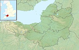
372:
362:
360:
351:
350:
346:
336:
334:
333:on 26 July 2011
330:
323:
319:
318:
314:
310:
274:
253:
236:
231:
207:Clatworthy Camp
196:
163:
147: countries
132:Primary inflows
106:
104:
100:
97:
92:
89:
87:
85:
84:
64:
63:
62:
61:
60:
59:
58:
54:
19:
12:
11:
5:
433:
431:
423:
422:
417:
407:
406:
403:
402:
394:
393:External links
391:
389:
388:
370:
344:
311:
309:
306:
273:
270:
252:
249:
235:
232:
230:
227:
168:
167:
160:
156:
155:
152:
151:
150:United Kingdom
148:
141:
140:
135:
127:
126:
121:
115:
114:
82:
76:
75:
70:
66:
65:
56:
55:
48:
47:
41:
40:
39:
38:
35:
34:
26:
25:
17:
13:
10:
9:
6:
4:
3:
2:
432:
421:
418:
416:
413:
412:
410:
400:
397:
396:
392:
384:
380:
374:
371:
358:
354:
348:
345:
329:
322:
316:
313:
307:
305:
303:
299:
295:
291:
287:
283:
279:
271:
269:
267:
257:
250:
248:
246:
242:
233:
228:
226:
224:
220:
219:Domesday Book
215:
212:
208:
204:
202:
194:
190:
186:
182:
181:Brendon Hills
178:
174:
161:
153:
149:
146:
142:
139:
136:
134:
128:
125:
122:
120:
116:
111:
83:
77:
74:
71:
45:
36:
32:
27:
22:
16:
382:
373:
361:. Retrieved
357:the original
347:
335:. Retrieved
328:the original
315:
286:silver birch
282:sessile oaks
275:
266:Wiveliscombe
262:
237:
205:
193:Wessex Water
172:
171:
159:Water volume
15:
245:brown trout
105: /
80:Coordinates
409:Categories
337:10 January
308:References
229:Recreation
201:River Tone
177:Clatworthy
138:River Tone
90:51°04′23″N
363:27 August
214:hill fort
124:reservoir
298:roe deer
294:Red deer
272:Wildlife
211:Iron Age
189:Somerset
187:in west
93:3°22′9″W
73:Somerset
69:Location
401:website
302:badgers
259:The dam
251:Walking
241:Rainbow
234:Angling
179:in the
379:"Home"
331:(PDF)
324:(PDF)
290:rowan
280:with
278:beech
209:, an
145:Basin
365:2010
339:2009
300:and
288:and
243:and
119:Type
411::
381:.
296:,
284:,
225:.
385:.
367:.
341:.
197:×
164:×
Text is available under the Creative Commons Attribution-ShareAlike License. Additional terms may apply.