68:
43:
84:
91:
322:
was a well-developed retail infrastructure serving the surrounding area of cattle and agricultural lands. In the rural area there were 369 establishments occupying about 1,000 persons. 176 of the farms had tractors, a ratio of one in two. There were 309 automobiles in all of the municipality, about one for every 10 inhabitants.
53:
321:
The most important economic activities are cattle raising, commerce, and agriculture. The GDP in 2005 was R$ 55,658,000. Comendador Gomes is in the top tier of municipalities in the state with regard to economic and social development. As of 2007 there were no banking agencies in the town. There
325:
Comendador Gomes is an important agricultural producer. There were 61,000 head of cattle in 2006, of which 12,000 head were dairy cows. In permanent crops there are 1,128 ha (2,790 acres) planted, while in perennial crops 1,697 ha (4,190 acres) were planted.
359:
In the health sector there were 02 health clinics and no hospitals. In the educational sector there were 11 primary schools and no middle schools.
533:
518:
67:
115:
52:
83:
240:. The population is 3,120 (2020 est.) in an area of 1,041.05 km (401.95 square miles). It became a municipality in 1948.
42:
500:
482:
452:
395:
in São Paulo with 0.919, while the lowest was
Setubinha. In more recent statistics (considering 5,507 municipalities)
162:
147:
30:
364:
253:
392:
249:
271:
418:
384:
248:
Comendador Gomes is located at an elevation of 557 meters in the west of the area known as the
157:
169:
504:
486:
396:
297:
224:
527:
237:
174:
497:
479:
400:
456:
220:
130:
117:
388:
277:
215:
440:
265:
309:
329:
The crops with a planted area of more than 100 hectares in 2007 were:
403:
has the lowest rating in the country—0,467—putting it in last place.
303:
283:
257:
252:
429:
383:
The highest ranking municipality in Minas Gerais in 2000 was
373:
National ranking: 676 out of 5,138 municipalities as of 2000
236:
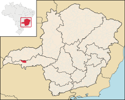
is a municipality in the west of the
Brazilian state of
370:
State ranking: 57 out of 853 municipalities as of 2000
214:
206:
198:
193:
185:
180:
168:
156:
146:
21:
379:Life expectancy: 73 (average of males and females)
256:). It belongs to the statistical microregion of
430:Instituto Brasileiro de Geografia e Estatística
8:
18:
189:1,041.05 km (401.95 sq mi)
391:with 0.568. Nationally the highest was
90:
411:
213:
192:
179:
145:
110:
76:
64:
36:
519:List of municipalities in Minas Gerais
475:
473:
333:oranges: 6,500 ha (16,000 acres)
205:
197:
184:
167:
155:
7:
339:sugarcane: 686 ha (1,700 acres)
345:soybeans: 700 ha (1,700 acres)
336:pineapple: 230 ha (570 acres)
260:. Neighboring municipalities are:
14:
387:with 0.841, while the lowest was
342:corn: 2,300 ha (5,700 acres)
16:Municipality in Southeast, Brazil
348:sorghum: 280 ha (690 acres)
89:
82:
66:
51:
41:
72:Location in Minas Gerais state
534:Municipalities in Minas Gerais
1:
550:
312:: 200 km (120 miles)
300:: 603 km (375 miles)
111:
77:
65:
37:
28:
365:Human Development Index
306:: 55 km (34 miles)
210:3.0/km (7.8/sq mi)
485:June 11, 2008, at the
355:Health and education
276:West and Southwest:
207: • Density
317:Economic activities
127: /
503:2011-07-06 at the
393:São Caetano do Sul
376:Literacy rate: 89%
199: • Total
186: • Total
103:Location in Brazil
250:Triângulo Mineiro
231:
230:
131:19.683°S 49.067°W
541:
507:
495:
489:
477:
468:
467:
465:
464:
455:. Archived from
449:
443:
438:
432:
427:
421:
416:
399:in the state of
234:Comendador Gomes
142:
141:
139:
138:
137:
136:-19.683; -49.067
132:
128:
125:
124:
123:
120:
97:Comendador Gomes
93:
92:
86:
70:
55:
45:
23:Comendador Gomes
19:
549:
548:
544:
543:
542:
540:
539:
538:
524:
523:
515:
510:
505:Wayback Machine
496:
492:
487:Wayback Machine
478:
471:
462:
460:
451:
450:
446:
439:
435:
428:
424:
417:
413:
409:
385:Poços de Caldas
357:
319:
246:
135:
133:
129:
126:
121:
118:
116:
114:
113:
107:
106:
105:
104:
101:
100:
99:
98:
94:
73:
61:
60:
59:
58:
49:
48:
33:
24:
17:
12:
11:
5:
547:
545:
537:
536:
526:
525:
522:
521:
514:
511:
509:
508:
490:
469:
444:
433:
422:
410:
408:
405:
381:
380:
377:
374:
371:
368:
367:: 0.795 (2000)
356:
353:
350:
349:
346:
343:
340:
337:
334:
318:
315:
314:
313:
307:
301:
298:Belo Horizonte
287:
286:
280:
274:
268:
245:
242:
229:
228:
218:
212:
211:
208:
204:
203:
200:
196:
195:
191:
190:
187:
183:
182:
178:
177:
172:
166:
165:
160:
154:
153:
150:
144:
143:
109:
108:
102:
96:
95:
88:
87:
81:
80:
79:
78:
75:
74:
71:
63:
62:
56:
50:
46:
40:
39:
38:
35:
34:
29:
26:
25:
22:
15:
13:
10:
9:
6:
4:
3:
2:
546:
535:
532:
531:
529:
520:
517:
516:
512:
506:
502:
499:
494:
491:
488:
484:
481:
476:
474:
470:
459:on 2010-07-07
458:
454:
448:
445:
442:
437:
434:
431:
426:
423:
420:
415:
412:
406:
404:
402:
398:
394:
390:
386:
378:
375:
372:
369:
366:
362:
361:
360:
354:
352:
347:
344:
341:
338:
335:
332:
331:
330:
327:
323:
316:
311:
308:
305:
302:
299:
296:
295:
294:
293:
289:
285:
281:
279:
275:
273:
269:
267:
263:
262:
261:
259:
255:
251:
243:
241:
239:
235:
226:
222:
219:
217:
209:
201:
188:
176:
173:
171:
164:
161:
159:
151:
149:
140:
112:Coordinates:
85:
69:
54:
44:
32:
27:
20:
493:
461:. Retrieved
457:the original
453:"Aonde fica"
447:
436:
425:
414:
382:
358:
351:
328:
324:
320:
291:
290:
288:
247:
238:Minas Gerais
233:
232:
175:Minas Gerais
57:Coat of arms
31:Municipality
221:UTC−3
134: /
498:Frigoletto
463:2008-06-14
441:Aonde fica
407:References
401:Pernambuco
363:Municipal
194:Population
419:IBGE 2020
389:Setubinha
292:Distances
278:Itapagipe
216:Time zone
163:Southeast
528:Category
513:See also
501:Archived
483:Archived
266:Pirajuba
244:Location
310:Uberaba
282:South:
264:North:
148:Country
119:19°41′S
397:Manari
304:Frutal
284:Frutal
270:East:
258:Frutal
254:Br-153
158:Region
152:Brazil
122:49°4′W
272:Prata
202:3,120
170:State
480:IBGE
181:Area
47:Flag
225:BRT
530::
472:^
466:.
227:)
223:(
Text is available under the Creative Commons Attribution-ShareAlike License. Additional terms may apply.