490:
150:
234:
64:
at the corner of the B3272 named for St
Barnabas. This burned down in the 1980s and was replaced by a new St Barnabas in Bell Lane, close to Frogmore Green. The previous incumbent was the Reverend Mike Saunders, who was also
38:
and Darby Green is separated from the rest of the parish by a small gap around Clarks Farm, until recently a composting farm in the mushroom producing industry. The ward has a boundary shared with
531:
555:
101:
524:
550:
213:
517:
31:
162:
66:
154:
382:
447:
244:
39:
57:
and Darby Green Road. The historian Sidney Loader was a resident of
Yateley and lived near this spot.
452:
397:
322:
35:
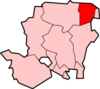
117:
206:
489:
191:
437:
432:
407:
347:
97:
43:
501:
462:
316:
275:
442:
362:
342:
337:
300:
265:
260:
290:
427:
332:
305:
73:. Every year, close to St Barnabas Day in June, the Church organises a community fair.
544:
417:
223:
199:
387:
285:
377:
372:
457:
422:
392:
367:
61:
54:
50:
177:
164:
497:
357:
255:
27:
233:
149:
327:
295:
270:
70:
468:
352:
250:
23:
412:
402:
310:
195:
93:
Reading & Windsor (Henley-on-Thames & Bracknell)
505:
53:; he was supposedly hung at the junction of the
525:
207:
8:
118:"Ordnance Survey: 1:50,000 Scale Gazetteer"
42:, which is one part of the Civil Parish of
532:
518:
214:
200:
192:
91:Ordnance Survey: Landranger map sheet 175
82:
49:Parson Darby was a local vicar and a
7:
486:
484:
504:. You can help Knowledge (XXG) by
14:
127:. Ordnance Survey. 1 January 2016
488:
232:
148:
222:Towns, villages and hamlets in
96:(Map). Ordnance Survey. 2012.
22:is a village in the parish of
1:
16:Village in Hampshire, England
572:
483:
556:Hampshire geography stubs
239:
230:
125:www.ordnancesurvey.co.uk
500:location article is a
551:Villages in Hampshire
157:at Wikimedia Commons
174: /
60:There used to be a
178:51.3316°N 0.8044°W
513:
512:
478:
477:
438:Warnborough Green
433:South Warnborough
408:North Warnborough
153:Media related to
563:
534:
527:
520:
492:
485:
463:Winchfield Green
276:Crookham Village
236:
216:
209:
202:
193:
189:
188:
186:
185:
184:
183:51.3316; -0.8044
179:
175:
172:
171:
170:
167:
152:
137:
136:
134:
132:
122:
121:(csv (download))
114:
108:
107:
87:
30:, England. The
571:
570:
566:
565:
564:
562:
561:
560:
541:
540:
539:
538:
481:
479:
474:
363:Heckfield Heath
343:Hartley Wintney
338:Hartley Wespall
301:Eversley Centre
266:Church Crookham
261:Chandlers Green
237:
226:
220:
182:
180:
176:
173:
168:
165:
163:
161:
160:
146:
141:
140:
130:
128:
120:
116:
115:
111:
104:
89:
88:
84:
79:
17:
12:
11:
5:
569:
567:
559:
558:
553:
543:
542:
537:
536:
529:
522:
514:
511:
510:
493:
476:
475:
473:
472:
465:
460:
455:
450:
445:
440:
435:
430:
425:
420:
415:
410:
405:
400:
395:
390:
385:
380:
375:
370:
365:
360:
355:
350:
345:
340:
335:
333:Hartfordbridge
330:
325:
320:
313:
308:
306:Eversley Cross
303:
298:
293:
288:
283:
278:
273:
268:
263:
258:
253:
248:
240:
238:
231:
228:
227:
221:
219:
218:
211:
204:
196:
145:
144:External links
142:
139:
138:
109:
102:
81:
80:
78:
75:
32:electoral ward
15:
13:
10:
9:
6:
4:
3:
2:
568:
557:
554:
552:
549:
548:
546:
535:
530:
528:
523:
521:
516:
515:
509:
507:
503:
499:
494:
491:
487:
482:
471:
470:
466:
464:
461:
459:
456:
454:
451:
449:
446:
444:
441:
439:
436:
434:
431:
429:
426:
424:
421:
419:
418:Phoenix Green
416:
414:
411:
409:
406:
404:
401:
399:
396:
394:
391:
389:
386:
384:
381:
379:
376:
374:
371:
369:
366:
364:
361:
359:
356:
354:
351:
349:
346:
344:
341:
339:
336:
334:
331:
329:
326:
324:
321:
319:
318:
314:
312:
309:
307:
304:
302:
299:
297:
294:
292:
289:
287:
284:
282:
279:
277:
274:
272:
269:
267:
264:
262:
259:
257:
254:
252:
249:
247:
246:
242:
241:
235:
229:
225:
224:Hart District
217:
212:
210:
205:
203:
198:
197:
194:
190:
187:
158:
156:
151:
143:
126:
119:
113:
110:
105:
103:9780319232149
99:
95:
92:
86:
83:
76:
74:
72:
68:
63:
58:
56:
52:
47:
45:
41:
37:
33:
29:
26:, North East
25:
21:
506:expanding it
495:
480:
467:
388:Lower Common
315:
291:Dora's Green
286:Dogmersfield
280:
243:
159:
147:
129:. Retrieved
124:
112:
94:
90:
85:
59:
48:
19:
18:
383:Long Sutton
378:Hound Green
373:Hook Common
281:Darby Green
181: /
155:Darby Green
131:18 February
20:Darby Green
545:Categories
458:Winchfield
448:West Green
423:Rotherwick
393:Mattingley
245:Blackwater
166:51°19′54″N
77:References
62:tin church
51:highwayman
40:Blackwater
498:Hampshire
453:Whitehall
398:Mill Lane
358:Heckfield
256:Bramshill
169:0°48′16″W
28:Hampshire
328:Greywell
323:Frogmore
296:Eversley
271:Crondall
71:Eversley
36:Frogmore
469:Yateley
353:Hazeley
251:Blounce
24:Yateley
413:Odiham
403:Minley
348:Hawley
311:Ewshot
100:
67:Rector
44:Hawley
496:This
317:Fleet
55:B3272
502:stub
443:Well
368:Hook
133:2016
98:ISBN
428:Rye
69:of
34:of
547::
123:.
46:.
533:e
526:t
519:v
508:.
215:e
208:t
201:v
135:.
106:.
Text is available under the Creative Commons Attribution-ShareAlike License. Additional terms may apply.