385:
peak in 1960, with a total population of 5,127. After this point, the population has steadily declined, with the total population (from the 2011 Census), to be recorded at 4,851. According to the 2011 Census, the most dominant age sector was the 45 - 59 year olds, accounting for a quarter of the population in
Darenth. The biggest population increase in Darenth has occurred in the 30 - 44 year old age sector, going from 325 people (according to the 2001 Census), to 1031 people, merely 10 years later. This also correlates with the population graph as there is a steady increase from 2001 to 2011. Over the 10-year period (2001 - 2011) Darenth has encountered a slight decrease in young dependants, with a decline of 9%, thus fewer people are having babies. The decline in young dependants and the increase in the economically active, has changed Darenth's demography, resulting in a population imbalance between the youth, the elderly and the economically active.
448:. Today, all occupations revolve around a tertiary and quaternary sector, with a dominance within Professional, Administrative and Secretarial occupations. The most dominant group is Professional occupations, with a total of 381 people employed in this sector, making up 16% of Darenth's occupation structure in 2011. The least common occupation revolves around the secondary sector, with 194 employed within plant, process and machine operatives. The occupation structure no longer revolves around a primary sector, this is because people are educated and thus have a higher skill set that is required for primary jobs. As a result of this, the occupation structure has shifted to secondary, tertiary and quaternary sectors, obviously, there are more opportunities in Darenth which people have taken advantage of, thus enabling a more service-based community.
428:
low-skilled and manual labour, this is also a reflection of the area it is in. Occupation structure is limited within the female community, often, females did not have paid work or the work was informal, thus explaining the 344 women whose occupation was either unknown or unemployed. The largest formal work undertaken by females was within domestic services, employing 115 women. Domestic services were most common within the female occupation structure, because jobs which females were allowed to do were limited, and as a result of this, domestic services were found to be the easiest within the female population because females were taught domestic skills form a young age.
31:
390:
47:
310:
318:
433:
888:
54:
410:
populations, making up as little as 0.04% (Jewish), 0.4% ( Buddhists), 1% (Sikhs), 1.4% (Muslim) and 2% (Hindu). The religious groupings directly correlate to the ethnic groupings, for example, the dominant religions correlate with the dominant ethnicities, this pattern is also similar with the minority religions and the minority ethnicities.
772:
690:
660:
192:
409:
The dominant religion in
Darenth is Christianity, making up 62% of the total population, on the contrary, 27% of the population identify as Atheists, and as a result Atheists are the second most common grouping. The minority religious groups in Darenth are the Jewish, Buddhist, Sikh, Muslim and Hindu
400:
Darenth has a total of 17 different Ethnic groups, however the majority remain white, with a total of 4,158 white people. The dominant minority are the
British Asian grouping, with a total of 140 people, the smallest ethnic grouping are the Mixed White and Black African grouping, with as little as 7
384:
The population in
Darenth remains stable, up until 1850. After this point, the population increases gradually, up until 1911, where the population dramatically increases. The boundary for Darenth changed on 1 April 1955, thus explaining the minor fluctuation, the population then went on to reach its
418:
Data in early Census reports, often got mixed up, causing multiple issues with social status due to the confusion of people's occupation, as well as who owned certain business'. In 1831, a much more detailed categorisation was published on occupations, and as a result, this Census has been the most
443:
From the 2011 Census, Darenth's occupation structure has completely shifted. Today a total of 2,449 men and women between the ages of 16-74 are in employment, compared to 1881, where the total came to 844. A lot of industries and business' that were dominant in 1881, such as agricultural work and
419:
detailed parish-occupational data to be published from the Census. After 1841 multiple occupations were used to provide data for detailed tables, contributing to over 3,000 different occupations, however by 1881, job titles had been re-organised and sub-categorised into a total of 414 job titles.
427:
The occupation structure of
Darenth in 1881, represents a clear divide of male and female work, the dominant structure for males is the Agricultural sector, in comparison to the females where Domestic services were dominant. Agriculture is the most common sector for males because it requires
556:
780:
698:
668:
564:
510:
401:
people, however as a whole, the Mixed grouping has a total of 51 people, which is not the smallest overall. The smallest grouping overall are the Arabs, with a total population making up as little as 8 people.
747:"1881 Census of England and Wales, Tables: Ages, Condition as to Marriage, Occupations and Birthplaces of people, Table 10: " Occupations of Males and Females in the Division and its Registration Counties""
232:
104:
216:
444:
dealerships, no longer provide jobs for the economically active in
Darenth, agricultural work has been overthrown by the secondary, tertiary and
746:
638:
612:
240:
30:
204:
866:
276:
221:
258:
1017:
176:
140:
1012:
209:
389:
46:
544:
A parish in
Dartford district, Kent; on the river Darent, 1½ mile N of Farningham r. station, and 2¼ SSE of Dartford.
372:
a parish in
Dartford district, Kent; on the river Darent, 1½ mile N of Farningham r. station, and 2¼ SSE of Dartford.
835:
1007:
639:"1881 Census of England and Wales, Tables: Ages, Condition as to Marriage, Occupations and Birthplaces of people"
613:"1881 Census of England and Wales, Tables: Ages, Condition as to Marriage, Occupations and Birthplaces of people"
482:
263:
844:
154:
466:
365:
988:
859:
268:
721:"Darenth CP/AP through time, Industry Statistics, Males aged 20 and over, in 9 occupational categories"
802:
86:
876:
720:
333:
130:
122:
94:
972:
932:
852:
445:
309:
381:
According to the 2011 Census, there were 2,398 males and 2,453 females living in the parish.
977:
937:
917:
181:
317:
839:
361:
962:
432:
1001:
490:
462:
922:
329:
586:
957:
197:
537:
967:
952:
897:
291:
278:
942:
486:
164:
887:
947:
912:
807:
478:
345:
169:
927:
902:
349:
341:
146:
832:
337:
112:
67:
848:
231:
215:
203:
191:
175:
163:
153:
139:
121:
103:
85:
77:
23:
667:. Office for National Statistics. Archived from
563:. Office for National Statistics. Archived from
803:"New bus route C3 starts on Tuesday 2nd April"
727:. GB Historical GIS / University of Portsmouth
860:
557:"Key Figures for 2011 Census: Key Statistics"
8:
753:. GB Historical GIS/University of Portsmouth
641:. GB Historical GIS/University of Portsmouth
619:. GB Historical GIS/University of Portsmouth
593:. GB Historical GIS/University of Portsmouth
481:routes C1 and C3, providing connections to
867:
853:
845:
20:
368:. In the 1870s, Darenth was described as
344:. It is located 3.4 miles south east of
316:
308:
539:Imperial Gazetteer of England and Wales
502:
230:
186:
162:
138:
27:
214:
202:
190:
174:
152:
120:
102:
84:
7:
14:
542:. Edinburgh: A.Fullarton and Co.
414:Occupation Structure Through Time
886:
587:"Darenth AP/CP boundary changes"
517:. Office for National Statistics
431:
388:
52:
45:
29:
536:Marius Wilson, John (1870–72).
53:
691:"Ethnic Group, 2011 (KS201EW)"
511:"Civil Parish population 2011"
1:
773:"Occupation, 2011 (KS608EW)"
439:Occupation Structure in 2011
348:and 4.6 miles north east of
313:20th Century map of Darenth
18:Human settlement in England
1034:
875:Towns and villages in the
469:, located 1.6 miles away.
986:
893:
884:
249:
227:
187:
40:
28:
838:23 November 2015 at the
777:Neighbourhood Statistics
695:Neighbourhood Statistics
665:Neighbourhood Statistics
561:Neighbourhood Statistics
515:Neighbourhood Statistics
321:Ethnic groups in Darenth
81:4,851 (2011 Census)
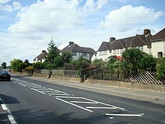
35:A street view of Darenth
366:Dartford Rural District
360:The parish was part of
1018:Civil parishes in Kent
989:List of places in Kent
374:
322:
314:
177:Postcode district
661:"Age Structure, 2011"
477:Darenth is served by
370:
320:
312:
833:St Margaret’s church
155:Sovereign state
1013:Borough of Dartford
877:Borough of Dartford
567:on 15 February 2017
334:Borough of Dartford
288: /
446:quaternary sectors
423:Occupation in 1881
323:
315:
292:51.4199°N 0.2567°E
233:UK Parliament
995:
994:
751:Vision of Britain
725:Vision of Britain
617:Vision of Britain
591:Vision of Britain
328:is a village and
307:
306:
105:Shire county
1025:
1008:Villages in Kent
890:
869:
862:
855:
846:
820:
819:
817:
815:
799:
793:
792:
790:
788:
779:. Archived from
769:
763:
762:
760:
758:
743:
737:
736:
734:
732:
717:
711:
710:
708:
706:
697:. Archived from
687:
681:
680:
678:
676:
671:on 22 March 2017
657:
651:
650:
648:
646:
635:
629:
628:
626:
624:
609:
603:
602:
600:
598:
583:
577:
576:
574:
572:
553:
547:
546:
533:
527:
526:
524:
522:
507:
435:
392:
303:
302:
300:
299:
298:
293:
289:
286:
285:
284:
281:
255:
222:South East Coast
149:
66:Location within
56:
55:
49:
33:
21:
1033:
1032:
1028:
1027:
1026:
1024:
1023:
1022:
998:
997:
996:
991:
982:
891:
880:
879:, Kent, England
873:
840:Wayback Machine
829:
824:
823:
813:
811:
801:
800:
796:
786:
784:
783:on 7 March 2017
771:
770:
766:
756:
754:
745:
744:
740:
730:
728:
719:
718:
714:
704:
702:
701:on 7 March 2017
689:
688:
684:
674:
672:
659:
658:
654:
644:
642:
637:
636:
632:
622:
620:
611:
610:
606:
596:
594:
585:
584:
580:
570:
568:
555:
554:
550:
535:
534:
530:
520:
518:
509:
508:
504:
499:
475:
467:Farningham Road
459:
454:
441:
425:
416:
407:
398:
379:
362:Axstane Hundred
358:
297:51.4199; 0.2567
296:
294:
290:
287:
282:
279:
277:
275:
274:
273:
253:
245:
145:
135:
117:
99:
73:
72:
71:
70:
64:
63:
62:
61:
57:
36:
19:
12:
11:
5:
1031:
1029:
1021:
1020:
1015:
1010:
1000:
999:
993:
992:
987:
984:
983:
981:
980:
975:
970:
965:
963:Sutton-at-Hone
960:
955:
950:
945:
940:
935:
930:
925:
920:
915:
910:
905:
900:
894:
892:
885:
882:
881:
874:
872:
871:
864:
857:
849:
843:
842:
828:
827:External links
825:
822:
821:
794:
764:
738:
712:
682:
652:
630:
604:
578:
548:
528:
501:
500:
498:
495:
474:
471:
458:
455:
453:
450:
440:
437:
424:
421:
415:
412:
406:
403:
397:
394:
378:
375:
357:
354:
305:
304:
272:
271:
266:
261:
256:
254:List of places
250:
247:
246:
244:
243:
237:
235:
229:
228:
225:
224:
219:
213:
212:
207:
201:
200:
195:
189:
188:
185:
184:
179:
173:
172:
167:
161:
160:
159:United Kingdom
157:
151:
150:
143:
137:
136:
134:
133:
127:
125:
119:
118:
116:
115:
109:
107:
101:
100:
98:
97:
91:
89:
83:
82:
79:
75:
74:
65:
59:
58:
51:
50:
44:
43:
42:
41:
38:
37:
34:
26:
25:
17:
13:
10:
9:
6:
4:
3:
2:
1030:
1019:
1016:
1014:
1011:
1009:
1006:
1005:
1003:
990:
985:
979:
976:
974:
971:
969:
966:
964:
961:
959:
956:
954:
951:
949:
946:
944:
941:
939:
938:Joyden's Wood
936:
934:
931:
929:
926:
924:
921:
919:
916:
914:
911:
909:
906:
904:
901:
899:
896:
895:
889:
883:
878:
870:
865:
863:
858:
856:
851:
850:
847:
841:
837:
834:
831:
830:
826:
810:
809:
804:
798:
795:
782:
778:
774:
768:
765:
752:
748:
742:
739:
726:
722:
716:
713:
700:
696:
692:
686:
683:
670:
666:
662:
656:
653:
640:
634:
631:
618:
614:
608:
605:
592:
588:
582:
579:
566:
562:
558:
552:
549:
545:
541:
540:
532:
529:
516:
512:
506:
503:
496:
494:
492:
491:New Ash Green
488:
484:
480:
472:
470:
468:
464:
463:National Rail
456:
451:
449:
447:
438:
436:
434:
429:
422:
420:
413:
411:
404:
402:
395:
393:
391:
386:
382:
376:
373:
369:
367:
363:
355:
353:
351:
347:
343:
339:
335:
331:
327:
319:
311:
301:
270:
267:
265:
262:
260:
257:
252:
251:
248:
242:
239:
238:
236:
234:
226:
223:
220:
218:
211:
208:
206:
199:
196:
194:
183:
180:
178:
171:
168:
166:
158:
156:
148:
144:
142:
132:
129:
128:
126:
124:
114:
111:
110:
108:
106:
96:
93:
92:
90:
88:
80:
76:
69:
48:
39:
32:
22:
16:
907:
812:. Retrieved
806:
797:
785:. Retrieved
781:the original
776:
767:
755:. Retrieved
750:
741:
729:. Retrieved
724:
715:
703:. Retrieved
699:the original
694:
685:
673:. Retrieved
669:the original
664:
655:
643:. Retrieved
633:
621:. Retrieved
616:
607:
595:. Retrieved
590:
581:
569:. Retrieved
565:the original
560:
551:
543:
538:
531:
521:11 September
519:. Retrieved
514:
505:
476:
461:The nearest
460:
442:
430:
426:
417:
408:
399:
387:
383:
380:
377:Demographics
371:
359:
330:civil parish
325:
324:
15:
973:Temple Hill
933:Joyce Green
757:28 February
645:28 February
623:28 February
597:28 February
571:14 February
465:station is
295: /
1002:Categories
978:Wilmington
968:Swanscombe
953:Southfleet
928:Hook Green
918:Greenhithe
497:References
364:and later
280:51°25′12″N
131:South East
78:Population
943:Longfield
487:Longfield
483:Bluewater
452:Transport
396:Ethnicity
283:0°15′24″E
217:Ambulance
165:Post town
948:New Barn
913:Dartford
836:Archived
814:15 April
808:Go-Coach
731:21 March
675:21 March
479:Go-Coach
405:Religion
346:Dartford
241:Dartford
170:Dartford
95:Dartford
87:District
908:Darenth
903:Betsham
787:7 March
705:7 March
356:History
350:Swanley
342:England
332:in the
326:Darenth
264:England
147:England
141:Country
60:Darenth
24:Darenth
923:Hawley
193:Police
123:Region
958:Stone
473:Buses
898:Bean
816:2024
789:2017
759:2017
733:2017
707:2017
677:2017
647:2017
625:2017
599:2017
573:2017
523:2016
489:and
457:Rail
338:Kent
269:Kent
210:Kent
205:Fire
198:Kent
113:Kent
68:Kent
182:DA2
1004::
805:.
775:.
749:.
723:.
693:.
663:.
615:.
589:.
559:.
513:.
493:.
485:,
352:.
340:,
336:,
259:UK
868:e
861:t
854:v
818:.
791:.
761:.
735:.
709:.
679:.
649:.
627:.
601:.
575:.
525:.
Text is available under the Creative Commons Attribution-ShareAlike License. Additional terms may apply.