358:
188:
220:
227:
195:
415:
Airport construction started in 1946. It was completed and the airport opened in 1947 with four unpaved runways. In 1987 the City
Council of Owatonna renamed the airport Glenn J. Degner Airfield, after one of the original aviation pioneers of Owatonna. In the 1990s, the concrete runway was lengthened
427:
was a business jet flight operated by East Coast Jets and destined for
Owatonna. The plane crashed on July 31, 2008, while attempting a go-around at the airport, killing all eight passengers and crew on board.
632:
627:
357:
134:
416:
to 5,500 feet (1,700 m) and an instrument landing system was added. The airport was renamed The
Owatonna Degner Regional Airport in August 1999.
554:
539:
499:
219:
187:
385:
348:
66:
622:
437:
127:
424:
403:. Its IATA identifier "OWA" comes from the first three letters of the city of Owatonna. The airport is used for
463:
400:
545:
117:
535:
459:
396:
388:
101:
69:
604:
572:
530:
504:
377:
369:
169:
55:
44:
404:
588:
17:
598:
616:
592:
578:
549:
361:
Sculpture of three retired USAF T-38A Talons at
Owatonna Degner Regional Airport
477:
149:
136:
582:
500:"NTSB preliminary report issued in crash that killed Bethlehem-area pilots"
566:
264:
251:
356:
467:. Federal Aviation Administration. Effective September 12, 2019.
633:
Buildings and structures in Steele County, Minnesota
333:
325:
316:
250:
175:
165:
126:
115:
107:
96:
88:
83:
32:
27:Airport serving Owatonna, Minnesota, United States
8:
628:Transportation in Steele County, Minnesota
478:"Owatonna Degner Regional Airport History"
322:
29:
449:
540:Minnesota Department of Transportation
455:
453:
7:
25:
531:Owatonna Degner Regional Airport
366:Owatonna Degner Regional Airport
225:
218:
193:
186:
170:Owatonna Degner Regional Airport
34:Owatonna Degner Regional Airport
587:NOAA/NWS weather observations:
555:FAA Terminal Procedures for OWA
536:Minnesota Public Airports (OWA)
349:Federal Aviation Administration
95:
498:Deegan, Jim (August 7, 2008).
395:) is three miles northwest of
1:
605:current OWA delay information
557:, effective September 5, 2024
460:FAA Airport Form 5010 for OWA
438:List of airports in Minnesota
241:Show map of the United States
567:airport information for KOWA
562:Resources for this airport:
599:aeronautical chart for KOWA
226:
194:
649:
122:1,146 ft / 349 m
425:East Coast Jets Flight 81
345:
321:
271:
268:
263:
259:
180:
39:
573:accident history for OWA
401:Steele County, Minnesota
546:Aerial image as of 2019
18:Degner Regional Airport
362:
623:Airports in Minnesota
360:
209:Show map of Minnesota
150:44.12333°N 93.26000°W
583:live flight tracker
579:airport information
326:Aircraft operations
155:44.12333; -93.26000
146: /
111:Owatonna, Minnesota
102:Owatonna, Minnesota
363:
542:Airport Directory
505:The Express-Times
466:
355:
354:
341:
340:
317:Statistics (2018)
312:
311:
16:(Redirected from
640:
517:
516:
514:
512:
495:
489:
488:
486:
484:
474:
468:
462:
457:
405:general aviation
323:
261:
260:
254:
242:
229:
228:
222:
210:
197:
196:
190:
161:
160:
158:
157:
156:
151:
147:
144:
143:
142:
139:
76:
75:
62:
61:
51:
50:
30:
21:
648:
647:
643:
642:
641:
639:
638:
637:
613:
612:
611:
593:past three days
526:
521:
520:
510:
508:
497:
496:
492:
482:
480:
476:
475:
471:
458:
451:
446:
434:
422:
413:
351:
252:
246:
245:
244:
243:
240:
239:
238:
237:
236:
230:
213:
212:
211:
208:
207:
206:
205:
204:
198:
154:
152:
148:
145:
140:
137:
135:
133:
132:
116:Elevation
79:
73:
65:
59:
54:
48:
43:
35:
28:
23:
22:
15:
12:
11:
5:
646:
644:
636:
635:
630:
625:
615:
614:
610:
609:
608:
607:
601:
595:
585:
575:
569:
560:
558:
552:
543:
533:
527:
525:
524:External links
522:
519:
518:
490:
469:
448:
447:
445:
442:
441:
440:
433:
430:
421:
418:
412:
409:
353:
352:
346:
343:
342:
339:
338:
335:
334:Based aircraft
331:
330:
327:
319:
318:
314:
313:
310:
309:
306:
303:
300:
296:
295:
292:
289:
286:
282:
281:
278:
274:
273:
270:
267:
257:
256:
248:
247:
232:
231:
224:
223:
217:
216:
215:
214:
200:
199:
192:
191:
185:
184:
183:
182:
181:
178:
177:
173:
172:
167:
163:
162:
130:
124:
123:
120:
113:
112:
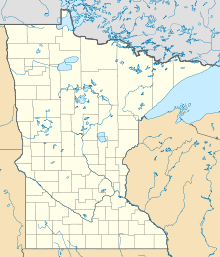
109:
105:
104:
98:
94:
93:
90:
86:
85:
81:
80:
78:
77:
63:
52:
40:
37:
36:
33:
26:
24:
14:
13:
10:
9:
6:
4:
3:
2:
645:
634:
631:
629:
626:
624:
621:
620:
618:
606:
602:
600:
596:
594:
590:
586:
584:
580:
576:
574:
570:
568:
564:
563:
561:
559:
556:
553:
551:
547:
544:
541:
537:
534:
532:
529:
528:
523:
507:
506:
501:
494:
491:
479:
473:
470:
465:
461:
456:
454:
450:
443:
439:
436:
435:
431:
429:
426:
419:
417:
410:
408:
406:
402:
398:
394:
390:
387:
383:
379:
375:
371:
367:
359:
350:
344:
336:
332:
328:
324:
320:
315:
307:
304:
301:
298:
297:
293:
290:
287:
284:
283:
279:
276:
275:
266:
262:
258:
255:
249:
235:
221:
203:
189:
179:
174:
171:
168:
164:
159:
131:
129:
125:
121:
119:
114:
110:
106:
103:
99:
91:
87:
82:
71:
68:
64:
57:
53:
46:
42:
41:
38:
31:
19:
577:FlightAware
509:. Retrieved
503:
493:
481:. Retrieved
472:
423:
414:
392:
381:
373:
365:
364:
233:
201:
89:Airport type
550:Google Maps
153: /
128:Coordinates
617:Categories
597:SkyVector
511:October 7,
483:October 7,
444:References
141:93°15′36″W
138:44°07′24″N
420:Accidents
294:Concrete
265:Direction
432:See also
397:Owatonna
347:Source:
308:Asphalt
272:Surface
100:City of
589:current
565:AirNav
411:History
269:Length
253:Runways
166:Website
84:Summary
329:29,930
302:3,000
291:1,676
288:5,500
285:12/30
108:Serves
92:Public
548:from
399:, in
299:5/23
97:Owner
603:FAA
581:and
571:ASN
513:2019
485:2019
382:KOWA
378:ICAO
370:IATA
305:914
118:AMSL
60:KOWA
56:ICAO
45:IATA
538:at
464:PDF
393:OWA
389:LID
386:FAA
374:OWA
277:ft
234:OWA
202:OWA
176:Map
74:OWA
70:LID
67:FAA
49:OWA
619::
591:,
502:.
452:^
407:.
391::
384:,
380::
376:,
372::
337:44
280:m
72::
58::
47::
515:.
487:.
368:(
20:)
Text is available under the Creative Commons Attribution-ShareAlike License. Additional terms may apply.