133:
28:
140:
62:
255:
The summit lies within the modern administrative boundaries of
Warwickshire following boundary changes over the last century, but technically the summit was historically (just) over the border in Gloucestershire. The true historic county top of Warwickshire thus lies about 30m south of the summit on
196:
386:
132:
75:
89:
286:
364:
337:
391:
190:
82:
354:
237:
232:, England, which at 261 m (856 ft) is the highest in the county. It is situated between the villages of
27:
53:
257:
61:
70:
360:
333:
282:
325:
245:
209:
204:
303:
176:
380:
229:
256:
a track (grid reference SP 18778 42599, height 260 metres (850 ft)). The
104:
91:
249:
241:
233:
183:
165:
169:
43:
225:
356:
The UK's County Tops: Reaching the top of 91 historic counties
260:
at 259 metres (850 ft) is not the summit of the hill.
203:
189:
175:
161:
120:
81:
69:
52:
42:
37:
20:
330:151 Stratford-upon-Avon, Warwick & Banbury
332:. OS Landranger Map Series. Ordnance Survey.
8:
281:. Chichester: Summersdale. pp. 98–104.
60:
17:
279:Walking the county high points of England
269:
139:
7:
306:. The Mountains of England and Wales
387:Highest points of English counties
14:
138:
131:
26:
152:Ebrington Hill in Warwickshire
58:111 m (364 ft)
1:
408:
125:
25:
277:Bathurst, David (2012).
244:on the Warwickshire and
48:261 m (856 ft)
302:Simon Edwardes (2001).
304:"Historic County Tops"
392:Hills of Warwickshire
353:Muir, Jonny (2011).
258:triangulation pillar
101: /
105:52.0817°N 1.7273°W
38:Highest point
288:978-1-84-953239-6
219:
218:
399:
371:
370:
350:
344:
343:
322:
316:
315:
313:
311:
299:
293:
292:
274:
199:
179:
142:
141:
135:
116:
115:
113:
112:
111:
110:52.0817; -1.7273
106:
102:
99:
98:
97:
94:
65:
64:
30:
18:
407:
406:
402:
401:
400:
398:
397:
396:
377:
376:
375:
374:
367:
352:
351:
347:
340:
326:Ordnance Survey
324:
323:
319:
309:
307:
301:
300:
296:
289:
276:
275:
271:
266:
246:Gloucestershire
195:
177:
157:
156:
155:
154:
153:
150:
149:
148:
147:
143:
109:
107:
103:
100:
95:
92:
90:
88:
87:
59:
33:
12:
11:
5:
405:
403:
395:
394:
389:
379:
378:
373:
372:
365:
345:
338:
317:
294:
287:
268:
267:
265:
262:
248:border in the
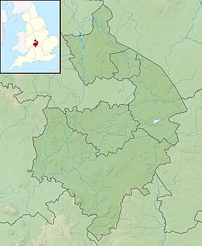
222:Ebrington Hill
217:
216:
207:
201:
200:
193:
187:
186:
181:
173:
172:
163:
159:
158:
151:
146:Ebrington Hill
145:
144:
137:
136:
130:
129:
128:
127:
126:
123:
122:
118:
117:
85:
79:
78:
73:
67:
66:
56:
50:
49:
46:
40:
39:
35:
34:
32:Ebrington Hill
31:
23:
22:
21:Ebrington Hill
13:
10:
9:
6:
4:
3:
2:
404:
393:
390:
388:
385:
384:
382:
368:
366:9781849655538
362:
358:
357:
349:
346:
341:
339:9780319231784
335:
331:
327:
321:
318:
305:
298:
295:
290:
284:
280:
273:
270:
263:
261:
259:
253:
251:
247:
243:
239:
235:
231:
227:
223:
214:
211:
208:
206:
202:
198:
194:
192:
188:
185:
182:
180:
174:
171:
167:
164:
160:
134:
124:
119:
114:
86:
84:
80:
77:
74:
72:
68:
63:
57:
55:
51:
47:
45:
41:
36:
29:
24:
19:
16:
359:. Cicerone.
355:
348:
329:
320:
308:. Retrieved
297:
278:
272:
254:
230:Warwickshire
221:
220:
212:
197:SP1878142634
178:Parent range
15:
108: /
83:Coordinates
381:Categories
264:References
213:Landranger
93:52°04′54″N
76:County Top
54:Prominence
250:Cotswolds
242:Ilmington
238:Mickleton
234:Ebrington
184:Cotswolds
166:Ebrington
121:Geography
96:1°43′38″W
44:Elevation
328:(2012).
205:Topo map
162:Location
310:28 June
191:OS grid
170:England
71:Listing
363:
336:
285:
224:is a
361:ISBN
334:ISBN
312:2013
283:ISBN
240:and
226:hill
228:in
215:151
383::
252:.
236:,
210:OS
168:,
369:.
342:.
314:.
291:.
Text is available under the Creative Commons Attribution-ShareAlike License. Additional terms may apply.