91:
1770:
107:
1182:
79:
114:
1075:
1217:
1129:
In the village, the population was spread out, with 22.4% under the age of 18, 5.6% from 18 to 24, 21.2% from 25 to 44, 19.5% from 45 to 64, and 31.3% who were 65 years of age or older. The median age was 46 years. For every 100 females, there were 92.4 males. For every 100 females age 18 and over,
1125:
living together, 9.4% had a female householder with no husband present, and 41.3% were non-families. 38.6% of all households were made up of individuals, and 23.3% had someone living alone who was 65 years of age or older. The average household size was 2.21 and the average family size was 2.97.
2107:
90:
422:
saw a business opportunity and decided to sell beef to the United States
Government so that the captive, displaced, and imprisoned Native Americans could be fed. This enterprise led to the establishment of the
523:, the village of Fort Sumner has a total area of 3.34 square miles (8.66 km), of which 3.31 square miles (8.58 km) is land and 0.03 square miles (0.08 km), or 0.93%, is water.
1094:
was 374.6 people per square mile (144.6 people/km). There were 680 housing units at an average density of 204.0 per square mile (78.8/km). The racial makeup of the village was 81.91%
1133:
The median income for a household in the village was $ 19,583, and the median income for a family was $ 28,625. Males had a median income of $ 24,722 versus $ 16,953 for females. The
1708:
407:, a prominent New Mexico landowner, in 1870. In the latter 1870s Maxwell's son Pete befriended legendary outlaw Billy the Kid, and it was in his house that Billy was killed by
449:
airline built an airfield in Fort Sumner as part of its coast-to-coast air passenger network, but the site was abandoned when the airline's ambitious plans collapsed in the
1256:
1887:
2092:
1541:
138:
1307:
106:
1701:
1629:
326:
431:
30:
This article is about the town in New Mexico. For the military fort charged with interning New Mexico at the Bosque
Redondo reservation, see
1609:
1197:
470:
372:
2097:
1694:
336:
2066:
1475:
1455:
1341:
414:
In 1866, the U.S. government was holding thousands of Native
American Indians at Fort Sumner after they were subdued by Kit Carson.
1873:
1278:
2102:
1686:
1447:
446:
190:
1880:
1149:
1099:
458:
454:
47:
2061:
1588:
1107:
520:
500:
488:
1718:
1390:
356:
195:
1311:
1845:
1053:
1038:
1023:
1008:
993:
978:
963:
948:
933:
918:
903:
368:
364:
1163:
314:
78:
1241:
1380:
2046:
1916:
1789:
1781:
1121:
There were 533 households, out of which 22.9% had children under the age of 18 living with them, 45.8% were
69:
2041:
1991:
1976:
1926:
1911:
1413:
1111:
504:
424:
1512:
2071:
2001:
1996:
1986:
1981:
1936:
1487:
466:
403:
populations from 1863 to 1868. The federal government closed the fort in 1868 and sold its buildings to
2036:
2016:
2011:
1956:
1931:
1852:
1751:
1115:
384:
287:
2051:
2031:
2026:
1941:
1832:
1799:
1647:
1470:
Myrick, David, ‘’New Mexico’s
Railroads, A Historic Survey’’, University of New Mexico Press 1990.
1103:
1095:
1971:
1966:
1951:
1946:
1809:
1616:
1137:
for the village was $ 13,327. About 20.4% of families and 25.3% of the population were below the
1091:
496:
492:
277:
1562:
1090:
of 2000, there were 1,249 people, 533 households, and 312 families residing in the village. The
1353:
1308:"Geographic Identifiers: 2010 Demographic Profile Data (G001): Fort Sumner village, New Mexico"
2021:
1921:
1657:
1471:
1451:
1337:
1187:
1134:
415:
388:
1441:
411:. Billy the Kid is buried in the old military cemetery in Fort Sumner, as is Lucien Maxwell.
2056:
2006:
1814:
450:
400:
1652:
481:
Fort Sumner is located northeast of the center of De Baca County on the north side of the
1633:
404:
39:
35:
1282:
17:
2086:
1537:
1079:
721:
419:
319:
1896:
1418:
1242:
U.S. Geological Survey
Geographic Names Information System: Fort Sumner, New Mexico
1138:
491:
passes through the village as Sumner Avenue, leading east 61 miles (98 km) to
435:
503:
comes in from the north as 4th Street, leading northwest 44 miles (71 km) to
395:
was a military fort established in 1862 and charged with the internment of nearby
1733:
1385:
482:
408:
392:
352:
43:
31:
1900:
1824:
1177:
360:
183:
178:
1865:
294:
273:
153:
140:
1358:
268:
1141:, including 33.9% of those under age 18 and 17.1% of those age 65 or over.
457:
as a training base during World War II. After the war, the base became the
1122:
302:
1681:
1251:
1249:
430:
In March 1908, the
Eastern Railway of New Mexico (as subsidiary of the
1074:
1769:
1087:
396:
27:
Village and county seat in De Baca County, New Mexico, United States
2108:
National
Register of Historic Places in De Baca County, New Mexico
1073:
508:
1682:
History of the stratospheric balloon research made at Fort Sumner
1610:"2020 CENSUS - SCHOOL DISTRICT REFERENCE MAP: De Baca County, NM"
507:. US 84 runs east from Fort Sumner with US 60 to Clovis and the
462:
439:
1869:
1690:
1768:
1584:
1310:. U.S. Census Bureau, American Factfinder. Archived from
531:
Climate data for Fort Sumner, New Mexico (1981–2010)
1823:
1798:
1780:
1750:
335:
325:
313:
301:
284:
267:
259:
251:
243:
238:
230:
222:
214:
206:
201:
189:
177:
169:
60:
1281:. National Association of Counties. Archived from
1334:New Mexico Place Names, A Geographical Dictionary
1152:is the school district of all of De Baca County.
371:. Fort Sumner is the spring and fall home of the
363:, United States. The population was 1,031 at the
1542:National Oceanic and Atmospheric Administration
113:
1881:
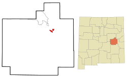
1773:Map of New Mexico highlighting De Baca County
1702:
1302:
1300:
8:
367:, down from the figure of 1,249 recorded in
1414:"Why Billy the Kid's Tombstone Says 'Pals'"
1161:Fort Sumner is featured in the video game,
1118:of any race were 48.28% of the population.
1888:
1874:
1866:
1709:
1695:
1687:
876:
527:
57:
1336:, University of New Mexico Press 1965.
1209:
324:
300:
266:
237:
229:
200:
168:
133:
99:
87:
75:
2093:Villages in De Baca County, New Mexico
1237:
1235:
896:
461:, and was chosen as a launch site for
1513:"Distance from Fort Sumner to Vaughn"
1488:"Distance from Fort Sumner to Clovis"
1443:Maxwell Land Grant: A New Mexico Item
432:Atchison, Topeka and Santa Fe Railway
334:
312:
283:
258:
250:
242:
221:
213:
205:
188:
176:
7:
1538:"NOWData - NOAA Online Weather Data"
1198:List of municipalities in New Mexico
1110:, and 1.92% from two or more races.
471:Columbia Scientific Balloon Facility
373:Columbia Scientific Balloon Facility
55:Village in New Mexico, United States
453:. The airfield was reopened by the
226:0.03 sq mi (0.08 km)
218:3.31 sq mi (8.58 km)
210:3.35 sq mi (8.66 km)
95:Location of Fort Sumner, New Mexico
1717:Municipalities and communities of
1563:"Census of Population and Housing"
1440:Keleher, William Aloysius (1983).
886:
495:and west 58 miles (93 km) to
25:
1412:Conradt, Stacy (July 15, 2016).
1381:"Billy the Kid is shot to death"
1354:"Three Friends of Billy the Kid"
1218:"ArcGIS REST Services Directory"
1180:
112:
105:
89:
77:
1646:O'Dell, Ron (March 18, 2016).
1448:University of New Mexico Press
447:Transcontinental Air Transport
1:
1259:. United States Census Bureau
1220:. United States Census Bureau
1150:Fort Sumner Municipal Schools
794:Average snowfall inches (cm)
459:Fort Sumner Municipal Airport
455:United States Army Air Forces
263:268.17/sq mi (103.56/km)
126:Location in the United States
234:4,045 ft (1,233 m)
83:Downtown Fort Sumner in 2003
48:Fort Sumner (disambiguation)
1589:United States Census Bureau
1391:A&E Television Networks
650:Mean daily minimum °F (°C)
580:Mean daily maximum °F (°C)
521:United States Census Bureau
252: • Estimate
2124:
2098:County seats in New Mexico
1720:De Baca County, New Mexico
863:
530:
29:
1907:
1841:
1766:
1731:
1067:
1052:
1037:
1022:
1007:
992:
977:
962:
947:
932:
917:
902:
895:
890:
885:
882:
793:
719:
649:
579:
574:
571:
568:
565:
562:
559:
556:
553:
550:
547:
544:
541:
538:
535:
434:) arrived as part of the
134:
100:
88:
76:
67:
1648:"ATS Real Logos Project"
1164:American Truck Simulator
351:is a village in and the
1257:"Census Population API"
1130:there were 86.3 males.
120:Fort Sumner, New Mexico
62:Fort Sumner, New Mexico
2103:Villages in New Mexico
1774:
1083:
425:Goodnight-Loving Trail
154:34.47583°N 104.24806°W
46:. For other uses, see
18:Ft. Sumner, New Mexico
2067:Truth or Consequences
1772:
1585:"U.S. Census website"
1332:Pearce, T.M.,editor,
1077:
1068:U.S. Decennial Census
878:Historical population
467:high-altitude balloon
286: • Summer (
1854:United States portal
1314:on February 13, 2020
385:New Mexico Territory
260: • Density
159:34.47583; -104.24806
1393:. November 13, 2009
879:
383:Named after former
150: /
1775:
1617:U.S. Census Bureau
1156:In popular culture
1092:population density
1084:
877:
511:border beyond it.
387:military governor
244: • Total
223: • Water
207: • Total
2080:
2079:
1863:
1862:
1847:New Mexico portal
1188:New Mexico portal
1135:per capita income
1072:
1071:
868:
867:
519:According to the
445:In the 1920s the
416:Charles Goodnight
389:Edwin Vose Sumner
346:
345:
215: • Land
16:(Redirected from
2115:
1890:
1883:
1876:
1867:
1855:
1848:
1771:
1743:
1736:
1726:
1721:
1711:
1704:
1697:
1688:
1669:
1668:
1666:
1664:
1643:
1637:
1627:
1625:
1623:
1614:
1606:
1600:
1599:
1597:
1595:
1581:
1575:
1574:
1572:
1570:
1559:
1553:
1552:
1550:
1548:
1534:
1528:
1527:
1525:
1523:
1509:
1503:
1502:
1500:
1498:
1484:
1478:
1468:
1462:
1461:
1437:
1431:
1430:
1428:
1426:
1409:
1403:
1402:
1400:
1398:
1377:
1371:
1370:
1368:
1366:
1350:
1344:
1330:
1324:
1323:
1321:
1319:
1304:
1295:
1294:
1292:
1290:
1275:
1269:
1268:
1266:
1264:
1253:
1244:
1239:
1230:
1229:
1227:
1225:
1214:
1190:
1185:
1184:
1183:
898:
893:
888:
880:
528:
451:Great Depression
401:Mescalero Apache
393:U.S. Fort Sumner
365:2010 U.S. Census
291:
165:
164:
162:
161:
160:
155:
151:
148:
147:
146:
143:
116:
115:
109:
93:
81:
58:
21:
2123:
2122:
2118:
2117:
2116:
2114:
2113:
2112:
2083:
2082:
2081:
2076:
2062:Tierra Amarilla
1903:
1894:
1864:
1859:
1853:
1846:
1837:
1819:
1801:
1794:
1776:
1764:
1746:
1741:
1734:
1727:
1724:
1719:
1715:
1678:
1673:
1672:
1662:
1660:
1653:Steam Community
1645:
1644:
1640:
1621:
1619:
1612:
1608:
1607:
1603:
1593:
1591:
1583:
1582:
1578:
1568:
1566:
1561:
1560:
1556:
1546:
1544:
1536:
1535:
1531:
1521:
1519:
1511:
1510:
1506:
1496:
1494:
1486:
1485:
1481:
1469:
1465:
1458:
1439:
1438:
1434:
1424:
1422:
1411:
1410:
1406:
1396:
1394:
1379:
1378:
1374:
1364:
1362:
1352:
1351:
1347:
1331:
1327:
1317:
1315:
1306:
1305:
1298:
1288:
1286:
1285:on May 31, 2011
1279:"Find a County"
1277:
1276:
1272:
1262:
1260:
1255:
1254:
1247:
1240:
1233:
1223:
1221:
1216:
1215:
1211:
1206:
1194:
1193:
1186:
1181:
1179:
1174:
1158:
1147:
1123:married couples
1100:Native American
891:
875:
870:
869:
858:
853:
848:
843:
838:
833:
828:
823:
818:
813:
808:
803:
798:
788:
783:
778:
773:
768:
763:
758:
753:
748:
743:
738:
733:
728:
714:
709:
704:
699:
694:
689:
684:
679:
674:
669:
664:
659:
654:
644:
639:
634:
629:
624:
619:
614:
609:
604:
599:
594:
589:
584:
517:
479:
381:
309:
285:
158:
156:
152:
149:
144:
141:
139:
137:
136:
130:
129:
128:
127:
124:
123:
122:
121:
117:
96:
84:
72:
63:
56:
51:
38:fort where the
28:
23:
22:
15:
12:
11:
5:
2121:
2119:
2111:
2110:
2105:
2100:
2095:
2085:
2084:
2078:
2077:
2075:
2074:
2069:
2064:
2059:
2054:
2049:
2044:
2039:
2034:
2029:
2024:
2019:
2014:
2009:
2004:
1999:
1994:
1989:
1984:
1979:
1974:
1969:
1964:
1959:
1954:
1949:
1944:
1939:
1934:
1929:
1924:
1919:
1914:
1908:
1905:
1904:
1895:
1893:
1892:
1885:
1878:
1870:
1861:
1860:
1858:
1857:
1850:
1842:
1839:
1838:
1836:
1835:
1829:
1827:
1821:
1820:
1818:
1817:
1812:
1806:
1804:
1800:Unincorporated
1796:
1795:
1793:
1792:
1786:
1784:
1778:
1777:
1767:
1765:
1763:
1762:
1756:
1754:
1748:
1747:
1732:
1729:
1728:
1716:
1714:
1713:
1706:
1699:
1691:
1685:
1684:
1677:
1676:External links
1674:
1671:
1670:
1638:
1634:Newspapers.com
1601:
1576:
1554:
1529:
1504:
1479:
1463:
1456:
1450:. p. 37.
1432:
1404:
1372:
1345:
1325:
1296:
1270:
1245:
1231:
1208:
1207:
1205:
1202:
1201:
1200:
1192:
1191:
1176:
1175:
1173:
1170:
1169:
1168:
1157:
1154:
1146:
1143:
1106:, 15.29% from
1082:in Fort Sumner
1070:
1069:
1065:
1064:
1061:
1059:
1056:
1050:
1049:
1046:
1044:
1041:
1035:
1034:
1031:
1029:
1026:
1020:
1019:
1016:
1014:
1011:
1005:
1004:
1001:
999:
996:
990:
989:
986:
984:
981:
975:
974:
971:
969:
966:
960:
959:
956:
954:
951:
945:
944:
941:
939:
936:
930:
929:
926:
924:
921:
915:
914:
911:
909:
906:
900:
899:
894:
889:
884:
874:
871:
866:
865:
861:
860:
855:
850:
845:
840:
835:
830:
825:
820:
815:
810:
805:
800:
795:
791:
790:
785:
780:
775:
770:
765:
760:
755:
750:
745:
740:
735:
730:
725:
717:
716:
711:
706:
701:
696:
691:
686:
681:
676:
671:
666:
661:
656:
651:
647:
646:
641:
636:
631:
626:
621:
616:
611:
606:
601:
596:
591:
586:
581:
577:
576:
573:
570:
567:
564:
561:
558:
555:
552:
549:
546:
543:
540:
537:
533:
532:
526:
525:
516:
513:
478:
475:
405:Lucien Maxwell
380:
377:
357:De Baca County
344:
343:
340:
333:
332:
329:
323:
322:
317:
311:
310:
307:
305:
299:
298:
292:
282:
281:
278:Mountain (MST)
271:
265:
264:
261:
257:
256:
253:
249:
248:
245:
241:
240:
236:
235:
232:
228:
227:
224:
220:
219:
216:
212:
211:
208:
204:
203:
199:
198:
193:
187:
186:
181:
175:
174:
171:
167:
166:
132:
131:
125:
119:
118:
111:
110:
104:
103:
102:
101:
98:
97:
94:
86:
85:
82:
74:
73:
68:
65:
64:
61:
54:
40:U.S. Civil War
36:South Carolina
26:
24:
14:
13:
10:
9:
6:
4:
3:
2:
2120:
2109:
2106:
2104:
2101:
2099:
2096:
2094:
2091:
2090:
2088:
2073:
2070:
2068:
2065:
2063:
2060:
2058:
2055:
2053:
2050:
2048:
2045:
2043:
2040:
2038:
2035:
2033:
2030:
2028:
2025:
2023:
2020:
2018:
2015:
2013:
2010:
2008:
2005:
2003:
2000:
1998:
1995:
1993:
1990:
1988:
1985:
1983:
1980:
1978:
1975:
1973:
1970:
1968:
1965:
1963:
1960:
1958:
1955:
1953:
1950:
1948:
1945:
1943:
1940:
1938:
1935:
1933:
1930:
1928:
1925:
1923:
1920:
1918:
1915:
1913:
1910:
1909:
1906:
1902:
1898:
1891:
1886:
1884:
1879:
1877:
1872:
1871:
1868:
1856:
1851:
1849:
1844:
1843:
1840:
1834:
1831:
1830:
1828:
1826:
1822:
1816:
1813:
1811:
1808:
1807:
1805:
1803:
1797:
1791:
1788:
1787:
1785:
1783:
1779:
1761:
1758:
1757:
1755:
1753:
1749:
1745:
1744:
1737:
1730:
1725:United States
1722:
1712:
1707:
1705:
1700:
1698:
1693:
1692:
1689:
1683:
1680:
1679:
1675:
1659:
1655:
1654:
1649:
1642:
1639:
1635:
1631:
1618:
1611:
1605:
1602:
1590:
1586:
1580:
1577:
1564:
1558:
1555:
1543:
1539:
1533:
1530:
1518:
1514:
1508:
1505:
1493:
1489:
1483:
1480:
1477:
1476:0-8263-1185-7
1473:
1467:
1464:
1459:
1457:9780826306784
1453:
1449:
1445:
1444:
1436:
1433:
1421:
1420:
1415:
1408:
1405:
1392:
1388:
1387:
1382:
1376:
1373:
1361:
1360:
1355:
1349:
1346:
1343:
1342:0-8263-0082-0
1339:
1335:
1329:
1326:
1313:
1309:
1303:
1301:
1297:
1284:
1280:
1274:
1271:
1258:
1252:
1250:
1246:
1243:
1238:
1236:
1232:
1219:
1213:
1210:
1203:
1199:
1196:
1195:
1189:
1178:
1171:
1166:
1165:
1160:
1159:
1155:
1153:
1151:
1144:
1142:
1140:
1136:
1131:
1127:
1124:
1119:
1117:
1113:
1109:
1105:
1101:
1097:
1093:
1089:
1081:
1080:U.S. Route 84
1076:
1066:
1062:
1060:
1057:
1055:
1051:
1047:
1045:
1042:
1040:
1036:
1032:
1030:
1027:
1025:
1021:
1017:
1015:
1012:
1010:
1006:
1002:
1000:
997:
995:
991:
987:
985:
982:
980:
976:
972:
970:
967:
965:
961:
957:
955:
952:
950:
946:
942:
940:
937:
935:
931:
927:
925:
922:
920:
916:
912:
910:
907:
905:
901:
881:
872:
864:Source: NOAA
862:
856:
851:
846:
841:
836:
831:
826:
821:
816:
811:
806:
801:
796:
792:
786:
781:
776:
771:
766:
761:
756:
751:
746:
741:
736:
731:
726:
723:
722:precipitation
718:
712:
707:
702:
697:
692:
687:
682:
677:
672:
667:
662:
657:
652:
648:
642:
637:
632:
627:
622:
617:
612:
607:
602:
597:
592:
587:
582:
578:
534:
529:
524:
522:
514:
512:
510:
506:
502:
501:U.S. Route 84
498:
494:
490:
489:U.S. Route 60
486:
484:
476:
474:
472:
469:program (see
468:
464:
460:
456:
452:
448:
443:
441:
437:
433:
428:
426:
421:
420:Oliver Loving
417:
412:
410:
406:
402:
398:
394:
390:
386:
378:
376:
374:
370:
366:
362:
358:
354:
350:
341:
338:
330:
328:
321:
318:
316:
306:
304:
296:
293:
289:
279:
275:
272:
270:
262:
254:
246:
233:
225:
217:
209:
197:
194:
192:
185:
182:
180:
173:United States
172:
163:
135:Coordinates:
108:
92:
80:
71:
66:
59:
53:
49:
45:
41:
37:
33:
19:
1961:
1897:County seats
1759:
1740:
1739:
1661:. Retrieved
1651:
1641:
1620:. Retrieved
1604:
1592:. Retrieved
1579:
1567:. Retrieved
1565:. Census.gov
1557:
1545:. Retrieved
1532:
1520:. Retrieved
1517:distances.io
1516:
1507:
1495:. Retrieved
1492:distances.io
1491:
1482:
1466:
1442:
1435:
1423:. Retrieved
1419:Mental Floss
1417:
1407:
1397:December 13,
1395:. Retrieved
1384:
1375:
1363:. Retrieved
1357:
1348:
1333:
1328:
1316:. Retrieved
1312:the original
1287:. Retrieved
1283:the original
1273:
1261:. Retrieved
1222:. Retrieved
1212:
1162:
1148:
1139:poverty line
1132:
1128:
1120:
1085:
873:Demographics
724:inches (mm)
518:
487:
480:
444:
436:Belen Cutoff
429:
413:
382:
348:
347:
52:
2047:Silver City
1962:Fort Sumner
1917:Albuquerque
1802:communities
1790:Lake Sumner
1760:Fort Sumner
1742:Fort Sumner
1735:County seat
1663:October 13,
1622:January 20,
1594:January 31,
1425:January 12,
1386:History.com
1365:January 12,
1318:November 3,
1263:October 12,
1224:October 12,
1108:other races
483:Pecos River
409:Pat Garrett
353:county seat
349:Fort Sumner
295:UTC−6
274:UTC−7
157: /
145:104°14′53″W
44:Fort Sumter
42:began, see
32:Fort Sumner
2087:Categories
2042:Santa Rosa
1992:Los Alamos
1977:Las Cruces
1927:Bernalillo
1912:Alamogordo
1901:New Mexico
1825:Ghost town
1204:References
1086:As of the
505:Santa Rosa
361:New Mexico
339:feature ID
239:Population
184:New Mexico
142:34°28′33″N
34:. For the
2072:Tucumcari
2002:Lovington
1997:Los Lunas
1987:Lordsburg
1982:Las Vegas
1937:Carrizozo
1359:Angelfire
1145:Education
477:Geography
327:FIPS code
315:Area code
269:Time zone
231:Elevation
2037:Santa Fe
2017:Portales
2012:Mosquero
1957:Estancia
1932:Carlsbad
1630:Clipping
1522:June 10,
1497:June 10,
1172:See also
1112:Hispanic
1102:, 0.08%
1098:, 0.80%
720:Average
331:35-27340
303:ZIP code
2052:Socorro
2032:Roswell
2027:Reserve
1942:Clayton
1752:Village
1569:June 4,
1289:June 7,
844:(0.25)
710:(−5.0)
705:(−1.6)
695:(12.9)
690:(17.2)
685:(17.9)
680:(15.8)
675:(10.4)
660:(−3.2)
655:(−5.4)
645:(24.5)
640:(13.2)
635:(18.1)
630:(24.5)
625:(30.2)
620:(33.6)
615:(34.7)
610:(35.2)
605:(29.8)
600:(25.3)
595:(20.3)
590:(16.0)
585:(13.5)
515:Climate
379:History
342:2413553
196:De Baca
170:Country
70:Village
1972:Grants
1967:Gallup
1952:Deming
1947:Clovis
1810:Taiban
1547:May 5,
1474:
1454:
1340:
1116:Latino
1088:census
1078:Along
1063:−13.8%
1048:−17.5%
1018:−10.7%
1003:−12.0%
988:−10.7%
883:Census
849:(3.8)
839:(0.0)
834:(0.0)
829:(0.0)
824:(0.0)
819:(0.0)
814:(1.3)
809:(2.5)
804:(7.4)
789:(387)
715:(5.8)
700:(5.9)
670:(4.3)
665:(0.9)
536:Month
497:Vaughn
493:Clovis
438:; now
397:Navajo
191:County
2022:Raton
1922:Aztec
1658:Valve
1632:from
1613:(PDF)
1104:Asian
1096:White
1043:1,031
1033:−1.6%
1028:1,249
1013:1,269
998:1,421
983:1,615
973:−8.7%
968:1,809
958:18.8%
953:1,982
943:98.9%
938:1,669
859:(38)
854:(12)
799:(10)
787:15.25
784:(15)
779:(17)
774:(40)
769:(44)
764:(82)
759:(55)
754:(41)
749:(33)
744:(22)
739:(18)
734:(10)
729:(11)
575:Year
509:Texas
308:88119
297:(MDT)
179:State
2057:Taos
2007:Mora
1833:Añal
1815:Yeso
1665:2018
1624:2023
1596:2008
1571:2015
1549:2013
1524:2010
1499:2010
1472:ISBN
1452:ISBN
1427:2019
1399:2018
1367:2019
1338:ISBN
1320:2015
1291:2011
1265:2022
1226:2022
1054:2020
1039:2010
1024:2000
1009:1990
994:1980
979:1970
964:1960
949:1950
934:1940
928:8.0%
919:1930
904:1920
892:Note
887:Pop.
857:15.0
782:0.60
777:0.66
772:1.57
767:1.74
762:3.22
757:2.18
752:1.60
747:1.30
742:0.86
737:0.70
732:0.41
727:0.42
713:42.5
708:23.0
703:29.1
698:42.7
693:55.3
688:62.9
683:64.3
678:60.5
673:50.7
668:39.7
663:33.7
658:26.2
653:22.3
643:76.1
638:55.7
633:64.6
628:76.1
623:86.4
618:92.4
613:94.4
608:95.3
603:85.7
598:77.5
593:68.5
588:60.8
583:56.3
572:Dec
569:Nov
566:Oct
563:Sep
560:Aug
557:Jul
554:Jun
551:May
548:Apr
545:Mar
542:Feb
539:Jan
463:NASA
440:BNSF
418:and
399:and
369:2000
337:GNIS
202:Area
1899:of
1782:CDP
1114:or
1058:889
923:839
908:777
852:4.9
847:1.5
842:0.1
837:0.0
832:0.0
827:0.0
822:0.0
817:0.0
812:0.5
807:1.0
802:2.9
797:4.1
473:).
465:'s
427:.
355:of
320:575
288:DST
255:863
247:889
2089::
1738::
1723:,
1656:.
1650:.
1628:-
1615:.
1587:.
1540:.
1515:.
1490:.
1446:.
1416:.
1389:.
1383:.
1356:.
1299:^
1248:^
1234:^
897:%±
499:.
485:.
442:.
391:,
375:.
359:,
1889:e
1882:t
1875:v
1710:e
1703:t
1696:v
1667:.
1636:.
1626:.
1598:.
1573:.
1551:.
1526:.
1501:.
1460:.
1429:.
1401:.
1369:.
1322:.
1293:.
1267:.
1228:.
1167:.
913:—
290:)
280:)
276:(
50:.
20:)
Text is available under the Creative Commons Attribution-ShareAlike License. Additional terms may apply.