43:
213:
317:
331:
219:
224:
95:
598:
265:– You must give appropriate credit, provide a link to the license, and indicate if changes were made. You may do so in any reasonable manner, but not in any way that suggests the licensor endorses you or your use.
308:
69:
65:
61:
57:
53:
47:
106:
78:
652:
441:
405:
324:
665:
This file contains additional information, probably added from the digital camera or scanner used to create or digitize it.
272:
529:
495:
389:
461:
425:
372:
175:
234:
668:
If the file has been modified from its original state, some details may not fully reflect the modified file.
629:
625:
The following pages on the
English Knowledge (XXG) use this file (pages on other projects are not listed):
597:
592:
42:
271:– If you remix, transform, or build upon the material, you must distribute your contributions under the
231:
114:
192:
Beck, H.E., Zimmermann, N. E., McVicar, T. R., Vergopolan, N., Berg, A., & Wood, E. F.
330:
101:
206:
I, the copyright holder of this work, hereby publish it under the following license:
608:
169:"Present and future Köppen-Geiger climate classification maps at 1-km resolution".
158:
634:
314:
180:
565:
Click on a date/time to view the file as it appeared at that time.
488:
316:
299:
89:
83:(SVG file, nominally 719 × 350 pixels, file size: 2.99 MB)
442:
Creative
Commons Attribution-ShareAlike 4.0 International
309:
9° 45′ 00″ N, 45° 58′ 00″ E
356:
Add a one-line explanation of what this file represents
149:
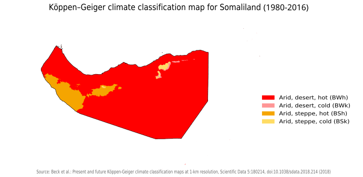
Köppen–Geiger climate classification map for
Somaliland
133:
113:
Commons is a freely licensed media file repository.
282:https://creativecommons.org/licenses/by-sa/4.0
94:
288:Creative Commons Attribution-Share Alike 4.0
212:
8:
248:– to copy, distribute and transmit the work
46:Size of this PNG preview of this SVG file:
670:
567:
352:
645:The following other wikis use this file:
235:Attribution-Share Alike 4.0 International
139:Koppen-Geiger Map Somaliland present.svg
680:
672:
627:
543:
527:
509:
493:
475:
459:
439:
423:
403:
387:
370:
367:
348:
341:
302:
323:View this and other nearby images on:
7:
615:Uploaded own work with UploadWizard
556:
223:
218:
174:
663:
361:
355:
209:
205:
143:
126:
76:
360:
496:coordinates of the point of view
346:
329:
315:
259:Under the following conditions:
230:This file is licensed under the
222:
217:
211:
93:
31:
21:
343:
144:
14:
342:
26:
1:
36:
368:Items portrayed in this file
511:9°45'0.000"N, 45°58'0.001"E
702:
649:Usage on ar.wikipedia.org
273:same or compatible license
557:
16:
345:
239:
100:This is a file from the
630:Geography of Somaliland
614:
188:
164:
157:
154:
136:
104:. Information from its
181:10.1038/sdata.2018.214
171:Nature Scientific Data
107:description page there
335:9.750000; 45.966667
70:2,560 × 1,246 pixels
254:– to adapt the work
52:Other resolutions:
653:جغرافيا صوماليلاند
593:21:56, 21 May 2021
66:1,280 × 623 pixels
62:1,024 × 498 pixels
689:
688:
641:Global file usage
618:
426:copyright license
354:
340:
339:
196:
195:
122:
121:
102:Wikimedia Commons
32:Global file usage
693:
671:
605:
390:copyright status
336:
333:
319:
318:
312:
311:
300:
295:
292:
289:
286:
283:
275:as the original.
232:Creative Commons
226:
225:
221:
220:
215:
214:
184:
178:
160:
148:
140:
134:
118:
97:
96:
90:
84:
73:
58:640 × 312 pixels
54:320 × 156 pixels
48:719 × 350 pixels
701:
700:
696:
695:
694:
692:
691:
690:
659:
639:
626:
619:
611:
603:
559:
558:
555:
554:
553:
552:
551:
550:
549:
548:
546:
536:
535:
534:
532:
521:
520:
519:
518:
517:
516:
515:
514:
512:
502:
501:
500:
498:
487:
486:
485:
484:
483:
482:
481:
480:
478:
468:
467:
466:
464:
453:
452:
451:
450:
449:
448:
447:
446:
444:
432:
431:
430:
428:
417:
416:
415:
414:
413:
412:
411:
410:
408:
396:
395:
394:
392:
381:
380:
379:
378:
377:
375:
359:
358:
357:
334:
307:
306:
303:Camera location
298:
297:
296:
293:
290:
287:
284:
281:
280:
238:
227:
208:
207:
202:
197:
168:
150:
138:
131:
124:
123:
112:
111:
110:is shown below.
86:
82:
75:
74:
51:
12:
11:
5:
699:
697:
687:
686:
683:
679:
678:
675:
662:
658:
657:
656:
655:
643:
642:
638:
637:
632:
624:
623:
622:
617:
616:
613:
609:
606:
600:
595:
590:
586:
585:
582:
579:
576:
573:
570:
563:
562:
547:
544:
542:
541:
540:
539:
538:
537:
533:
528:
526:
525:
524:
523:
522:
513:
510:
508:
507:
506:
505:
504:
503:
499:
494:
492:
491:
490:
489:
479:
476:
474:
473:
472:
471:
470:
469:
465:
460:
458:
457:
456:
455:
454:
445:
440:
438:
437:
436:
435:
434:
433:
429:
424:
422:
421:
420:
419:
418:
409:
404:
402:
401:
400:
399:
398:
397:
393:
388:
386:
385:
384:
383:
382:
376:
371:
369:
366:
365:
364:
363:
362:
351:
350:
347:
344:
338:
337:
327:
321:
304:
279:
278:
277:
276:
266:
257:
256:
255:
249:
242:You are free:
229:
228:
210:
204:
203:
201:
198:
194:
193:
190:
186:
185:
166:
162:
161:
156:
152:
151:
141:
132:
130:
127:
125:
120:
119:
98:
88:
87:
45:
41:
40:
39:
34:
29:
24:
19:
13:
10:
9:
6:
4:
3:
2:
698:
684:
681:
676:
673:
669:
666:
660:
654:
651:
650:
648:
647:
646:
640:
636:
633:
631:
628:
620:
612:
607:
601:
599:
596:
594:
591:
588:
587:
583:
580:
577:
574:
571:
569:
568:
566:
560:
545:image/svg+xml
531:
497:
463:
443:
427:
407:
391:
374:
332:
328:
326:
325:OpenStreetMap
322:
320:
310:
305:
301:
285:CC BY-SA 4.0
274:
270:
267:
264:
261:
260:
258:
253:
250:
247:
244:
243:
241:
240:
236:
233:
216:
199:
191:
187:
182:
177:
172:
167:
163:
153:
147:
142:
135:
128:
116:
109:
108:
103:
99:
92:
91:
85:
80:
79:Original file
71:
67:
63:
59:
55:
49:
44:
38:
35:
33:
30:
28:
25:
23:
20:
18:
15:
667:
664:
644:
564:
561:File history
268:
262:
251:
245:
170:
145:
115:You can help
105:
77:
22:File history
477:22 May 2021
406:copyrighted
269:share alike
263:attribution
159:22 May 2021
137:Description
635:Somaliland
621:File usage
602:719 × 350
578:Dimensions
530:media type
27:File usage
604:(2.99 MB)
575:Thumbnail
572:Date/Time
462:inception
200:Licensing
146:English:
661:Metadata
349:Captions
252:to remix
246:to share
237:license.
37:Metadata
610:Siirski
589:current
584:Comment
373:depicts
353:English
129:Summary
81:
682:Height
313:
189:Author
165:Source
685:280pt
677:575pt
674:Width
581:User
294:true
291:true
155:Date
17:File
176:DOI
173:.
68:|
64:|
60:|
56:|
50:.
183:.
179::
117:.
72:.
Text is available under the Creative Commons Attribution-ShareAlike License. Additional terms may apply.
