817:
38:
290:
340:
823:
128:
90:
1127:
1511:
1358:
1373:
1368:
1363:
1353:
1348:
1343:
1338:
1333:
1328:
1323:
1318:
1313:
1308:
1303:
1298:
1293:
1288:
1283:
1278:
864:– You must give appropriate credit, provide a link to the license, and indicate if changes were made. You may do so in any reasonable manner, but not in any way that suggests the licensor endorses you or your use.
1163:
1273:
1491:
1406:
1383:
1451:
1378:
405:
if the screenshot shows any work that is not a direct result of the program code itself, such as a text or graphics that are not part of the program, the
154:
for more information. If an SVG form of this image is available, please upload it and afterwards replace this template with
1431:
1541:
56:
151:
52:
48:
42:
1476:
101:
1144:{{Information |Description ={{en|1=y}} |Source =y |Author =y |Date =y |Permission = |other_versions = }}
69:
271:
1263:
1004:
987:
951:
1168:
352:
1188:
360:; either version 2 of the License, or any later version. This work is distributed in the hope that it will be useful, but
1481:
1058:
935:
357:
171:
157:
1223:
1024:
971:
918:
1621:
1228:
1566:
145:
1576:
806:
1561:
1238:
1154:
The following pages on the
English Knowledge (XXG) use this file (pages on other projects are not listed):
1268:
1243:
833:
1426:
1401:
1471:
1466:
1203:
1198:
830:
1208:
1126:
1121:
109:
60:
37:
1591:
1551:
1253:
1218:
1193:
347:
334:
1158:
1137:
141:
1461:
326:
170:
It is recommended to name the SVG file “Location map Ryukyu
Islands.svg”—then the template
1586:
1546:
1416:
373:
1521:
1601:
1213:
1183:
1178:
406:
310:
321:
1233:
96:
1173:
796:
787:
1501:
1441:
733:
329:
of
Wikimedia Commons. You may use it freely according to its particular license.
679:
490:
278:
242:
706:
454:
315:
778:
769:
760:
751:
742:
724:
715:
697:
688:
670:
661:
652:
643:
634:
625:
616:
607:
598:
589:
580:
571:
562:
553:
544:
535:
526:
517:
508:
499:
481:
472:
463:
445:
436:
427:
418:
175:
377:
289:
1248:
325:(which should be indicated beneath this notice), and as such follows the
1359:
User:Ty654/List of earthquakes from 2000-present exceeding magnitude 7+
1258:
1374:
User:Ty654/List of earthquakes from 2015-2019 exceeding magnitude 6+
1369:
User:Ty654/List of earthquakes from 2010-2014 exceeding magnitude 6+
1364:
User:Ty654/List of earthquakes from 2005-2009 exceeding magnitude 6+
1354:
User:Ty654/List of earthquakes from 2000-2004 exceeding magnitude 6+
1349:
User:Ty654/List of earthquakes from 1995-1999 exceeding magnitude 6+
1344:
User:Ty654/List of earthquakes from 1990-1994 exceeding magnitude 6+
1339:
User:Ty654/List of earthquakes from 1985-1989 exceeding magnitude 6+
1334:
User:Ty654/List of earthquakes from 1980-1984 exceeding magnitude 6+
1329:
User:Ty654/List of earthquakes from 1975-1979 exceeding magnitude 6+
1324:
User:Ty654/List of earthquakes from 1970-1974 exceeding magnitude 6+
1319:
User:Ty654/List of earthquakes from 1965-1969 exceeding magnitude 6+
1314:
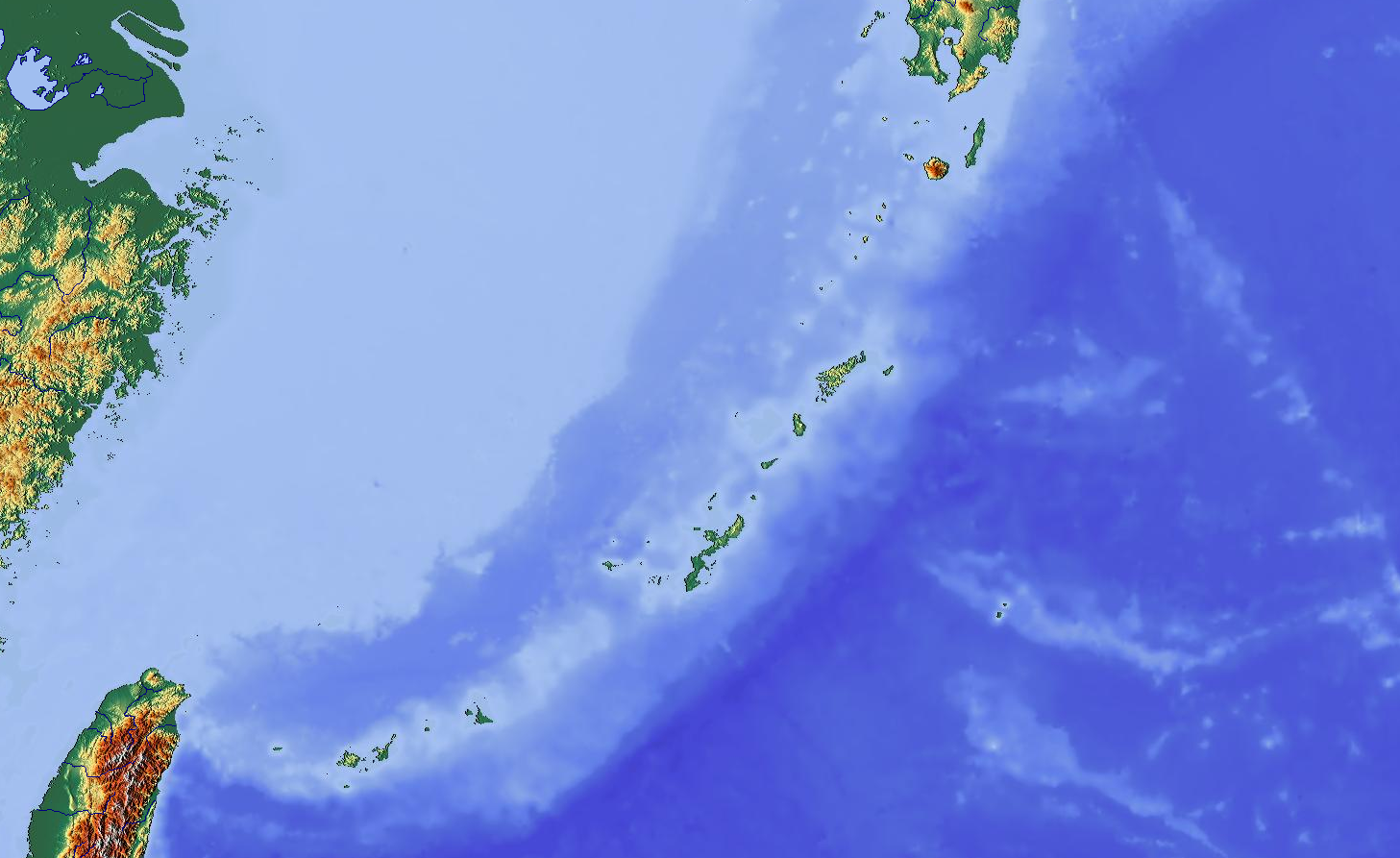
User:Ty654/List of earthquakes from 1960-1964 exceeding magnitude 6+
1309:
User:Ty654/List of earthquakes from 1955-1959 exceeding magnitude 6+
1304:
User:Ty654/List of earthquakes from 1950-1999 exceeding magnitude 7+
1299:
User:Ty654/List of earthquakes from 1950-1954 exceeding magnitude 6+
1294:
User:Ty654/List of earthquakes from 1940-1949 exceeding magnitude 6+
1289:
User:Ty654/List of earthquakes from 1930-1939 exceeding magnitude 6+
1284:
User:Ty654/List of earthquakes from 1920-1929 exceeding magnitude 6+
1279:
User:Ty654/List of earthquakes from 1900-1949 exceeding magnitude 7+
1094:
Click on a date/time to view the file as it appeared at that time.
350:; you can redistribute it and/or modify it under the terms of the
252:
122:
84:
1164:
Gusuku Sites and
Related Properties of the Kingdom of Ryukyu
902:
Add a one-line explanation of what this file represents
797:
788:
1611:
1567:
Modül:Konum haritası/veri/Japonya Ryukyu Adaları/belge
734:
1274:
User:Ty654/List of earthquakes exceeding magnitude 8+
680:
491:
1531:
194:
108:
Commons is a freely licensed media file repository.
707:
455:
74:(1,457 × 893 pixels, file size: 797 KB, MIME type:
779:
770:
761:
752:
743:
725:
716:
698:
689:
671:
662:
653:
644:
635:
626:
617:
608:
599:
590:
581:
572:
563:
554:
545:
536:
527:
518:
509:
500:
482:
473:
464:
446:
437:
428:
419:
1592:Module:Location map/data/Japan Ryukyu Islands/doc
1552:Module:Location map/data/Japan Ryukyu Islands/doc
1384:Module:Location map/data/Japan Ryukyu Islands/doc
1562:Modül:Konum haritası/veri/Japonya Ryukyu Adaları
1005:GNU General Public License, version 2.0 or later
319:software, or the author has released it under a
1477:모듈:Location map/data/Japan Ryukyu Islands/설명문서
89:
1587:Module:Location map/data/Japan Ryukyu Islands
1547:Module:Location map/data/Japan Ryukyu Islands
1379:Module:Location map/data/Japan Ryukyu Islands
816:
8:
279:http://www.maps-for-free.com/html/about.html
1452:ಟೆಂಪ್ಲೇಟು:Location map Japan Ryukyu Islands
1417:Plantilya:Location map Japan Ryukyu Islands
871:https://creativecommons.org/licenses/by/3.0
847:– to copy, distribute and transmit the work
378:version 3 of the GNU General Public License
1522:Template:Location map Japan Ryukyu Islands
1096:
898:
805:
1602:Batakan:Location map Japan Ryukyu Islands
1472:모듈:Location map/data/Japan Ryukyu Islands
1394:The following other wikis use this file:
988:Creative Commons Attribution 3.0 Unported
150:. This has several advantages; see
1577:سانچہ:Location map Japan Ryukyu Islands
1156:
1072:
1056:
1038:
1022:
1002:
985:
969:
949:
933:
916:
913:
894:
887:
364:; without even the implied warranty of
1427:الگو:Location map Japan Ryukyu Islands
1402:قالب:Location map Japan Ryukyu Islands
7:
1502:Templat:Peta lokasi Kepulauan Ryukyu
1442:Templat:Peta lokasi Kepulauan Ryukyu
382:http://www.gnu.org/licenses/gpl.html
327:licensing guidelines for screenshots
1512:Шаблон:ПозКарта Япония Острова Рюкю
1492:Шаблон:Location map Јапонија Рјукју
1085:
822:
303:
210:Map showing Ryukyu Islands for pin
907:
901:
838:
813:
204:
133:
121:
67:
906:
877:Creative Commons Attribution 3.0
1264:Talk:Sanchi oil tanker collision
892:
858:Under the following conditions:
829:This file is licensed under the
821:
815:
370:fitness for a particular purpose
339:
338:
288:
126:
88:
31:
21:
1169:Iriomote-Ishigaki National Park
889:
205:
200:Location map Ryukyu Islands.png
14:
888:
26:
1:
1407:تسونامي ياياما الكبير في 1771
253:http://www.maps-for-free.com/
213:Geographic limits of the map:
914:Items portrayed in this file
1598:Usage on war.wikipedia.org
1518:Usage on sco.wikipedia.org
1413:Usage on ceb.wikipedia.org
1224:Sanchi oil tanker collision
1640:
1618:Usage on zh.wikipedia.org
1608:Usage on www.wikidata.org
1583:Usage on uz.wikipedia.org
1573:Usage on ur.wikipedia.org
1558:Usage on tr.wikipedia.org
1538:Usage on si.wikipedia.org
1528:Usage on sc.wikipedia.org
1508:Usage on ru.wikipedia.org
1498:Usage on ms.wikipedia.org
1488:Usage on mk.wikipedia.org
1458:Usage on ko.wikipedia.org
1448:Usage on kn.wikipedia.org
1438:Usage on id.wikipedia.org
1423:Usage on fa.wikipedia.org
1398:Usage on ar.wikipedia.org
1229:Third Taiwan Strait Crisis
1189:Kerama Shotō National Park
388:GNU General Public License
353:GNU General Public License
138:image could be re-created
1086:
413:be indicated separately.
152:Commons:Media for cleanup
16:
891:
834:Attribution 3.0 Unported
358:Free Software Foundation
309:either does not contain
172:Vector version available
158:vector version available
95:This is a file from the
1143:
284:
266:
262:Modified by Dr. Blofeld
258:
248:
241:
238:
197:
99:. Information from its
1239:VH-3 (Rescue squadron)
1122:15:03, 26 October 2012
416:
331:Free software license:
102:description page there
41:Size of this preview:
1269:User:Aom2-vh3/sandbox
1244:Yambaru National Park
1204:Naha Airport Station
1199:Minami-Daito Airport
362:without any warranty
356:as published by the
313:parts or visuals of
178:) does not need the
853:– to adapt the work
681:português do Brasil
47:Other resolutions:
1432:جزیرههای ساکیشیما
1209:Naval Base Okinawa
311:copyright-eligible
61:1,457 × 893 pixels
57:1,024 × 628 pixels
1390:Global file usage
1254:Yonaguni Knoll IV
1219:Sakishima Islands
1194:Kitadaito Airport
1147:
972:copyright license
900:
809:
400:
399:
380:for more details.
296:
295:
275:
272:Reusing this file
187:
186:
117:
116:
97:Wikimedia Commons
32:Global file usage
1631:
1134:
936:copyright status
884:
881:
878:
875:
872:
831:Creative Commons
825:
824:
819:
818:
810:
573:Bahasa Indonesia
395:
392:
389:
386:
383:
342:
341:
335:
292:
269:
244:
209:
201:
195:
165:
130:
129:
123:
113:
92:
91:
85:
79:
77:
64:
53:640 × 392 pixels
49:320 × 196 pixels
43:800 × 490 pixels
1639:
1638:
1634:
1633:
1632:
1630:
1629:
1628:
1388:
1155:
1148:
1140:
1132:
1088:
1087:
1084:
1083:
1082:
1081:
1080:
1079:
1078:
1077:
1075:
1065:
1064:
1063:
1061:
1050:
1049:
1048:
1047:
1046:
1045:
1044:
1043:
1041:
1040:26 October 2012
1031:
1030:
1029:
1027:
1016:
1015:
1014:
1013:
1012:
1011:
1010:
1009:
1007:
996:
995:
994:
993:
992:
990:
978:
977:
976:
974:
963:
962:
961:
960:
959:
958:
957:
956:
954:
942:
941:
940:
938:
927:
926:
925:
924:
923:
921:
905:
904:
903:
886:
885:
882:
879:
876:
873:
870:
869:
837:
826:
812:
811:
799:
790:
781:
772:
763:
754:
745:
736:
727:
718:
709:
700:
691:
682:
673:
664:
655:
646:
637:
628:
619:
610:
601:
592:
583:
574:
565:
556:
547:
538:
529:
520:
511:
502:
493:
492:British English
484:
475:
466:
457:
448:
439:
430:
421:
417:
393:
390:
387:
384:
381:
366:merchantability
302:
297:
243:26 October 2012
234:
199:
192:
183:
155:
142:vector graphics
127:
119:
118:
107:
106:
105:is shown below.
81:
75:
73:
66:
65:
46:
12:
11:
5:
1637:
1635:
1627:
1626:
1625:
1624:
1616:
1615:
1614:
1606:
1605:
1604:
1596:
1595:
1594:
1589:
1581:
1580:
1579:
1571:
1570:
1569:
1564:
1556:
1555:
1554:
1549:
1544:
1536:
1535:
1534:
1526:
1525:
1524:
1516:
1515:
1514:
1506:
1505:
1504:
1496:
1495:
1494:
1486:
1485:
1484:
1479:
1474:
1469:
1464:
1456:
1455:
1454:
1446:
1445:
1444:
1436:
1435:
1434:
1429:
1421:
1420:
1419:
1411:
1410:
1409:
1404:
1392:
1391:
1387:
1386:
1381:
1376:
1371:
1366:
1361:
1356:
1351:
1346:
1341:
1336:
1331:
1326:
1321:
1316:
1311:
1306:
1301:
1296:
1291:
1286:
1281:
1276:
1271:
1266:
1261:
1256:
1251:
1246:
1241:
1236:
1231:
1226:
1221:
1216:
1214:Okinawa Island
1211:
1206:
1201:
1196:
1191:
1186:
1184:Kerama Islands
1181:
1176:
1171:
1166:
1161:
1153:
1152:
1151:
1146:
1145:
1142:
1138:
1135:
1129:
1124:
1119:
1115:
1114:
1111:
1108:
1105:
1102:
1099:
1092:
1091:
1076:
1073:
1071:
1070:
1069:
1068:
1067:
1066:
1062:
1057:
1055:
1054:
1053:
1052:
1051:
1042:
1039:
1037:
1036:
1035:
1034:
1033:
1032:
1028:
1023:
1021:
1020:
1019:
1018:
1017:
1008:
1003:
1001:
1000:
999:
998:
997:
991:
986:
984:
983:
982:
981:
980:
979:
975:
970:
968:
967:
966:
965:
964:
955:
950:
948:
947:
946:
945:
944:
943:
939:
934:
932:
931:
930:
929:
928:
922:
917:
915:
912:
911:
910:
909:
908:
897:
896:
893:
890:
868:
867:
866:
865:
856:
855:
854:
848:
841:You are free:
828:
827:
814:
735:Simple English
409:for that work
398:
397:
343:
301:
298:
294:
293:
286:
285:Other versions
282:
281:
276:
264:
263:
260:
256:
255:
250:
246:
245:
240:
236:
235:
233:
232:
231:
230:
227:
224:
221:
215:
214:
202:
193:
191:
188:
185:
184:
180:new image name
162:new image name
131:
120:
115:
114:
93:
83:
82:
40:
36:
35:
34:
29:
24:
19:
13:
10:
9:
6:
4:
3:
2:
1636:
1623:
1620:
1619:
1617:
1613:
1610:
1609:
1607:
1603:
1600:
1599:
1597:
1593:
1590:
1588:
1585:
1584:
1582:
1578:
1575:
1574:
1572:
1568:
1565:
1563:
1560:
1559:
1557:
1553:
1550:
1548:
1545:
1543:
1540:
1539:
1537:
1533:
1530:
1529:
1527:
1523:
1520:
1519:
1517:
1513:
1510:
1509:
1507:
1503:
1500:
1499:
1497:
1493:
1490:
1489:
1487:
1483:
1480:
1478:
1475:
1473:
1470:
1468:
1465:
1463:
1460:
1459:
1457:
1453:
1450:
1449:
1447:
1443:
1440:
1439:
1437:
1433:
1430:
1428:
1425:
1424:
1422:
1418:
1415:
1414:
1412:
1408:
1405:
1403:
1400:
1399:
1397:
1396:
1395:
1389:
1385:
1382:
1380:
1377:
1375:
1372:
1370:
1367:
1365:
1362:
1360:
1357:
1355:
1352:
1350:
1347:
1345:
1342:
1340:
1337:
1335:
1332:
1330:
1327:
1325:
1322:
1320:
1317:
1315:
1312:
1310:
1307:
1305:
1302:
1300:
1297:
1295:
1292:
1290:
1287:
1285:
1282:
1280:
1277:
1275:
1272:
1270:
1267:
1265:
1262:
1260:
1257:
1255:
1252:
1250:
1247:
1245:
1242:
1240:
1237:
1235:
1234:Tsuken Island
1232:
1230:
1227:
1225:
1222:
1220:
1217:
1215:
1212:
1210:
1207:
1205:
1202:
1200:
1197:
1195:
1192:
1190:
1187:
1185:
1182:
1180:
1177:
1175:
1172:
1170:
1167:
1165:
1162:
1160:
1159:Daitō Islands
1157:
1149:
1141:
1136:
1130:
1128:
1125:
1123:
1120:
1117:
1116:
1112:
1109:
1106:
1103:
1100:
1098:
1097:
1095:
1089:
1060:
1026:
1006:
989:
973:
953:
937:
920:
863:
860:
859:
857:
852:
849:
846:
843:
842:
840:
839:
835:
832:
820:
808:
804:
800:
795:
791:
786:
782:
777:
773:
768:
764:
759:
755:
750:
746:
741:
737:
732:
728:
723:
719:
714:
710:
705:
701:
696:
692:
687:
683:
678:
674:
669:
665:
660:
656:
651:
647:
642:
638:
633:
629:
627:Bahasa Melayu
624:
620:
615:
611:
606:
602:
597:
593:
588:
584:
579:
575:
570:
566:
561:
557:
552:
548:
543:
539:
534:
530:
525:
521:
516:
512:
507:
503:
498:
494:
489:
485:
480:
476:
471:
467:
462:
458:
453:
449:
444:
440:
435:
431:
426:
422:
415:
414:
412:
408:
404:
396:
379:
375:
371:
367:
363:
359:
355:
354:
349:
348:free software
346:This work is
344:
337:
336:
333:
332:
328:
324:
323:
318:
317:
312:
308:
299:
291:
287:
283:
280:
277:
273:
268:
265:
261:
257:
254:
251:
247:
237:
229:E: 135.824° E
228:
226:W: 119.817° E
225:
222:
219:
218:
217:
216:
212:
211:
208:
203:
196:
189:
181:
177:
173:
169:
168:
163:
159:
153:
149:
147:
143:
137:
132:
125:
124:
111:
104:
103:
98:
94:
87:
86:
80:
71:
70:Original file
62:
58:
54:
50:
44:
39:
33:
30:
28:
25:
23:
20:
18:
15:
1542:ඔකිනාවා දූපත
1482:제3차 대만 해협 위기
1393:
1174:Izena Island
1131:1,457 × 893
1093:
1090:File history
861:
850:
844:
802:
793:
784:
775:
766:
757:
748:
739:
730:
721:
712:
703:
694:
685:
676:
667:
658:
649:
640:
636:norsk bokmål
631:
622:
613:
604:
595:
586:
577:
568:
559:
550:
541:
532:
523:
514:
505:
496:
487:
478:
469:
460:
451:
442:
433:
424:
410:
402:
401:
369:
365:
361:
351:
345:
330:
322:free license
320:
314:
306:
304:
223:S: 23.312° N
220:N: 31.959° N
206:
179:
167:
161:
139:
135:
110:You can help
100:
68:
22:File history
1179:Iōtorishima
1139:Blofeld Dr.
952:copyrighted
862:attribution
726:slovenščina
316:copyrighted
198:Description
136:locator map
1150:File usage
1107:Dimensions
1059:media type
874:CC BY 3.0
780:українська
717:slovenčina
645:Nederlands
609:македонски
456:kaszëbsczi
307:screenshot
267:Permission
182:parameter.
27:File usage
1612:Q10905515
1104:Thumbnail
1101:Date/Time
1074:image/png
1025:inception
708:sicilianu
672:português
501:Esperanto
429:български
374:version 2
300:Licensing
207:English:
76:image/png
1622:已不存在国家列表
1467:상치 충돌 사고
1249:Yonaguni
1133:(797 KB)
895:Captions
851:to remix
845:to share
836:license.
582:italiano
537:français
474:Ελληνικά
1532:Okinawa
1118:current
1113:Comment
919:depicts
899:English
744:svenska
699:русский
510:español
483:English
465:Deutsch
447:čeština
420:العربية
407:license
190:Summary
72:
1462:난세이 제도
801:
792:
783:
774:
771:Türkçe
765:
756:
747:
738:
729:
720:
711:
702:
693:
690:română
684:
675:
666:
663:polski
657:
648:
639:
630:
621:
618:മലയാളം
612:
603:
594:
585:
576:
567:
564:magyar
558:
549:
546:galego
540:
531:
522:
513:
504:
495:
486:
477:
468:
459:
450:
441:
438:català
432:
423:
372:. See
259:Author
249:Source
144:as an
140:using
798:繁體中文
789:简体中文
753:தமிழ்
654:norsk
555:עברית
528:suomi
519:فارسی
403:Note:
305:This
134:This
1259:Ōike
1110:User
883:true
880:true
411:must
394:true
391:true
376:and
239:Date
174:(or
148:file
17:File
807:+/−
762:ไทย
600:한국어
591:日本語
385:GPL
368:or
176:Vva
146:SVG
164:}}
156:{{
59:|
55:|
51:|
45:.
803:∙
794:∙
785:∙
776:∙
767:∙
758:∙
749:∙
740:∙
731:∙
722:∙
713:∙
704:∙
695:∙
686:∙
677:∙
668:∙
659:∙
650:∙
641:∙
632:∙
623:∙
614:∙
605:∙
596:∙
587:∙
578:∙
569:∙
560:∙
551:∙
542:∙
533:∙
524:∙
515:∙
506:∙
497:∙
488:∙
479:∙
470:∙
461:∙
452:∙
443:∙
434:∙
425:∙
274:)
270:(
166:.
160:|
112:.
78:)
63:.
Text is available under the Creative Commons Attribution-ShareAlike License. Additional terms may apply.