34:
62:
69:
41:
679:
606:
708:
61:
713:
33:
703:
192:
672:
597:
271:
246:
The name appears as "Flatt Creek" on some 19th-century sources. Amelia
Springs, located next to Flat Creek 2 miles north of
555:, vol. 20, no. 4, Omohundro Institute of Early American History and Culture, 1940, pp. 492–96. Retrieved December 19, 2021.
718:
665:
698:
514:
479:
228:
255:
579:
275:
232:
247:
240:
224:
126:
501:, USGS topographic map quad for Crewe West, VA. TopoZone, Locality LLC. Retrieved December 19, 2021.
569:
The War of the
Rebellion: A Compilation of the Official Records of the Union and Confederate Armies
498:
251:
593:
236:
212:
162:
564:
518:
279:
649:
692:
97:
510:
U.S. Geological Survey. National
Hydrography Dataset high-resolution flowline data.
267:
278:
defenders clashed with Kautz's forces at the bridge over Flat Creek just north of
147:
263:
216:
621:
608:
531:
208:
235:, then northeast to join the Appomattox River just outside the village of
592:(4th ed.). Richmond, VA: Virginia Office of Graphic Communications.
511:
220:
534:. Philadelphia: R.L. Barnes, circa 1850. Library of Congress permalink=
259:
580:
U.S. Geological Survey
Geographic Names Information System: Flat Creek
258:
just days before the end of the war in April 1865. The year before,
548:
535:
571:, Serial 68, Page 6, Chapter XLVIII. Retrieved December 19, 2021.
653:
588:
Salmon, Emily J.; Edward D. C. Campbell, Jr. (1994).
584:
USGS Hydrologic Unit Map - State of
Virginia (1974)
191:
186:
178:
168:
156:
146:
132:
120:
112:
103:
93:
88:
21:
648:This article related to a river in Virginia is a
673:
68:
40:
8:
680:
666:
499:Burkeville Topo Map in Nottoway County VA
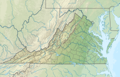
207:is a 34.0-mile (54.7 km) right-bank
76:Flat Creek (Virginia) (the United States)
292:
48:Location within Commonwealth of Virginia
491:
18:
290:Listed in order, beginning at mouth:
7:
645:
643:
223:. It rises just east of the town of
709:Rivers of Nottoway County, Virginia
239:28 miles (45 km) northwest of
549:"Amelia Sulphur Springs, Virginia"
14:
714:Rivers of Amelia County, Virginia
590:The Hornbook of Virginia History
565:"Operations in SE. VA. and N.C."
532:A map of Amelia County, Virginia
270:had conducted raids against the
67:
60:
39:
32:
536:https://lccn.loc.gov/2014588019
704:Tributaries of the James River
553:The William and Mary Quarterly
272:Richmond and Danville Railroad
250:, was a popular resort in pre-
1:
104:Physical characteristics
79:Show map of the United States
652:. You can help Knowledge by
538:. Retrieved January 4, 2022.
170: • elevation
134: • elevation
158: • location
122: • location
735:
642:
480:List of rivers of Virginia
254:days, and the site of the
16:River in the United States
182:34.0 miles (54.7 km)
142:
108:
26:
521:, accessed April 1, 2011
256:Battle of Amelia Springs
622:37.39182°N 77.87305°W
231:and flows north into
138:500 feet (150 m)
719:Virginia river stubs
174:180 feet (55 m)
127:Burkeville, Virginia
51:Show map of Virginia
627:37.39182; -77.87305
618: /
530:Booker, William L.
187:Basin features
699:Rivers of Virginia
517:2012-03-29 at the
661:
660:
471:
470:
384:Beaverpond Creek
307:Barkhouse Branch
202:
201:
726:
682:
675:
668:
644:
633:
632:
630:
629:
628:
623:
619:
616:
615:
614:
611:
603:
572:
562:
556:
545:
539:
528:
522:
512:The National Map
508:
502:
496:
428:Webster's Creek
318:Horsepen Branch
293:
213:Appomattox River
163:Appomattox River
135:
123:
80:
71:
70:
64:
52:
43:
42:
36:
19:
734:
733:
729:
728:
727:
725:
724:
723:
689:
688:
687:
686:
640:
637:
626:
624:
620:
617:
612:
609:
607:
605:
604:
600:
587:
576:
575:
563:
559:
546:
542:
529:
525:
519:Wayback Machine
509:
505:
497:
493:
488:
476:
417:Vaughn's Creek
373:Horsepen Creek
340:Wildcat Branch
288:
229:Nottoway County
171:
159:
133:
121:
84:
83:
82:
81:
78:
77:
74:
73:
72:
55:
54:
53:
50:
49:
46:
45:
44:
17:
12:
11:
5:
732:
730:
722:
721:
716:
711:
706:
701:
691:
690:
685:
684:
677:
670:
662:
659:
658:
635:
634:
598:
585:
582:
574:
573:
557:
547:Turner, W. R.
540:
523:
503:
490:
489:
487:
484:
483:
482:
475:
472:
469:
468:
465:
462:
458:
457:
454:
451:
447:
446:
443:
440:
439:Walnut Branch
436:
435:
432:
429:
425:
424:
421:
418:
414:
413:
410:
407:
403:
402:
399:
396:
392:
391:
388:
385:
381:
380:
377:
374:
370:
369:
366:
363:
359:
358:
355:
352:
351:Walker Branch
348:
347:
344:
341:
337:
336:
333:
330:
326:
325:
322:
319:
315:
314:
311:
308:
304:
303:
300:
297:
287:
284:
200:
199:
196:
189:
188:
184:
183:
180:
176:
175:
172:
169:
166:
165:
160:
157:
154:
153:
150:
144:
143:
140:
139:
136:
130:
129:
124:
118:
117:
114:
110:
109:
106:
105:
101:
100:
95:
91:
90:
86:
85:
75:
66:
65:
59:
58:
57:
56:
47:
38:
37:
31:
30:
29:
28:
27:
24:
23:
15:
13:
10:
9:
6:
4:
3:
2:
731:
720:
717:
715:
712:
710:
707:
705:
702:
700:
697:
696:
694:
683:
678:
676:
671:
669:
664:
663:
657:
655:
651:
646:
641:
638:
631:
601:
599:0-88490-177-7
595:
591:
586:
583:
581:
578:
577:
570:
566:
561:
558:
554:
550:
544:
541:
537:
533:
527:
524:
520:
516:
513:
507:
504:
500:
495:
492:
485:
481:
478:
477:
473:
466:
463:
460:
459:
455:
452:
450:Little Creek
449:
448:
444:
441:
438:
437:
433:
430:
427:
426:
422:
419:
416:
415:
411:
408:
406:Little Creek
405:
404:
400:
397:
395:Neal's Creek
394:
393:
389:
386:
383:
382:
378:
375:
372:
371:
367:
364:
361:
360:
356:
353:
350:
349:
345:
342:
339:
338:
334:
331:
328:
327:
323:
320:
317:
316:
312:
309:
306:
305:
301:
298:
295:
294:
291:
285:
283:
281:
277:
273:
269:
265:
261:
257:
253:
249:
244:
242:
238:
234:
233:Amelia County
230:
226:
222:
218:
214:
210:
206:
197:
194:
190:
185:
181:
177:
173:
167:
164:
161:
155:
151:
149:
145:
141:
137:
131:
128:
125:
119:
115:
111:
107:
102:
99:
98:United States
96:
92:
87:
63:
35:
25:
20:
654:expanding it
647:
639:
636:
589:
568:
560:
552:
543:
526:
506:
494:
461:Ellis Creek
329:Nibbs Creek
289:
268:August Kautz
245:
204:
203:
625: /
362:Haw Branch
286:Tributaries
282:on May 14.
276:Confederate
248:Jetersville
693:Categories
613:77°52′23″W
610:37°23′31″N
486:References
241:Petersburg
225:Burkeville
217:U.S. state
205:Flat Creek
22:Flat Creek
467:Nottoway
252:Civil War
209:tributary
515:Archived
474:See also
266:general
221:Virginia
89:Location
456:Amelia
445:Amelia
434:Amelia
423:Amelia
412:Amelia
401:Amelia
390:Amelia
379:Amelia
368:Amelia
357:Amelia
346:Amelia
335:Amelia
324:Amelia
313:Amelia
302:County
262:led by
260:cavalry
237:Coverly
215:in the
211:of the
198:1466649
94:Country
596:
453:Right
420:Right
387:Right
332:Right
310:Right
274:, and
179:Length
152:
116:
113:Source
464:Left
442:Left
431:Left
409:Left
398:Left
376:Left
365:Left
354:Left
343:Left
321:Left
299:Bank
296:Name
280:Chula
264:Union
148:Mouth
650:stub
594:ISBN
193:GNIS
227:in
219:of
695::
567:,
551:,
243:.
195:ID
681:e
674:t
667:v
656:.
602:.
Text is available under the Creative Commons Attribution-ShareAlike License. Additional terms may apply.