589:
70:
53:
103:
577:
176:
214:
787:
195:
41:
607:
110:
77:
325:
The village was first mentioned in 1408 as
Fyochtelo, and probably means moist forest. The church was demolished in 1832, but the bell tower with two bells has remained. From 1908 until 2008, there was a chapel in the dairy factory. In 1840, Fochteloo was home to 163 people.
639:
632:
771:
828:
625:
69:
52:
206:
267:
588:
852:
847:
279:
138:
857:
102:
649:
447:
821:
576:
338:
187:
814:
342:
346:
519:
358:
334:
617:
667:
545:
294:
611:
362:
40:
693:
653:
306:
218:
213:
451:
367:
444:
394:
798:
841:
759:
728:
723:
688:
467:
314:
180:
175:
733:
713:
708:
330:
153:
140:
794:
738:
683:
310:
199:
194:
786:
606:
329:
In 1942, Camp
Ybenheer was established as a Jewish forced labour camp. On
718:
493:
754:
302:
349:
refugees. In 2002, a memorial was placed at the former camp grounds.
703:
419:
621:
357:
There is a nature reserve located between
Fochteloo and
802:
333:
1942 (2–3 October), all 215 labourers were moved to
747:
676:
660:
305:with around 400 inhabitants in the municipality of
278:
266:
258:
250:
245:
237:
229:
224:
205:
186:
169:
21:
772:List of cities, towns and villages in Friesland
822:
633:
8:
829:
815:
640:
626:
618:
18:
57:Location in Ooststellingwerf municipality
572:
381:
345:. After the war, the camp was used for
265:
244:
236:
223:
168:
133:
61:
49:
37:
389:
387:
385:
277:
257:
249:
228:
204:
185:
7:
783:
781:
395:"Kerncijfers wijken en buurten 2021"
337:from where they were transported to
233:19.77 km (7.63 sq mi)
14:
520:"Monument Rijkswerkkamp Ybenheer"
468:"Fochteloo - (geografische naam)"
109:
76:
16:Village in Friesland, Netherlands
785:
605:
587:
575:
454:- Ooststellingwerf Municipality
212:
193:
174:
108:
101:
75:
68:
51:
39:
426:(in Dutch). Het Waterschapshuis
424:Actueel Hoogtebestand Nederland
1:
853:Populated places in Friesland
848:Geography of Ooststellingwerf
801:. You can help Knowledge by
399:Central Bureau of Statistics
89:Location in the Netherlands
874:
780:
858:Friesland geography stubs
769:
420:"Postcodetool for 8428HA"
134:
62:
50:
38:
31:
648:Populated places in the
582:Bell tower of Fochteloo
546:"Fochteloo, 'Ybenheer'"
335:Westerbork transit camp
125:Show map of Netherlands
122:Fochteloo (Netherlands)
797:location article is a
298:
262:18/km (46/sq mi)
241:7 m (23 ft)
92:Show map of Friesland
614:at Wikimedia Commons
259: • Density
154:52.99250°N 6.33472°E
45:Welcome to Fochteloo
150: /
450:2017-09-28 at the
251: • Total
230: • Total
810:
809:
778:
777:
610:Media related to
594:Farm in Fochteloo
288:
287:
159:52.99250; 6.33472
865:
831:
824:
817:
789:
782:
654:Ooststellingwerf
642:
635:
628:
619:
609:
591:
579:
562:
561:
559:
557:
542:
536:
535:
533:
531:
516:
510:
509:
507:
505:
490:
484:
483:
481:
479:
464:
458:
457:
442:
436:
435:
433:
431:
416:
410:
409:
407:
405:
391:
371:
309:in southeastern
307:Ooststellingwerf
219:Ooststellingwerf
217:
216:
198:
197:
179:
178:
165:
164:
162:
161:
160:
155:
151:
148:
147:
146:
143:
126:
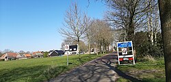
112:
111:
105:
93:
79:
78:
72:
55:
43:
19:
873:
872:
868:
867:
866:
864:
863:
862:
838:
837:
836:
835:
779:
774:
765:
743:
672:
656:
646:
602:
595:
592:
583:
580:
571:
566:
565:
555:
553:
544:
543:
539:
529:
527:
518:
517:
513:
503:
501:
492:
491:
487:
477:
475:
466:
465:
461:
455:
452:Wayback Machine
443:
439:
429:
427:
418:
417:
413:
403:
401:
393:
392:
383:
378:
365:
355:
323:
274:
211:
192:
173:
158:
156:
152:
149:
144:
141:
139:
137:
136:
130:
129:
128:
127:
124:
123:
120:
119:
118:
117:
113:
96:
95:
94:
91:
90:
87:
86:
85:
84:
80:
58:
46:
34:
27:
24:
17:
12:
11:
5:
871:
869:
861:
860:
855:
850:
840:
839:
834:
833:
826:
819:
811:
808:
807:
790:
776:
775:
770:
767:
766:
764:
763:
757:
751:
749:
745:
744:
742:
741:
736:
731:
726:
721:
716:
711:
706:
701:
696:
691:
686:
680:
678:
674:
673:
671:
670:
664:
662:
658:
657:
647:
645:
644:
637:
630:
622:
616:
615:
601:
600:External links
598:
597:
596:
593:
586:
584:
581:
574:
570:
567:
564:
563:
537:
511:
485:
472:Etymologiebank
459:
437:
411:
380:
379:
377:
374:
363:Fochteloërveen
354:
351:
347:South Moluccan
322:
319:
286:
285:
282:
276:
275:
272:
270:
264:
263:
260:
256:
255:
252:
248:
247:
243:
242:
239:
235:
234:
231:
227:
226:
222:
221:
209:
203:
202:
190:
184:
183:
171:
167:
166:
132:
131:
121:
115:
114:
107:
106:
100:
99:
98:
97:
88:
82:
81:
74:
73:
67:
66:
65:
64:
63:
60:
59:
56:
48:
47:
44:
36:
35:
32:
29:
28:
25:
22:
15:
13:
10:
9:
6:
4:
3:
2:
870:
859:
856:
854:
851:
849:
846:
845:
843:
832:
827:
825:
820:
818:
813:
812:
806:
804:
800:
796:
791:
788:
784:
773:
768:
761:
758:
756:
753:
752:
750:
746:
740:
737:
735:
732:
730:
727:
725:
722:
720:
717:
715:
712:
710:
707:
705:
702:
700:
697:
695:
692:
690:
687:
685:
682:
681:
679:
675:
669:
666:
665:
663:
659:
655:
651:
643:
638:
636:
631:
629:
624:
623:
620:
613:
608:
604:
603:
599:
590:
585:
578:
573:
568:
551:
547:
541:
538:
525:
524:Traces of War
521:
515:
512:
499:
495:
489:
486:
473:
469:
463:
460:
453:
449:
446:
441:
438:
425:
421:
415:
412:
400:
396:
390:
388:
386:
382:
375:
373:
369:
364:
360:
352:
350:
348:
344:
340:
336:
332:
327:
320:
318:
316:
312:
308:
304:
300:
296:
292:
283:
281:
271:
269:
261:
253:
240:
232:
220:
215:
210:
208:
201:
196:
191:
189:
182:
177:
172:
163:
135:Coordinates:
104:
71:
54:
42:
30:
20:
803:expanding it
792:
698:
650:municipality
554:. Retrieved
549:
540:
528:. Retrieved
523:
514:
502:. Retrieved
498:Plaatsengids
497:
488:
476:. Retrieved
471:
462:
440:
428:. Retrieved
423:
414:
402:. Retrieved
398:
356:
328:
324:
295:West Frisian
290:
289:
280:Dialing code
207:Municipality
762:(partially)
760:Oude Willem
729:Oldeberkoop
724:Nijeberkoop
689:Donkerbroek
668:Oosterwolde
494:"Fochteloo"
366: [
315:Netherlands
268:Postal code
181:Netherlands
157: /
842:Categories
734:Ravenswoud
714:Langedijke
709:Haulerwijk
552:(in Dutch)
550:4 en 5 mei
526:(in Dutch)
500:(in Dutch)
474:(in Dutch)
456:(in Dutch)
376:References
359:Veenhuizen
331:Yom Kippur
299:De Fochtel
246:Population
142:52°59′33″N
26:De Fochtel
795:Friesland
739:Waskemeer
699:Fochteloo
684:Appelscha
612:Fochteloo
361:, called
353:Geography
339:Auschwitz
311:Friesland
291:Fochteloo
238:Elevation
200:Friesland
116:Fochteloo
83:Fochteloo
23:Fochteloo
719:Makkinga
677:Villages
448:Archived
445:Villages
188:Province
145:6°20′5″E
755:Aekinga
748:Hamlets
569:Gallery
556:1 April
530:1 April
504:1 April
478:1 April
430:1 April
404:1 April
343:Sobibor
321:History
313:in the
303:village
301:) is a
170:Country
33:Village
694:Elsloo
793:This
704:Haule
661:Towns
370:]
799:stub
558:2022
532:2022
506:2022
480:2022
432:2022
406:2022
341:and
284:0516
273:8428
225:Area
652:of
254:350
844::
548:.
522:.
496:.
470:.
422:.
397:.
384:^
372:.
368:nl
317:.
297::
830:e
823:t
816:v
805:.
641:e
634:t
627:v
560:.
534:.
508:.
482:.
434:.
408:.
293:(
Text is available under the Creative Commons Attribution-ShareAlike License. Additional terms may apply.