463:
38:
54:
482:, Leicestershire. It had an estimate of 29.9 households (representing the heads of families, with an average 5 persons per household) and was considered to be a large settlement in 1086. The Lordship of Frisby (juxta Gaulby) by 1086 was held by Fulco, under Hugh de Grandmesnil. Archaeological evidence of activity prior to this is very slim, but the name of the settlement does imply an Anglo-Saxon origin, possibly founded sometime between the 7th and 8th century. At around 1220, the Rolls of
455:
487:
show a further reduction, listing only 8 houses. Inclosure of the land began to take place at this stage, and it is believed that by 1655 a significant amount of land around Frisby was inclosed; with much of the land utilised for the breeding and raising of livestock. By 1679, inclosure activity in the parish was complete. A Hearth Tax return reflected a small growth in size by 1666, listing 10 houses. However, a century later, the printer and author
509:(c.1220) stating that the mother church of Gaulby serves the Frisby community 3 days a week from a chapel in the hamlet. The chapel was dedicated to St James, which was forgotten until bequests to the chapel of St James were discovered listed in wills dating from the early 1530s. However, there is no mention of St James after 1533, supporting the notion that the
61:
269:
486:
reveal that there was a chapel in Frisby. The Poll Tax returns of 1381 listed 16 houses in Frisby with 39 people deemed eligible to pay. A subsidy taken in 1524 listed 10 households, implying a significant drop in population during the 1400s. 40 years later, the Bishop of
Lincoln returns (1562-1564)
524:"Frisby is noticed in the "Liber Regis" as a chaplry in the parish of Gaulby; but the chapel is there said to be desecrated. Mr. Wyrley, who visited this chapel in 1591, found "nothing of any note there." No remains are now to be seen, except a bank in the town-street, which is called Chapel Mount."
545:. The outbuilding is about 30 metres southwest of Frisby House Farmhouse and displays what is believed to be the lower story of a house built of quarried ironstone and stone mullioned windows. These features are consistent with construction styles of the period.
496:
listed a population of 23 in Frisby, and only 5 houses remained standing by 1831. By the 1870s, the hamlet listed 4 houses, along with 19 residents which reduced even further by 1931 with a population of only 12 residents.
491:
noted that Frisby remained a small hamlet within the parish of Gaulby and that the chapel was reduced to nothing more than a grassy mound where it once stood, locally identified as "Chapel Mount". By 1801, the new national
532:
on the left side of the lane as you enter the village from Gaulby Road. It is said that a timber roof beam was salvaged from the site by a farmer and used in the roof of a farm building on the opposite side of the lane.
309:
1048:
173:
286:
293:
119:
1043:
1028:
996:
822:
429:
and can be located on the eastern side of the lane that leads down the hill from Gaulby Road, via Frisby House on a south-eastwards direction. The earthwork "
462:
413:'. The 2011 census for Frisby returned 5 houses and 16 residents. Often termed as Frisby by Gaulby (so as not to be confused with the nearby village of
353:
1038:
442:
317:
255:
736:
53:
716:
570:
281:
409:. According to the University of Nottingham English Place-names project, the settlement name Frisby could mean 'farm/settlement of the
1033:
974:
943:
680:
969:
938:
675:
345:
335:
298:
243:
209:
908:
505:
It is not known when the chapel was founded, but the earliest record of a chapel in Frisby is mentioned in the
Matriculus of
438:
112:
493:
806:
426:
475:
406:
340:
437:" are still visible today, with foundations for two stone built buildings noted towards the center of the site (
542:
529:
223:
811:. Vol. 2. United Kingdom -- England -- Leicestershire: Printed for the author by J. Nichols. p. 573.
612:
528:
The site of the chapel of St James is believed to be situated behind the Frisby House
Farmhouse which is a
37:
802:
514:
488:
274:
541:
A 16th century outbuilding, now incorporated as part of the house opposite Frisby House
Farmhouse is a
889:. Great Britain Historical GIS Project (2017) 'Great Britain Historical GIS'. University of Portsmouth
454:
470:
Mentioned in the
Domesday Book survey of 1086, Frisby was a settlement that was part of the manor of
414:
155:
17:
394:
163:
16:
This article is about the village in
Harborough district. For the village in Melton district, see
191:
102:
562:
712:
965:
934:
858:
743:
671:
248:
520:
Nichols noted in "The history and antiquities of the county of
Leicester" Vol. 2, Part 2:
479:
425:
1.94 miles (3.12 km) to the northeast. The deserted part of the ancient hamlet is a
513:
may have contributed towards the chapel's demise. By the late 18th century, the author
398:
181:
74:
1022:
737:
An
Archaeological Watching Brief At Rose Cottage, Gaulby Road, Frisby, Leicestershire
506:
483:
199:
645:
434:
430:
390:
139:
882:
769:
510:
676:"Site of Deserted Medieval Village (Grade Scheduled Monument) (1018579)"
368:
355:
808:
The history and antiquities of the county of
Leicester : Vol. 2, Part 2
422:
402:
233:
401:
that lies approximately 7.3 miles (11.7 km) southeast of the city of
410:
742:(Report). University of Leicester Archaeological Services. p. 17.
215:
471:
418:
129:
860:
747:
461:
453:
709:
The Medieval Earthworks of South & South-East Leicestershire
863:. Vol. 5. Victoria County History, London. pp. 96–102
970:"late 16th/17th century outbuilding (Grade II) (1074848)"
730:
728:
711:. Leicestershire Fieldworkers, Leicester. pp. 144–146.
883:"A Vision of Britain Through Time: Frisby, Leicestershire"
852:
850:
848:
846:
844:
417:), the modern hamlet is situated between the village of
620:
Transactions of the Leicestershire Archaeology Society
797:
795:
793:
791:
308:
292:
280:
268:
254:
242:
232:
222:
208:
190:
172:
154:
138:
127:
111:
100:
92:
84:
30:
939:"Frisby House Farmhouse (Grade II) (1074847)"
702:
700:
698:
522:
517:declared that nothing remained of the chapel.
606:
604:
602:
600:
598:
596:
594:
592:
590:
588:
8:
1049:Deserted medieval villages in Leicestershire
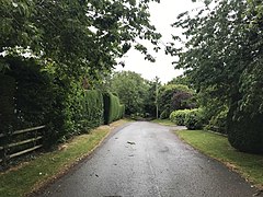
458:Gaulby Road: looking towards Frisby (2006)
421:1 mile (1.6 km) to the southwest and
27:
466:Site of deserted medieval village (2013)
88:1.50460 sq mi (3.8969 km)
554:
307:
263:
231:
207:
126:
110:
83:
34:
823:"A perforated hammer-head, axe hammer"
1044:Scheduled monuments in Leicestershire
1029:Civil parishes in Harborough District
613:"A Short History of Galby and Frisby"
291:
279:
267:
253:
241:
221:
189:
171:
153:
99:
7:
573:from the original on 10 August 2021
975:National Heritage List for England
944:National Heritage List for England
857:Lee, J.M.; McKinley, R.A. (1964).
681:National Heritage List for England
14:
997:"Frisby 16th Century Outbuilding"
1039:Civil parishes in Leicestershire
59:
52:
36:
134:84.38 mi (135.80 km)
60:
1:
563:"Key to English Place-names"
113:OS grid reference
25:Human settlement in England
1065:
427:Scheduled Ancient Monument
15:
1034:Hamlets in Leicestershire
407:deserted medieval village
326:
304:
264:
47:
35:
909:"Frisby House Farmhouse"
770:"Frisby, Leicestershire"
707:Hartley, Robert (2018).
543:Grade II listed building
530:Grade II listed building
405:, that is now largely a
1001:heritagegateway.org.uk
913:heritagegateway.org.uk
887:visionofbritain.org.uk
827:heritagegateway.org.uk
611:Hoskins, W.G. (1941).
526:
467:
459:
369:52.607499°N 0.962351°W
244:Postcode district
107:11/sq mi (4.2/km)
567:kepn.nottingham.ac.uk
465:
457:
750:. Report No 2009-012
415:Frisby on the Wreake
374:52.607499; -0.962351
224:Sovereign state
18:Frisby on the Wreake
735:Martin, S. (2009).
646:"Population (2011)"
365: /
1003:. Heritage Gateway
915:. Heritage Gateway
829:. Heritage Gateway
468:
460:
310:UK Parliament
256:Dialling code
718:978-0-9548200-3-9
384:
383:
174:Shire county
1056:
1013:
1012:
1010:
1008:
993:
987:
986:
984:
982:
966:Historic England
962:
956:
955:
953:
951:
935:Historic England
931:
925:
924:
922:
920:
905:
899:
898:
896:
894:
879:
873:
872:
870:
868:
854:
839:
838:
836:
834:
819:
813:
812:
799:
786:
785:
783:
781:
774:opendomesday.org
766:
760:
759:
757:
755:
741:
732:
723:
722:
704:
693:
692:
690:
688:
672:Historic England
668:
662:
661:
659:
657:
642:
636:
635:
633:
631:
617:
608:
583:
582:
580:
578:
559:
445:
389:is a hamlet and
380:
379:
377:
376:
375:
370:
366:
363:
362:
361:
358:
332:
218:
123:
122:
73:Location within
63:
62:
56:
40:
28:
1064:
1063:
1059:
1058:
1057:
1055:
1054:
1053:
1019:
1018:
1017:
1016:
1006:
1004:
995:
994:
990:
980:
978:
964:
963:
959:
949:
947:
933:
932:
928:
918:
916:
907:
906:
902:
892:
890:
881:
880:
876:
866:
864:
856:
855:
842:
832:
830:
821:
820:
816:
801:
800:
789:
779:
777:
776:. Open Domesday
768:
767:
763:
753:
751:
748:10.5284/1010971
739:
734:
733:
726:
719:
706:
705:
696:
686:
684:
670:
669:
665:
655:
653:
644:
643:
639:
629:
627:
615:
610:
609:
586:
576:
574:
561:
560:
556:
551:
539:
503:
452:
441:
373:
371:
367:
364:
359:
356:
354:
352:
351:
350:
330:
322:
214:
204:
186:
168:
150:
118:
117:
80:
79:
78:
77:
71:
70:
69:
68:
64:
43:
26:
21:
12:
11:
5:
1062:
1060:
1052:
1051:
1046:
1041:
1036:
1031:
1021:
1020:
1015:
1014:
988:
957:
926:
900:
874:
840:
814:
787:
761:
724:
717:
694:
663:
652:. doogal.co.uk
637:
584:
553:
552:
550:
547:
538:
535:
507:Hugh de Welles
502:
499:
484:Hugh de Welles
451:
448:
443:SK 70547 01602
439:grid reference
399:Leicestershire
382:
381:
349:
348:
346:Leicestershire
343:
338:
333:
331:List of places
327:
324:
323:
321:
320:
314:
312:
306:
305:
302:
301:
296:
290:
289:
287:Leicestershire
284:
278:
277:
275:Leicestershire
272:
266:
265:
262:
261:
258:
252:
251:
246:
240:
239:
236:
230:
229:
228:United Kingdom
226:
220:
219:
212:
206:
205:
203:
202:
196:
194:
188:
187:
185:
184:
182:Leicestershire
178:
176:
170:
169:
167:
166:
160:
158:
152:
151:
149:
148:
144:
142:
136:
135:
132:
125:
124:
115:
109:
108:
105:
98:
97:
96:16 (2011)
94:
90:
89:
86:
82:
81:
75:Leicestershire
72:
66:
65:
58:
57:
51:
50:
49:
48:
45:
44:
41:
33:
32:
24:
13:
10:
9:
6:
4:
3:
2:
1061:
1050:
1047:
1045:
1042:
1040:
1037:
1035:
1032:
1030:
1027:
1026:
1024:
1002:
998:
992:
989:
977:
976:
971:
967:
961:
958:
946:
945:
940:
936:
930:
927:
914:
910:
904:
901:
888:
884:
878:
875:
862:
861:
853:
851:
849:
847:
845:
841:
828:
824:
818:
815:
810:
809:
804:
803:Nichols, John
798:
796:
794:
792:
788:
775:
771:
765:
762:
749:
745:
738:
731:
729:
725:
720:
714:
710:
703:
701:
699:
695:
683:
682:
677:
673:
667:
664:
651:
647:
641:
638:
625:
621:
614:
607:
605:
603:
601:
599:
597:
595:
593:
591:
589:
585:
572:
568:
564:
558:
555:
548:
546:
544:
536:
534:
531:
525:
521:
518:
516:
512:
508:
500:
498:
495:
490:
485:
481:
477:
473:
464:
456:
449:
447:
444:
440:
436:
432:
428:
424:
420:
416:
412:
408:
404:
400:
396:
392:
388:
378:
347:
344:
342:
339:
337:
334:
329:
328:
325:
319:
316:
315:
313:
311:
303:
300:
299:East Midlands
297:
295:
288:
285:
283:
276:
273:
271:
259:
257:
250:
247:
245:
237:
235:
227:
225:
217:
213:
211:
201:
200:East Midlands
198:
197:
195:
193:
183:
180:
179:
177:
175:
165:
162:
161:
159:
157:
146:
145:
143:
141:
137:
133:
131:
121:
116:
114:
106:
104:
95:
91:
87:
76:
55:
46:
42:Frisby (2020)
39:
29:
23:
19:
1005:. Retrieved
1000:
991:
979:. Retrieved
973:
960:
948:. Retrieved
942:
929:
917:. Retrieved
912:
903:
891:. Retrieved
886:
877:
865:. Retrieved
859:
831:. Retrieved
826:
817:
807:
778:. Retrieved
773:
764:
752:. Retrieved
708:
685:. Retrieved
679:
666:
654:. Retrieved
650:doogal.co.uk
649:
640:
628:. Retrieved
623:
619:
575:. Retrieved
566:
557:
540:
527:
523:
519:
515:John Nichols
504:
489:John Nichols
469:
397:district of
391:civil parish
386:
385:
140:Civil parish
22:
511:Reformation
372: /
1023:Categories
549:References
501:The Chapel
395:Harborough
357:52°36′27″N
318:Harborough
164:Harborough
93:Population
1007:17 August
981:17 August
950:17 August
919:17 August
893:17 August
867:15 August
833:17 August
780:15 August
754:16 August
687:15 August
656:15 August
630:15 August
626:: 173–210
577:29 August
537:Buildings
423:Billesdon
403:Leicester
360:0°57′44″W
294:Ambulance
238:LEICESTER
234:Post town
805:(1798).
571:Archived
411:Frisians
156:District
120:SK703015
480:Gartree
476:Hundred
474:in the
450:History
393:in the
341:England
216:England
210:Country
128:•
103:Density
101:•
715:
494:census
472:Gaulby
435:crofts
433:&
419:Gaulby
387:Frisby
270:Police
192:Region
147:Frisby
130:London
67:Frisby
31:Frisby
740:(PDF)
616:(PDF)
431:tofts
1009:2022
983:2022
952:2022
921:2022
895:2022
869:2022
835:2022
782:2022
756:2022
713:ISBN
689:2022
658:2022
632:2022
579:2021
282:Fire
260:0116
85:Area
744:doi
478:of
446:).
249:LE7
1025::
999:.
972:.
968:.
941:.
937:.
911:.
885:.
843:^
825:.
790:^
772:.
727:^
697:^
678:.
674:.
648:.
624:22
622:.
618:.
587:^
569:.
565:.
336:UK
1011:.
985:.
954:.
923:.
897:.
871:.
837:.
784:.
758:.
746::
721:.
691:.
660:.
634:.
581:.
20:.
Text is available under the Creative Commons Attribution-ShareAlike License. Additional terms may apply.