45:
29:
537:
509:
523:
52:
405:
about 18 km (11 mi) to the northeast. Water from the reservoir is piped the long distance from the dam to the power station. The difference in elevation between the reservoir and the power station downstream affords a
410:
of 582.5 m (1,911 ft). Construction on the dam began in 1975 and the power station was operational in 1986. In 2012 the dam's reservoir was drained for repairs. It is expected to be impounded again in 2014.
618:
628:
623:
428:
398:
275:
638:
287:
97:
633:
453:
44:
479:
613:
608:
556:
402:
603:
542:
390:
583:
386:
370:
197:
578:
350:
573:
457:
378:
85:
514:
407:
327:
257:
28:
597:
394:
366:
337:
528:
536:
568:
504:
434:. International Association for Automation and Robotics in Construction. 2009
302:
289:
112:
99:
522:
374:
81:
429:"Stability Monitoring System Implementation for Rural Mare Retezat Dam"
382:
71:
393:. It is the tallest dam in Romania. The primary purpose of the dam is
343:
184:
349:
336:
326:
318:
281:
274:
266:
256:
248:
243:
235:
227:
219:
211:
203:
193:
183:
178:
170:
152:
144:
136:
128:
91:
77:
67:
21:
385:. It is fed by the Râul Mare and its tributaries
456:(in Romanian). Hidroconstructia. Archived from
239:10,285,000 m (13,452,000 cu yd)
8:
619:Buildings and structures in Hunedoara County
397:power generation and it supports the 335 MW
373:about 35 km (22 mi) southwest of
27:
18:
252:225,000,000 m (182,000 acre⋅ft)
629:Hydroelectric power stations in Romania
624:Energy infrastructure completed in 1986
482:(in Romanian). Evz.Ro. 22 February 2013
420:
51:
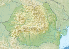
59:Location of Gura Apelor Dam in Romania
399:Râul Mare Hydroelectric Power Station
276:Râul Mare Hydroelectric Power Station
7:
14:
480:"Looks like a lake without water"
535:
521:
507:
262:235 km (91 sq mi)
50:
43:
639:1986 establishments in Romania
16:Dam in Hațeg, Hunedoara County
1:
267:Maximum water depth
332:582.5 m (1,911 ft)
584:GPX (secondary coordinates)
158:; 38 years ago
655:
634:Underground power stations
231:574 m (1,883 ft)
215:464 m (1,522 ft)
33:Downstream face of the dam
579:GPX (primary coordinates)
554:Map all coordinates using
303:45.4787861°N 22.8239806°E
113:45.3391750°N 22.7216667°E
38:
26:
562:Download coordinates as:
270:162 m (531 ft)
207:168 m (551 ft)
174:S.C. Hidroelectrica S.A.
543:Renewable energy portal
351:Installed capacity
145:Construction began
614:Dams completed in 1986
308:45.4787861; 22.8239806
223:12 m (39 ft)
140:Complete, under repair
118:45.3391750; 22.7216667
574:GPX (all coordinates)
189:Embankment, rock-fill
185:Type of dam
319:Commission date
299: /
258:Catchment area
249:Total capacity
109: /
220:Width (crest)
401:which is located
359:
358:
228:Width (base)
179:Dam and spillways
153:Opening date
646:
609:Rock-filled dams
545:
540:
539:
531:
526:
525:
517:
512:
511:
510:
492:
491:
489:
487:
476:
470:
469:
467:
465:
450:
444:
443:
441:
439:
433:
425:
379:Hunedoara County
314:
313:
311:
310:
309:
304:
300:
297:
296:
295:
292:
166:
164:
159:
124:
123:
121:
120:
119:
114:
110:
107:
106:
105:
102:
86:Hunedoara County
54:
53:
47:
31:
19:
654:
653:
649:
648:
647:
645:
644:
643:
604:Dams in Romania
594:
593:
592:
591:
590:
589:
588:
549:
548:
541:
534:
527:
520:
513:
508:
506:
501:
496:
495:
485:
483:
478:
477:
473:
463:
461:
460:on 12 June 2013
452:
451:
447:
437:
435:
431:
427:
426:
422:
417:
363:Gura Apelor Dam
307:
305:
301:
298:
293:
290:
288:
286:
285:
236:Dam volume
162:
160:
157:
117:
115:
111:
108:
103:
100:
98:
96:
95:
63:
62:
61:
60:
57:
56:
55:
34:
22:Gura Apelor Dam
17:
12:
11:
5:
652:
650:
642:
641:
636:
631:
626:
621:
616:
611:
606:
596:
595:
587:
586:
581:
576:
571:
565:
559:
552:
551:
550:
547:
546:
532:
518:
515:Romania portal
503:
502:
500:
499:External links
497:
494:
493:
471:
445:
419:
418:
416:
413:
408:hydraulic head
387:Lăpușnicul Mic
357:
356:
353:
347:
346:
340:
334:
333:
330:
328:Hydraulic head
324:
323:
320:
316:
315:
283:
279:
278:
272:
271:
268:
264:
263:
260:
254:
253:
250:
246:
245:
241:
240:
237:
233:
232:
229:
225:
224:
221:
217:
216:
213:
209:
208:
205:
201:
200:
195:
191:
190:
187:
181:
180:
176:
175:
172:
168:
167:
154:
150:
149:
146:
142:
141:
138:
134:
133:
130:
126:
125:
93:
89:
88:
79:
75:
74:
69:
65:
64:
58:
49:
48:
42:
41:
40:
39:
36:
35:
32:
24:
23:
15:
13:
10:
9:
6:
4:
3:
2:
651:
640:
637:
635:
632:
630:
627:
625:
622:
620:
617:
615:
612:
610:
607:
605:
602:
601:
599:
585:
582:
580:
577:
575:
572:
570:
567:
566:
564:
563:
558:
557:OpenStreetMap
555:
544:
538:
533:
530:
524:
519:
516:
505:
498:
481:
475:
472:
459:
455:
449:
446:
430:
424:
421:
414:
412:
409:
404:
400:
396:
395:hydroelectric
392:
388:
384:
380:
376:
372:
369:on the river
368:
367:rock-fill dam
364:
354:
352:
348:
345:
341:
339:
335:
331:
329:
325:
321:
317:
312:
294:22°49′26.33″E
291:45°28′43.63″N
284:
280:
277:
273:
269:
265:
261:
259:
255:
251:
247:
242:
238:
234:
230:
226:
222:
218:
214:
210:
206:
202:
199:
196:
192:
188:
186:
182:
177:
173:
169:
155:
151:
147:
143:
139:
135:
131:
127:
122:
104:22°43′18.00″E
101:45°20′21.03″N
94:
90:
87:
83:
80:
76:
73:
70:
66:
46:
37:
30:
25:
20:
561:
560:
553:
529:Water portal
484:. Retrieved
474:
462:. Retrieved
458:the original
448:
436:. Retrieved
423:
362:
360:
454:"SUCURSALE"
403:underground
306: /
282:Coordinates
116: /
92:Coordinates
598:Categories
415:References
342:2 x 167.5
371:Râul Mare
244:Reservoir
198:Râul Mare
338:Turbines
194:Impounds
171:Owner(s)
78:Location
486:7 April
464:8 April
438:8 April
383:Romania
161: (
129:Purpose
72:Romania
68:Country
355:335 MW
212:Length
204:Height
137:Status
432:(PDF)
375:Hațeg
365:is a
132:Power
82:Hațeg
488:2014
466:2014
440:2014
389:and
361:The
322:1986
163:1986
156:1986
148:1975
569:KML
391:Șes
377:in
600::
381:,
344:MW
84:,
490:.
468:.
442:.
165:)
Text is available under the Creative Commons Attribution-ShareAlike License. Additional terms may apply.