47:
67:
497:
864:
74:
46:
928:
398:
909:
953:
355:
259:
Huber was established in 1910. It is named for Jacob Huber, an early resident of the area. The Huber post office opened in 1916 and was closed on
December 31, 1953.
66:
943:
933:
902:
348:
938:
806:
98:
895:
948:
658:
220:
341:
713:
321:
552:
796:
333:
582:
248:
154:
871:
365:
240:
159:
236:
130:
297:
557:
508:
311:
834:
572:
526:
841:
718:
542:
452:
426:
193:
683:
653:
623:
598:
531:
485:
446:
36:
778:
773:
698:
648:
588:
536:
463:
743:
708:
668:
633:
577:
567:
441:
436:
416:
411:
387:
317:
183:
879:
811:
768:
738:
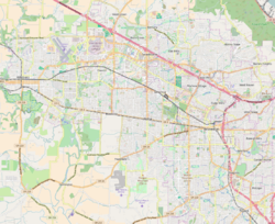
673:
643:
638:
613:
479:
469:
457:
276:
801:
763:
753:
728:
703:
663:
562:
521:
758:
733:
723:
693:
688:
628:
618:
608:
547:
474:
431:
421:
922:
516:
406:
244:
135:
748:
380:
788:
142:
113:
100:
863:
174:
825:‡This populated place also has portions in an adjacent county or counties
298:
U.S. Geological Survey
Geographic Names Information System: Huber, Oregon
208:
875:
147:
200:
179:
337:
16:
Unincorporated community in the state of Oregon, United States
495:
52:
Aerial photograph of the
Tualatin Hills Nature Park in 1998,
277:"Huber (in Washington County, OR) Populated Place Profile"
929:
Unincorporated communities in
Washington County, Oregon
883:
820:
787:
597:
507:
397:
219:
207:
190:
173:
165:
153:
141:
129:
26:
21:Unincorporated community in Oregon, United States
316:. Oregon Historical Society Press. p. 428.
903:
496:
349:
8:
243:, United States, now mostly located within
954:Portland metropolitan area geography stubs
910:
896:
356:
342:
334:
23:
268:
206:
172:
164:
128:
93:
59:
43:
218:
189:
152:
140:
86:Location within Washington County, OR
7:
944:Populated places established in 1910
934:Unincorporated communities in Oregon
860:
858:
882:. You can help Knowledge (XXG) by
364:Municipalities and communities of
14:
862:
72:
65:
45:
1:
939:1910 establishments in Oregon
73:
878:state location article is a
309:McArthur, Lewis L. (1992).
54:Huber is in the foreground.
970:
949:Portland metropolitan area
857:
249:Tualatin Hills Nature Park
830:
493:
378:
367:Washington County, Oregon
241:Washington County, Oregon
94:
60:
44:
33:
237:unincorporated community
37:Unincorporated community
312:Oregon Geographic Names
169:197 ft (60 m)
501:
114:45.49194°N 122.85111°W
500:Washington County map
499:
192: • Summer (
843:United States portal
553:Garden Home–Whitford
119:45.49194; -122.85111
110: /
502:
891:
890:
872:Washington County
852:
851:
583:West Haven–Sylvan
279:. HomeTownLocator
230:
229:
961:
912:
905:
898:
866:
859:
844:
837:
498:
390:
383:
373:
368:
358:
351:
344:
335:
328:
327:
306:
300:
295:
289:
288:
286:
284:
273:
197:
125:
124:
122:
121:
120:
115:
111:
108:
107:
106:
103:
76:
75:
69:
55:
49:
39:
24:
969:
968:
964:
963:
962:
960:
959:
958:
919:
918:
917:
916:
855:
853:
848:
842:
835:
826:
816:
783:
600:
593:
558:Marlene Village
503:
491:
393:
388:
381:
374:
371:
366:
362:
332:
331:
324:
314:(sixth edition)
308:
307:
303:
296:
292:
282:
280:
275:
274:
270:
265:
257:
215:
191:
118:
116:
112:
109:
104:
101:
99:
97:
96:
90:
89:
88:
87:
84:
83:
82:
81:
77:
56:
53:
51:
40:
35:
29:
22:
17:
12:
11:
5:
967:
965:
957:
956:
951:
946:
941:
936:
931:
921:
920:
915:
914:
907:
900:
892:
889:
888:
867:
850:
849:
847:
846:
839:
831:
828:
827:
824:
822:
818:
817:
815:
814:
809:
804:
799:
793:
791:
785:
784:
782:
781:
776:
771:
766:
761:
756:
751:
746:
741:
736:
731:
726:
721:
716:
711:
706:
701:
696:
691:
686:
681:
676:
671:
666:
661:
656:
651:
646:
641:
636:
631:
626:
621:
616:
611:
605:
603:
595:
594:
592:
591:
586:
580:
575:
570:
565:
560:
555:
550:
545:
540:
534:
529:
524:
519:
513:
511:
505:
504:
494:
492:
490:
489:
483:
477:
472:
467:
461:
455:
450:
444:
439:
434:
429:
424:
419:
414:
409:
403:
401:
395:
394:
379:
376:
375:
363:
361:
360:
353:
346:
338:
330:
329:
322:
301:
290:
267:
266:
264:
261:
256:
253:
228:
227:
224:
217:
216:
213:
211:
205:
204:
198:
188:
187:
177:
171:
170:
167:
163:
162:
157:
151:
150:
145:
139:
138:
133:
127:
126:
92:
91:
85:
79:
78:
71:
70:
64:
63:
62:
61:
58:
57:
50:
42:
41:
34:
31:
30:
27:
20:
15:
13:
10:
9:
6:
4:
3:
2:
966:
955:
952:
950:
947:
945:
942:
940:
937:
935:
932:
930:
927:
926:
924:
913:
908:
906:
901:
899:
894:
893:
887:
885:
881:
877:
873:
868:
865:
861:
856:
845:
840:
838:
836:Oregon portal
833:
832:
829:
823:
819:
813:
810:
808:
805:
803:
800:
798:
795:
794:
792:
790:
786:
780:
777:
775:
772:
770:
767:
765:
762:
760:
757:
755:
752:
750:
747:
745:
742:
740:
737:
735:
732:
730:
727:
725:
722:
720:
717:
715:
712:
710:
707:
705:
702:
700:
697:
695:
692:
690:
687:
685:
682:
680:
677:
675:
672:
670:
667:
665:
662:
660:
657:
655:
652:
650:
647:
645:
642:
640:
637:
635:
632:
630:
627:
625:
622:
620:
617:
615:
612:
610:
607:
606:
604:
602:
596:
590:
587:
584:
581:
579:
576:
574:
573:Raleigh Hills
571:
569:
566:
564:
561:
559:
556:
554:
551:
549:
546:
544:
541:
538:
535:
533:
530:
528:
527:Bull Mountain
525:
523:
520:
518:
515:
514:
512:
510:
506:
487:
484:
481:
478:
476:
473:
471:
468:
465:
462:
459:
456:
454:
451:
448:
445:
443:
440:
438:
435:
433:
430:
428:
425:
423:
420:
418:
415:
413:
410:
408:
405:
404:
402:
400:
396:
392:
391:
384:
377:
372:United States
369:
359:
354:
352:
347:
345:
340:
339:
336:
325:
323:0-87595-236-4
319:
315:
313:
305:
302:
299:
294:
291:
278:
272:
269:
262:
260:
254:
252:
250:
246:
242:
238:
234:
225:
222:
212:
210:
202:
199:
195:
185:
184:Pacific (PST)
181:
178:
176:
168:
161:
158:
156:
149:
146:
144:
137:
136:United States
134:
132:
123:
95:Coordinates:
68:
48:
38:
32:
25:
19:
884:expanding it
869:
854:
719:Mountaindale
678:
543:Cherry Grove
453:North Plains
427:Forest Grove
386:
310:
304:
293:
281:. Retrieved
271:
258:
232:
231:
18:
789:Ghost towns
684:Kansas City
654:Gales Creek
624:Bonny Slope
601:communities
532:Cedar Hills
486:Wilsonville
447:Lake Oswego
382:County seat
283:October 11,
117: /
923:Categories
807:Greenville
779:Wilkesboro
774:West Union
699:Laurelwood
649:Farmington
589:West Slope
537:Cedar Mill
464:Rivergrove
263:References
223:feature ID
160:Washington
105:122°51′4″W
102:45°29′31″N
821:Footnotes
744:Reedville
709:Middleton
669:Hazeldale
634:Carnation
578:Rockcreek
568:Oak Hills
442:King City
437:Hillsboro
417:Cornelius
412:Beaverton
389:Hillsboro
247:near the
209:ZIP codes
175:Time zone
166:Elevation
812:Thatcher
769:Verboort
739:Progress
674:Helvetia
659:Glenwood
644:Elmonica
639:Chehalem
614:Blooming
480:Tualatin
470:Sherwood
458:Portland
802:Glencoe
764:Tonquin
754:Scholls
729:Norwood
704:Manning
664:Hayward
563:Metzger
522:Bethany
255:History
226:1166664
131:Country
876:Oregon
759:Timber
734:Orenco
724:Mulloy
714:Midway
694:Laurel
689:Kinton
629:Buxton
619:Bonita
609:Bacona
548:Dilley
475:Tigard
432:Gaston
422:Durham
399:Cities
320:
235:is an
155:County
148:Oregon
870:This
797:Dixie
679:Huber
599:Other
517:Aloha
407:Banks
245:Aloha
233:Huber
214:97007
203:(PDT)
201:UTC-7
180:UTC-8
143:State
80:Huber
28:Huber
880:stub
509:CDPs
318:ISBN
285:2016
221:GNIS
749:Roy
239:in
194:DST
925::
874:,
385::
370:,
251:.
911:e
904:t
897:v
886:.
585:‡
539:‡
488:‡
482:‡
466:‡
460:‡
449:‡
357:e
350:t
343:v
326:.
287:.
196:)
186:)
182:(
Text is available under the Creative Commons Attribution-ShareAlike License. Additional terms may apply.