83:
360:, known as the "Queen of Sharks", who protected Oʻahu and strictly enforced kind, fair behavior on the part of both sharks and humans. Until the late 1890s, the home of Kaʻahupahau was famously lined with beds of pearl oysters, however, according to Kanaka Maoli religious experts who follow the goddess, Kaʻahupahau removed all of the oysters (and some say, herself) because the area was being abused by human misdeeds. Today, the water of Pearl Harbor has been highly contaminated by nuclear defueling and other toxic influences, and has thereby been designated as a
1423:
143:
400:
although they now do so through a layer of soot and with the roar of the freeway as a constant sonic backdrop. Many kanaka maoli do not use the freeway because of these impacts, and because of the lasting belief that the road is haunted—an often-attributed explanation for the high accident rate on the freeway (more generally believed to be caused by the high speeds often used by the motorists who traverse it).
799:
161:
510:
424:
68:
395:
construction began), many more are declining rapidly, the main aquifer of the area was badly damaged, and religious sites were seriously impacted. Although the freeway was opened in 1997, many are still fighting for mitigation of these impacts, and some are asking for the freewayʻs closure. In 1993, thirteen
403:
There is evidence in the documentary record that upper Halawa was highly significant to Kanaka Maoli. Most of the evidence may be, however, be in the oral record. The Hale O Papa and luakini are mentioned in the massive collection of Bishop Museum reports that took many years to finally be released.
593:; although very expensive to construct, the viaduct is the only way to construct a freeway of this magnitude through such a narrow valley without flooding and destabilization concerns; it is also believed to offer some returns in terms of preservation of both archeological sites and stream ecology.
733:
living together, 13.9% had a female householder with no husband present, and 20.9% were non-families. 15.5% of all households were made up of individuals, and 5.2% had someone living alone who was 65 years of age or older. The average household size was 3.28 and the average family size was 3.64.
697:
of 2000, there were 13,891 people, 4,142 households, and 3,276 families residing in the CDP. The population density was 5,974.5 inhabitants per square mile (2,306.8/km). There were 4,289 housing units at an average density of 1,844.7 per square mile (712.2/km). The racial makeup of the CDP was
399:
were arrested while conducting a ceremony to pray for the healing of the valley. Their lele (religious altar) was destroyed, and the caretakers of the area were barred from entrance to the sites. Today, some of these caretakers, many of them kupuna (elders), have returned to care for the sites,
737:
In the CDP the population was spread out, with 23.4% under the age of 18, 9.9% from 18 to 24, 28.3% from 25 to 44, 22.6% from 45 to 64, and 15.8% who were 65 years of age or older. The median age was 37 years. For every 100 females there were 98.8 males. For every 100 females age 18 and over,
394:
In the last two decades, North Halawa has been the site of a very public battle over the religious sites and ecological resources destroyed by H-3, which is the most expensive freeway per mile in human history. At least two species were driven to probable extinction (none have been sighted since
414:
The Papa temples were associated with the great Ku temples (luakini), which demanded human sacrifice and were usually in areas of greater population and state sponsorship. Without a luakini, there would be no Hale o Papa, according to Samuel
Kamakau (see Bishop Museum, H-3 project reports).
318:, United States. Halawa Stream branches into two valleys: North and South Halawa; North Halawa is the larger stream and fluvial feature. Their confluence is within the H-3/H-201 highways exchange. Most of Halawa Valley is undeveloped. As of the
82:
1575:
439:"Neighborhoods" of Halawa are very disjointed, in part because of the significant highway exchanges (see below) that now occupy nearly all of the lower end of Halawa Valley between Red Hill and
741:
The median income for a household in the CDP in 2000 was $ 63,176, and the median income for a family was $ 68,519. Males had a median income of $ 35,764 versus $ 28,527 for females. The
379:, womenʻs temples where Papa is worshipped. The valley contains many religious and other cultural sites sacred to Kanaka Maoli. Although many sites were destroyed by the invasion of
447:
is developed into commercial and light industrial properties. On the east side of H-3 are found the State Animal
Quarantine Station and the Halawa High and Medium Security Facility (
1091:
67:
404:
However, there was no archaeological evidence that these structures existed by the time of highway construction. The area has been greatly impacted by
1570:
272:
842:
1084:
1054:
103:
1010:
411:, homesteading, and light industrial use. The site of Waipao Heiau, for example, is currently occupied by a food distribution warehouse.
869:
282:
1041:
769:
329:
252:
1069:
1434:
1497:
1077:
820:
520:
787:
operates public schools. Aiea
Elementary School, Gus Webling Elementary School, and Aiea Intermediate School are in Halawa CDP.
1492:
1037:
784:
715:
1585:
909:
723:
707:
773:
448:
987:
938:
913:
552:
408:
375:, as it is, according to legend, her birthplace and primary home, as well as one of only two or three known remaining
935:"Profile of General Population and Housing Characteristics: 2010 Demographic Profile Data (DP-1): Halawa CDP, Hawaii"
1580:
1518:
672:
657:
642:
627:
319:
1513:
1412:
1402:
1352:
1247:
260:
135:
1397:
1282:
729:
There were 4,142 households, out of which 30.3% had children under the age of 18 living with them, 60.1% were
1382:
1134:
1101:
311:
307:
178:
88:
58:
31:
1297:
1212:
1202:
1167:
1059:
1312:
1217:
1540:
1482:
1407:
1152:
579:
1332:
1162:
1547:
1377:
1317:
1172:
1157:
846:
1337:
1307:
711:
699:
37:
This article is about the place on the island of Oahu. For the place on the island of
Molokai, see
1459:
1454:
1444:
1342:
1322:
1257:
1017:
963:
719:
376:
357:
173:
1187:
959:
1523:
1487:
1292:
1277:
1192:
866:
742:
590:
498:
493:(the same as for Aiea). The postal code for Foster Village, the stadium area, and Makalapa is
463:
396:
333:
302:
745:
for the CDP was $ 21,868. About 7.5% of families and 10.1% of the population were below the
349:
1302:
1287:
1272:
1237:
1197:
1142:
703:
567:
563:
368:
325:
73:
1387:
1372:
1367:
1362:
1357:
1347:
1327:
1262:
1252:
1242:
1222:
1182:
873:
583:
38:
1392:
1232:
1227:
571:
559:
444:
388:
384:
1063:. October 16, 2009. Retrieved on May 19, 2010. "A 22-year-old Halawa prison inmate..."
1564:
1449:
804:
757:
440:
372:
265:
1267:
1147:
746:
575:
483:
455:
353:
345:
482:. Along the lower, western edge, Halawa Heights merges with the neighborhoods of
1116:
428:
380:
749:, including 20.9% of those under the age of 18 and 3.7% of those 65 and older.
794:
153:
884:
535:
522:
118:
105:
405:
361:
243:
431:, or area of land ruled by chief or king and managed by the members of the
509:
423:
356:, it is, according to Kanaka Maoli beliefs, the home of the shark goddess
1207:
1123:
730:
555:, the CDP has a total area of 2.3 square miles (6.0 km), all land.
17:
694:
315:
248:
166:
92:
589:
A significant proportion of H-3 within the valley is carried on the
1422:
582:, penetrating the Ko‘olau crest. The freeway continues beyond to
508:
474:. The interfluve (uplands between valleys) on the west comprises
422:
432:
1073:
1421:
383:
and especially by the building of the highly controversial
1055:
Argument leads to beating death of inmate in Halawa prison
443:. Much of the remainder of the valley along both sides of
983:
934:
578:) to the 1100-foot (335-m) elevation entrance into the
367:
The upland, or Mauka, portion of Halawa is sacred to
72:
Interstate H-3 in Halawa Valley looking towards the
1576:
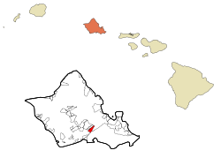
Census-designated places in
Honolulu County, Hawaii
1506:
1475:
1468:
1433:
1133:
281:
271:
259:
242:
234:
226:
221:
213:
205:
197:
189:
184:
172:
152:
134:
49:
344:The entire ahupuaʻa of Halawa is highly sacred to
1011:"2010 CENSUS - CENSUS BLOCK MAP: Halawa CDP, HI"
562:extends from its western terminus with east–west
387:, many remain and are cared for by Kanaka Maoli
44:Census-designated place in Hawaii, United States
27:Census-designated place in Hawaii, United States
960:"CENSUS OF POPULATION AND HOUSING (1790-2000)"
1085:
30:"Halawa" redirects here. For other uses, see
8:
1100:Islands, municipalities, and communities of
1005:
1003:
489:The U.S. Postal Code for Halawa Heights is
1472:
1426:Map of Hawaii highlighting Honolulu County
1092:
1078:
1070:
910:"US Gazetteer files: 2010, 2000, and 1990"
867:Kapi'olani Community College - © 1999-2006
726:of any race were 6.52% of the population.
600:
46:
885:United States General Accounting Office
812:
270:
258:
241:
220:
212:
183:
133:
98:
79:
64:
899:Bishop Museum Press, Honolulu, p. 325.
722:, and 20.31% from two or more races.
620:
454:Where the valley widens out closer to
336:is located at the base of the valley.
334:Hālawa (Aloha Stadium) Skyline station
322:, the CDP had a population of 15,016.
301:
280:
233:
225:
204:
196:
188:
171:
151:
7:
348:. At the far Makai (ocean) side at
209:0.00 sq mi (0.00 km)
201:2.39 sq mi (6.19 km)
193:2.39 sq mi (6.19 km)
1042:Hawaii Department of Public Safety
770:Hawaii Department of Public Safety
610:
330:United States Indo-Pacific Command
25:
458:occur residential neighborhoods:
238:6,285.48/sq mi (2,427.05/km)
797:
159:
141:
81:
66:
566:(H-201; connecting eastward to
466:; and the stadium area between
1571:Archaeological sites in Hawaii
785:Hawaii Department of Education
310:(CDP) in the ‘Ewa District of
1:
843:"The History of Pearl Harbor"
823:. United States Census Bureau
764:Government and infrastructure
513:Halawa viaducts, carrying H-3
1044:. Retrieved on May 19, 2010.
1038:Halawa Correctional Facility
774:Halawa Correctional Facility
427:Historically, Halawa was an
988:United States Census Bureau
939:United States Census Bureau
914:United States Census Bureau
821:"2020 U.S. Gazetteer Files"
553:United States Census Bureau
391:practitioners to this day.
371:, the Kanaka Maoli form of
1602:
760:is located in Halawa CDP.
548:(21.377633, -157.922759).
328:, the headquarters of the
36:
29:
1536:
1419:
1114:
686:
671:
656:
641:
626:
619:
614:
609:
606:
99:
80:
65:
56:
776:in an area near Halawa.
1103:Honolulu County, Hawaii
738:there were 98.3 males.
332:, is located here. The
308:census-designated place
299:Hawaiian pronunciation:
217:177 ft (54 m)
59:Census-designated place
32:Halawa (disambiguation)
1427:
1060:Honolulu Star-Bulletin
536:21.37750°N 157.92278°W
514:
436:
397:cultural practitioners
119:21.37750°N 157.92278°W
1425:
984:"U.S. Census website"
602:Historical population
580:Tetsuo Harano Tunnels
517:Halawa is located at
512:
426:
1586:Sacred natural sites
1549:United States portal
1498:Prosecuting Attorney
541:21.37750; -157.92278
235: • Density
124:21.37750; -157.92278
1493:Neighborhood Boards
603:
532: /
115: /
1428:
1343:Schofield Barracks
1053:Fujimori, Leila. "
1018:U.S. Census Bureau
964:U.S. Census Bureau
872:2009-09-18 at the
724:Hispanic or Latino
601:
586:on windward Oahu.
515:
478:, extending up to
437:
227: • Total
206: • Water
190: • Total
1581:Valleys of Hawaii
1558:
1557:
1532:
1531:
1519:Police Department
1476:Elected officials
743:per capita income
691:
690:
591:Windward Viaducts
551:According to the
449:main O‘ahu prison
303:[həˈlɐvə]
292:
291:
198: • Land
91:and the state of
16:(Redirected from
1593:
1550:
1543:
1473:
1424:
1413:Whitmore Village
1403:West Loch Estate
1353:Waiahole-Waikāne
1126:
1119:
1109:
1104:
1094:
1087:
1080:
1071:
1064:
1051:
1045:
1034:
1028:
1027:
1025:
1024:
1015:
1007:
998:
997:
995:
994:
980:
974:
973:
971:
970:
956:
950:
949:
947:
945:
931:
925:
924:
922:
921:
906:
900:
893:
887:
882:
876:
864:
858:
857:
855:
854:
845:. Archived from
839:
833:
832:
830:
828:
817:
807:
802:
801:
800:
716:Pacific Islander
704:African American
622:
617:
612:
604:
564:Moanalua Freeway
547:
546:
544:
543:
542:
537:
533:
530:
529:
528:
525:
480:Camp H. M. Smith
340:Cultural history
326:Camp H. M. Smith
305:
300:
165:
163:
162:
147:
145:
144:
130:
129:
127:
126:
125:
120:
116:
113:
112:
111:
108:
85:
70:
47:
21:
1601:
1600:
1596:
1595:
1594:
1592:
1591:
1590:
1561:
1560:
1559:
1554:
1548:
1541:
1528:
1514:Fire Department
1502:
1464:
1436:
1429:
1417:
1383:Waimānalo Beach
1129:
1124:
1117:
1110:
1107:
1102:
1098:
1068:
1067:
1052:
1048:
1035:
1031:
1022:
1020:
1013:
1009:
1008:
1001:
992:
990:
982:
981:
977:
968:
966:
958:
957:
953:
943:
941:
933:
932:
928:
919:
917:
908:
907:
903:
894:
890:
883:
879:
874:Wayback Machine
865:
861:
852:
850:
841:
840:
836:
826:
824:
819:
818:
814:
803:
798:
796:
793:
782:
766:
755:
731:married couples
708:Native American
615:
599:
570:or westward to
540:
538:
534:
531:
526:
523:
521:
519:
518:
507:
421:
342:
312:Honolulu County
298:
253:Hawaii-Aleutian
160:
158:
142:
140:
123:
121:
117:
114:
109:
106:
104:
102:
101:
95:
89:Honolulu County
76:
61:
52:
45:
42:
39:Halawa, Molokai
35:
28:
23:
22:
15:
12:
11:
5:
1599:
1597:
1589:
1588:
1583:
1578:
1573:
1563:
1562:
1556:
1555:
1553:
1552:
1545:
1537:
1534:
1533:
1530:
1529:
1527:
1526:
1521:
1516:
1510:
1508:
1504:
1503:
1501:
1500:
1495:
1490:
1485:
1479:
1477:
1470:
1466:
1465:
1463:
1462:
1457:
1452:
1447:
1441:
1439:
1431:
1430:
1420:
1418:
1416:
1415:
1410:
1405:
1400:
1395:
1390:
1385:
1380:
1375:
1370:
1365:
1360:
1355:
1350:
1345:
1340:
1335:
1330:
1325:
1320:
1315:
1310:
1305:
1300:
1298:Mililani Mauka
1295:
1290:
1285:
1280:
1275:
1270:
1265:
1260:
1255:
1250:
1245:
1240:
1235:
1230:
1225:
1220:
1215:
1213:Iroquois Point
1210:
1205:
1203:Hickam Housing
1200:
1195:
1190:
1185:
1180:
1175:
1170:
1165:
1160:
1155:
1150:
1145:
1139:
1137:
1131:
1130:
1115:
1112:
1111:
1099:
1097:
1096:
1089:
1082:
1074:
1066:
1065:
1046:
1029:
999:
975:
951:
926:
901:
895:Kamakau 1992.
888:
877:
859:
834:
811:
810:
809:
808:
792:
789:
781:
778:
765:
762:
754:
751:
689:
688:
684:
683:
680:
678:
675:
669:
668:
665:
663:
660:
654:
653:
650:
648:
645:
639:
638:
635:
633:
630:
624:
623:
618:
613:
608:
598:
595:
506:
503:
476:Halawa Heights
460:Foster Village
445:Interstate H-3
420:
417:
341:
338:
290:
289:
286:
279:
278:
275:
269:
268:
263:
257:
256:
246:
240:
239:
236:
232:
231:
228:
224:
223:
219:
218:
215:
211:
210:
207:
203:
202:
199:
195:
194:
191:
187:
186:
182:
181:
176:
170:
169:
156:
150:
149:
138:
132:
131:
97:
96:
86:
78:
77:
71:
63:
62:
57:
54:
53:
50:
43:
26:
24:
14:
13:
10:
9:
6:
4:
3:
2:
1598:
1587:
1584:
1582:
1579:
1577:
1574:
1572:
1569:
1568:
1566:
1551:
1546:
1544:
1542:Hawaii portal
1539:
1538:
1535:
1525:
1522:
1520:
1517:
1515:
1512:
1511:
1509:
1505:
1499:
1496:
1494:
1491:
1489:
1486:
1484:
1481:
1480:
1478:
1474:
1471:
1467:
1461:
1458:
1456:
1453:
1451:
1448:
1446:
1443:
1442:
1440:
1438:
1432:
1414:
1411:
1409:
1406:
1404:
1401:
1399:
1398:Waipiʻo Acres
1396:
1394:
1391:
1389:
1386:
1384:
1381:
1379:
1376:
1374:
1371:
1369:
1366:
1364:
1361:
1359:
1356:
1354:
1351:
1349:
1346:
1344:
1341:
1339:
1336:
1334:
1331:
1329:
1326:
1324:
1321:
1319:
1316:
1314:
1311:
1309:
1306:
1304:
1303:Mililani Town
1301:
1299:
1296:
1294:
1291:
1289:
1286:
1284:
1283:Mākaha Valley
1281:
1279:
1276:
1274:
1271:
1269:
1266:
1264:
1261:
1259:
1256:
1254:
1251:
1249:
1246:
1244:
1241:
1239:
1236:
1234:
1231:
1229:
1226:
1224:
1221:
1219:
1216:
1214:
1211:
1209:
1206:
1204:
1201:
1199:
1196:
1194:
1191:
1189:
1186:
1184:
1181:
1179:
1176:
1174:
1173:ʻEwa Villages
1171:
1169:
1166:
1164:
1161:
1159:
1156:
1154:
1153:East Honolulu
1151:
1149:
1146:
1144:
1141:
1140:
1138:
1136:
1132:
1128:
1127:
1120:
1113:
1108:United States
1105:
1095:
1090:
1088:
1083:
1081:
1076:
1075:
1072:
1062:
1061:
1056:
1050:
1047:
1043:
1039:
1033:
1030:
1019:
1012:
1006:
1004:
1000:
989:
985:
979:
976:
965:
961:
955:
952:
940:
936:
930:
927:
915:
911:
905:
902:
898:
897:Ruling Chiefs
892:
889:
886:
881:
878:
875:
871:
868:
863:
860:
849:on 2008-04-08
848:
844:
838:
835:
822:
816:
813:
806:
805:Hawaii portal
795:
790:
788:
786:
779:
777:
775:
772:operates the
771:
763:
761:
759:
758:Aloha Stadium
752:
750:
748:
744:
739:
735:
732:
727:
725:
721:
718:, 0.84% from
717:
713:
709:
705:
701:
696:
685:
681:
679:
676:
674:
670:
666:
664:
661:
659:
655:
651:
649:
646:
644:
640:
636:
634:
631:
629:
625:
605:
596:
594:
592:
587:
585:
581:
577:
573:
569:
565:
561:
558:The route of
556:
554:
549:
545:
511:
504:
502:
500:
497:(the same as
496:
492:
487:
485:
481:
477:
473:
469:
468:Aloha Stadium
465:
461:
457:
452:
450:
446:
442:
441:Aloha Stadium
434:
430:
425:
419:Neighborhoods
418:
416:
412:
410:
407:
401:
398:
392:
390:
386:
382:
378:
374:
370:
369:Papahānaumoku
365:
363:
359:
355:
351:
347:
339:
337:
335:
331:
327:
323:
321:
317:
313:
309:
304:
296:
287:
284:
276:
274:
267:
264:
262:
254:
250:
247:
245:
237:
229:
216:
208:
200:
192:
180:
177:
175:
168:
157:
155:
148:United States
139:
137:
128:
100:Coordinates:
94:
90:
84:
75:
74:Koʻolau crest
69:
60:
55:
48:
40:
33:
19:
1318:Ocean Pointe
1248:Kaneohe Base
1177:
1158:East Kapolei
1122:
1058:
1049:
1032:
1021:. Retrieved
991:. Retrieved
978:
967:. Retrieved
954:
942:. Retrieved
929:
918:. Retrieved
916:. 2011-02-12
904:
896:
891:
880:
862:
851:. Retrieved
847:the original
837:
827:December 18,
825:. Retrieved
815:
783:
767:
756:
747:poverty line
740:
736:
728:
692:
597:Demographics
588:
557:
550:
516:
494:
490:
488:
479:
475:
471:
467:
462:adjacent to
459:
456:Pearl Harbor
453:
438:
413:
402:
393:
373:Mother Earth
366:
354:Pearl Harbor
346:Kanaka Maoli
343:
324:
294:
293:
87:Location in
1507:Departments
1455:Hawaiʻi Kai
1445:ʻĀina Haina
1437:communities
1408:Wheeler AFB
1338:Royal Kunia
1168:ʻEwa Gentry
1118:County seat
720:other races
539: /
527:157°55′22″W
409:plantations
389:Aloha ʻAina
385:H-3 Freeway
381:Kahekili II
377:Hale o Papa
358:Kaʻahupahau
320:2020 census
122: /
110:157°55′22″W
1565:Categories
1469:Government
1460:Kunia Camp
1323:Pearl City
1258:Kawela Bay
1163:ʻEwa Beach
1023:2020-10-08
993:2008-01-31
969:2010-07-31
920:2011-04-23
853:2008-03-05
791:References
753:Recreation
693:As of the
524:21°22′39″N
285:feature ID
222:Population
107:21°22′39″N
1378:Waimānalo
1308:Mokulēʻia
1293:Maunawili
1143:ʻĀhuimanu
780:Education
714:, 10.43%
710:, 50.90%
505:Geography
406:sugarcane
362:Superfund
273:FIPS code
261:Area code
244:Time zone
214:Elevation
1363:Waiʻanae
1328:Punaluʻu
1313:Nānākuli
1288:Makakilo
1263:Ko Olina
1243:Kāneʻohe
1238:Kalaeloa
1223:Kahaluʻu
1218:Kaʻaʻawa
1208:Honolulu
1198:Helemano
1183:Haleʻiwa
1125:Honolulu
870:Archived
706:, 0.20%
702:, 1.83%
568:Honolulu
499:Āliamanu
472:Makalapa
464:Āliamanu
429:ahupuaʻa
277:15-10000
179:Honolulu
1483:Council
1393:Waipiʻo
1388:Waipahu
1373:Waimalu
1368:Waikele
1358:Waialua
1348:Wahiawā
1333:Pūpūkea
1253:Kapolei
1188:Hauʻula
944:May 17,
698:15.50%
687:source:
584:Kaneohe
350:Puʻuloa
306:) is a
288:1867251
136:Country
1524:TheBus
1278:Mākaha
1273:Māʻili
1233:Kailua
1228:Kahuku
1193:Heʻeia
1178:Halawa
695:census
677:15,016
662:14,014
647:13,891
632:13,408
607:Census
433:ʻaliʻi
364:site.
316:Hawaii
295:Halawa
249:UTC-10
230:15,016
174:County
167:Hawaii
164:
146:
93:Hawaii
51:Halawa
18:Halawa
1488:Mayor
1450:Akupu
1435:Other
1268:Lāʻie
1148:ʻAiea
1014:(PDF)
712:Asian
700:White
495:96818
491:96701
484:‘Aiea
154:State
1135:CDPs
946:2012
829:2021
768:The
682:7.1%
673:2020
667:0.9%
658:2010
652:3.6%
643:2000
628:1990
616:Note
611:Pop.
576:Aiea
574:and
470:and
283:GNIS
185:Area
1057:."
1040:."
572:H-1
560:H-3
501:).
451:).
352:or
266:808
1567::
1121::
1106:,
1016:.
1002:^
986:.
962:.
937:.
912:.
621:%±
486:.
314:,
1093:e
1086:t
1079:v
1036:"
1026:.
996:.
972:.
948:.
923:.
856:.
831:.
637:—
435:.
297:(
255:)
251:(
41:.
34:.
20:)
Text is available under the Creative Commons Attribution-ShareAlike License. Additional terms may apply.