45:
32:
259:
52:
215:
in Japan. The dam is used for power production. The catchment area of the dam is 635.3 km. The dam impounds about 16 ha of land when full and can store 1400 thousand cubic meters of water. The construction of the dam was started on 1960 and completed in 1964.
44:
296:
84:
320:
315:
289:
282:
212:
71:
233:
266:
186:
309:
142:
99:
86:
265:
This article about a dam or floodgate in Kantō region of Honshu, Japan is a
200:
31:
258:
137:
270:
195:
185:
177:
172:
164:
156:
148:
136:
131:
123:
115:
78:
67:
24:
181:1,400,000 m (49,000,000 cu ft)1
290:
8:
297:
283:
30:
21:
225:
191:635.3 km (245.3 sq mi)
7:
255:
253:
51:
14:
257:
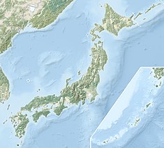
59:Location of Hiraide Dam in Japan
50:
43:
19:Dam in Gunma Prefecture, Japan
16:Dam in Gunma Prefecture, Japan
1:
234:"Hiraide Dam - Dams in Japan"
269:. You can help Knowledge by
211:is a gravity dam located in
337:
252:
38:
29:
316:Dams in Gunma Prefecture
168:87 m (285 ft)
160:40 m (130 ft)
116:Construction began
321:Kantō region dam stubs
100:36.65889°N 139.11694°E
138:Type of dam
187:Catchment area
178:Total capacity
105:36.65889; 139.11694
96: /
278:
277:
206:
205:
196:Surface area
132:Dam and spillways
124:Opening date
328:
299:
292:
285:
261:
254:
244:
243:
241:
240:
230:
213:Gunma Prefecture
111:
110:
108:
107:
106:
101:
97:
94:
93:
92:
89:
72:Gunma Prefecture
54:
53:
47:
34:
22:
336:
335:
331:
330:
329:
327:
326:
325:
306:
305:
304:
303:
250:
248:
247:
238:
236:
232:
231:
227:
222:
152:Katashina River
104:
102:
98:
95:
90:
87:
85:
83:
82:
63:
62:
61:
60:
57:
56:
55:
20:
17:
12:
11:
5:
334:
332:
324:
323:
318:
308:
307:
302:
301:
294:
287:
279:
276:
275:
262:
246:
245:
224:
223:
221:
218:
204:
203:
197:
193:
192:
189:
183:
182:
179:
175:
174:
170:
169:
166:
162:
161:
158:
154:
153:
150:
146:
145:
140:
134:
133:
129:
128:
125:
121:
120:
117:
113:
112:
80:
76:
75:
69:
65:
64:
58:
49:
48:
42:
41:
40:
39:
36:
35:
27:
26:
18:
15:
13:
10:
9:
6:
4:
3:
2:
333:
322:
319:
317:
314:
313:
311:
300:
295:
293:
288:
286:
281:
280:
274:
272:
268:
263:
260:
256:
251:
235:
229:
226:
219:
217:
214:
210:
202:
198:
194:
190:
188:
184:
180:
176:
171:
167:
163:
159:
155:
151:
147:
144:
141:
139:
135:
130:
126:
122:
118:
114:
109:
81:
77:
73:
70:
66:
46:
37:
33:
28:
23:
271:expanding it
264:
249:
237:. Retrieved
228:
208:
207:
209:Hiraide Dam
103: /
79:Coordinates
25:Hiraide Dam
310:Categories
239:2022-02-22
220:References
91:139°7′01″E
88:36°39′32″N
173:Reservoir
201:hectares
149:Impounds
68:Location
143:Gravity
74:, Japan
165:Length
157:Height
267:stub
127:1964
119:1960
199:16
312::
298:e
291:t
284:v
273:.
242:.
Text is available under the Creative Commons Attribution-ShareAlike License. Additional terms may apply.