76:
48:
83:
55:
317:
condition. The site shed considerable light on society during this period of Japan's prehistory. It appears that each residence was a compound containing the pit-dwelling residence, ground-level workshops and livestock sheds and raised-floor granaries, surrounded by a fence. Each compound thus consisted of seven to ten buildings, and it appear that several families lived in each compound. The settlement consisted of eight to ten of such compounds. Daily life combined
31:
316:
under the pumice layer. From 1985, as a result of excavation survey of about 40,000 m2, the extent of the late Kofun period settlement, consisting of pit dwellings, flat dwellings, raised-floor structures, garden traces, roads, fence rows, ritual sites, etc. was revealed to be in a very good
75:
300:, which is located ten kilometers to the southwest. The eruption covered the entire area from 50-cm to two meters in thickness. The ruins were discovered in 1982.
132:
344:
426:
416:
47:
431:
368:
421:
305:
301:
393:
411:
241:
269:
210:
325:
257:
253:
106:
281:
261:
120:
332:
285:
249:
405:
364:
288:, in the central part of Gunma. It was buried almost instantly by a large amount of
309:
297:
293:
245:
180:
318:
147:
134:
30:
248:
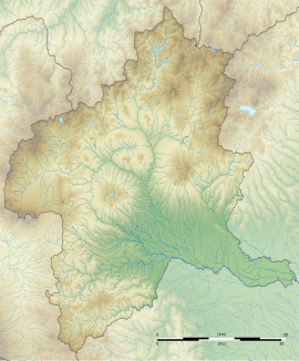
settlement (dating from around the mid 500 AD) located in what is now the
335:. The ruins were backfilled after excavation and are now an empty field.
329:
385:
289:
313:
265:
110:
199:
191:
186:
176:
171:
163:
126:
116:
102:
321:agriculture with grazing of cattle and horses.
231:
225:
8:
16:
324:The site is located 30 minutes by car from
29:
15:
356:
345:List of Historic Sites of Japan (Gunma)
82:
54:
386:Gunma tourism home page official site
7:
14:
81:
74:
53:
46:
270:National Historic Site of Japan
211:National Historic Site of Japan
1:
427:Archaeological sites in Japan
394:Shibukawa city official site
268:. The site was designated a
252:neighborhood of the city of
65:Show map of Gunma Prefecture
417:History of Gunma Prefecture
369:Agency for Cultural Affairs
232:
448:
244:containing the ruins of a
203:Yes (no public facilities)
308:found the remains of 110
284:on the north bank of the
280:The site is located on a
226:
207:
40:
28:
21:
302:Ground-penetrating radar
148:36.529528°N 139.002222°E
432:Historic Sites of Japan
90:Kuroimine Site (Japan)
153:36.529528; 139.002222
304:surveys followed by
296:from an eruption of
242:archaeological site
144: /
18:
200:Public access
326:Shibukawa Station
306:trench excavation
218:
217:
93:Show map of Japan
439:
422:Shibukawa, Gunma
398:
390:
373:
372:
361:
260:in the northern
258:Gunma Prefecture
239:
238:
235:
229:
228:
159:
158:
156:
155:
154:
149:
145:
142:
141:
140:
137:
107:Shibukawa, Gunma
94:
85:
84:
78:
66:
57:
56:
50:
33:
19:
447:
446:
442:
441:
440:
438:
437:
436:
402:
401:
396:
388:
382:
377:
376:
367:(in Japanese).
363:
362:
358:
353:
341:
278:
236:
233:Kuroimine iseki
223:
214:
213:
152:
150:
146:
143:
138:
135:
133:
131:
130:
98:
97:
96:
95:
92:
91:
88:
87:
86:
69:
68:
67:
64:
63:
60:
59:
58:
36:
24:
12:
11:
5:
445:
443:
435:
434:
429:
424:
419:
414:
404:
403:
400:
399:
391:
381:
380:External links
378:
375:
374:
355:
354:
352:
349:
348:
347:
340:
337:
286:Agatsuma River
277:
274:
221:Kuroimine Site
216:
215:
209:
208:
205:
204:
201:
197:
196:
193:
189:
188:
184:
183:
178:
174:
173:
169:
168:
165:
161:
160:
128:
124:
123:
118:
114:
113:
104:
100:
99:
89:
80:
79:
73:
72:
71:
70:
62:Kuroimine Site
61:
52:
51:
45:
44:
43:
42:
41:
38:
37:
35:Kuroimine Site
34:
26:
25:
22:
17:Kuroimine Site
13:
10:
9:
6:
4:
3:
2:
444:
433:
430:
428:
425:
423:
420:
418:
415:
413:
410:
409:
407:
397:(in Japanese)
395:
392:
389:(in Japanese)
387:
384:
383:
379:
370:
366:
360:
357:
350:
346:
343:
342:
338:
336:
334:
331:
327:
322:
320:
315:
311:
310:pit dwellings
307:
303:
299:
295:
291:
287:
283:
282:river terrace
275:
273:
271:
267:
263:
259:
255:
251:
247:
243:
234:
222:
212:
206:
202:
198:
194:
190:
185:
182:
179:
175:
170:
166:
162:
157:
139:139°00′08.0″E
129:
125:
122:
119:
115:
112:
108:
105:
101:
77:
49:
39:
32:
27:
20:
412:Kofun period
359:
323:
298:Mount Haruna
294:volcanic ash
279:
262:Kantō region
246:Kofun period
220:
219:
181:Kofun period
136:36°31′46.3″N
121:Kantō region
333:Jōetsu Line
319:paddy field
151: /
127:Coordinates
406:Categories
351:References
192:Discovered
187:Site notes
167:settlement
272:in 1993.
254:Shibukawa
339:See also
276:Overview
103:Location
365:"黒井峯遺跡"
330:JR East
328:on the
250:Komochi
177:Periods
172:History
314:tumuli
290:pumice
240:is an
117:Region
266:Japan
227:黒井峯遺跡
111:Japan
23:黒井峯遺跡
312:and
292:and
195:1982
164:Type
264:of
408::
256:,
230:,
109:,
371:.
237:)
224:(
Text is available under the Creative Commons Attribution-ShareAlike License. Additional terms may apply.