475:
133:
436:
170:
140:
110:
467:
163:
103:
396:
40:
342:
371:), which literally means "cross stone". The name may be used in various senses. It may describe the whole mountain range, including the many mountain groups, or it may just describe the Kaçkar-Kavron group with its highest peak, or just the highest peak itself. The local name of the highest peak or its mountain group
457:
Kaçkar
Mountains are one of the best trekking sites in Turkey. Kaçkars have two ideal trekking routes. The first is from the Black Sea side; the path is clear and it is easy to trek, while the Çoruh side is more difficult and hazardous. Kaçkar Mountains are cold and have glaciers, hence ice axes and
771:
132:
950:
737:
301:, at an elevation of 3,937 metres (12,917 ft), and mountain plateaus at about 3,000 m (9,800 ft) in elevation, the range is the highest part of the
973:
1125:
474:
686:. P.212. "River between the port of Atina (now Pazar) on the coast and the great inland peak called Kajkar (Arm. Khach'k'ar) Dagh 'Cross-stone Mountain'"
1021:
872:
210:
766:
1074:
935:
887:
162:
1016:
859:
730:
683:
892:
333:. The Kackar range boasts a wide variety of plants and wildlife such as wolves, bears, boars, feral goats, deer, jackals and wild chickens.
102:
1120:
1011:
1105:
1026:
1110:
723:
675:
655:
829:
804:
746:
930:
839:
1084:
907:
844:
834:
1031:
882:
435:
877:
1061:
1003:
758:
530:
514:
203:
945:
809:
940:
814:
983:
978:
849:
1046:
902:
1115:
1036:
824:
819:
897:
968:
917:
466:
1041:
781:
867:
1051:
493:
625:
447:
298:
45:
695:
670:
Robert H. Hewsen. Armenia: A Historical Atlas. — University of
Chicago Press, 2001. — 341 p. —
395:
679:
671:
651:
600:
356:
279:
256:
17:
796:
439:
302:
248:
345:
39:
313:
in character, with steep rocky peaks and numerous mountain lakes. The area was declared a
960:
326:
287:
1099:
786:
588:
314:
1079:
925:
458:
crampons are required. The best time for trekking is between June and
September.
1069:
776:
330:
604:
225:
212:
408:
291:
993:
715:
404:
361:
269:
322:
306:
550:(in Armenian). Yerevan: Armenian Encyclopedia Publishing. p. 373.
750:
318:
196:
67:
473:
465:
434:
394:
341:
340:
988:
488:
451:
403:
On the south and east, the Kaçkar
Mountains are bordered by the
310:
719:
561:
516:
The
English Cyclopedia A New Dictionary of Universal Knowledge
470:
Kaçkar mountains from the view of Gito plateau, a foggy day
710:
317:
in 1994. Recreational activities in the park include
599:(3). Winter Park, Florida: Bonnier Corporation: 28.
1060:
1002:
959:
916:
858:
795:
757:
202:
192:
89:
81:
76:
66:
58:
53:
32:
366:
731:
8:
535:. Ordered to be printed. 1869. p. 363.
532:Accounts and Papers of the House of Commons
738:
724:
716:
29:
169:
139:
109:
711:Hiking and Climbing Routes, GPS sources
548:Soviet Armenian Encyclopedia, Volume 12
505:
519:. Bradbury et Evans. p. 507, 508.
7:
1126:Tourist attractions in Rize Province
772:Dilek Peninsula-Büyük Menderes Delta
568:. Ankara. 31 October 2007. p. 1
407:river valley; on the north, by the
566:Turkish Daily News. (National ed.)
25:
587:Hadik, Jancsi (1 November 2005).
646:Marc Dubin; Enver Lucas (1989).
626:"KACKAR MOUNTAINS NATIONAL PARK"
168:
161:
138:
131:
108:
101:
38:
951:Sarıkamış-Allahuekber Mountains
650:. Lonely Planet. p. 125.
294:coast in northeastern Turkey.
182:Show map of Caucasus Mountains
18:Kaçkar Mountains National Park
1:
72:3,937 m (12,917 ft)
1062:Southeastern Anatolia Region
1004:Mediterranean Region, Turkey
562:"Mt. Kackar to be monitored"
546:Ayvazyan, Hovhannes (1979).
379:, and the name of the range
85:1,000 km (620 mi)
1142:
1121:Landforms of Rize Province
1075:Hakkari Cilo-Sat Mountains
974:İğneada Floodplain Forests
1106:Mountain ranges of Turkey
423:Kavron (or Kaçkar-Kavron)
367:
283:
267:), formerly known as the
260:
94:
37:
1111:National parks of Turkey
513:Knight, Charles (1854).
446:) near Kaçkar Mountains
27:Mountain range in Turkey
918:Eastern Anatolia Region
860:Central Anatolia Region
696:Kackar Mountains Turkey
297:With the highest peak,
1022:Mount Güllük-Termessos
873:Derebucak Çamlık Caves
479:
471:
454:
400:
348:
252:
868:Anti-Taurus Mountains
477:
469:
438:
415:Major mountain groups
398:
344:
329:, and, increasingly,
290:that rises above the
276:Mountains of Khaghtik
152:Show map of Black Sea
478:Elevit Plateau, Rize
931:Battle of Manzikert
840:Mount Kop Defensive
810:Boğazköy-Alacahöyük
309:mountains that are
222: /
48:from Mezovit Çayiri
767:Commander-in-Chief
648:Trekking in Turkey
480:
472:
455:
401:
349:
305:. The Kaçkars are
122:Show map of Turkey
54:Highest point
1093:
1092:
1085:Tek Tek Mountains
1052:Yumurtalık Lagoon
1027:Karatepe-Aslantaş
936:Mount Kop Defense
908:Yozgat Pine Grove
888:Battle of Sakarya
883:Independence Path
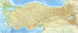
684:978-0-226-33228-4
355:derives from the
241:
240:
226:40.833°N 41.150°E
204:Range coordinates
44:The highest peak
16:(Redirected from
1133:
1116:Black Sea Region
1017:Beydağları Coast
830:Kaçkar Mountains
805:Altındere Valley
797:Black Sea Region
740:
733:
726:
717:
698:
693:
687:
668:
662:
661:
643:
637:
636:
634:
633:
622:
616:
615:
613:
611:
584:
578:
577:
575:
573:
558:
552:
551:
543:
537:
536:
527:
521:
520:
510:
444:Amanita muscaria
420:Altıparmak group
385:Kaçkar Mountains
370:
369:
303:Pontic Mountains
285:
262:
245:Kaçkar Mountains
237:
236:
234:
233:
232:
227:
223:
220:
219:
218:
215:
183:
176:Kaçkar Mountains
172:
171:
165:
153:
146:Kaçkar Mountains
142:
141:
135:
123:
116:Kaçkar Mountains
112:
111:
105:
42:
33:Kaçkar Mountains
30:
21:
1141:
1140:
1136:
1135:
1134:
1132:
1131:
1130:
1096:
1095:
1094:
1089:
1056:
1012:Altınbeşik Cave
998:
955:
912:
854:
791:
753:
744:
707:
702:
701:
694:
690:
669:
665:
658:
645:
644:
640:
631:
629:
624:
623:
619:
609:
607:
586:
585:
581:
571:
569:
560:
559:
555:
545:
544:
540:
529:
528:
524:
512:
511:
507:
502:
485:
464:
433:
417:
393:
377:Kaçkar Mountain
339:
230:
228:
224:
221:
216:
213:
211:
209:
208:
188:
187:
186:
185:
184:
181:
180:
179:
178:
177:
173:
156:
155:
154:
151:
150:
149:
148:
147:
143:
126:
125:
124:
121:
120:
119:
118:
117:
113:
49:
28:
23:
22:
15:
12:
11:
5:
1139:
1137:
1129:
1128:
1123:
1118:
1113:
1108:
1098:
1097:
1091:
1090:
1088:
1087:
1082:
1077:
1072:
1066:
1064:
1058:
1057:
1055:
1054:
1049:
1044:
1042:Köprülü Canyon
1039:
1034:
1029:
1024:
1019:
1014:
1008:
1006:
1000:
999:
997:
996:
991:
986:
981:
976:
971:
965:
963:
961:Marmara Region
957:
956:
954:
953:
948:
943:
938:
933:
928:
922:
920:
914:
913:
911:
910:
905:
900:
895:
893:Mount Sarıçalı
890:
885:
880:
875:
870:
864:
862:
856:
855:
853:
852:
847:
845:Küre Mountains
842:
837:
835:Karagöl-Sahara
832:
827:
822:
817:
812:
807:
801:
799:
793:
792:
790:
789:
784:
779:
774:
769:
763:
761:
755:
754:
747:National parks
745:
743:
742:
735:
728:
720:
714:
713:
706:
705:External links
703:
700:
699:
688:
663:
656:
638:
617:
589:"First Tracks"
579:
553:
538:
522:
504:
503:
501:
498:
497:
496:
494:Çağlayan River
491:
484:
481:
463:
460:
432:
429:
428:
427:
426:Verçenik group
424:
421:
416:
413:
392:
389:
383:translates to
381:Kaçkar Dağları
375:translates to
338:
335:
327:mountaineering
288:mountain range
284:Խաղտեաց լեռներ
253:Kaçkar Dağları
239:
238:
231:40.833; 41.150
206:
200:
199:
194:
190:
189:
175:
174:
167:
166:
160:
159:
158:
157:
145:
144:
137:
136:
130:
129:
128:
127:
115:
114:
107:
106:
100:
99:
98:
97:
96:
95:
92:
91:
87:
86:
83:
79:
78:
74:
73:
70:
64:
63:
60:
56:
55:
51:
50:
43:
35:
34:
26:
24:
14:
13:
10:
9:
6:
4:
3:
2:
1138:
1127:
1124:
1122:
1119:
1117:
1114:
1112:
1109:
1107:
1104:
1103:
1101:
1086:
1083:
1081:
1078:
1076:
1073:
1071:
1068:
1067:
1065:
1063:
1059:
1053:
1050:
1048:
1045:
1043:
1040:
1038:
1035:
1033:
1030:
1028:
1025:
1023:
1020:
1018:
1015:
1013:
1010:
1009:
1007:
1005:
1001:
995:
992:
990:
987:
985:
982:
980:
977:
975:
972:
970:
967:
966:
964:
962:
958:
952:
949:
947:
944:
942:
941:Munzur Valley
939:
937:
934:
932:
929:
927:
924:
923:
921:
919:
915:
909:
906:
904:
901:
899:
896:
894:
891:
889:
886:
884:
881:
879:
878:Lake Beyşehir
876:
874:
871:
869:
866:
865:
863:
861:
857:
851:
848:
846:
843:
841:
838:
836:
833:
831:
828:
826:
823:
821:
818:
816:
815:Hatila Valley
813:
811:
808:
806:
803:
802:
800:
798:
794:
788:
787:Mount Sipylus
785:
783:
780:
778:
775:
773:
770:
768:
765:
764:
762:
760:
759:Aegean Region
756:
752:
748:
741:
736:
734:
729:
727:
722:
721:
718:
712:
709:
708:
704:
697:
692:
689:
685:
681:
677:
676:0-226-33228-4
673:
667:
664:
659:
657:0-86442-037-4
653:
649:
642:
639:
627:
621:
618:
606:
602:
598:
594:
590:
583:
580:
567:
563:
557:
554:
549:
542:
539:
534:
533:
526:
523:
518:
517:
509:
506:
499:
495:
492:
490:
487:
486:
482:
476:
468:
461:
459:
453:
449:
445:
441:
437:
430:
425:
422:
419:
418:
414:
412:
410:
406:
397:
390:
388:
386:
382:
378:
374:
364:
363:
358:
354:
347:
343:
336:
334:
332:
328:
324:
320:
316:
315:national park
312:
308:
304:
300:
295:
293:
289:
281:
277:
273:
271:
266:
258:
254:
250:
246:
235:
207:
205:
201:
198:
195:
191:
164:
134:
104:
93:
88:
84:
80:
75:
71:
69:
65:
61:
57:
52:
47:
41:
36:
31:
19:
1080:Mount Nemrut
1070:Botan Valley
926:Mount Ararat
903:Sultan Reedy
691:
666:
647:
641:
630:. Retrieved
628:. 2021-11-01
620:
608:. Retrieved
596:
592:
582:
570:. Retrieved
565:
556:
547:
541:
531:
525:
515:
508:
456:
443:
402:
384:
380:
376:
372:
360:
352:
350:
296:
275:
268:
264:
244:
242:
1037:Lake Kovada
825:Mount Ilgaz
777:Mount Honaz
448:Çamlıhemşin
373:Kaçkar Dağı
299:Kaçkar Dağı
229: /
62:Kaçkar Dağı
46:Kaçkar Dağı
1100:Categories
984:Kuşcenneti
946:Nene Hatun
850:Yedigöller
820:Lake Abant
632:2023-11-08
610:11 October
572:11 October
500:References
440:Fly Agaric
346:Deniz Gölü
331:heliskiing
77:Dimensions
1047:Saklıkent
969:Lake Gala
605:0037-6264
409:Black Sea
391:Geography
351:The name
337:Etymology
307:glaciated
292:Black Sea
286:), are a
272:Mountains
90:Geography
68:Elevation
1032:Kızıldağ
782:Marmaris
483:See also
431:Trekking
362:khachkar
357:Armenian
280:Armenian
270:Lazistan
257:Armenian
979:Kazdağı
898:Soğuksu
462:Gallery
411:coast.
323:camping
274:or the
249:Turkish
214:40°50′N
193:Country
994:Uludağ
751:Turkey
682:
674:
654:
603:
593:Skiing
399:Winter
368:Խաչքար
353:Kaçkar
319:hiking
311:alpine
265:Kajkar
261:Քաջքար
217:41°9′E
197:Turkey
82:Length
405:Çoruh
359:term
989:Troy
680:ISBN
672:ISBN
652:ISBN
612:2009
601:ISSN
574:2009
489:Rize
452:Rize
243:The
59:Peak
749:of
1102::
678:,
597:58
595:.
591:.
564:.
387:.
325:,
321:,
282::
263:,
259::
255:;
251::
739:e
732:t
725:v
660:.
635:.
614:.
576:.
450:/
442:(
365:(
278:(
247:(
20:)
Text is available under the Creative Commons Attribution-ShareAlike License. Additional terms may apply.