36:
56:
49:
258:
415:
184:
429:
246:
Some clearance and investigation of King Arthur's Hall was conducted by members of The
Heritage Trust in 2013/14. Their work revealed a revetment wall built to retain the inner bank. It was concluded that over time the earth had covered over the top of the revetment wall and that around 140 upright
191:
The monument consists of fifty-six stones arranged in a rectangle with a bank of earth around them and measures approximately 20m by 47m. The interior fills with water and a contemporary ground level has not been established. It has suffered damage by cattle in the past and is now protected by a
243:
date. It has even been suggested that it was merely a medieval cattle pound, but the effort required to build the bank and to erect the slabs suggests that it had a more important function.
247:
stones now lie buried, recumbent, or standing at an angle. It was suggested that the structure originally formed a tank which filled with water, possibly for ritualistic use.
448:
463:
254:’s Monumental Improvement project worked with the Cornwall Archaeological Unit to conduct an excavation, to determine when the structure was built.
48:
473:
458:
88:
279:
359:
304:
433:
22:
468:
35:
223:
In the absence of any archaeological finds, its origin and use is only speculative. A similar enclosure exists in
240:
453:
316:
228:
355:
283:
420:
442:
384:
251:
257:
200:
183:
156:
75:
410:
204:
193:
172:
140:
103:
90:
232:
168:
136:
428:
224:
160:
152:
236:
164:
256:
208:
182:
212:
231:
cremation site, but a similar rampart construction at
16:
Megalithic enclosure on Bodmin Moor, Cornwall, England
192:
gated fence. It can be reached by footpaths east of
132:
127:
119:
82:
71:
280:"Secret Cornwall - Bodmin Moor and its Environs"
389:The Cornwall Area of Outstanding Natural Beauty
55:
8:
28:
350:
348:
346:
344:
342:
340:
338:
449:Locations associated with Arthurian legend
34:
27:
305:Access to Monuments - King Arthur's Hall
271:
364:Research records (formerly PastScape)
7:
464:Buildings and structures in Cornwall
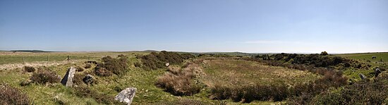
261:Panoramic view of King Arthur's Hall
199:The surrounding area contains many
21:For the building in Tintagel, see
14:
187:King Arthur's Hall on Bodmin Moor
427:
413:
54:
47:
385:"King Arthur's Hall Excavation"
1:
474:Prehistoric sites in Cornwall
360:"King Arthurs Hall (433143)"
167:. It is thought to be a late
459:Bronze Age sites in Cornwall
23:King Arthur's Hall, Tintagel
490:
20:
42:
33:
262:
188:
436:at Wikimedia Commons
260:
186:
63:Shown within Cornwall
317:"King Arthur's Hall"
239:suggests an earlier
123:Megalithic enclosure
104:50.56833°N 4.64250°W
469:History of Cornwall
250:In September 2022
100: /
30:
434:King Arthur's Hall
323:. 29 November 2011
263:
189:
149:King Arthur's Hall
109:50.56833; -4.64250
29:King Arthur's Hall
432:Media related to
175:ceremonial site.
146:
145:
481:
431:
423:
418:
417:
416:
400:
399:
397:
395:
381:
375:
374:
372:
370:
356:Historic England
352:
333:
332:
330:
328:
313:
307:
302:
296:
295:
293:
291:
286:on 25 April 2015
282:. Archived from
276:
115:
114:
112:
111:
110:
105:
101:
98:
97:
96:
93:
58:
57:
51:
38:
31:
489:
488:
484:
483:
482:
480:
479:
478:
439:
438:
421:Cornwall portal
419:
414:
412:
409:
404:
403:
393:
391:
383:
382:
378:
368:
366:
354:
353:
336:
326:
324:
315:
314:
310:
303:
299:
289:
287:
278:
277:
273:
268:
221:
181:
108:
106:
102:
99:
94:
91:
89:
87:
86:
67:
66:
65:
64:
61:
60:
59:
26:
17:
12:
11:
5:
487:
485:
477:
476:
471:
466:
461:
456:
451:
441:
440:
425:
424:
408:
407:External links
405:
402:
401:
376:
334:
321:Cornwall Guide
308:
297:
270:
269:
267:
264:
220:
219:Origin and use
217:
180:
177:
144:
143:
134:
130:
129:
125:
124:
121:
117:
116:
84:
80:
79:
73:
69:
68:
62:
53:
52:
46:
45:
44:
43:
40:
39:
15:
13:
10:
9:
6:
4:
3:
2:
486:
475:
472:
470:
467:
465:
462:
460:
457:
455:
452:
450:
447:
446:
444:
437:
435:
430:
422:
411:
406:
390:
386:
380:
377:
365:
361:
357:
351:
349:
347:
345:
343:
341:
339:
335:
322:
318:
312:
309:
306:
301:
298:
285:
281:
275:
272:
265:
259:
255:
253:
252:Cornwall AONB
248:
244:
242:
238:
234:
230:
226:
218:
216:
214:
210:
206:
202:
201:stone circles
197:
195:
185:
178:
176:
174:
170:
166:
162:
158:
155:enclosure on
154:
150:
142:
138:
135:
131:
126:
122:
118:
113:
85:
81:
77:
74:
70:
50:
41:
37:
32:
24:
19:
426:
394:19 September
392:. Retrieved
388:
379:
367:. Retrieved
363:
327:19 September
325:. Retrieved
320:
311:
300:
288:. Retrieved
284:the original
274:
249:
245:
227:which was a
222:
198:
190:
148:
147:
18:
454:Bodmin Moor
205:hut circles
179:Description
157:Bodmin Moor
107: /
83:Coordinates
76:Bodmin Moor
443:Categories
369:28 October
266:References
229:Bronze Age
194:St Breward
173:Bronze Age
153:megalithic
141:Bronze Age
92:50°34′06″N
78:, Cornwall
241:Neolithic
233:Lough Gur
171:or early
169:Neolithic
137:Neolithic
95:4°38′33″W
225:Brittany
161:Cornwall
72:Location
290:20 July
237:Ireland
165:England
133:Periods
128:History
209:cairns
213:cists
151:is a
396:2022
371:2014
329:2022
292:2008
211:and
120:Type
235:in
159:in
445::
387:.
362:.
358:.
337:^
319:.
215:.
207:,
203:,
196:.
163:,
139:/
398:.
373:.
331:.
294:.
25:.
Text is available under the Creative Commons Attribution-ShareAlike License. Additional terms may apply.