52:
36:
378:
304:. After operations at the mill were shut down, the dam and lake were neglected for several years. In 1932, John W. Kiser and his family owned the land and donated several hundred acres to the State of Ohio to rebuild the lake for recreational purposes. In 1939, work on the dam started, and in 1940, all work was completed on the dam and Kiser Lake was filled.
59:
452:
423:
281:
102:
416:
362:
344:
308:
409:
51:
442:
249:
447:
327:
297:
385:
231:
80:
285:
243:
17:
300:
in the low, swampy region of
Champaign County known as Mosquito Creek Valley to build a grist and
210:
393:
284:
sits at the headwaters on the southeastern edge of the lake, and the 531 acres (215 ha)
35:
235:
146:
436:
134:
88:
239:
234:, United States, It is located approximately 4.2 miles (6.8 km) northwest of
339:
357:
328:
U.S. Geological Survey
Geographic Names Information System: Kiser Lake (Ohio)
264:
251:
117:
104:
227:
139:
377:
301:
296:
Mosquito Lake was first created in 1840, when a dam was built across
389:
84:
397:
200:
192:
184:
176:
168:
160:
156:
145:
133:
94:
76:
28:
95:
453:Dayton-Springfield-Greenville geography stubs
417:
288:surrounds the rest of the lake to the north.
8:
424:
410:
25:
282:Kiser Lake Wetlands State Nature Preserve
320:
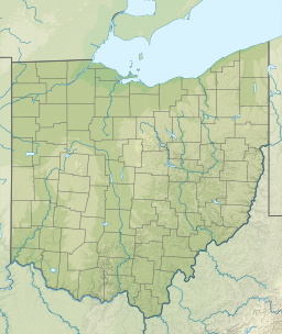
7:
374:
372:
363:Ohio Department of Natural Resources
345:Ohio Department of Natural Resources
309:Ohio Department of Natural Resources
238:and 34 miles (55 km) north of
396:. You can help Knowledge (XXG) by
58:
14:
376:
57:
50:
40:Kiser Lake viewed from the south
34:
199:
191:
183:
175:
167:
159:
307:The lake is maintained by the
1:
75:
392:state location article is a
469:
371:
222:(previously also known as
211:not a well-defined measure
15:
280:The 51-acre (21 ha)
208:
45:
33:
172:0.3 miles (0.48 km)
16:Not to be confused with
204:1,063 feet (324 m)
196:5.3 miles (8.5 km)
180:394 acres (159 ha)
164:2.5 miles (4.0 km)
443:Champaign County, Ohio
232:Champaign County, Ohio
23:Reservoir in Ohio, USA
358:Kiser Lake State Park
286:Kiser Lake State Park
265:40.18806°N 83.96556°W
118:40.18806°N 83.96556°W
244:Ohio State Route 235
188:18 feet (5.5 m)
270:40.18806; -83.96556
261: /
123:40.18806; -83.96556
114: /
18:Mosquito Creek Lake
448:Reservoirs in Ohio
405:
404:
217:
216:
201:Surface elevation
460:
426:
419:
412:
386:Champaign County
380:
373:
366:
354:
348:
336:
330:
325:
276:
275:
273:
272:
271:
266:
262:
259:
258:
257:
254:
209:Shore length is
129:
128:
126:
125:
124:
119:
115:
112:
111:
110:
107:
97:
81:Champaign County
61:
60:
54:
38:
26:
468:
467:
463:
462:
461:
459:
458:
457:
433:
432:
431:
430:
370:
369:
355:
351:
337:
333:
326:
322:
317:
294:
269:
267:
263:
260:
255:
252:
250:
248:
247:
149: countries
122:
120:
116:
113:
108:
105:
103:
101:
100:
72:
71:
70:
69:
68:
67:
66:
62:
41:
24:
21:
12:
11:
5:
466:
464:
456:
455:
450:
445:
435:
434:
429:
428:
421:
414:
406:
403:
402:
381:
368:
367:
349:
331:
319:
318:
316:
313:
298:Mosquito Creek
293:
290:
215:
214:
206:
205:
202:
198:
197:
194:
190:
189:
186:
182:
181:
178:
174:
173:
170:
166:
165:
162:
158:
157:
154:
153:
150:
143:
142:
137:
131:
130:
98:
92:
91:
78:
74:
73:
64:
63:
56:
55:
49:
48:
47:
46:
43:
42:
39:
31:
30:
22:
13:
10:
9:
6:
4:
3:
2:
465:
454:
451:
449:
446:
444:
441:
440:
438:
427:
422:
420:
415:
413:
408:
407:
401:
399:
395:
391:
387:
382:
379:
375:
364:
360:
359:
353:
350:
346:
342:
341:
335:
332:
329:
324:
321:
314:
312:
310:
305:
303:
299:
291:
289:
287:
283:
278:
274:
245:
241:
237:
233:
229:
225:
224:Mosquito Lake
221:
212:
207:
203:
195:
187:
185:Average depth
179:
171:
163:
155:
152:United States
151:
148:
144:
141:
138:
136:
132:
127:
99:
93:
90:
86:
82:
79:
53:
44:
37:
32:
27:
19:
398:expanding it
383:
356:
352:
338:
334:
323:
306:
295:
279:
223:
219:
218:
193:Shore length
177:Surface area
268: /
161:Max. length
121: /
96:Coordinates
437:Categories
340:Kiser Lake
315:References
256:83°57′56″W
253:40°11′17″N
220:Kiser Lake
169:Max. width
109:83°57′56″W
106:40°11′17″N
65:Kiser Lake
29:Kiser Lake
236:St. Paris
228:reservoir
140:Reservoir
302:saw mill
77:Location
292:History
226:) is a
365:, 2012
347:, 2012
242:along
240:Dayton
384:This
246:, at
147:Basin
394:stub
390:Ohio
135:Type
85:Ohio
230:in
89:USA
439::
388:,
361:,
343:,
311:.
277:.
87:,
83:,
425:e
418:t
411:v
400:.
213:.
20:.
Text is available under the Creative Commons Attribution-ShareAlike License. Additional terms may apply.