26:
105:
112:
775:
371:
261:
190:. With an elevation of 640 feet (200 m), Lumpkin Hill is the 914th highest summit in the state of Georgia. The hill is considered to be one of the Seven Hills of Rome, Georgia.
816:
364:
685:
835:
840:
357:
380:
845:
732:
456:
104:
809:
737:
61:
315:
327:
802:
257:
153:
411:
586:
54:
531:
649:
634:
471:
466:
25:
710:
576:
406:
245:
680:
566:
556:
511:
644:
629:
599:
401:
198:
30:
782:
197:, who is also buried on the hill. In 1956, Lumpkin Hill's peak was leveled during the construction of
571:
486:
388:
141:
742:
690:
654:
516:
496:
451:
446:
194:
774:
727:
705:
695:
604:
551:
521:
436:
396:
311:
786:
700:
624:
609:
501:
431:
747:
722:
715:
675:
670:
148:
757:
752:
639:
619:
594:
561:
481:
461:
441:
421:
416:
829:
536:
526:
187:
137:
476:
166:
541:
506:
491:
426:
76:
63:
546:
275:
221:
294:
246:
U.S. Geological Survey
Geographic Names Information System: Lumpkin Hill
349:
183:
44:
353:
266:(Topographic map). Reston, VA: United States Geological Survey
297:. RomeGeorgia.com. 23 February 2002. Retrieved 17 March 2018.
289:
287:
285:
790:
663:
585:
387:
165:
160:
147:
133:
92:
53:
43:
38:
18:
810:
365:
8:
817:
803:
372:
358:
350:
15:
216:
214:
210:
241:
239:
7:
771:
769:
111:
33:goes over the summit of Lumpkin Hill
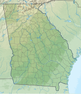
124:Location of Lumpkin Hill in Georgia
836:Mountains of Floyd County, Georgia
789:. You can help Knowledge (XXG) by
14:
841:Mountains of Georgia (U.S. state)
773:
110:
103:
24:
334:. September 1, 2004. p. 76
308:The Enchanted Land Eighth Hill.
258:United States Geological Survey
1:
846:North Georgia geography stubs
733:Pine Mountain (Bartow County)
785:state location article is a
738:Pine Mountain (Cobb County)
862:
768:
263:North Rome, GA quadrangle
193:The summit was named for
97:
77:34.2589824°N 85.1663393°W
23:
711:Little Kennesaw Mountain
49:640 ft (200 m)
295:The Seven Hills of Rome
199:Turner McCall Boulevard
82:34.2589824; -85.1663393
402:Big John Dick Mountain
31:Georgia State Route 20
783:Floyd County, Georgia
487:Horsetrough Mountain
389:Blue Ridge Mountains
381:Mountains of Georgia
743:Pine Mountain Range
691:Chenocetah Mountain
412:Black Rock Mountain
73: /
686:Blackjack Mountain
655:White Oak Mountain
517:Slaughter Mountain
497:Levelland Mountain
447:Double Spring Knob
260:(March 19, 2018).
195:John Henry Lumpkin
39:Highest point
798:
797:
766:
765:
728:Pine Log Mountain
706:Kennesaw Mountain
605:Horseleg Mountain
552:Screamer Mountain
522:Springer Mountain
437:Currahee Mountain
397:Big Bald Mountain
306:Denmon, Shirley.
177:
176:
853:
819:
812:
805:
777:
770:
625:Old Shorter Hill
610:Lookout Mountain
587:Ridge-and-Valley
532:Wildcat Mountain
502:Mount Oglethorpe
432:Cowrock Mountain
374:
367:
360:
351:
344:
343:
341:
339:
324:
318:
304:
298:
291:
280:
279:
273:
271:
254:
248:
243:
234:
233:
231:
229:
218:
169:
114:
113:
107:
88:
87:
85:
84:
83:
78:
74:
71:
70:
69:
66:
28:
16:
861:
860:
856:
855:
854:
852:
851:
850:
826:
825:
824:
823:
767:
762:
748:Sawnee Mountain
723:Panola Mountain
716:Mount Wilkinson
676:Arabia Mountain
671:Alcovy Mountain
659:
650:Turkey Mountain
635:Pigeon Mountain
581:
472:Grassy Mountain
467:Glassy Mountain
383:
378:
348:
347:
337:
335:
326:
325:
321:
310:(2012). pp. 5.
305:
301:
292:
283:
269:
267:
256:
255:
251:
244:
237:
227:
225:
220:
219:
212:
207:
167:
129:
128:
127:
126:
125:
122:
121:
120:
119:
115:
81:
79:
75:
72:
67:
64:
62:
60:
59:
34:
12:
11:
5:
859:
857:
849:
848:
843:
838:
828:
827:
822:
821:
814:
807:
799:
796:
795:
778:
764:
763:
761:
760:
758:Sweat Mountain
755:
753:Stone Mountain
750:
745:
740:
735:
730:
725:
719:
718:
713:
708:
703:
698:
696:Dowdell's Knob
693:
688:
683:
678:
673:
667:
665:
661:
660:
658:
657:
652:
647:
642:
640:Snodgrass Hill
637:
632:
627:
622:
620:Johns Mountain
617:
612:
607:
602:
597:
595:Baugh Mountain
591:
589:
583:
582:
580:
579:
577:Rocky Mountain
574:
569:
564:
562:Yonah Mountain
559:
554:
549:
544:
539:
534:
529:
524:
519:
514:
509:
504:
499:
494:
489:
484:
482:Hightower Bald
479:
474:
469:
464:
462:Glade Mountain
459:
454:
449:
444:
439:
434:
429:
424:
422:Brasstown Bald
419:
417:Blood Mountain
414:
409:
407:Black Mountain
404:
399:
393:
391:
385:
384:
379:
377:
376:
369:
362:
354:
346:
345:
328:"Floyd County"
319:
299:
281:
249:
235:
222:"Lumpkin Hill"
209:
208:
206:
203:
175:
174:
171:
163:
162:
158:
157:
156:Rome North, GA
151:
145:
144:
135:
131:
130:
123:
117:
116:
109:
108:
102:
101:
100:
99:
98:
95:
94:
90:
89:
57:
51:
50:
47:
41:
40:
36:
35:
29:
21:
20:
13:
10:
9:
6:
4:
3:
2:
858:
847:
844:
842:
839:
837:
834:
833:
831:
820:
815:
813:
808:
806:
801:
800:
794:
792:
788:
784:
779:
776:
772:
759:
756:
754:
751:
749:
746:
744:
741:
739:
736:
734:
731:
729:
726:
724:
721:
720:
717:
714:
712:
709:
707:
704:
702:
701:Heggie's Rock
699:
697:
694:
692:
689:
687:
684:
682:
681:Bear Mountain
679:
677:
674:
672:
669:
668:
666:
662:
656:
653:
651:
648:
646:
643:
641:
638:
636:
633:
631:
628:
626:
623:
621:
618:
616:
613:
611:
608:
606:
603:
601:
598:
596:
593:
592:
590:
588:
584:
578:
575:
573:
570:
568:
567:Rock Mountain
565:
563:
560:
558:
557:Three Sisters
555:
553:
550:
548:
545:
543:
540:
538:
537:Wolfpen Ridge
535:
533:
530:
528:
527:Tray Mountain
525:
523:
520:
518:
515:
513:
512:Rich Mountain
510:
508:
505:
503:
500:
498:
495:
493:
490:
488:
485:
483:
480:
478:
475:
473:
470:
468:
465:
463:
460:
458:
457:Fort Mountain
455:
453:
450:
448:
445:
443:
440:
438:
435:
433:
430:
428:
425:
423:
420:
418:
415:
413:
410:
408:
405:
403:
400:
398:
395:
394:
392:
390:
386:
382:
375:
370:
368:
363:
361:
356:
355:
352:
333:
332:Calhoun Times
329:
323:
320:
317:
316:9781452089553
313:
309:
303:
300:
296:
290:
288:
286:
282:
277:
265:
264:
259:
253:
250:
247:
242:
240:
236:
224:. Peakery.com
223:
217:
215:
211:
204:
202:
200:
196:
191:
189:
188:Rome, Georgia
185:
181:
172:
170:
168:Easiest route
164:
159:
155:
152:
150:
146:
143:
142:Georgia, U.S.
139:
136:
132:
106:
96:
91:
86:
58:
56:
52:
48:
46:
42:
37:
32:
27:
22:
17:
791:expanding it
780:
645:Taylor Ridge
630:Jackson Hill
615:Lumpkin Hill
614:
600:Blossom Hill
477:Grassy Ridge
336:. Retrieved
331:
322:
307:
302:
293:Wilson, CC.
274:– via
268:. Retrieved
262:
252:
226:. Retrieved
192:
180:Lumpkin Hill
179:
178:
118:Lumpkin Hill
19:Lumpkin Hill
442:Dick's Knob
80: /
55:Coordinates
830:Categories
572:Rocky Knob
542:Young Lick
507:Rabun Bald
492:Jacks Knob
427:Coosa Bald
205:References
68:85°09′59″W
65:34°15′32″N
547:Rich Knob
276:TopoQuest
270:March 19,
93:Geography
45:Elevation
452:Flat Top
338:24 April
228:25 April
161:Climbing
149:Topo map
134:Location
664:Others
314:
184:summit
781:This
182:is a
173:Drive
787:stub
340:2015
312:ISBN
272:2018
230:2015
154:USGS
138:Rome
186:in
832::
330:.
284:^
238:^
213:^
201:.
140:,
818:e
811:t
804:v
793:.
373:e
366:t
359:v
342:.
278:.
232:.
Text is available under the Creative Commons Attribution-ShareAlike License. Additional terms may apply.