47:
31:
54:
223:(loch of the meddlesome or gossiping ghillie) is a large irregular shaped freshwater hill loch, situated on a north-south orientation, that lies about a half-mile north of the west-end of
46:
79:
94:
320:
298:
200:
330:
325:
294:
211:
30:
263:
235:
district of
Scotland. The loch is also occasionally known as Loch a' Ghille Ghobhaich.
314:
126:
224:
109:
96:
270:. Scotland and Northern Ireland Forum for Environmental Research (SNIFFER)
232:
228:
35:
Loch a' Ghille
Ghobaich viewed from an ascent of Sgùrr na Dubh-creige.
291:
Rivers and Lochs of
Scotland: The Angler's Complete Guide
175:
46,362,330.49 cu ft (1,312,835.000 m)
199:
195:
187:
179:
171:
163:
155:
147:
139:
135:
125:
86:
74:
53:
23:
87:
293:. Black & White Publishing. p. 508.
8:
258:
256:
254:
252:
250:
248:
20:
244:
7:
289:Sandison, Bruce (15 February 2011).
14:
268:Centre for Ecology and Hydrology
52:
45:
29:
186:
178:
170:
162:
154:
146:
138:
1:
227:and is south-by-southeast of
73:
321:Freshwater lochs of Scotland
151:0.30 km (0.19 mi)
143:4.29 km (2.67 mi)
347:
212:not a well-defined measure
209:
167:17.4 ft (5.3 m)
40:
28:
264:"Loch a Ghille Ghobaich"
183:4 km (2.5 mi)
221:Loch a' Ghille Ghobaich
191:66 m (217 ft)
60:Loch a' Ghille Ghobaich
24:Loch a' Ghille Ghobaich
159:25 ha (62 acres)
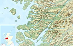
66:Location in Lochaber
106: /
110:56.9823°N 5.8109°W
331:Lochs of Lochaber
300:978-1-84502-520-5
218:
217:
188:Surface elevation
338:
305:
304:
286:
280:
279:
277:
275:
260:
210:Shore length is
121:
120:
118:
117:
116:
115:56.9823; -5.8109
111:
107:
104:
103:
102:
99:
89:
82:
56:
55:
49:
33:
21:
346:
345:
341:
340:
339:
337:
336:
335:
311:
310:
309:
308:
301:
288:
287:
283:
273:
271:
262:
261:
246:
241:
131:freshwater loch
114:
112:
108:
105:
100:
97:
95:
93:
92:
78:
70:
69:
68:
67:
64:
63:
62:
61:
57:
36:
17:
16:Freshwater loch
12:
11:
5:
344:
342:
334:
333:
328:
323:
313:
312:
307:
306:
299:
281:
243:
242:
240:
237:
216:
215:
207:
206:
203:
197:
196:
193:
192:
189:
185:
184:
181:
177:
176:
173:
169:
168:
165:
161:
160:
157:
153:
152:
149:
145:
144:
141:
137:
136:
133:
132:
129:
123:
122:
90:
84:
83:
76:
72:
71:
65:
59:
58:
51:
50:
44:
43:
42:
41:
38:
37:
34:
26:
25:
15:
13:
10:
9:
6:
4:
3:
2:
343:
332:
329:
327:
324:
322:
319:
318:
316:
302:
296:
292:
285:
282:
269:
265:
259:
257:
255:
253:
251:
249:
245:
238:
236:
234:
230:
226:
222:
213:
208:
204:
202:
198:
194:
190:
182:
174:
166:
164:Average depth
158:
150:
142:
134:
130:
128:
124:
119:
91:
85:
81:
77:
48:
39:
32:
27:
22:
19:
290:
284:
274:29 September
272:. Retrieved
267:
220:
219:
180:Shore length
172:Water volume
156:Surface area
18:
326:Morar Basin
140:Max. length
113: /
88:Coordinates
315:Categories
239:References
225:Loch Morar
148:Max. width
98:56°58′56″N
80:NM68559419
101:5°48′39″W
233:Lochaber
75:Location
231:in the
229:Mallaig
201:Islands
297:
295:ISBN
276:2023
127:Type
317::
266:.
247:^
303:.
278:.
214:.
205:7
Text is available under the Creative Commons Attribution-ShareAlike License. Additional terms may apply.