67:
39:
832:
757:
785:
771:
74:
46:
484:
Since operation, the reservoirs associated with the power plant have received an estimated 1,500,000 m (1,216 acre⋅ft) of sediment annually. Of the reservoir's combined 67,000,000 m (54,318 acre⋅ft) active capacity, 23,000,000 m (18,646 acre⋅ft) has been filled with
561:
489:
threatens safe operation of the dams and power generation, in addition to drastically shortening the predicted operational lifespan of the dam. At first, the minimum and maximum water levels were raised and, in 2007,
648:
565:
1072:
1092:
820:
688:
1067:
1087:
436:
1082:
66:
897:
494:
work was performed around the head work of the upper reservoir's head. Selective dredging in the upper reservoir began in 2010, and continues as of 2011.
396:
280:
659:
798:
1077:
38:
129:
813:
382:
power plant; the power plant is capable of generating 255 megawatts (342,000 hp) of power. Construction began in 1982; the first two
723:
Forests, Water and People in the Humid
Tropics: Past, Present and Future Hydrological Research for Integrated Land and Water Management
731:
605:
806:
595:
473:, 7.5 km (5 mi) to the south. At the lower reservoir, water is fed to each of the three 85 MW (114,000 hp)
695:
485:
silt. The siltation rate was almost 1 meter annually and caused the dam's reservoir to work at 50% capacity. The unexpected
943:
188:
433:
diverts water into a power channel which parallels the river until it reaches the lower reservoir (surge pool) at
903:
514:
790:
865:
948:
938:
1018:
974:
541:
1013:
1003:
998:
762:
383:
336:
1008:
993:
536:
928:
727:
721:
601:
531:
481:. The Pulangi IV power plant provides 23% of the hydroelectric power generated on Mindanao.
376:
933:
474:
386:
became operational in
December 1985, with the last generator being commissioned in 1986.
908:
591:
252:
1061:
379:
356:
320:
213:
886:
881:
854:
776:
329:
223:
621:
969:
840:
831:
784:
1030:
1025:
923:
876:
752:
452:
438:
412:
398:
295:
282:
144:
131:
918:
913:
871:
859:
836:
770:
689:"The Effectiveness of Desilting the Pulangi IV Hydropower Plant's Reservoir"
498:
486:
597:
Land use change in tropical watersheds : evidence, causes and remedies
526:
501:
created by the reservoir proper is called the
Pulangi Lake or the Maramag.
953:
491:
478:
368:
364:
326:
117:
891:
390:
360:
113:
802:
372:
200:
1046:
Planned, proposed, and under construction systems are in
371:
in the
Philippines. It uses two reservoirs, produced by
649:"Pulangi IV Hydropower Plant Reservoir Rehabilitation"
983:
962:
847:
335:
319:
311:
274:
269:
261:
251:
243:
235:
230:
219:
209:
199:
194:
184:
176:
168:
160:
123:
109:
101:
93:
26:
656:18th Conference of Electric Power Supply Industry
622:"Pulangi 4 Hydroelectric Power Plant Philippines"
600:( ed.). Wallingford : CABI Pub. p. 11.
1073:Hydroelectric power plants in the Philippines
814:
8:
1093:20th-century architecture in the Philippines
694:. National Power Corporation. Archived from
658:. National Power Corporation. Archived from
564:. National Power Corporation. Archived from
726:. Cambridge University Press. p. 138.
821:
807:
799:
23:
585:
583:
375:the Pulangi River, to supply water to a
1068:Energy infrastructure completed in 1986
682:
680:
553:
247:67,000,000 m (54,318 acre⋅ft)
1088:1986 establishments in the Philippines
720:Bonell, M.; Bruijnzeel, L. A. (2005).
687:Delgado Jr., Victor M. (August 2010).
257:18,000 km (6,950 sq mi)
239:Pulangi IV Reservoir (upper and lower)
97:Pulangi IV Hydroelectric Power Station
643:
641:
639:
7:
1083:Buildings and structures in Bukidnon
464:Pulangi IV Hydroelectric Power Plant
349:Pulangi IV Hydroelectric Power Plant
270:Pulangi IV Hydroelectric Power Plant
73:
45:
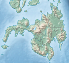
14:
265:19.85 km (8 sq mi)
830:
783:
769:
755:
72:
65:
44:
37:
1078:Run-of-the-river power stations
1:
56:Show map of Mindanao mainland
16:Dam in Bukidnon, Philippines
624:. Global Energy Observatory
542:GPX (secondary coordinates)
81:Location in the Philippines
1109:
424:Pulangi IV Upper Reservoir
367:province on the island of
189:National Power Corporation
1044:
537:GPX (primary coordinates)
512:Map all coordinates using
296:7.7157500°N 125.0237944°E
31:
520:Download coordinates as:
21:Dam in Maramag, Bukidnon
791:Renewable energy portal
393:) reservoir located at
337:Installed capacity
169:Construction began
84:Show map of Philippines
562:"Power Plant Profiles"
301:7.7157500; 125.0237944
532:GPX (all coordinates)
453:7.71556°N 125.02361°E
413:7.78639°N 125.02361°E
201:Type of dam
145:7.78639°N 125.02361°E
355:, is located on the
351:, also known as the
312:Commission date
244:Active capacity
53:Location in Mindanao
568:on October 28, 2011
448: /
408: /
292: /
253:Catchment area
141: /
763:Philippines portal
477:-generators via a
458:7.71556; 125.02361
418:7.78639; 125.02361
220:Spillway type
205:Gravity/embankment
150:7.78639; 125.02361
1055:
1054:
701:on April 25, 2012
665:on April 25, 2012
345:
344:
262:Surface area
195:Dam and spillways
177:Opening date
1100:
835:
834:
823:
816:
809:
800:
793:
788:
787:
779:
774:
773:
765:
760:
759:
758:
745:
744:
742:
740:
717:
711:
710:
708:
706:
700:
693:
684:
675:
674:
672:
670:
664:
653:
645:
634:
633:
631:
629:
618:
612:
611:
587:
578:
577:
575:
573:
558:
472:
471:
469:
468:
467:
465:
460:
459:
454:
449:
446:
445:
444:
441:
432:
431:
429:
428:
427:
425:
420:
419:
414:
409:
406:
405:
404:
401:
377:run-of-the-river
307:
306:
304:
303:
302:
297:
293:
290:
289:
288:
285:
156:
155:
153:
152:
151:
146:
142:
139:
138:
137:
134:
85:
76:
75:
69:
57:
48:
47:
41:
24:
1108:
1107:
1103:
1102:
1101:
1099:
1098:
1097:
1058:
1057:
1056:
1051:
1040:
979:
958:
949:Upper Tabuating
843:
829:
827:
797:
796:
789:
782:
775:
768:
761:
756:
754:
749:
748:
738:
736:
734:
719:
718:
714:
704:
702:
698:
691:
686:
685:
678:
668:
666:
662:
651:
647:
646:
637:
627:
625:
620:
619:
615:
608:
594:, eds. (2005).
592:Shively, Gerald
589:
588:
581:
571:
569:
560:
559:
555:
550:
549:
548:
547:
546:
507:
499:artificial lake
475:Francis turbine
463:
461:
457:
455:
451:
450:
447:
442:
439:
437:
435:
434:
423:
421:
417:
415:
411:
410:
407:
402:
399:
397:
395:
394:
300:
298:
294:
291:
286:
283:
281:
279:
278:
149:
147:
143:
140:
135:
132:
130:
128:
127:
89:
88:
87:
86:
83:
82:
79:
78:
77:
60:
59:
58:
55:
54:
51:
50:
49:
22:
17:
12:
11:
5:
1106:
1104:
1096:
1095:
1090:
1085:
1080:
1075:
1070:
1060:
1059:
1053:
1052:
1045:
1042:
1041:
1039:
1038:
1033:
1028:
1023:
1022:
1021:
1016:
1011:
1006:
1001:
996:
987:
985:
981:
980:
978:
977:
972:
966:
964:
960:
959:
957:
956:
951:
946:
941:
936:
931:
926:
921:
916:
911:
906:
901:
894:
889:
884:
879:
874:
869:
862:
857:
851:
849:
845:
844:
828:
826:
825:
818:
811:
803:
795:
794:
780:
766:
751:
750:
747:
746:
732:
712:
676:
635:
613:
606:
590:Coxhead, Ian;
579:
552:
551:
545:
544:
539:
534:
529:
523:
517:
510:
509:
508:
506:
503:
343:
342:
339:
333:
332:
323:
317:
316:
313:
309:
308:
287:125°01′25.66″E
276:
272:
271:
267:
266:
263:
259:
258:
255:
249:
248:
245:
241:
240:
237:
233:
232:
228:
227:
221:
217:
216:
211:
207:
206:
203:
197:
196:
192:
191:
186:
182:
181:
178:
174:
173:
170:
166:
165:
162:
158:
157:
125:
121:
120:
111:
107:
106:
103:
99:
98:
95:
91:
90:
80:
71:
70:
64:
63:
62:
61:
52:
43:
42:
36:
35:
34:
33:
32:
29:
28:
20:
15:
13:
10:
9:
6:
4:
3:
2:
1105:
1094:
1091:
1089:
1086:
1084:
1081:
1079:
1076:
1074:
1071:
1069:
1066:
1065:
1063:
1049:
1043:
1037:
1034:
1032:
1029:
1027:
1024:
1020:
1017:
1015:
1012:
1010:
1007:
1005:
1002:
1000:
997:
995:
992:
991:
989:
988:
986:
982:
976:
973:
971:
968:
967:
965:
961:
955:
952:
950:
947:
945:
942:
940:
937:
935:
932:
930:
927:
925:
922:
920:
917:
915:
912:
910:
907:
905:
902:
900:
899:
895:
893:
890:
888:
885:
883:
880:
878:
875:
873:
870:
868:
867:
863:
861:
858:
856:
853:
852:
850:
846:
842:
838:
833:
824:
819:
817:
812:
810:
805:
804:
801:
792:
786:
781:
778:
772:
767:
764:
753:
735:
733:9781139443845
729:
725:
724:
716:
713:
697:
690:
683:
681:
677:
661:
657:
650:
644:
642:
640:
636:
623:
617:
614:
609:
607:0-85199-912-3
603:
599:
598:
593:
586:
584:
580:
567:
563:
557:
554:
543:
540:
538:
535:
533:
530:
528:
525:
524:
522:
521:
516:
515:OpenStreetMap
513:
504:
502:
500:
495:
493:
488:
482:
480:
476:
470:
430:
392:
387:
385:
381:
380:hydroelectric
378:
374:
370:
366:
362:
358:
357:Pulangi River
354:
350:
340:
338:
334:
331:
328:
324:
322:
318:
314:
310:
305:
277:
273:
268:
264:
260:
256:
254:
250:
246:
242:
238:
234:
229:
225:
222:
218:
215:
214:Pulangi River
212:
208:
204:
202:
198:
193:
190:
187:
183:
179:
175:
171:
167:
163:
159:
154:
126:
122:
119:
115:
112:
108:
104:
100:
96:
94:Official name
92:
68:
40:
30:
25:
19:
1047:
1035:
896:
864:
777:Water portal
739:December 15,
737:. Retrieved
722:
715:
703:. Retrieved
696:the original
667:. Retrieved
660:the original
655:
626:. Retrieved
616:
596:
570:. Retrieved
566:the original
556:
519:
518:
511:
496:
483:
388:
352:
348:
346:
330:Francis-type
284:7°42′56.70″N
224:Tainter gate
18:
934:Pantabangan
866:Balbalungao
841:Philippines
705:November 4,
669:November 4,
628:November 4,
572:November 4,
456: /
416: /
389:The upper (
353:Pulangi Dam
299: /
275:Coordinates
226:-controlled
164:Operational
148: /
124:Coordinates
105:Philippines
27:Pulangi Dam
1062:Categories
505:References
462: (
443:125°1′25″E
422: (
403:125°1′25″E
384:generators
136:125°1′25″E
944:San Roque
939:Peñaranda
487:siltation
440:7°42′56″N
400:7°47′11″N
231:Reservoir
133:7°47′11″N
984:Mindanao
975:Jaclupan
887:Casecnan
882:Caliraya
855:Ambuklao
492:dredging
479:penstock
369:Mindanao
365:Bukidnon
321:Turbines
210:Impounds
185:Owner(s)
118:Bukidnon
110:Location
1048:italics
1036:Pulangi
970:Buhisan
963:Visayas
909:Labasin
904:La Mesa
839:in the
391:pondage
373:damming
361:Maramag
325:3 x 85
315:1985/86
236:Creates
114:Maramag
102:Country
1031:Aragon
1026:Agusan
924:Molino
898:Kaliwa
877:Bustos
730:
604:
341:255 MW
161:Status
990:Agus
919:Magat
914:Lumot
872:Binga
860:Angat
848:Luzon
699:(PDF)
692:(PDF)
663:(PDF)
652:(PDF)
359:near
954:Wawa
929:Pasa
837:Dams
741:2016
728:ISBN
707:2011
671:2011
630:2011
602:ISBN
574:2011
497:The
347:The
180:1986
172:1982
1019:VII
892:Ipo
527:KML
363:in
1064::
1014:VI
1004:IV
999:II
679:^
654:.
638:^
582:^
327:MW
116:,
1050:.
1009:V
994:I
822:e
815:t
808:v
743:.
709:.
673:.
632:.
610:.
576:.
466:)
426:)
Text is available under the Creative Commons Attribution-ShareAlike License. Additional terms may apply.