537:, for example) recovered help create a clearer picture of Mayan raised field agriculture in Pulltrouser. Maize was recovered in the form of pollen as well as a carbonized stalk found in one of the platforms. It is possible that this could be evidence of maize as agricultural crop or it could have been from mulch to aid the growth of other crops. Gosypium pollen was also recovered, which may represent either domesticated cotton or a wild population. The presence of water lily phytoliths suggests that there was permanent water in the canals during construction and/or use of the fields. It has been suggested that these water lilies may have been used as mulch, as modern day experiments show that water lily mulch is effective in retaining moisture, providing nutrients and other benefits. Unfortunately not enough organic material was recovered to conclusively show which crops or plants the Maya were using Pulltrouser Swamp for.
967:
495:
tree pollen and an increase in charcoal. This is evidence for a rapid and extensive expansion of agriculture with maize as an important crop. Further charcoal indicates that agriculture was expanded in the area between 1500 and 1300 B.C. and squash and bottle gourd were cultivated as well as maize. Evidence of what was originally thought to be canals at the site were found to be natural hummocks with no evidence of excavation. Pohl et al. (1996) suggest that the adoption of wetland agriculture was not a response to increases in population growth that created the need for more resources but instead a reaction to the changes in groundwater levels they believe to have occurred around 1500–1300 B.C.
388:
213:
595:). The tools found at the site were mostly for agricultural use or manufacturing agricultural products. There is little evidence that any of the tools were manufactured at the site. The types of tools found consisted of oval bifaces, tranchet bits, celts, picks, beveled bits, blades, and hammer stones. The majority of the tools are made from chert with some of chalcedony, cherty-limestone and obsidian. The oval bifaces are made from chert sourced near the site of
40:
33:
599:; these tools have wear consistent with agricultural work and were most likely used as hoes. The tranchet bits arrived fully formed at Pulltrouser, although there is evidence of retouching at the site. There are also blades made of chalcedony, stemmed knives and battered tools, sixteen of them made from chalcedony and two of cherty-limestone. Obsidian tools were mostly prismatic blades that were made from abraded surfaces and were sourced from
507:
suggested that these fields were in use from 400 BC-600AD, however this date could be biased due to repositioning of artifacts during the shifting of material in construction. The
Pulltrouser swamp sites are often used as representative of this agricultural type in interpretations of the use of raised-field agriculture in Maya culture. The investigations at the site have involved both coring and excavations.
437:
hillsides and slopes for the raised fields. The people of
Pulltrouser built their small living structures on terraces 2–3 meters above the swamp. There was also a hard platform composed of hard limestone and plaster built within the housing structure area. Within the settlement areas there was evidence of both ceramic and stone artifact production and use.
612:
different species and their uses include: Melongena melongena, used as a major food source. Pachychilus, used as a supplementary food source. The shells were a source of powdered lime used when cooking maize. Strombus gigas, used as a major food source. Larger shells were used for hoes as well as worked into ornaments or utensils.
436:
Located north of Orange Walk in Belize is a Y-shaped settlement that makes up a series of complex elongated depressions. In
Pulltrouser there were three different immediate settlements that surrounded the swamp equalling 8.5 km. In these settlements the key to organization was the utilization of
494:
People likely settled around swamps because of the rich faunal, plant, soil and water resources this environment made available. Maize appears at the site around 890 cal BP. Pollen records show mass forest disturbance around 2500 B.C., this coincides with the appearance of maize pollen, a decline in
510:
There are two distinct ground patterns observed in
Pulltrouser: "quadrilateral shapes in paired rows and quadrilateral to amorphous shapes in sectional or group patterns". There are approximately 311ha of well-defined patterns located along the mainland edge, which have been measured to be 1m above
481:
The botan and escoba forest have been expanded as a result of the construction of fields and canals. Logging that has taken place over the last three hundred years has also altered the landscape and vegetation of the depression. The saw grass zone occurs at the center surrounded by the escoba then
486:
Archaeobotanical evidence suggests that several arboreal crops such as hog plum and avocado were evident at
Pulltrouser Swamp as well as other evidence including maize and cotton. Pineapple, tobacco, vanilla were also found at the swamp most likely for the easy transportability and market value.
461:
species and nearly twice as many trees per square meter. Botan forest also has a greater range of tree sizes. The two types of forest are associated with different moisture levels in the soil, the soil that supports escoba forest maintains its moisture content throughout the year while the soil
506:
of ground patterns in
Pulltrouser swamp has revealed that the Maya were utilising raised field agriculture in the area. Raised field agriculture is a form of hydraulic cultivation using raised and canalized fields creating conditions in which the earth is above its natural height. It has been
485:
During construction of the canals and raised field system, it is believed
Pulltrouser was simply a wet, non-forested area containing large amounts of water lilies. However, raised fields were constructed in marshlike environments since they are easier to channelize to construct raised fields.
611:
At the excavated sites within
Pulltrouser Swamp there are many different species of mollusc shell types found. There were also many different uses; the most prominent shells being mixed terrestrial gastropods that were used in construction materials as fill in the raised fields. Some of the
570:
recovered at
Pulltrouser Swamp are too small to clearly establish ceramic sequence or detailed understandings. However, there is some useful information that can be gained from the ceramics that were found. There is a presence of Early and Moderate Classic sherds (pieces) that are mixed and
476:
Grass savannah – Vegetation consists of an herb cover of grasses and sedges with scattered savannah trees. The areas experiences a dramatic change in moisture content throughout the year and at its driest the vegetation can dry out. This area is used for cattle grazing during the dry
547:
Buildup of the field foundations- In this step the subsoil materials that were taken out of the ground to form the canals is now deposited on the area where the field will be (in between the canals). This build of material is generally built up to 200 cm above the bottom of
472:
Saw grass – Dominated by dense grasses and sedges of the tussock variety. Grasses can reach a height of up to two meters near the escoba forest zone. The density of the vegetation allows the soil below to remain saturated despite being fully exposed to the
525:
However, there is evidence of a fourth category, "extra-large canals" which run 200m long and 6-8m wide between South
Pulltrouser and the New River, which have the suggested purposes of either controlling water-levels or being part of a transport system.
603:. The lithics found at Pulltrouser suggest extensive trade with nearby sites, since there is little evidence of manufacturing at the site. In addition, many of the chert tools were recycled and reused suggesting that these items were highly valued.
511:
the surrounding depressions. There are also 357 ha of less distinct patterns seen in both the East and West interiors of the site. Running around these platforms are systems of different sized canals. There are three main categories of canals:
737:
Pohl, Mary D., Kevin O. Pope, John G. Jones, John S. Jacob, Dolores R. Piperno, Susan D. deFrance, David L. Lentz, John A. Gifford, Marie E. Danforth & J. Kathryn Josser, 1996. "Early Agriculture in the Maya Lowlands".
671:
Pohl, Mary D., Kevin O. Pope, John G. Jones, John S. Jacob, Dolores R. Piperno, Susan D. deFrance, David L. Lentz, John A. Gifford, Marie E. Danforth & J. Kathryn Josser, 1996. "Early Agriculture in the Maya Lowlands".
551:
Fertile Soil- The original top soil that was first removed in the first stage is now added on top of the subsoil field foundations along with top soils taken from other areas and organics added for planting
465:
Escoba forest – This area is characterized by leguminous trees and shrubs as well as palms that can grow as tall as seventeen meters. Three vegetation layers have been identified; an upper
966:
540:
Based on profiles, sediments and other information produced by excavation on the fields, Turner and Harrison propose that the raised fields were created using the following steps:
187:
structures. Three of these sites, called Raised-Field Site I, Raised-Field Site 2, and Raised-Field site 3, were excavated by archaeologists B.L. Turner and Peter D. Harrison.
544:
Creating a depression- In this step the soil is removed from the area and stored for later use, as the canals are cut into the earth removing subsoil material.
95:
418:
591:(or "lithics") at Pulltrouser Swamp suggest that their use was during occupation of the site from the Late Preclassic to Late Classic Period (see
730:
McAnany, Patricia, 1989. "Stone-Tool Production and Exchange in the Eastern Lowlands: The Consumer Perspective from Pulltrouser Swamp, Belize".
713:
McAnany, Patricia, 1989. "Stone-Tool Production and Exchange in the Eastern Lowlands: The Consumer Perspective from Pulltrouser Swamp, Belize".
781:
575:. The pottery style of the few specimens (bowls and vessels) that could be identified is linked to coastal sites in Belize and sites from
32:
1459:
326:
411:
1696:
358:
1759:
1675:
1273:
368:
373:
349:
1183:
1003:
363:
135:
1716:
1574:
1218:
404:
292:
194:
579:
to Lake Bakalar. The sites from Becan to Lake Bakalar are also sites where raised field agriculture is prevalent.
1253:
572:
252:
1701:
1594:
774:
1248:
1068:
931:
592:
212:
1609:
1063:
555:
Planting and Use- The crops are then planted, grown, tended and harvested from the raised field platforms.
1356:
806:
445:
There are four different vegetation types that occur at Pulltrouser Swamp; botan forest, escoba forest,
340:
745:
Turner, B.L. and Peter D. Harrison, 1981. "Prehistoric Raised Field Agriculture in the Maya Lowlands".
700:
Turner, B.L. and Peter D. Harrison, 1981. "Prehistoric Raised Field Agriculture in the Maya Lowlands".
1188:
988:
176:
69:
1754:
936:
767:
1544:
1484:
881:
790:
503:
392:
172:
1243:
469:(15-17m), a second layer of palms and saplings (8-10m) and a weakly developed herb layer (1-3m)
466:
1734:
1509:
1018:
821:
262:
202:
180:
153:
83:
1711:
1223:
1153:
993:
916:
282:
1579:
482:
botan forest respectively. The grass savannah occurs in the western portion of the swamp.
335:
232:
1379:
896:
754:
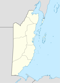
Pulltrouser Swamp: ancient Maya habitat, agriculture, and settlement in northern Belize
653:
Pulltrouser Swamp: ancient Maya habitat, agriculture, and settlement in northern Belize
457:
Botan forest – This area is similar to the escoba forest but with the addition of some
267:
247:
453:. Each of these appears to be spatially related to fluctuations of water in the area.
1748:
1549:
1469:
1038:
846:
596:
307:
287:
272:
242:
1499:
1434:
1333:
1263:
941:
906:
317:
312:
227:
222:
184:
148:
1479:
1449:
1233:
861:
1706:
1688:
1439:
1424:
1394:
1303:
1268:
1238:
1228:
1178:
1143:
1133:
1013:
956:
886:
277:
237:
1669:
1589:
1559:
1429:
1419:
1414:
1288:
1173:
1163:
1088:
1073:
1058:
1048:
1033:
1028:
1023:
1008:
841:
826:
816:
588:
302:
297:
110:
97:
1654:
1584:
1519:
1464:
1444:
1168:
1158:
1148:
1078:
1043:
975:
891:
600:
530:
446:
257:
1659:
1604:
1504:
866:
1569:
1564:
1409:
1404:
1351:
1343:
1323:
1293:
1193:
1123:
998:
983:
921:
871:
856:
811:
450:
1721:
1649:
1539:
1524:
1389:
1374:
1328:
1283:
1213:
1208:
1108:
1083:
1053:
946:
926:
901:
876:
831:
567:
1644:
1639:
1629:
1534:
1489:
1366:
1313:
1308:
1298:
1258:
1128:
1098:
1093:
951:
911:
851:
836:
798:
534:
168:
73:
179:. This area contains numerous archaeological sites belonging to the
518:
Medium (4m wide): These canals encompass the majority of the fields
1634:
1619:
1614:
1599:
1554:
1529:
1514:
1494:
1474:
1399:
1318:
1278:
1203:
1198:
1138:
1113:
1103:
576:
462:
beneath botan forest experiences a decrease during the dry season.
458:
521:
Small (2-3m wide): These canals are mainly cut into the mainland
1664:
1624:
1454:
1118:
763:
1384:
515:
Large (7-10m wide): These canals connect segments of the field
759:
667:
665:
663:
661:
1687:
1676:
for more articles see Category:Maya sites in Mexico
1365:
1342:
974:
797:
647:
645:
141:
131:
126:
89:
79:
65:
57:
696:
694:
692:
690:
688:
686:
684:
682:
643:
641:
639:
637:
635:
633:
631:
629:
627:
625:
775:
412:
183:, the most studied features of which are the
8:
21:
782:
768:
760:
752:Turner, B.L. and Peter D. Harrison, 1983.
651:Turner, B.L. and Peter D. Harrison, 1983.
419:
405:
189:
20:
39:
111:18.166870082576747°N 88.56666674910738°W
621:
348:
325:
201:
529:Within the fields, the plant remains (
167:is a wetland area located in northern
116:18.166870082576747; -88.56666674910738
16:Archaeological site in northern Belize
7:
756:. Austin: University of Texas Press.
655:. Austin: University of Texas Press.
14:
965:
386:
211:
38:
31:
1:
350:Spanish conquest of the Maya
1776:
1732:
749:, New Series, 213:399-405.
1730:
963:
704:, New Series, 213:399-405
26:
740:Latin American Antiquity
674:Latin American Antiquity
193:This article is part of
593:Mesoamerican chronology
393:Mesoamerica portal
807:Actun Tunichil Muknal
341:Classic Maya collapse
58:Alternative name
1760:Maya sites in Belize
989:Altar de Sacrificios
449:community and grass
177:Hondo River (Belize)
717:, 54(2), p.332-346.
566:Much of the sample
107: /
23:
732:American Antiquity
715:American Antiquity
504:Aerial photography
173:New River (Belize)
61:Pull Trouser Swamp
1742:
1741:
1735:Pre-Columbian era
1680:
1189:Motul de San José
822:Barton Creek Cave
429:
428:
204:Maya civilization
181:Maya civilization
165:Pulltrouser Swamp
162:
161:
84:Yucatan Peninsula
46:Pulltrouser Swamp
22:Pulltrouser Swamp
1767:
1672:
1224:Punta de Chimino
994:Arroyo de Piedra
969:
784:
777:
770:
761:
734:, 54(2):332-346.
718:
711:
705:
698:
677:
669:
656:
649:
421:
414:
407:
391:
390:
389:
215:
205:
190:
122:
121:
119:
118:
117:
112:
108:
105:
104:
103:
100:
42:
41:
35:
24:
1775:
1774:
1770:
1769:
1768:
1766:
1765:
1764:
1745:
1744:
1743:
1738:
1737:
1726:
1683:
1361:
1338:
970:
961:
793:
788:
727:
722:
721:
712:
708:
699:
680:
670:
659:
650:
623:
618:
609:
585:
564:
501:
492:
443:
434:
425:
387:
385:
378:
336:Preclassic Maya
203:
158:
115:
113:
109:
106:
101:
98:
96:
94:
93:
53:
52:
51:
50:
49:
48:
47:
43:
17:
12:
11:
5:
1773:
1771:
1763:
1762:
1757:
1747:
1746:
1740:
1739:
1731:
1728:
1727:
1725:
1724:
1719:
1714:
1709:
1704:
1699:
1693:
1691:
1685:
1684:
1682:
1681:
1667:
1662:
1657:
1652:
1647:
1642:
1637:
1632:
1627:
1622:
1617:
1612:
1607:
1602:
1597:
1592:
1587:
1582:
1577:
1575:Plan de Ayutla
1572:
1567:
1562:
1557:
1552:
1547:
1542:
1537:
1532:
1527:
1522:
1517:
1512:
1507:
1502:
1497:
1492:
1487:
1482:
1477:
1472:
1467:
1462:
1457:
1452:
1447:
1442:
1437:
1432:
1427:
1422:
1417:
1412:
1407:
1402:
1397:
1392:
1387:
1382:
1377:
1371:
1369:
1363:
1362:
1360:
1359:
1354:
1348:
1346:
1340:
1339:
1337:
1336:
1331:
1326:
1321:
1316:
1311:
1306:
1301:
1296:
1291:
1286:
1281:
1276:
1271:
1266:
1261:
1256:
1251:
1246:
1241:
1236:
1231:
1226:
1221:
1219:Piedras Negras
1216:
1211:
1206:
1201:
1196:
1191:
1186:
1181:
1176:
1171:
1166:
1161:
1156:
1151:
1146:
1141:
1136:
1131:
1126:
1121:
1116:
1111:
1106:
1101:
1096:
1091:
1086:
1081:
1076:
1071:
1066:
1061:
1056:
1051:
1046:
1041:
1036:
1031:
1026:
1021:
1016:
1011:
1006:
1001:
996:
991:
986:
980:
978:
972:
971:
964:
962:
960:
959:
954:
949:
944:
939:
934:
929:
924:
919:
914:
909:
904:
899:
897:Marco Gonzalez
894:
889:
884:
879:
874:
869:
864:
859:
854:
849:
844:
839:
834:
829:
824:
819:
814:
809:
803:
801:
795:
794:
789:
787:
786:
779:
772:
764:
758:
757:
750:
743:
735:
726:
723:
720:
719:
706:
678:
657:
620:
619:
617:
614:
608:
605:
584:
581:
563:
560:
557:
556:
553:
549:
545:
523:
522:
519:
516:
500:
497:
491:
488:
479:
478:
474:
470:
463:
442:
439:
433:
430:
427:
426:
424:
423:
416:
409:
401:
398:
397:
396:
395:
380:
379:
377:
376:
371:
366:
361:
353:
352:
346:
345:
344:
343:
338:
330:
329:
323:
322:
321:
320:
315:
310:
305:
300:
295:
290:
285:
280:
275:
270:
265:
260:
255:
250:
245:
240:
235:
230:
225:
217:
216:
208:
207:
199:
198:
171:, between the
160:
159:
157:
156:
151:
145:
143:
139:
138:
133:
129:
128:
124:
123:
91:
87:
86:
81:
77:
76:
67:
63:
62:
59:
55:
54:
45:
44:
37:
36:
30:
29:
28:
27:
15:
13:
10:
9:
6:
4:
3:
2:
1772:
1761:
1758:
1756:
1753:
1752:
1750:
1736:
1729:
1723:
1720:
1718:
1715:
1713:
1712:Joya de Cerén
1710:
1708:
1705:
1703:
1700:
1698:
1695:
1694:
1692:
1690:
1686:
1678:
1677:
1671:
1668:
1666:
1663:
1661:
1658:
1656:
1653:
1651:
1648:
1646:
1643:
1641:
1638:
1636:
1633:
1631:
1628:
1626:
1623:
1621:
1618:
1616:
1613:
1611:
1608:
1606:
1603:
1601:
1598:
1596:
1593:
1591:
1588:
1586:
1583:
1581:
1578:
1576:
1573:
1571:
1568:
1566:
1563:
1561:
1558:
1556:
1553:
1551:
1550:Moral Reforma
1548:
1546:
1543:
1541:
1538:
1536:
1533:
1531:
1528:
1526:
1523:
1521:
1518:
1516:
1513:
1511:
1508:
1506:
1503:
1501:
1498:
1496:
1493:
1491:
1488:
1486:
1483:
1481:
1478:
1476:
1473:
1471:
1470:Dzibilchaltun
1468:
1466:
1463:
1461:
1458:
1456:
1453:
1451:
1448:
1446:
1443:
1441:
1438:
1436:
1433:
1431:
1428:
1426:
1423:
1421:
1418:
1416:
1413:
1411:
1408:
1406:
1403:
1401:
1398:
1396:
1393:
1391:
1388:
1386:
1383:
1381:
1378:
1376:
1373:
1372:
1370:
1368:
1364:
1358:
1355:
1353:
1350:
1349:
1347:
1345:
1341:
1335:
1332:
1330:
1327:
1325:
1322:
1320:
1317:
1315:
1312:
1310:
1307:
1305:
1302:
1300:
1297:
1295:
1292:
1290:
1287:
1285:
1282:
1280:
1277:
1275:
1272:
1270:
1267:
1265:
1262:
1260:
1257:
1255:
1252:
1250:
1247:
1245:
1242:
1240:
1237:
1235:
1232:
1230:
1227:
1225:
1222:
1220:
1217:
1215:
1212:
1210:
1207:
1205:
1202:
1200:
1197:
1195:
1192:
1190:
1187:
1185:
1182:
1180:
1177:
1175:
1172:
1170:
1167:
1165:
1162:
1160:
1157:
1155:
1152:
1150:
1147:
1145:
1142:
1140:
1137:
1135:
1132:
1130:
1127:
1125:
1122:
1120:
1117:
1115:
1112:
1110:
1107:
1105:
1102:
1100:
1097:
1095:
1092:
1090:
1087:
1085:
1082:
1080:
1077:
1075:
1072:
1070:
1067:
1065:
1062:
1060:
1057:
1055:
1052:
1050:
1047:
1045:
1042:
1040:
1039:Cotzumalhuapa
1037:
1035:
1032:
1030:
1027:
1025:
1022:
1020:
1017:
1015:
1012:
1010:
1007:
1005:
1002:
1000:
997:
995:
992:
990:
987:
985:
982:
981:
979:
977:
973:
968:
958:
955:
953:
950:
948:
945:
943:
940:
938:
935:
933:
930:
928:
925:
923:
920:
918:
917:Nohoch Cheʼen
915:
913:
910:
908:
905:
903:
900:
898:
895:
893:
890:
888:
885:
883:
880:
878:
875:
873:
870:
868:
865:
863:
860:
858:
855:
853:
850:
848:
845:
843:
840:
838:
835:
833:
830:
828:
825:
823:
820:
818:
815:
813:
810:
808:
805:
804:
802:
800:
796:
792:
785:
780:
778:
773:
771:
766:
765:
762:
755:
751:
748:
744:
742:7(4):355-372.
741:
736:
733:
729:
728:
724:
716:
710:
707:
703:
697:
695:
693:
691:
689:
687:
685:
683:
679:
675:
668:
666:
664:
662:
658:
654:
648:
646:
644:
642:
640:
638:
636:
634:
632:
630:
628:
626:
622:
615:
613:
606:
604:
602:
598:
597:Colha, Belize
594:
590:
582:
580:
578:
574:
569:
561:
559:
554:
550:
546:
543:
542:
541:
538:
536:
532:
527:
520:
517:
514:
513:
512:
508:
505:
499:Raised fields
498:
496:
489:
487:
483:
475:
471:
468:
464:
460:
456:
455:
454:
452:
448:
440:
438:
431:
422:
417:
415:
410:
408:
403:
402:
400:
399:
394:
384:
383:
382:
381:
375:
372:
370:
367:
365:
362:
360:
357:
356:
355:
354:
351:
347:
342:
339:
337:
334:
333:
332:
331:
328:
324:
319:
316:
314:
311:
309:
306:
304:
301:
299:
296:
294:
291:
289:
286:
284:
281:
279:
276:
274:
271:
269:
266:
264:
261:
259:
256:
254:
251:
249:
246:
244:
241:
239:
236:
234:
231:
229:
226:
224:
221:
220:
219:
218:
214:
210:
209:
206:
200:
196:
192:
191:
188:
186:
182:
178:
174:
170:
166:
155:
152:
150:
147:
146:
144:
140:
137:
134:
130:
125:
120:
92:
88:
85:
82:
78:
75:
71:
68:
64:
60:
56:
34:
25:
19:
1674:
1595:San Gervasio
1435:Chichen Itza
1380:Aguada Fénix
1334:Zapote Bobal
1264:Takalik Abaj
1254:San Clemente
907:Nim Li Punit
753:
746:
739:
731:
714:
709:
701:
676:7(4):355-372
673:
652:
610:
586:
565:
558:
539:
528:
524:
509:
502:
493:
484:
480:
444:
435:
263:Architecture
185:raised field
164:
163:
149:Palaeoindian
18:
1702:Casa Blanca
1689:El Salvador
1440:Chunchucmil
1395:Balankanche
1304:Wajxaklajun
1269:Tamarindito
1249:San Bartolo
1179:Mixco Viejo
1134:Kaminaljuyu
1069:El Porvenir
1014:Cerro Quiac
957:Xunantunich
932:San Estevan
887:Lower Dover
589:stone tools
583:Stone tools
490:Agriculture
441:Environment
432:Settlements
114: /
90:Coordinates
70:Orange Walk
1755:Maya sites
1749:Categories
1733:See also:
1717:San Andrés
1697:Cara Sucia
1610:Tortuguero
1485:Hormiguero
1460:Comalcalco
1430:Chinkultic
1415:Chacchoben
1289:Tres Islas
1174:Machaquila
1164:La Joyanca
1074:El Temblor
1059:El Mirador
1034:Chutixtiox
1024:Chitinamit
937:Santa Rita
882:Louisville
842:Chaa Creek
827:Cahal Pech
817:Baking Pot
791:Maya sites
725:References
531:phytoliths
467:tree layer
136:Preceramic
102:88°34′00″W
99:18°10′01″N
1655:Yaxchilan
1585:Punta Sur
1520:Kohunlich
1480:Ekʼ Balam
1465:Dzibanche
1450:Chunlimón
1445:Chunhuhub
1357:El Puente
1234:Qʼumarkaj
1169:La Muerta
1159:La Corona
1154:La Blanca
1149:La Amelia
1079:El Tintal
1044:Dos Pilas
976:Guatemala
892:Lubaantun
862:KaʼKabish
601:Guatemala
573:disturbed
447:saw grass
369:Guatemala
268:Astronomy
253:Sacrifice
248:Mythology
233:Languages
1707:Cihuatán
1670:Yoʼokop
1570:Palenque
1565:Oxkintok
1425:Chicanná
1410:Calakmul
1405:Bonampak
1344:Honduras
1324:Zacpeten
1294:Uaxactun
1239:Río Azul
1229:Quiriguá
1194:Naachtun
1144:Kʼatepan
1124:Ixtonton
999:Balberta
984:Aguateca
922:Pacbitun
872:La Milpa
857:El Pilar
812:Altun Ha
607:Molluscs
568:ceramics
562:Ceramics
552:mediums.
451:savannah
308:Medicine
288:Textiles
273:Calendar
243:Religion
195:a series
142:Cultures
66:Location
1722:Tazumal
1650:Xtampak
1590:Río Bec
1560:Ocomtún
1540:Mayapan
1525:Komchen
1420:Chactún
1390:Balamku
1375:Acanceh
1329:Zaculeu
1284:Topoxte
1274:Tayasal
1214:Pajaral
1209:Naranjo
1184:Montana
1109:Iximche
1089:Guaytán
1084:El Zotz
1064:El Perú
1054:El Chal
1049:El Baúl
1029:Chocolá
1009:Cancuén
1004:Bejucal
947:Uxbenka
927:Pusilha
902:Minanha
877:Lamanai
832:Caracol
747:Science
702:Science
548:canals.
477:season.
364:Chiapas
359:Yucatán
327:History
318:Warfare
313:Cuisine
238:Writing
228:Society
132:Periods
127:History
1660:Yaxuná
1645:Xpuhil
1640:Xlapak
1630:Xcaret
1605:Toniná
1580:Pomona
1535:La Mar
1505:Joljaʼ
1490:Izamal
1367:Mexico
1314:Xultun
1309:Witzna
1299:Ucanal
1259:Seibal
1129:Ixtutz
1099:Holtun
1094:Holmul
952:Xnaheb
912:Nohmul
867:Kʼaxob
852:Cuello
837:Cerros
799:Belize
535:pollen
278:Stelae
258:Cities
223:People
197:on the
169:Belize
80:Region
74:Belize
1635:Xelha
1620:Uxmal
1615:Tulum
1600:Sayil
1555:Muyil
1530:Labna
1515:Kiuic
1510:Kabah
1500:Jaina
1495:Izapa
1475:Edzna
1400:Becan
1352:Copán
1319:Yaxha
1279:Tikal
1244:Sacul
1204:Nakum
1199:Nakbe
1139:Kinal
1114:Ixkun
1104:Itzan
1019:Chama
847:Colha
616:Notes
577:Becan
459:sabal
374:Petén
303:Dance
298:Music
293:Trade
154:Mayan
1665:Yula
1625:Uxul
1545:Maní
1455:Coba
1119:Ixlu
942:Tipu
587:The
533:and
473:sun.
175:and
1385:Aké
283:Art
1751::
681:^
660:^
624:^
72:,
1679:)
1673:(
783:e
776:t
769:v
420:e
413:t
406:v
Text is available under the Creative Commons Attribution-ShareAlike License. Additional terms may apply.