132:
165:
99:
82:
70:
240:
260:
172:
139:
106:
574:
As of the 2010 census, the population of Port
Jefferson Station was 7,838. Out of those, 5,598 (76.5%) were White, 183 (2.3%) were Black, 416 (5.3%) were Asian, 7 (0.1%) were Native American, 3 (0.04%) were Native Hawaiian or Pacific Islander, 7 (0.1%) were some other race, and 66 (0.8%) were two or
582:
living together, 11.5% had a female householder with no husband present, and 30.9% were non-families. 23.3% of all households were made up of individuals, and 9.5% were someone living alone who was 65 years of age or older. The average household size was 2.75, and the average family size was 3.21.
586:
In the CDP, the population was spread out, with 21.9% under the age of 18, 9.5% from 18 to 24, 27.6% from 25 to 44, 26.9% from 45 to 64, and 14.1% who were 65 years of age or older. The median age was 39.2 years. For every 100 females, there were 95.7 males. For every 100 females age 18 and over,
590:
For the period 2007–11, the median annual income for a household in the CDP was $ 61,218, and the median income for a family was $ 73,854. Males had a median income of $ 67,466 versus $ 32,571 for females. The
69:
1319:
619:. As such, children who reside within Port Jefferson Station and attend public school will attend school in one of these three districts, depending on where they live within the hamlet.
1314:
515:
The train tracks mark the northern boundary of Port
Jefferson Station, separating it from the Village of Port Jefferson. Nesconset Highway to the south forms a boundary with
738:
930:
1324:
1022:
969:
951:
284:
200:
857:
831:
712:
164:
425:
98:
131:
578:
As of the 2010 census, there were 2,812 households, out of which 34.3% had children under the age of 18 living with them, 52.8% were headed by
616:
1309:
435:
832:"Profile of General Population and Housing Characteristics: 2010 Demographic Profile Data (DP-1): Port Jefferson Station CDP, New York"
690:
923:
858:"Selected Economic Characteristics, 2007-2011 American Community Survey 5-Year Estimates (DP03): Port Jefferson Station CDP, New York"
670:
631:
station is on the hamlet's northern border with the
Incorporated Village of Port Jefferson. The area is also served by the following
750:
1304:
916:
628:
302:
74:
1999 photo of the Port
Jefferson LIRR station, which changed the name of the community formerly known as "Echo, New York"
272:
1105:
612:
509:
1185:
81:
1065:
1035:
608:
861:
835:
1175:
1130:
1045:
716:
553:
1180:
1170:
1110:
1080:
1007:
959:
644:
497:
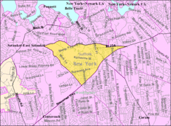
490:
463:
413:
277:
232:
30:
1150:
1090:
1085:
1075:
455:
60:
1283:
1260:
1255:
1240:
1155:
1140:
1100:
1055:
891:
652:
632:
418:
1235:
1230:
1225:
1200:
1165:
977:
486:
1245:
1205:
1125:
1070:
1050:
1030:
987:
939:
516:
459:
387:
289:
713:"Geographic Identifiers: 2010 Demographic Profile Data (G001): Port Jefferson Station CDP, New York"
1040:
997:
992:
482:. The name "Echo" was also used. The first Colonial resident, William Tooker, had arrived by 1750.
496:
The primarily farming community began to experience suburban growth following the construction of
1275:
1215:
1160:
1120:
1115:
1095:
1012:
982:
607:
Port
Jefferson Station is primarily located within the boundaries of (and is thus served by) the
1265:
1220:
1145:
1002:
658:
640:
596:
592:
451:
377:
56:
1210:
1135:
943:
648:
595:
for the CDP was $ 32,894. About 0.8% of families and 12.7% of the population were below the
467:
265:
1250:
1195:
1060:
478:
The area now known as Port
Jefferson Station was first called by the Native American name
394:
373:
17:
1298:
245:
500:
in the mid 1950s. By the early 1970s, it had become a primarily suburban community.
804:
908:
252:
215:
202:
368:
599:, including 10.0% of those under age 18 and 2.3% of those age 65 or over.
579:
401:
296:
575:
more races. 1,158 people (14.8%) were
Hispanic or Latino (of any race).
512:, the CDP has a total area of 2.6 square miles (6.7 km), all land.
746:
779:
470:, United States. The population was 7,838 as of the 2010 census.
883:
912:
36:
Hamlet & census-designated place in New York, United States
611:, although smaller portions are within the boundaries of the
860:. U.S. Census Bureau, American Factfinder. Archived from
834:. U.S. Census Bureau, American Factfinder. Archived from
715:. U.S. Census Bureau, American Factfinder. Archived from
1320:
Census-designated places in
Suffolk County, New York
1274:
1021:
968:
950:
434:
424:
412:
400:
384:
367:
359:
351:
346:
338:
330:
322:
314:
309:
295:
283:
271:
251:
231:
41:
826:
824:
822:
493:, providing the hamlet with its present-day name.
615:, Middle country central school district and the
609:Brookhaven-Comsewogue Union Free School District
171:
138:
105:
924:
8:
1315:Census-designated places in New York (state)
931:
917:
909:
526:
184:Port Jefferson Station (the United States)
38:
682:
423:
399:
366:
345:
337:
308:
230:
195:
90:
78:
66:
613:Mount Sinai Union Free School District
546:
617:Three Village Central School District
489:arrived to provide service to nearby
433:
411:
383:
358:
350:
329:
321:
313:
294:
282:
270:
250:
118:Location within the state of New York
7:
780:"Long Island Index: Interactive Map"
774:
772:
770:
768:
1325:Hamlets in Suffolk County, New York
334:0.00 sq mi (0.00 km)
326:2.64 sq mi (6.84 km)
318:2.64 sq mi (6.84 km)
805:"Census of Population and Housing"
671:Lawrence Aviation Industries, Inc.
536:
25:
363:3,010.22/sq mi (1,162.23/km)
151:Port Jefferson Station (New York)
691:"ArcGIS REST Services Directory"
258:
238:
170:
163:
137:
130:
104:
97:
80:
68:
43:Port Jefferson Station, New York
1:
693:. United States Census Bureau
303:Long Island Rail Road station
187:Show map of the United States
1310:Hamlets in New York (state)
1176:North Patchogue/Canaan Lake
784:www.longislandindexmaps.org
510:United States Census Bureau
1341:
739:"New York State Route 347"
28:
567:
552:
545:
540:
535:
532:
305:located within the hamlet
196:
91:
79:
67:
54:
31:Port Jefferson, New York
29:Not to be confused with
657:62: Smith Haven Mall -
587:there were 94.7 males.
456:census-designated place
342:177 ft (54 m)
121:Show map of Long Island
61:census-designated place
1191:Port Jefferson Station
892:Suffolk County Transit
659:Riverhead LIRR station
653:Stony Brook University
641:Patchogue LIRR station
633:Suffolk County Transit
448:Port Jefferson Station
178:Port Jefferson Station
145:Port Jefferson Station
112:Port Jefferson Station
18:Port Jefferson Station
629:Long Island Rail Road
568:U.S. Decennial Census
528:Historical population
487:Long Island Rail Road
386: • Summer (
216:40.92417°N 73.06167°W
1305:Brookhaven, New York
864:on February 12, 2020
838:on February 12, 2020
719:on February 12, 2020
360: • Density
154:Show map of New York
529:
221:40.92417; -73.06167
212: /
940:Town of Brookhaven
753:on October 1, 2005
527:
460:Town of Brookhaven
352: • Total
331: • Water
315: • Total
1292:
1291:
1106:Fire Island Pines
593:per capita income
572:
571:
508:According to the
498:Nesconset Highway
445:
444:
378:Eastern Time Zone
323: • Land
16:(Redirected from
1332:
933:
926:
919:
910:
903:
902:
900:
898:
880:
874:
873:
871:
869:
854:
848:
847:
845:
843:
828:
817:
816:
814:
812:
801:
795:
794:
792:
790:
776:
763:
762:
760:
758:
749:. Archived from
735:
729:
728:
726:
724:
709:
703:
702:
700:
698:
687:
649:Smith Haven Mall
548:
543:
538:
530:
391:
264:
262:
261:
244:
242:
241:
227:
226:
224:
223:
222:
217:
213:
210:
209:
208:
205:
188:
174:
173:
167:
155:
141:
140:
134:
122:
108:
107:
101:
84:
72:
39:
21:
1340:
1339:
1335:
1334:
1333:
1331:
1330:
1329:
1295:
1294:
1293:
1288:
1270:
1131:Lake Ronkonkoma
1046:Center Moriches
1017:
964:
946:
937:
907:
906:
896:
894:
882:
881:
877:
867:
865:
856:
855:
851:
841:
839:
830:
829:
820:
810:
808:
803:
802:
798:
788:
786:
778:
777:
766:
756:
754:
737:
736:
732:
722:
720:
711:
710:
706:
696:
694:
689:
688:
684:
679:
667:
625:
605:
580:married couples
541:
525:
506:
476:
408:
385:
259:
257:
239:
237:
220:
218:
214:
211:
206:
203:
201:
199:
198:
192:
191:
190:
189:
186:
185:
182:
181:
180:
179:
175:
158:
157:
156:
153:
152:
149:
148:
147:
146:
142:
125:
124:
123:
120:
119:
116:
115:
114:
113:
109:
87:
86:U.S. Census map
75:
63:
50:
47:
44:
37:
34:
23:
22:
15:
12:
11:
5:
1338:
1336:
1328:
1327:
1322:
1317:
1312:
1307:
1297:
1296:
1290:
1289:
1287:
1286:
1280:
1278:
1272:
1271:
1269:
1268:
1263:
1258:
1253:
1248:
1243:
1238:
1233:
1228:
1223:
1218:
1213:
1208:
1203:
1198:
1193:
1188:
1186:Point O' Woods
1183:
1181:Ocean Bay Park
1178:
1173:
1171:North Bellport
1168:
1163:
1158:
1153:
1148:
1143:
1138:
1133:
1128:
1123:
1118:
1113:
1111:Gordon Heights
1108:
1103:
1098:
1093:
1088:
1083:
1081:East Patchogue
1078:
1073:
1068:
1066:Cupsogue Beach
1063:
1058:
1053:
1048:
1043:
1038:
1033:
1027:
1025:
1019:
1018:
1016:
1015:
1010:
1008:Port Jefferson
1005:
1000:
995:
990:
985:
980:
974:
972:
966:
965:
963:
962:
956:
954:
948:
947:
938:
936:
935:
928:
921:
913:
905:
904:
875:
849:
818:
796:
764:
730:
704:
681:
680:
678:
675:
674:
673:
666:
663:
662:
661:
655:
645:Port Jefferson
624:
623:Transportation
621:
604:
601:
570:
569:
565:
564:
561:
559:
556:
550:
549:
544:
539:
534:
524:
521:
505:
502:
491:Port Jefferson
475:
472:
464:Suffolk County
443:
442:
439:
432:
431:
428:
422:
421:
416:
410:
409:
406:
404:
398:
397:
392:
382:
381:
371:
365:
364:
361:
357:
356:
353:
349:
348:
344:
343:
340:
336:
335:
332:
328:
327:
324:
320:
319:
316:
312:
311:
307:
306:
299:
293:
292:
287:
281:
280:
275:
269:
268:
255:
249:
248:
235:
229:
228:
194:
193:
183:
177:
176:
169:
168:
162:
161:
160:
159:
150:
144:
143:
136:
135:
129:
128:
127:
126:
117:
111:
110:
103:
102:
96:
95:
94:
93:
92:
89:
88:
85:
77:
76:
73:
65:
64:
55:
52:
51:
49:Echo, New York
48:
45:
42:
35:
24:
14:
13:
10:
9:
6:
4:
3:
2:
1337:
1326:
1323:
1321:
1318:
1316:
1313:
1311:
1308:
1306:
1303:
1302:
1300:
1285:
1282:
1281:
1279:
1277:
1273:
1267:
1264:
1262:
1259:
1257:
1254:
1252:
1249:
1247:
1244:
1242:
1239:
1237:
1234:
1232:
1229:
1227:
1224:
1222:
1219:
1217:
1214:
1212:
1209:
1207:
1204:
1202:
1199:
1197:
1194:
1192:
1189:
1187:
1184:
1182:
1179:
1177:
1174:
1172:
1169:
1167:
1164:
1162:
1159:
1157:
1154:
1152:
1151:Middle Island
1149:
1147:
1144:
1142:
1139:
1137:
1134:
1132:
1129:
1127:
1124:
1122:
1119:
1117:
1114:
1112:
1109:
1107:
1104:
1102:
1099:
1097:
1094:
1092:
1091:East Shoreham
1089:
1087:
1086:East Setauket
1084:
1082:
1079:
1077:
1076:East Moriches
1074:
1072:
1069:
1067:
1064:
1062:
1059:
1057:
1054:
1052:
1049:
1047:
1044:
1042:
1039:
1037:
1034:
1032:
1029:
1028:
1026:
1024:
1020:
1014:
1011:
1009:
1006:
1004:
1001:
999:
996:
994:
991:
989:
986:
984:
981:
979:
976:
975:
973:
971:
967:
961:
958:
957:
955:
953:
949:
945:
941:
934:
929:
927:
922:
920:
915:
914:
911:
893:
889:
885:
879:
876:
863:
859:
853:
850:
837:
833:
827:
825:
823:
819:
806:
800:
797:
785:
781:
775:
773:
771:
769:
765:
752:
748:
744:
740:
734:
731:
718:
714:
708:
705:
697:September 20,
692:
686:
683:
676:
672:
669:
668:
664:
660:
656:
654:
650:
646:
642:
638:
637:
636:
634:
630:
622:
620:
618:
614:
610:
602:
600:
598:
594:
588:
584:
581:
576:
566:
562:
560:
557:
555:
551:
531:
522:
520:
518:
513:
511:
503:
501:
499:
494:
492:
488:
485:In 1873, the
483:
481:
473:
471:
469:
465:
461:
458:(CDP) in the
457:
453:
449:
440:
437:
429:
427:
420:
417:
415:
405:
403:
396:
393:
389:
379:
375:
372:
370:
362:
354:
341:
333:
325:
317:
304:
300:
298:
291:
288:
286:
279:
276:
274:
267:
256:
254:
247:
246:United States
236:
234:
225:
197:Coordinates:
166:
133:
100:
83:
71:
62:
58:
53:
40:
32:
27:
19:
1261:Water Island
1256:Wading River
1241:Strongs Neck
1190:
1156:Miller Place
1141:Mastic Beach
1101:Farmingville
1056:Cherry Grove
895:. Retrieved
887:
884:"System Map"
878:
866:. Retrieved
862:the original
852:
840:. Retrieved
836:the original
809:. Retrieved
807:. Census.gov
799:
787:. Retrieved
783:
755:. Retrieved
751:the original
742:
733:
721:. Retrieved
717:the original
707:
695:. Retrieved
685:
635:bus routes:
626:
606:
597:poverty line
589:
585:
577:
573:
523:Demographics
514:
507:
495:
484:
479:
477:
447:
446:
414:Area code(s)
26:
1276:Reservation
1236:Stony Brook
1231:South Haven
1226:Sound Beach
1201:Rocky Point
1166:Mount Sinai
978:Belle Terre
897:October 31,
743:newsday.com
219: /
1299:Categories
1284:Poospatuck
1246:Terryville
1206:Ronkonkoma
1126:Holtsville
1071:Davis Park
1051:Centereach
1036:Brookhaven
1031:Blue Point
988:Lake Grove
888:sctbus.org
868:January 7,
842:January 7,
723:January 7,
677:References
517:Terryville
480:Comsewogue
438:feature ID
347:Population
290:Brookhaven
204:40°55′27″N
46:Comsewogue
1041:Calverton
998:Patchogue
993:Old Field
603:Education
504:Geography
426:FIPS code
402:ZIP Codes
395:UTC−04:00
374:UTC−05:00
369:Time zone
339:Elevation
297:Named for
207:73°3′42″W
1216:Setauket
1161:Moriches
1121:Holbrook
1116:Hagerman
1096:Eastport
1013:Shoreham
983:Bellport
970:Villages
944:New York
789:July 12,
757:July 15,
665:See also
468:New York
430:36-59377
419:631, 934
266:New York
1266:Yaphank
1221:Shirley
1146:Medford
1023:Hamlets
1003:Poquott
960:Suffolk
811:June 4,
747:Newsday
474:History
441:0960970
278:Suffolk
233:Country
1211:Selden
1136:Mastic
952:County
651:&
533:Census
452:hamlet
273:County
263:
243:
59:&
57:Hamlet
1251:Upton
1196:Ridge
1061:Coram
558:7,950
466:, in
462:, in
450:is a
407:11776
355:7,950
253:State
899:2023
870:2013
844:2013
813:2016
791:2022
759:2009
725:2013
699:2022
647:via
639:51:
627:The
554:2020
542:Note
537:Pop.
454:and
436:GNIS
310:Area
301:The
285:Town
388:DST
1301::
942:,
890:.
886:.
821:^
782:.
767:^
745:.
741:.
643:-
547:%±
519:.
932:e
925:t
918:v
901:.
872:.
846:.
815:.
793:.
761:.
727:.
701:.
563:—
390:)
380:)
376:(
33:.
20:)
Text is available under the Creative Commons Attribution-ShareAlike License. Additional terms may apply.