131:
162:
515:
22:
169:
146:
530:
is credited with being the first
European to lay eyes upon the Rum. He was taken to see it during the spring of 1680, while under the captivity of a party of Dakota. He referred to it as the St. Francis river in his published journals, although obviously the name didn't stick. The current river
858:
DESCRIPTION of LOUISIANA, By FATHER LOUIS HENNEPIN, RECOLLECT MISSIONARY: Translated from the
Edition of 1683, and compared with the Novella Decouverte, The La Salle Documents and other Contemporaneous
812:
744:, by the late 18th-century Europeans interpreted the Mdewakanton Dakota name for the river not as "Spirit" denoting a mystical force, but instead as "spirit" denoting
1032:
1042:
896:
1022:
1037:
1027:
161:
652:. Upham notes that both Carver in 1766 and Pike in 1805 found the name "Rum River" in use by English-speaking fur traders. However, the 1778
778:
933:
105:
593:
551:
978:
581:, the West Branch of the Rum served as the counties' boundary. Today, Mille Lacs County's western boundary instead follows the
379:
43:
532:
302:
1017:
763:
574:
273:
130:
86:
269:
58:
316:
39:
32:
582:
65:
879:
773:
712:, Fire-water River). Due to changes in the Dakota language, two slightly varying river's name appears as well:
578:
265:
800:
261:
866:
72:
768:
495:
54:
570:
539:
487:
483:
136:
660:(River of the Lake), with Samuel Mitchell reproducing the map in 1880, with the river recorded as
929:
681:
555:
519:
491:
479:
475:
471:
970:
499:
741:
613:
467:
436:
225:
210:
965:
745:
527:
79:
648:(St. Francis or Sioux River). On the 1733 Henry Popple map, the Rum River is shown as
1011:
733:
620:, Spirit(ual)/Mystic Lake). In 1702, d'Isle's map recorded the name of the river as
588:
The Bogus Brook, which flows into the Rum River, was known to have been a refuge for
829:
U.S. Geological Survey. National
Hydrography Dataset high-resolution flowline data.
921:
653:
514:
729:
625:
503:
352:
21:
629:
547:
993:
980:
394:
381:
331:
318:
589:
463:
728:
The current
English name is a mistranslation of the one given to it by the
704:
names can be found for this river: one indicating the lake of its origin (
830:
145:
543:
801:
U.S. Geological Survey
Geographic Names Information System: Rum Rivere
506:. It is one of the six protected Wild and Scenic rivers in Minnesota.
701:
563:
573:, the Rum divides between the Main Branch and the West Branch. When
558:, known as "Choking Creek", became a treaty boundary separating the
546:
complex west of
Cambridge as the sharp bend constricts the river's
542:. During the spring floods, the Rum River forces itself through a
535:, located 12 miles west of the Rum, parallels the flow of the Rum.
605:
559:
513:
474:. It runs for 151 miles (243 km) through the communities of
926:
Minnesota Place Names, A Geographical
Encyclopedia, 3rd Edition
664:; Mille Lacs Lake, though, was recorded in the reproduction as
843:
750:
15:
554:, the outlet of this natural diversion channel located near
861:, New York: John G Shea (1880), pp 368–70. (The spelling
708:, Grand Lake River) and the other reflecting the English (
692:. By 1832, Tanner's map recorded the name of the river as
966:
Minnesota DNR: A Canoe and
Boating Guide to the Rum River
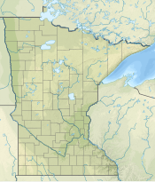
928:. Saint Paul, Minnesota: Minnesota Historical Society.
634:entre le 49e d. et le 42e d. ou aboutit la rivière
442:
430:
422:
410:
371:
361:
351:
308:
296:
288:
279:
257:
249:
241:
236:
195:
184:
123:
46:. Unsourced material may be challenged and removed.
716:representing the historically recorded name, and
688:in 1820 records the Rum River by its Ojibwe name
865:is the translator's. See original title page (
538:The Rum River makes a sharp turn southward at
8:
971:Rum River – State water trail: Minnesota DNR
217:
202:
462:is a slow, meandering stream that connects
646:Rivière de S. François ou des Nadouessioux
518:The Rum River as seen on the west side of
106:Learn how and when to remove this message
748:and ever since it has been known as the
638:lac Supérieure, lac des Illinois et lac
790:
1033:Rivers of Mille Lacs County, Minnesota
796:
794:
656:by John Mitchell records the river as
120:
1043:Rivers of Sherburne County, Minnesota
7:
1023:Tributaries of the Mississippi River
779:List of longest streams of Minnesota
44:adding citations to reliable sources
1038:Rivers of Isanti County, Minnesota
740:(Spirit(ual)/Mystic River) in the
612:(Spirit(ual)/Mystic River), after
14:
1028:Rivers of Anoka County, Minnesota
168:
118:River in Minnesota, United States
552:First Treaty of Prairie du Chien
502:, roughly 20 miles northwest of
167:
160:
144:
129:
20:
31:needs additional citations for
897:"History of Mille Lacs County"
844:"City of Princeton, Minnesota"
373: • coordinates
310: • coordinates
1:
948:Schoolcraft, Henry R. (1820)
720:reflecting the current name.
498:before ending at the city of
303:Mille Lacs Indian Reservation
280:Physical characteristics
950:Narrative Journal of Travels
880:"Treaty of Prairie du Chien"
764:Mille Lacs Kathio State Park
676:" being a mis-recording of "
575:Mille Lacs County, Minnesota
644:, Rum River is recorded as
432: • location
363: • location
298: • location
1059:
833:, accessed October 5, 2012
622:Riviere des Mendeoüacanton
444: • average
452:
418:
347:
284:
155:
143:
128:
952:. (Reprint: 1953, 1992.)
774:List of Minnesota rivers
579:Benton County, Minnesota
700:. Today, two different
630:"Carte représentant le
414:151 miles (243 km)
395:45.189985°N 93.390311°W
367:Anoka, Anoka County, MN
332:46.160499°N 93.756020°W
203:
769:Rum River State Forest
706:Misi-zaaga'igani-ziibi
608:name for the river is
523:
219:Misi-zaaga'igani-ziibi
218:
176:Mouth of the Rum River
517:
400:45.189985; -93.390311
337:46.160499; -93.756020
150:Rum River highlighted
867:image at Hathi Trust
856:Shea, John Gilmary.
571:Princeton, Minnesota
540:Cambridge, Minnesota
137:Princeton, Minnesota
40:improve this article
1018:Rivers of Minnesota
994:45.1900°N 93.3903°W
990: /
710:Ishkodewaaboo-ziibi
526:The early explorer
448:683 cu/ft. per sec.
391: /
328: /
885:. August 19, 1825.
724:Naming controversy
583:public land survey
524:
188:Mistranslation of
999:45.1900; -93.3903
682:Henry Schoolcraft
650:R. Nendivaocanton
577:was created from
556:Isanti, Minnesota
533:St. Francis River
531:bearing the name
520:Milaca, Minnesota
472:Mississippi River
456:
455:
357:Mississippi River
116:
115:
108:
90:
1050:
1005:
1004:
1002:
1001:
1000:
995:
991:
988:
987:
986:
983:
953:
946:
940:
939:
918:
912:
911:
909:
907:
893:
887:
886:
884:
876:
870:
854:
848:
847:
840:
834:
831:The National Map
827:
821:
820:
809:
803:
798:
736:) tribe. Though
445:
433:
406:
405:
403:
402:
401:
396:
392:
389:
388:
387:
384:
343:
342:
340:
339:
338:
333:
329:
326:
325:
324:
321:
311:
299:
229:
221:
214:
206:
171:
170:
164:
148:
133:
121:
111:
104:
100:
97:
91:
89:
48:
24:
16:
1058:
1057:
1053:
1052:
1051:
1049:
1048:
1047:
1008:
1007:
998:
996:
992:
989:
984:
981:
979:
977:
976:
962:
957:
956:
947:
943:
936:
920:
919:
915:
905:
903:
895:
894:
890:
882:
878:
877:
873:
855:
851:
842:
841:
837:
828:
824:
811:
810:
806:
799:
792:
787:
760:
742:Dakota language
726:
690:Missisawgaiegon
642:" map (c. 1730)
614:Mille Lacs Lake
602:
550:. In the 1825
512:
468:Mille Lacs Lake
443:
437:St. Francis, MN
431:
399:
397:
393:
390:
385:
382:
380:
378:
377:
374:
364:
336:
334:
330:
327:
322:
319:
317:
315:
314:
309:
297:
292:Mille Lacs Lake
232:
223:
208:
180:
179:
178:
177:
174:
173:
172:
151:
139:
119:
112:
101:
95:
92:
49:
47:
37:
25:
12:
11:
5:
1056:
1054:
1046:
1045:
1040:
1035:
1030:
1025:
1020:
1010:
1009:
974:
973:
968:
961:
960:External links
958:
955:
954:
941:
934:
913:
901:Mille Lacs.gov
888:
871:
849:
835:
822:
804:
789:
788:
786:
783:
782:
781:
776:
771:
766:
759:
756:
725:
722:
658:Fiume del Lago
624:(River of the
601:
598:
528:Louis Hennepin
511:
508:
454:
453:
450:
449:
446:
440:
439:
434:
428:
427:
424:
420:
419:
416:
415:
412:
408:
407:
375:
372:
369:
368:
365:
362:
359:
358:
355:
349:
348:
345:
344:
312:
306:
305:
300:
294:
293:
290:
286:
285:
282:
281:
277:
276:
259:
255:
254:
251:
247:
246:
243:
239:
238:
234:
233:
231:
230:
215:
199:
197:
193:
192:
186:
182:
181:
175:
166:
165:
159:
158:
157:
156:
153:
152:
149:
141:
140:
134:
126:
125:
117:
114:
113:
28:
26:
19:
13:
10:
9:
6:
4:
3:
2:
1055:
1044:
1041:
1039:
1036:
1034:
1031:
1029:
1026:
1024:
1021:
1019:
1016:
1015:
1013:
1006:
1003:
972:
969:
967:
964:
963:
959:
951:
945:
942:
937:
935:0-87351-396-7
931:
927:
923:
922:Upham, Warren
917:
914:
902:
898:
892:
889:
881:
875:
872:
868:
864:
860:
853:
850:
845:
839:
836:
832:
826:
823:
818:
814:
808:
805:
802:
797:
795:
791:
784:
780:
777:
775:
772:
770:
767:
765:
762:
761:
757:
755:
753:
752:
747:
743:
739:
735:
731:
723:
721:
719:
715:
711:
707:
703:
699:
695:
694:Missisagaigon
691:
687:
683:
679:
678:Miſsiſacaigon
675:
671:
667:
663:
659:
655:
651:
647:
643:
641:
637:
633:
627:
623:
619:
615:
611:
607:
599:
597:
595:
591:
586:
584:
580:
576:
572:
567:
565:
561:
557:
553:
549:
545:
541:
536:
534:
529:
521:
516:
509:
507:
505:
501:
497:
493:
489:
485:
481:
477:
473:
469:
465:
461:
451:
447:
441:
438:
435:
429:
425:
421:
417:
413:
409:
404:
376:
370:
366:
360:
356:
354:
350:
346:
341:
313:
307:
304:
301:
295:
291:
287:
283:
278:
275:
271:
267:
263:
260:
256:
252:
248:
245:United States
244:
240:
235:
227:
220:
216:
212:
205:
201:
200:
198:
194:
191:
187:
183:
163:
154:
147:
142:
138:
135:Rum River in
132:
127:
122:
110:
107:
99:
96:December 2010
88:
85:
81:
78:
74:
71:
67:
64:
60:
57: –
56:
52:
51:Find sources:
45:
41:
35:
34:
29:This article
27:
23:
18:
17:
975:
949:
944:
925:
916:
904:. Retrieved
900:
891:
874:
862:
857:
852:
838:
825:
816:
807:
749:
737:
732:Dakota (see
727:
717:
713:
709:
705:
697:
693:
689:
685:
677:
674:Mustiacalsan
673:
670:Mustiacalsan
669:
665:
661:
657:
654:Mitchell Map
649:
645:
639:
635:
631:
621:
617:
609:
603:
600:Name history
587:
568:
537:
525:
459:
457:
189:
102:
93:
83:
76:
69:
62:
50:
38:Please help
33:verification
30:
997: /
813:"Rum River"
738:Watpa waḳaŋ
730:Mdewakanton
718:Wakpa waḳaŋ
714:Watpa waḳaŋ
626:Mdewakanton
610:Watpa waḳaŋ
594:Prohibition
590:moonshiners
548:floodwaters
504:Minneapolis
496:St. Francis
398: /
335: /
204:Watpa waḳaŋ
196:Native name
190:Watpa waḳaŋ
55:"Rum River"
1012:Categories
985:93°23′25″W
982:45°11′24″N
785:References
686:Narratives
640:Alemepigon
636:Wisconsing
628:). On the
386:93°23′25″W
383:45°11′24″N
323:93°45′22″W
320:46°09′38″N
274:Mille Lacs
66:newspapers
906:April 11,
863:Recollect
698:Rum River
632:Messisipi
618:Mde waḳaŋ
562:from the
488:Cambridge
484:Princeton
470:with the
464:Minnesota
460:Rum River
423:Discharge
270:Sherburne
253:Minnesota
185:Etymology
124:Rum River
924:(2001).
758:See also
666:Red Lake
592:during
258:Counties
237:Location
754:River.
746:alcohol
684:in his
662:Lake R.
544:wetland
510:History
242:Country
80:scholar
932:
859:Papers
734:Dakota
702:Ojibwe
606:Dakota
585:line.
564:Ojibwe
560:Dakota
494:, and
492:Isanti
480:Milaca
476:Onamia
426:
411:Length
289:Source
266:Isanti
226:Ojibwe
222:
211:Dakota
207:
82:
75:
68:
61:
53:
883:(PDF)
500:Anoka
353:Mouth
262:Anoka
250:State
87:JSTOR
73:books
930:ISBN
908:2021
817:USGS
680:").
604:The
458:The
59:news
869:).)
751:Rum
696:or
668:or
569:In
466:'s
272:,
42:by
1014::
899:.
815:.
793:^
672:("
596:.
566:.
490:,
486:,
482:,
478:,
268:,
264:,
938:.
910:.
846:.
819:.
616:(
522:.
228:)
224:(
213:)
209:(
109:)
103:(
98:)
94:(
84:·
77:·
70:·
63:·
36:.
Text is available under the Creative Commons Attribution-ShareAlike License. Additional terms may apply.