838:
50:
582:
762:
601:. The Bristol and Gloucester Company under the influence of the GWR started to convert the 4 ft 8in tramway to a 7 ft railway on 5 June 1844 and this was completed by 9 July. However the colliery owners at Coalpit Heath still had the right to transport their coal in 4 ft 8in trucks and the section of Dramway from Bitterwell Lake to Mangotsfield North Junction was the first dual gauge railway in the country. Another twist was that the line was sold to the
453:
803:
660:
351:
532:
379:
732:
684:
424:
524:
1048:
1065:
1040:
1023:
770:
farm buildings and storage compounds, can detract from this, visually eroding the rural character and resulting in removal or fragmentation of hedgerows. In places the recreational pressure for "horsiculture" with the associated infrastructure of stables, access tracks, exercise areas, jumps and floodlighting, can result in a change in landscape character.
57:
31:
749:– The Study indicates that Ram Hill, a colliery settlement, and Henfield are small dispersed/linear and clustered hamlets respectively, consisting of a mix of Pennant sandstone with more recent render and brick buildings, focused around a convergence of minor roads and lanes. Around the two settlements are scattered farms.
448:. The pit shaft had a depth of 510 ft and the 1772 map records that an early pumping beam engine operated in the pit. According to MJH Southway (1971) the engine at this site had a 7 ft stroke, working 8 strokes per minute and raising 28 gallons per stroke by means of an 11" pump lifting 224 gallons per minute.
213:
567:. The Dramway was built as a single track railway, built to a standard 4 ft 8in gauge, with passing places along the route. The whole length of the railway was built on a down hill gradient dropping 225 ft along the route. It lasted only nine years before a steam railway connected the pits.
366:
and
Churchleaze Pits in the 1860s represented change but the new branch line to the Frog Lane Pit along with the movement of labour to the pit and the nearby Parkfield Colliery would have ensured that the industrial nature of the area was maintained to well into the twentieth century. In 1903 the new
757:
pattern and non-agricultural activities such as storage compounds, are reasonably well integrated as a result of this framework. Horse paddocks are however locally evident where hedgerows have become replaced with fences. Associated ad hoc home-made stables are also evident and atypical of a rural
390:
in 1949 represented a step change in the area and Ram Hill reverted to its agricultural roots, a dispersed linear settlement, adjoining the London to South Wales railway, surrounded by pastoral agricultural land. There were new additions at that time with further ribbon development consolidating the
358:
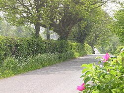
Ram Hill is a small hamlet that has seen considerable land use change over the recent centuries moving from a traditional agricultural landscape to an active coal mining area by the beginning of the nineteenth century. The population would have increased at that time supported by the introduction of
769:
The small scale settlement at Ram Hill and
Henfield is largely well integrated within the framework of hegerow trees and woodland. The area has a generally tranquil character, although the presence of stables and fences associated with the increase in land use change to "horsiculture". modern large
474:
rail line and stands on
British Rail land near the Ha' Penny Bridge. The pit was 558 ft deep and was abandoned around 1860. A number of remains are discernible on the ground including the horse gin, the shaft and the tramway lines finishing at an arch. In 2006 the Ram Hill Colliery site was
667:
Being a small hamlet Ram Hill does not have its own community facilities although the social facilities are available at
Coalpit Heath Cricket Club in Serridge Lane. Social and recreational facilities are provided at Henfield Village Hall, Bitterwell Lake and the Newman Field amenity area in the
433:
Ram Hill is situated near the centre of the North
Bristol Coal Field, this area at one time having been a coal mining community. Coal had been mined in this area since the fourteenth century and most likely even earlier. However it was Sir Samuel Astry, Lord of the Manor of Westerleigh c1680 who
822:
but has relocated to
Serridge Lane where a clubhouse has been created which includes social facilities and a skittle alley. The club is a family orientated club running three Senior sides on Saturdays in the Bristol and District Leagues and a Sunday side in the Village Cricket League.
410:. In time Ram Hill has lost its rural tranquillity and adopted a new role as a commuter satellite to the main urban areas. At the same time the character of the landscape has changed with dairy farming being replaced by new uses in particular "horsiculture".
539:
In the
Railway Act of 1828, parliament granted permission to the Avon and Gloucester Railway Company to build a Dramway (horse-drawn railway) from Ram Hill to the River Avon and this section of the Dramway was completed and in use by July 1832. The
489:
lay beside the
Dramway where it crosses Serridge Lane (previously known as Churchleaze). The mine site was clearly visible in the 1960s but was "tidied up" by a local farmer and now apart from a declivity in the ground no traces of the pit
752:
The area of Ram Hill and
Henfield comprises a largely strong, irregular rural framework with areas of woodland, mixed overgrown/clipped hedgerows supplemented with wire fences, defining regular shaped fields. The
1529:
700:
608:
In the 1st edition (1881) Ordnance Survey Map it shows that the southern branch of the railway line finishes at the New Engine Pit at
Henfield, the centre branch having served
2200:
1455:
1356:
1274:
1160:
1119:
850:
This Scout Hall is located at Serridge Lane, Ram Hill and is run by the Cotswold Edge District Scout Council. Both the Hall and Tullett Field are available for hire.
237:
818:, situated in Serridge Lane (formerly known as Chuchleaze) at Ram Hill, has well over 100 years of history. It was based for many years at the recreation ground at
1573:
1419:
740:
980:
1533:
718:
The hamlet is within an area defined as Green Belt and is located within the Forest of Avon area. There are also Major Recreational Routes in the hamlet.
402:
in the late 1960s began to change the character of the area and the increasing encroachment of night-time lights highlighted the continuing expansion of
712:
831:
434:
started mining on a grander scale and his descendants, or their business partners, continued to be connected with the Coalpit Heath Colliery Company.
826:
The club also provides facilities for young players to learn and play the game of cricket within their Youth section. The club is affiliated to the
199:
49:
1340:
715:
Ram Hill does not have a Defined Settlement Boundary on the Proposals Map and there are no sites allocated for new residential development.
391:
1920s/30s "plotlands" developments along the convergent minor roads. Another addition was the introduction of a caravan site at Greenacres.
791:
589:
Soon after the horse-drawn tramway was in operation pressure built up to convert the line to accommodate steam driven locomotives as the
1959:
1566:
571:
225:
2174:
973:
1699:
271:
1964:
1889:
1689:
910:
544:
was the northern terminus of the Dramway and to the south of Bitterwell Lake there was also a southern spur to New Engine Pit in
261:
1462:
1367:
1285:
1214:
1171:
1130:
1679:
242:
187:
153:
2044:
1739:
1559:
279:
218:
117:
2169:
2119:
2019:
2014:
1954:
1859:
1032:
966:
914:
827:
779:
695:
2079:
2049:
1430:
394:
Ram Hill was peaceful in the 1950s and early 1960s without extensive noise and light pollution. The construction of the
230:
2004:
1929:
1839:
862:– At the old Coalpit Heath Railway Station and associated goods yard sidings a small business park has been created.
2149:
2099:
1734:
1624:
837:
480:
320:
89:
1849:
1774:
1079:
927:
669:
545:
512:
501:
399:
340:
266:
36:
1754:
1719:
167:
1944:
1864:
1819:
879:
612:. In around 1860 a northern branch was constructed near Boxhedge Farm that served the new Frog Lane Pit at
581:
1634:
643:
site in 1898 and a deep railway cutting was created immediately north of the former mine. To the west the
511:
and Churchleaze pits on Ram Hill joined together with those of the Serridge Engine and New Engine pits in
631:. This involved the construction of about 33 miles of new track, part of which skirted Ram Hill and
2154:
1914:
1854:
1583:
636:
620:
590:
368:
343:
immediately to the south. In the Mudge Map 1815, Ram Hill was known as Nutridge Hill, and was linked to
324:
107:
761:
758:
landscape. Large modern agricultural sheds are prominent within older farm complexes within this area.
1395:
500:
For the nearby Serridge Engine Pit, Orchard (or Middle Wimsey) Pit, No. 11 Pit and New Engine Pit see
1809:
99:
585:
The site of Coalpit Heath Railway Station and goods yard sidings now part of Ram Hill Business Park
1799:
1709:
1002:
143:
135:
452:
627:
in 1886. The new route was established in 1903 with the building of what is often known as the
1984:
1669:
1336:
935:
765:
The small scale settlement of Ram Hill – well integrated within the framework of hegerow trees
754:
640:
609:
541:
508:
466:
445:
427:
363:
1899:
1844:
1684:
898:
802:
616:. This line remained operational for almost 90 years until the closure of the mine in 1949.
476:
192:
659:
350:
1724:
947:
602:
437:
Within Ram Hill itself there were four mines operational in the early nineteenth century:
328:
125:
70:
2139:
1396:"South Gloucestershire Council – South Gloucestershire Local Plan (2006) – Proposals Map"
375:
and the railway sidings at Coalpit Heath Railway Station would also have had an impact.
1994:
1919:
1904:
1779:
1769:
1674:
1599:
931:
564:
1198:
Kingswood Coal Part 2, in the magazine of Bristol Industrial Archaeology Society Vol 5
531:
378:
2194:
2124:
2084:
1979:
1939:
1784:
1694:
1654:
1644:
1007:
958:
939:
819:
632:
624:
613:
552:
387:
332:
2059:
2029:
1924:
1909:
1084:
906:
316:
81:
1551:
1275:"The Dramway – The old horse drawn railway path from Coalpit Heath to Willsbridge"
1242:
1161:"The Dramway – The old horse drawn railway path from Coalpit Heath to Willsbridge"
731:
683:
423:
2164:
2144:
2089:
2064:
2039:
1974:
1949:
1884:
1834:
1814:
1704:
1604:
1074:
1054:
648:
471:
395:
372:
344:
336:
523:
2104:
1894:
1879:
1874:
1649:
1487:
943:
815:
598:
551:
This early tramway scheme was designed to provide transport from the mines of
294:
281:
2114:
2109:
2094:
2074:
1764:
1664:
177:
507:
The underground map of around 1850 shows that the underground roads of the
691:
The two tiers of local government responsible for administering Ram Hill:
647:
was opened and goods yard sidings established. The station fell victim to
2054:
2009:
1999:
1969:
1934:
1824:
1804:
1789:
1749:
1729:
1659:
1629:
1609:
1508:
1215:"Scheduled Ancient Monument Notification – Ram Hill Colliery and Dramway"
872:
556:
1310:
2159:
2134:
2024:
1989:
1744:
594:
560:
527:
Site of the Dramway at Ram Hill, next to the Coalpit Heath Cricket Club
403:
159:
2129:
2069:
1829:
1794:
1759:
1714:
1639:
1619:
458:(with the Dramway which ran along the boundary on the left-hand side)
444:
was an older pit that lay 300 yards downhill to the west of the
30:
1869:
1594:
836:
801:
760:
730:
682:
658:
580:
530:
522:
451:
422:
377:
349:
2179:
1614:
1012:
902:
407:
1555:
962:
778:
One area of Broadleaved Woodland at Ram Hill is identified by
359:
new miner's cottages by the Coalpit Heath Colliery Company.
880:
The Ridings Federation Winterbourne International Academy
942:
and more recently has been Head of Youth Development at
741:
South Gloucestershire Landscape Character Assessment SPD
675:
The hamlet is well served with footpaths and cycleways.
382:
The growing influence of "horsiculture" on the landscape
1357:"Ram Hill Colliery – Site Report and Conservation Plan"
1120:"Ram Hill Colliery – Site Report and Conservation Plan"
496:
lay to the south of Pit No. 1, adjoining Henfield Road.
1420:"South Gloucestershire Landscape Character Assessment"
743:
the hamlet of Ram Hill is within an area defined as:
593:(GWR) were keen to build a 7 ft gauge line from
236:
224:
212:
198:
186:
176:
166:
152:
134:
116:
98:
80:
23:
875:, a primary school catering for pupils aged 5–11.
1509:"The Manor C of E Primary School, Coalpit Heath"
1390:
1388:
1333:GWR The Badminton Line – A portrait of a railway
873:The Manor C of E Primary School, Coalpit Heath
354:Pennant sandstone miners' cottages on Ram Hill
1567:
974:
782:as a Site of Nature Conservation Importance:
347:by Broad Lane and to Mays Hill by Frog Lane.
8:
1311:"South Gloucestershire Mines Research Group"
1269:
1267:
1265:
1263:
1209:
1207:
1155:
1153:
1151:
1114:
1112:
1110:
1108:
623:was re-routed following the opening of the
2201:Villages in South Gloucestershire District
1574:
1560:
1552:
981:
967:
959:
832:Bristol & District Cricket Association
20:
1331:Kevin Robertson and David Abbott (1988).
1104:
890:Ram Hill is served by one bus service:
207:
175:
151:
27:
327:district, in the ceremonial county of
651:'s cuts and was closed in the 1960s.
235:
223:
211:
197:
185:
165:
133:
115:
97:
7:
1247:Winterbourne – South Gloucestershire
998:
792:Sites of Special Scientific Interest
386:The closure of the Frog Lane Pit at
572:Bristol and Gloucestershire Railway
990:Neighbouring villages, and hamlets
834:and Bristol Youth Cricket League.
747:Westerleigh Vale and Oldland Ridge
14:
331:, England. It is located between
1063:
1046:
1038:
1021:
946:and holds a similar position at
713:South Gloucestershire Local Plan
605:in 1845 rather than to the GWR.
56:
55:
48:
29:
1456:"South Gloucestershire Council"
735:Bluebells at Martin Croft Brake
470:site lies beside the London to
371:direct route from Badminton to
555:to the wharves on the Avon at
456:Site of Churchleaze No. 1 Pit
1:
1427:South Gloucestershire Council
1364:South Gloucestershire Council
1127:South Gloucestershire Council
1064:
1022:
930:– who was chief executive of
915:South Gloucestershire Council
828:Gloucestershire Cricket Board
780:South Gloucestershire Council
696:South Gloucestershire Council
645:Coalpit Heath Railway Station
321:Westerleigh and Coalpit Heath
90:Westerleigh and Coalpit Heath
1488:"Coalpit Heath Cricket Club"
1243:"The Ram Hill Colliery site"
1047:
1039:
1530:"South Gloucestershire 686"
1196:Southway, MJH, ed. (1971).
18:Human settlement in England
2217:
816:Coalpit Heath Cricket Club
811:Coalpit Heath Cricket Club
806:Coalpit Heath Cricket Club
701:Westerleigh Parish Council
639:purchased the land at the
569:
481:Scheduled Ancient Monument
339:and adjoins the hamlet of
1590:
1335:. Sutton Publishing Ltd.
996:
663:Cycle route at Broad Lane
428:Site of Ram Hill Colliery
252:
248:
208:
43:
35:Ram Hill looking towards
28:
871:The hamlet is served by
922:Notable former resident
878:Older children attend
860:Ram Hill Business Park
842:
807:
766:
736:
688:
664:
586:
536:
528:
461:
430:
414:Industrial archaeology
383:
355:
188:Postcode district
118:Ceremonial county
100:Unitary authority
1915:Littleton-upon-Severn
1584:South Gloucestershire
840:
805:
764:
734:
686:
662:
637:Great Western Railway
621:South Wales Main Line
591:Great Western Railway
584:
535:Dramway Footpath Sign
534:
526:
494:Churchleaze No. 2 Pit
487:Churchleaze No. 1 Pit
455:
426:
381:
369:Great Western Railway
353:
325:South Gloucestershire
108:South Gloucestershire
1373:on 27 September 2011
1136:on 27 September 2011
798:Sport and Recreation
755:clustered settlement
668:adjoining hamlet of
655:Community facilities
559:which supplied both
168:Sovereign state
794:within the hamlet.
442:Ram Hill Engine Pit
315:is a hamlet in the
291: /
1800:Frampton Cotterell
1710:Compton Greenfield
1003:Frampton Cotterell
843:
808:
786:Martin Croft Brake
767:
737:
689:
687:Avon Cycleway sign
665:
587:
537:
529:
462:
431:
384:
356:
200:Dialling code
2188:
2187:
2175:Winterbourne Down
1985:Oldbury-on-Severn
1810:Gaunt's Earthcott
1342:978-0-86299-459-4
1095:
1094:
1090:
1089:
936:Norwich City F.C.
641:Ram Hill Colliery
610:Ram Hill Colliery
542:Ram Hill Colliery
509:Ram Hill Colliery
467:Ram Hill Colliery
446:Ram Hill Colliery
364:Ram Hill Colliery
310:
309:
219:Avon and Somerset
2208:
1900:Little Badminton
1845:Hawkesbury Upton
1685:Chipping Sodbury
1576:
1569:
1562:
1553:
1546:
1545:
1543:
1541:
1532:. Archived from
1526:
1520:
1519:
1517:
1515:
1505:
1499:
1498:
1496:
1494:
1484:
1478:
1477:
1475:
1473:
1468:on 18 March 2012
1467:
1461:. Archived from
1460:
1452:
1446:
1445:
1443:
1441:
1435:
1429:. Archived from
1424:
1416:
1410:
1409:
1407:
1405:
1400:
1392:
1383:
1382:
1380:
1378:
1372:
1366:. Archived from
1361:
1353:
1347:
1346:
1328:
1322:
1321:
1319:
1317:
1307:
1301:
1300:
1298:
1296:
1291:on 18 March 2012
1290:
1284:. Archived from
1279:
1271:
1258:
1257:
1255:
1253:
1239:
1233:
1232:
1230:
1228:
1222:English Heritage
1219:
1211:
1202:
1201:
1193:
1187:
1186:
1184:
1182:
1177:on 18 March 2012
1176:
1170:. Archived from
1165:
1157:
1146:
1145:
1143:
1141:
1135:
1129:. Archived from
1124:
1116:
1067:
1066:
1050:
1049:
1042:
1041:
1025:
1024:
999:
983:
976:
969:
960:
899:Chipping Sodbury
477:English Heritage
398:to the south of
306:
305:
303:
302:
301:
296:
292:
289:
288:
287:
284:
258:
162:
69:Location within
59:
58:
52:
33:
21:
2216:
2215:
2211:
2210:
2209:
2207:
2206:
2205:
2191:
2190:
2189:
2184:
1725:Cribbs Causeway
1586:
1580:
1550:
1549:
1539:
1537:
1536:on 18 July 2011
1528:
1527:
1523:
1513:
1511:
1507:
1506:
1502:
1492:
1490:
1486:
1485:
1481:
1471:
1469:
1465:
1458:
1454:
1453:
1449:
1439:
1437:
1436:on 19 July 2011
1433:
1422:
1418:
1417:
1413:
1403:
1401:
1398:
1394:
1393:
1386:
1376:
1374:
1370:
1359:
1355:
1354:
1350:
1343:
1330:
1329:
1325:
1315:
1313:
1309:
1308:
1304:
1294:
1292:
1288:
1277:
1273:
1272:
1261:
1251:
1249:
1241:
1240:
1236:
1226:
1224:
1217:
1213:
1212:
1205:
1195:
1194:
1190:
1180:
1178:
1174:
1163:
1159:
1158:
1149:
1139:
1137:
1133:
1122:
1118:
1117:
1106:
1101:
1096:
1091:
1051:
992:
987:
957:
948:Plymouth Argyle
924:
888:
869:
856:
848:
813:
800:
776:
729:
724:
711:In the adopted
709:
681:
657:
603:Midland Railway
579:
574:
521:
421:
416:
362:The closure of
329:Gloucestershire
299:
297:
295:51.52°N 02.46°W
293:
290:
285:
282:
280:
278:
277:
276:
272:Gloucestershire
256:
158:
148:
130:
126:Gloucestershire
112:
94:
76:
75:
74:
73:
71:Gloucestershire
67:
66:
65:
64:
60:
39:
19:
12:
11:
5:
2214:
2212:
2204:
2203:
2193:
2192:
2186:
2185:
2183:
2182:
2177:
2172:
2167:
2162:
2157:
2152:
2147:
2142:
2137:
2132:
2127:
2122:
2117:
2112:
2107:
2102:
2097:
2092:
2087:
2082:
2077:
2072:
2067:
2062:
2057:
2052:
2047:
2042:
2037:
2032:
2027:
2022:
2017:
2012:
2007:
2002:
1997:
1995:Oldland Common
1992:
1987:
1982:
1977:
1972:
1967:
1962:
1957:
1952:
1947:
1942:
1937:
1932:
1927:
1922:
1920:Longwell Green
1917:
1912:
1907:
1905:Little Sodbury
1902:
1897:
1892:
1887:
1882:
1877:
1872:
1867:
1862:
1857:
1852:
1847:
1842:
1837:
1832:
1827:
1822:
1817:
1812:
1807:
1802:
1797:
1792:
1787:
1782:
1780:Emersons Green
1777:
1772:
1770:Easter Compton
1767:
1762:
1757:
1752:
1747:
1742:
1737:
1732:
1727:
1722:
1717:
1712:
1707:
1702:
1697:
1692:
1687:
1682:
1677:
1675:Charlton Hayes
1672:
1667:
1662:
1657:
1652:
1647:
1642:
1637:
1632:
1627:
1622:
1617:
1612:
1607:
1602:
1600:Acton Turville
1597:
1591:
1588:
1587:
1581:
1579:
1578:
1571:
1564:
1556:
1548:
1547:
1521:
1500:
1479:
1447:
1411:
1384:
1348:
1341:
1323:
1302:
1259:
1234:
1203:
1200:. p. 115.
1188:
1147:
1103:
1102:
1100:
1097:
1093:
1092:
1088:
1087:
1082:
1077:
1071:
1070:
1068:
1061:
1058:
1057:
1052:
1037:
1035:
1029:
1028:
1026:
1019:
1016:
1015:
1010:
1005:
997:
994:
993:
988:
986:
985:
978:
971:
963:
956:
953:
952:
951:
932:Bristol Rovers
928:Gordon Bennett
923:
920:
919:
918:
913:(supported by
905:– Ram Hill –
887:
884:
868:
865:
864:
863:
855:
852:
847:
844:
812:
809:
799:
796:
788:
787:
775:
772:
728:
725:
723:
720:
708:
705:
704:
703:
698:
680:
677:
656:
653:
629:Badminton Line
578:
575:
570:Main article:
520:
517:
498:
497:
491:
484:
475:designated by
450:
449:
420:
417:
415:
412:
308:
307:
275:
274:
269:
264:
259:
257:List of places
253:
250:
249:
246:
245:
240:
234:
233:
228:
222:
221:
216:
210:
209:
206:
205:
202:
196:
195:
190:
184:
183:
180:
174:
173:
172:United Kingdom
170:
164:
163:
156:
150:
149:
147:
146:
140:
138:
132:
131:
129:
128:
122:
120:
114:
113:
111:
110:
104:
102:
96:
95:
93:
92:
86:
84:
78:
77:
68:
62:
61:
54:
53:
47:
46:
45:
44:
41:
40:
34:
26:
25:
17:
13:
10:
9:
6:
4:
3:
2:
2213:
2202:
2199:
2198:
2196:
2181:
2178:
2176:
2173:
2171:
2168:
2166:
2163:
2161:
2158:
2156:
2153:
2151:
2148:
2146:
2143:
2141:
2138:
2136:
2133:
2131:
2128:
2126:
2125:Upton Cheyney
2123:
2121:
2118:
2116:
2113:
2111:
2108:
2106:
2103:
2101:
2098:
2096:
2093:
2091:
2088:
2086:
2085:Stoke Gifford
2083:
2081:
2078:
2076:
2073:
2071:
2068:
2066:
2063:
2061:
2058:
2056:
2053:
2051:
2048:
2046:
2043:
2041:
2038:
2036:
2033:
2031:
2028:
2026:
2023:
2021:
2018:
2016:
2013:
2011:
2008:
2006:
2003:
2001:
1998:
1996:
1993:
1991:
1988:
1986:
1983:
1981:
1980:Oldbury Naite
1978:
1976:
1973:
1971:
1968:
1966:
1963:
1961:
1958:
1956:
1953:
1951:
1948:
1946:
1943:
1941:
1940:Milbury Heath
1938:
1936:
1933:
1931:
1928:
1926:
1923:
1921:
1918:
1916:
1913:
1911:
1908:
1906:
1903:
1901:
1898:
1896:
1893:
1891:
1888:
1886:
1883:
1881:
1878:
1876:
1873:
1871:
1868:
1866:
1863:
1861:
1858:
1856:
1853:
1851:
1848:
1846:
1843:
1841:
1838:
1836:
1833:
1831:
1828:
1826:
1823:
1821:
1818:
1816:
1813:
1811:
1808:
1806:
1803:
1801:
1798:
1796:
1793:
1791:
1788:
1786:
1785:Engine Common
1783:
1781:
1778:
1776:
1773:
1771:
1768:
1766:
1763:
1761:
1758:
1756:
1753:
1751:
1748:
1746:
1743:
1741:
1738:
1736:
1733:
1731:
1728:
1726:
1723:
1721:
1718:
1716:
1713:
1711:
1708:
1706:
1703:
1701:
1698:
1696:
1695:Coalpit Heath
1693:
1691:
1688:
1686:
1683:
1681:
1678:
1676:
1673:
1671:
1668:
1666:
1663:
1661:
1658:
1656:
1655:Cadbury Heath
1653:
1651:
1648:
1646:
1645:Bradley Stoke
1643:
1641:
1638:
1636:
1633:
1631:
1628:
1626:
1623:
1621:
1618:
1616:
1613:
1611:
1608:
1606:
1603:
1601:
1598:
1596:
1593:
1592:
1589:
1585:
1577:
1572:
1570:
1565:
1563:
1558:
1557:
1554:
1535:
1531:
1525:
1522:
1510:
1504:
1501:
1489:
1483:
1480:
1464:
1457:
1451:
1448:
1432:
1428:
1421:
1415:
1412:
1397:
1391:
1389:
1385:
1369:
1365:
1358:
1352:
1349:
1344:
1338:
1334:
1327:
1324:
1312:
1306:
1303:
1287:
1283:
1276:
1270:
1268:
1266:
1264:
1260:
1248:
1244:
1238:
1235:
1223:
1216:
1210:
1208:
1204:
1199:
1192:
1189:
1173:
1169:
1162:
1156:
1154:
1152:
1148:
1132:
1128:
1121:
1115:
1113:
1111:
1109:
1105:
1098:
1086:
1083:
1081:
1078:
1076:
1073:
1072:
1069:
1062:
1060:
1059:
1056:
1053:
1045:
1036:
1034:
1031:
1030:
1027:
1020:
1018:
1017:
1014:
1011:
1009:
1008:Coalpit Heath
1006:
1004:
1001:
1000:
995:
991:
984:
979:
977:
972:
970:
965:
964:
961:
955:Location grid
954:
949:
945:
941:
940:Aberdeen F.C.
937:
933:
929:
926:
925:
921:
916:
912:
908:
904:
900:
896:
893:
892:
891:
885:
883:
881:
876:
874:
866:
861:
858:
857:
853:
851:
846:Mafeking Hall
845:
841:Mafeking Hall
839:
835:
833:
829:
824:
821:
820:Coalpit Heath
817:
810:
804:
797:
795:
793:
790:There are no
785:
784:
783:
781:
773:
771:
763:
759:
756:
750:
748:
744:
742:
733:
726:
721:
719:
716:
714:
706:
702:
699:
697:
694:
693:
692:
685:
678:
676:
673:
671:
661:
654:
652:
650:
646:
642:
638:
634:
633:Coalpit Heath
630:
626:
625:Severn Tunnel
622:
617:
615:
614:Coalpit Heath
611:
606:
604:
600:
596:
592:
583:
576:
573:
568:
566:
562:
558:
554:
553:Coalpit Heath
549:
547:
543:
533:
525:
518:
516:
514:
510:
505:
503:
495:
492:
488:
485:
482:
478:
473:
469:
468:
464:
463:
459:
454:
447:
443:
440:
439:
438:
435:
429:
425:
418:
413:
411:
409:
405:
401:
397:
392:
389:
388:Coalpit Heath
380:
376:
374:
370:
365:
360:
352:
348:
346:
342:
338:
334:
333:Coalpit Heath
330:
326:
322:
318:
314:
304:
300:51.52; -02.46
273:
270:
268:
265:
263:
260:
255:
254:
251:
247:
244:
243:South Western
241:
239:
232:
229:
227:
220:
217:
215:
203:
201:
194:
191:
189:
181:
179:
171:
169:
161:
157:
155:
145:
142:
141:
139:
137:
127:
124:
123:
121:
119:
109:
106:
105:
103:
101:
91:
88:
87:
85:
83:
79:
72:
51:
42:
38:
32:
22:
16:
2170:Winterbourne
2140:Watley's End
2120:Tytherington
2060:Severn Beach
2034:
2030:Pucklechurch
2020:Petty France
2015:Pennsylvania
1960:North Common
1925:Mangotsfield
1910:Little Stoke
1538:. Retrieved
1534:the original
1524:
1512:. Retrieved
1503:
1491:. Retrieved
1482:
1470:. Retrieved
1463:the original
1450:
1438:. Retrieved
1431:the original
1426:
1414:
1402:. Retrieved
1375:. Retrieved
1368:the original
1363:
1351:
1332:
1326:
1314:. Retrieved
1305:
1293:. Retrieved
1286:the original
1281:
1250:. Retrieved
1246:
1237:
1225:. Retrieved
1221:
1197:
1191:
1179:. Retrieved
1172:the original
1167:
1138:. Retrieved
1131:the original
1126:
1085:Pucklechurch
1043:
1033:Winterbourne
989:
907:Mangotsfield
894:
889:
877:
870:
859:
849:
825:
814:
789:
777:
774:Biodiversity
768:
751:
746:
745:
738:
717:
710:
690:
674:
666:
644:
628:
618:
607:
588:
550:
538:
506:
499:
493:
486:
465:
457:
441:
436:
432:
393:
385:
361:
357:
317:civil parish
312:
311:
82:Civil parish
15:
2165:Willsbridge
2145:Westerleigh
2090:Stoke Lodge
2080:Staple Hill
2065:Shepperdine
2050:Rockhampton
2040:Rangeworthy
1975:Old Sodbury
1950:New Passage
1885:Kendleshire
1835:Harry Stoke
1815:Great Stoke
1705:Cold Ashton
1605:Almondsbury
1404:27 February
1282:Ross Barber
1168:Ross Barber
1075:Kendleshire
1055:Westerleigh
739:Within the
722:Environment
649:Dr Beeching
472:South Wales
396:M4 Motorway
373:South Wales
345:Westerleigh
337:Westerleigh
298: /
2105:Tockington
1930:Marshfield
1895:Latteridge
1880:Itchington
1875:Iron Acton
1840:Hawkesbury
1700:Codrington
1650:Bridgeyate
1582:Places in
1099:References
944:Stoke City
679:Governance
599:Gloucester
419:Coal mines
144:South West
2150:Whitfield
2115:Tortworth
2110:Tormarton
2100:Thornbury
2095:Swineford
2075:Soundwell
1965:Northwick
1890:Kingswood
1765:Earthcott
1735:Dodington
1690:Churchend
1665:Charfield
1625:Badminton
911:Kingswood
886:Transport
867:Education
727:Landscape
323:, in the
238:Ambulance
178:Post town
2195:Category
2055:Rudgeway
2035:Ram Hill
2010:Patchway
2000:Olveston
1970:Old Down
1935:Mayshill
1850:Henfield
1825:Hambrook
1805:Frenchay
1790:Falfield
1775:Elberton
1750:Duckhole
1730:Cromhall
1680:Cheswick
1670:Charlton
1660:Catbrain
1630:Bagstone
1610:Alveston
1493:11 March
1377:11 March
1252:11 March
1227:11 March
1181:11 March
1080:Henfield
1044:Ram Hill
707:Planning
670:Henfield
577:Railways
557:Keynsham
546:Henfield
513:Henfield
502:Henfield
400:Henfield
341:Henfield
313:Ram Hill
63:Ram Hill
37:Henfield
24:Ram Hill
2160:Wickwar
2135:Warmley
2045:Redwick
2025:Pilning
1990:Oldland
1755:Dunkirk
1745:Doynton
1740:Downend
1720:Cowhill
1540:8 March
1514:9 March
1472:8 March
1440:9 March
1316:8 March
1295:8 March
1140:8 March
854:Economy
595:Bristol
561:Bristol
519:Dramway
490:remain.
404:Bristol
283:51°31′N
267:England
182:Bristol
160:England
154:Country
2130:Wapley
2070:Siston
1955:Nibley
1945:Morton
1865:Horton
1860:Hinton
1830:Hanham
1820:Hallen
1795:Filton
1760:Dyrham
1715:Conham
1640:Bitton
1620:Awkley
1339:
635:. The
286:2°28′W
214:Police
136:Region
1870:Ingst
1635:Beach
1595:Abson
1466:(PDF)
1459:(PDF)
1434:(PDF)
1423:(PDF)
1399:(PDF)
1371:(PDF)
1360:(PDF)
1289:(PDF)
1278:(PDF)
1218:(PDF)
1175:(PDF)
1164:(PDF)
1134:(PDF)
1123:(PDF)
479:as a
204:01454
2180:Yate
2155:Wick
2005:Over
1855:Hill
1615:Aust
1542:2011
1516:2011
1495:2011
1474:2011
1442:2011
1406:2011
1379:2011
1337:ISBN
1318:2011
1297:2011
1254:2011
1229:2011
1183:2011
1142:2011
1013:Yate
938:and
903:Yate
619:The
565:Bath
563:and
408:Yate
406:and
335:and
231:Avon
226:Fire
193:BS36
895:686
597:to
319:of
2197::
1425:.
1387:^
1362:.
1280:.
1262:^
1245:.
1220:.
1206:^
1166:.
1150:^
1125:.
1107:^
934:,
909:–
901:–
897::
882:.
830:,
672:.
548:.
515:.
504:.
262:UK
1575:e
1568:t
1561:v
1544:.
1518:.
1497:.
1476:.
1444:.
1408:.
1381:.
1345:.
1320:.
1299:.
1256:.
1231:.
1185:.
1144:.
982:e
975:t
968:v
950:.
917:)
483:.
460:.
Text is available under the Creative Commons Attribution-ShareAlike License. Additional terms may apply.