61:
448:
73:
371:
281:
439:. The name comes from the narrowest point of the estuary at Finnebrogue, where a ford and ferry existed before the construction of the bridge. Harris, in 1744, mistakenly writes that the name of the bridge should be Coyne (after the branch of Loch Cuan up stream) not Coyle because he overlooked the origin.
524:. However, the tides of Strangford Lough made time-keeping difficult and there was insufficient low-volume, high-value trade suitable for a steam-boat route. The company folded in 1839 and their ship was sold off.
547:
Following the building of the tidal barrier in 1957, the Quoile
Pondage evolved into a freshwater marsh. A footpath runs along the bank from the old floodgates to the remains of the stream-boat quay.
539:, provided a regular cargo service from the Quoile to northern English ports for 17 years from 1866. The main export was agricultural produce and coal the main import.
435:
landlord of
Downpatrick built a tidal barrier at the Quoile and began draining the land, creating 500 acres of land from what was previously the western branch of
708:
21:
486:
led by Sitric, King of the Danes, who came up the Quoile with a fleet from the sea. The
Vikings plundered the settlement again in 1149.
588:
418:
328:
432:
701:
1183:
396:
306:
392:
302:
969:
381:
291:
1057:
694:
400:
385:
310:
295:
60:
1042:
726:
556:
342:
447:
72:
1124:
1104:
1099:
513:
In
September 1837, the County Down and Liverpool Steam-Boat Company commenced regular sailings of their
1188:
804:
672:
1164:
864:
840:
954:
497:
is situated 1.5 miles (2.4 km) from
Downpatrick, just off the main road from Downpatrick to
1005:
799:
717:
584:
1160:
915:
823:
812:
436:
354:
264:
228:
192:
139:
78:
673:"Quoile Pondage Nature Reserve | Department of Agriculture, Environment and Rural Affairs"
341:
The river begins its life as the
Ballynahinch River which flows from west of the town of
455:
On the north bank of the river, 0.75 miles (1.2 km) north-west of
Downpatrick, the
997:
634:
McCaughan, Michael (2009). "The County Down and
Liverpool Steam-Boat Company 1836-39".
460:
346:
252:
129:
112:
90:
1177:
1134:
1091:
1072:
891:
755:
653:
McCaughan, Michael (2011). "Enterprise and
Tribulations of a County Down Shipowner".
532:
494:
1139:
1129:
1119:
1109:
1077:
1020:
1010:
974:
949:
930:
920:
910:
879:
874:
859:
854:
818:
514:
1052:
1047:
1037:
1015:
964:
925:
897:
886:
869:
848:
835:
794:
789:
762:
536:
502:
370:
350:
280:
260:
205:
187:
149:
1144:
1114:
1067:
1032:
1026:
984:
979:
941:
830:
748:
741:
498:
456:
36:
23:
1087:
1062:
959:
781:
769:
521:
468:
483:
482:), was in existence by the year 800. In 1002 it was plundered by the
686:
471:
446:
690:
364:
274:
240:
583:. Belfast: Institute of Irish Studies, QUB. pp. 85–88.
619:
Department of the
Environment for Northern Ireland (1983).
349:. This then becomes the Quoile proper, which flows through
501:, on the east bank of the river. It is a 16th-century
237:
234:
353:
and the Quoile Pondage before finally emptying into
243:
1086:
995:
939:
779:
733:
606:
An Account of the Ancient Monuments in State Charge
231:
211:
198:
186:
172:
164:
155:
145:
135:
125:
120:
100:
86:
53:
1159:indicate rivers which are partially or wholly in
702:
8:
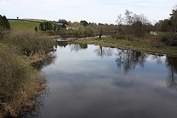
65:River Quoile, from Quoile Bridge, April 2010
505:which was inhabited into the 18th century.
399:. Unsourced material may be challenged and
309:. Unsourced material may be challenged and
104:
709:
695:
687:
71:
419:Learn how and when to remove this message
329:Learn how and when to remove this message
604:Government of Northern Ireland (1947).
568:
451:River Quoile and Inch Abbey, March 2010
431:The river was effectively created when
621:Historic Monuments of Northern Ireland
81:; River Quoile is visible to its south
50:
16:River in County Down, Northern Ireland
345:to Annacloy where it is known as the
7:
1163:, with the rest being wholly in the
574:
572:
397:adding citations to reliable sources
307:adding citations to reliable sources
474:monastic settlement here, known as
459:site was originally on an island (
259: 'the narrow') is a river in
14:
520:between a quay on the Quoile and
467:) in the Quoile Marshes. The pre-
608:. Belfast: HMSO. pp. 26–27.
369:
279:
227:
59:
1:
623:. Belfast: HMSO. p. 107.
543:Quoile Pondage Nature Reserve
156:Physical characteristics
433:Edward Southwell (1705–1755)
215:27.5 mi (44.3 km)
200: • location
174: • location
1205:
1153:
724:
557:List of rivers of Ireland
182:
160:
70:
58:
535:, built in 1857 on the
464:
452:
105:
1184:Rivers of County Down
579:Donnelly, CJ (1997).
450:
393:improve this section
303:improve this section
37:54.37000°N 5.67722°W
1165:Republic of Ireland
679:. 12 November 2015.
527:The iron steamship
136:Constituent country
33: /
453:
178:Ballynahinch River
42:54.37000; -5.67722
1171:
1170:
970:The Three Sisters
718:Rivers of Ireland
429:
428:
421:
339:
338:
331:
219:
218:
1196:
1161:Northern Ireland
916:Shanganagh River
711:
704:
697:
688:
681:
680:
669:
663:
662:
650:
644:
643:
631:
625:
624:
616:
610:
609:
601:
595:
594:
576:
476:Inis Cumhscraigh
437:Strangford Lough
424:
417:
413:
410:
404:
373:
365:
355:Strangford Lough
334:
327:
323:
320:
314:
283:
275:
265:Northern Ireland
250:
249:
246:
245:
242:
239:
236:
233:
193:Strangford Lough
175:
140:Northern Ireland
116:
108:
79:Strangford Lough
75:
63:
51:
48:
47:
45:
44:
43:
38:
34:
31:
30:
29:
26:
1204:
1203:
1199:
1198:
1197:
1195:
1194:
1193:
1174:
1173:
1172:
1167:
1155:River names in
1149:
1082:
996:Flowing to the
991:
940:Flowing to the
935:
780:Flowing to the
775:
729:
720:
715:
685:
684:
671:
670:
666:
652:
651:
647:
633:
632:
628:
618:
617:
613:
603:
602:
598:
591:
578:
577:
570:
565:
553:
545:
511:
509:Steam-Boat Quay
492:
445:
425:
414:
408:
405:
390:
374:
363:
335:
324:
318:
315:
300:
284:
273:
230:
226:
201:
173:
110:
82:
66:
41:
39:
35:
32:
27:
24:
22:
20:
19:
17:
12:
11:
5:
1202:
1200:
1192:
1191:
1186:
1176:
1175:
1169:
1168:
1154:
1151:
1150:
1148:
1147:
1142:
1137:
1132:
1127:
1122:
1117:
1112:
1107:
1102:
1096:
1094:
1084:
1083:
1081:
1080:
1075:
1070:
1065:
1060:
1055:
1050:
1045:
1040:
1035:
1030:
1023:
1018:
1013:
1008:
1002:
1000:
993:
992:
990:
989:
988:
987:
982:
977:
967:
962:
957:
952:
946:
944:
937:
936:
934:
933:
928:
923:
918:
913:
908:
901:
894:
889:
884:
883:
882:
877:
872:
867:
862:
852:
845:
844:
843:
833:
828:
827:
826:
816:
809:
808:
807:
797:
792:
786:
784:
777:
776:
774:
773:
766:
759:
752:
745:
737:
735:
731:
730:
725:
722:
721:
716:
714:
713:
706:
699:
691:
683:
682:
664:
645:
626:
611:
596:
589:
567:
566:
564:
561:
560:
559:
552:
549:
544:
541:
510:
507:
491:
488:
480:Inis Cuscraidh
444:
441:
427:
426:
377:
375:
368:
362:
359:
347:Annacloy River
337:
336:
287:
285:
278:
272:
269:
217:
216:
213:
209:
208:
202:
199:
196:
195:
190:
184:
183:
180:
179:
176:
170:
169:
166:
162:
161:
158:
157:
153:
152:
147:
143:
142:
137:
133:
132:
130:United Kingdom
127:
123:
122:
118:
117:
102:
98:
97:
88:
84:
83:
76:
68:
67:
64:
56:
55:
15:
13:
10:
9:
6:
4:
3:
2:
1201:
1190:
1187:
1185:
1182:
1181:
1179:
1166:
1162:
1158:
1152:
1146:
1143:
1141:
1138:
1136:
1135:Mulkear River
1133:
1131:
1128:
1126:
1123:
1121:
1118:
1116:
1113:
1111:
1108:
1106:
1103:
1101:
1098:
1097:
1095:
1093:
1089:
1085:
1079:
1076:
1074:
1071:
1069:
1066:
1064:
1061:
1059:
1056:
1054:
1051:
1049:
1046:
1044:
1041:
1039:
1036:
1034:
1031:
1029:
1028:
1024:
1022:
1019:
1017:
1014:
1012:
1009:
1007:
1004:
1003:
1001:
999:
994:
986:
983:
981:
978:
976:
973:
972:
971:
968:
966:
963:
961:
958:
956:
953:
951:
948:
947:
945:
943:
938:
932:
929:
927:
924:
922:
919:
917:
914:
912:
909:
907:
906:
902:
900:
899:
895:
893:
890:
888:
885:
881:
878:
876:
873:
871:
868:
866:
863:
861:
858:
857:
856:
853:
851:
850:
846:
842:
839:
838:
837:
834:
832:
829:
825:
822:
821:
820:
817:
815:
814:
810:
806:
803:
802:
801:
798:
796:
793:
791:
788:
787:
785:
783:
778:
772:
771:
767:
765:
764:
760:
758:
757:
753:
751:
750:
746:
744:
743:
739:
738:
736:
734:Flowing north
732:
728:
723:
719:
712:
707:
705:
700:
698:
693:
692:
689:
678:
674:
668:
665:
660:
656:
655:Lecale Review
649:
646:
641:
637:
636:Lecale Review
630:
627:
622:
615:
612:
607:
600:
597:
592:
590:9780853894759
586:
582:
581:Living Places
575:
573:
569:
562:
558:
555:
554:
550:
548:
542:
540:
538:
534:
530:
525:
523:
519:
516:
508:
506:
504:
500:
496:
495:Quoile Castle
490:Quoile Castle
489:
487:
485:
481:
477:
473:
470:
466:
462:
458:
449:
442:
440:
438:
434:
423:
420:
412:
402:
398:
394:
388:
387:
383:
378:This section
376:
372:
367:
366:
360:
358:
356:
352:
348:
344:
333:
330:
322:
312:
308:
304:
298:
297:
293:
288:This section
286:
282:
277:
276:
270:
268:
266:
262:
258:
254:
248:
224:
214:
210:
207:
203:
197:
194:
191:
189:
185:
181:
177:
171:
167:
163:
159:
154:
151:
148:
144:
141:
138:
134:
131:
128:
124:
119:
114:
107:
103:
99:
95:
92:
89:
85:
80:
74:
69:
62:
57:
52:
49:
46:
1156:
1140:Nenagh River
1025:
904:
903:
896:
847:
811:
768:
761:
754:
747:
740:
676:
667:
658:
654:
648:
639:
635:
629:
620:
614:
605:
599:
580:
546:
529:Robert Burns
528:
526:
517:
515:steam packet
512:
493:
479:
475:
454:
430:
415:
409:October 2022
406:
391:Please help
379:
343:Ballynahinch
340:
325:
319:October 2022
316:
301:Please help
289:
256:
222:
220:
93:
54:River Quoile
18:
1189:Downpatrick
1105:Boyle River
1100:Abbey River
1088:Tributaries
1006:Ballisodare
800:Broadmeadow
503:Tower house
351:Downpatrick
261:County Down
251:; from
206:Downpatrick
101:Native name
40: /
1178:Categories
955:Blackwater
942:Celtic Sea
824:Glencullen
813:Castletown
563:References
533:gross tons
499:Strangford
457:Inch Abbey
443:Inch Abbey
96:, "narrow"
25:54°22′12″N
782:Irish Sea
522:Liverpool
380:does not
290:does not
204:North of
87:Etymology
28:5°40′38″W
998:Atlantic
551:See also
518:Victoria
121:Location
1157:italics
1092:Shannon
1090:of the
1073:Shannon
892:Naniken
756:Faughan
484:Vikings
401:removed
386:sources
361:History
311:removed
296:sources
257:An Caol
126:Country
106:An Caol
77:Map of
1130:Maigue
1120:Fergus
1110:Brosna
1078:Swilly
1021:Corrib
1011:Caragh
975:Barrow
950:Bandon
931:Vartry
921:Slaney
911:Santry
905:Quoile
880:Dodder
875:Poddle
860:Morell
855:Liffey
819:Dargle
587:
531:, 120
472:Celtic
469:Norman
271:Course
223:Quoile
212:Length
168:
165:Source
146:County
109:
1058:Maine
1053:Ferta
1048:Laune
1038:Feale
1016:Clare
965:Mahon
926:Tolka
898:Newry
887:Mayne
870:Camac
849:Lagan
836:Glyde
795:Boyne
790:Avoca
763:Foyle
677:DAERA
537:Clyde
461:Irish
255:
253:Irish
188:Mouth
113:Irish
91:Irish
1145:Suck
1125:Inny
1115:Deel
1068:Robe
1043:Inny
1033:Eske
1027:Erne
985:Suir
980:Nore
831:Fane
805:Ward
749:Bush
742:Bann
727:List
585:ISBN
478:(or
465:Inis
384:any
382:cite
294:any
292:cite
221:The
150:Down
94:caol
1063:Moy
960:Lee
865:Rye
841:Dee
770:Roe
395:by
305:by
1180::
675:.
657:.
638:.
571:^
463::
357:.
267:.
263:,
241:ɔɪ
710:e
703:t
696:v
661:.
659:9
642:.
640:7
593:.
422:)
416:(
411:)
407:(
403:.
389:.
332:)
326:(
321:)
317:(
313:.
299:.
247:/
244:l
238:w
235:k
232:ˈ
229:/
225:(
115:)
111:(
Text is available under the Creative Commons Attribution-ShareAlike License. Additional terms may apply.