29:
159:
115:
108:
221:
It is an important stand of primary coastal forest in
Tanzania, but also contains elements of montane forest, as it reaches 900 metres in altitude. The higher slopes are covered in extensive semi-deciduous hardwood forest, constituting over 18 square km of closed canopy forest. The plateau vegetation
213:, making the plateaus cooler and wetter than the surrounding lowlands. The average annual rainfall is 1088 mm (1951-1979), recorded at the Rondo Forest station. The highest rainfall occurs between November and January, and March to May.
334:
Other forest reserves in the plateau region are Chitoa (770 ha), Litipo (1000 ha), Makangala (1271 ha), Ndimba (2687 ha), and Ruawa (2949 ha). The Noto
Plateau is home to 12,000 ha of dry evergreen forest which has no protected status.
433:
323:
Though a forest reserve since colonial times, much wood was harvested in the 1950s, when some 20 square km of forest was cleared to establish exotic plantations, chiefly pine.
28:
241:), but the forests were heavily logged from the 1950s onwards. Logging stopped in the 1980s, and since then the forests have regrown, and some areas were planted with
158:
201:, and is situated 15 km north of the Masasi road. It was revealed as an important biodiversity site in studies conducted since the 1980s.
107:
64:
389:
Perkin, Andrew; Charles
Leonard and Nike Doggart (2008). "Landscape Profile: Rondo/Noto". Tanzania Forest Conservation Group, July 2008.
163:
418:
189:. A portion of the plateau is protected by the Rondo Forest Reserve. It is one of a group of dissected plateaus lying between the
249:
is still one of the dominant species in the 25 m high canopy within the Rondo Forest
Reserve. Other dominant canopy species are
423:
390:
57:
428:
263:
210:
190:
400:"About Rondo Nature Forest Reserve". Tanzania Forest Services (TFS) Agency. Accessed 24 June 2018.
145:
312:
363:
278:
251:
299:
331:
The Rondo Nature Forest
Reserve covers an area 11,742.26 ha, with a boundary of 51.6 km.
270:
234:
33:
194:
412:
182:
178:
150:
222:
is diverse, with areas of scrub forest, dry evergreen forest, riverine forest,
79:
66:
230:) woodland, and thicket. Some 100 species of plant are endemic to the area.
209:
The plateaus rise behind a narrow coastal plain. They receive considerable
401:
186:
311:
The plateau is home to various species of monkey and small mammals. The
257:
223:
47:
198:
157:
290:
162:
The
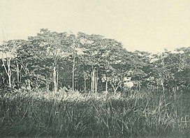
Nigerian brigade halts on the Rondo Plateau, October 1917,
233:
The plateau was once covered by extensive forests of
315:was discovered here in the 1990s by Simon Bearder.
197:rivers. It is approximately 60 km inland from
144:
136:
95:
56:
46:
41:
21:
434:Southern Zanzibar–Inhambane coastal forest mosaic
16:Plateau in Lindi and Mtwara Regions, Tanzania
8:
18:
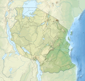
127:Location of the Rondo Plateau in Tanzania
385:
383:
381:
177:, is a high and extensive massif in the
344:
277:The forest reserve also has areas of
114:
7:
358:
356:
354:
352:
350:
348:
14:
113:
106:
27:
285:sp. with small trial plots of
1:
36:on the Rondo Plateau, c.1908
327:Rondo Nature Forest Reserve
450:
52:900 m (3,000 ft)
419:Geography of Lindi Region
100:
26:
264:Ricinodendron heudelotii
211:orographic precipitation
364:"Mtwara: Rondo Plateau"
166:
424:Mountains of Tanzania
161:
173:, also known as the
185:of southeastern of
76: /
429:Plateaus of Africa
313:Rondo dwarf galago
167:
42:Highest point
279:forest plantation
252:Albizia gummifera
237:or African teak (
156:
155:
80:10.150°S 39.250°E
441:
403:
398:
392:
387:
376:
375:
373:
371:
366:. bushroutes.com
360:
300:Maesopsis eminii
117:
116:
110:
91:
90:
88:
87:
86:
81:
77:
74:
73:
72:
69:
31:
19:
449:
448:
444:
443:
442:
440:
439:
438:
409:
408:
407:
406:
399:
395:
388:
379:
369:
367:
362:
361:
346:
341:
329:
321:
309:
295:Tectona grandis
287:Milicia excelsa
271:Dialium holtzii
247:Milicia excelsa
243:Milicia excelsa
239:Milicia excelsa
219:
207:
132:
131:
130:
129:
128:
125:
124:
123:
122:
118:
85:-10.150; 39.250
84:
82:
78:
75:
70:
67:
65:
63:
62:
37:
17:
12:
11:
5:
447:
445:
437:
436:
431:
426:
421:
411:
410:
405:
404:
393:
377:
343:
342:
340:
337:
328:
325:
320:
317:
308:
305:
218:
215:
206:
203:
154:
153:
148:
142:
141:
138:
134:
133:
126:
120:
119:
112:
111:
105:
104:
103:
102:
101:
98:
97:
93:
92:
60:
54:
53:
50:
44:
43:
39:
38:
32:
24:
23:
15:
13:
10:
9:
6:
4:
3:
2:
446:
435:
432:
430:
427:
425:
422:
420:
417:
416:
414:
402:
397:
394:
391:
386:
384:
382:
378:
365:
359:
357:
355:
353:
351:
349:
345:
338:
336:
332:
326:
324:
318:
316:
314:
306:
304:
303:
301:
296:
292:
288:
284:
280:
275:
273:
272:
267:
265:
260:
259:
254:
253:
248:
244:
240:
236:
231:
229:
225:
216:
214:
212:
204:
202:
200:
196:
192:
188:
184:
183:Mtwara Region
181:and northern
180:
176:
175:Muera Plateau
172:
171:Rondo Plateau
165:
160:
152:
149:
147:
143:
139:
135:
121:Rondo Plateau
109:
99:
94:
89:
61:
59:
55:
51:
49:
45:
40:
35:
30:
25:
22:Rondo Plateau
20:
396:
368:. Retrieved
333:
330:
322:
319:Conservation
310:
298:
294:
286:
282:
276:
269:
262:
256:
250:
246:
242:
238:
232:
228:Brachystegia
227:
220:
208:
179:Lindi Region
174:
170:
168:
34:African teak
164:World War I
83: /
58:Coordinates
413:Categories
339:References
281:, mostly
191:Mbwemburu
96:Geography
48:Elevation
195:Lukuledi
187:Tanzania
140:Tanzania
258:Dombeya
205:Climate
137:Country
71:39°15′E
68:10°09′S
370:23 May
297:) and
224:miombo
146:Region
307:Fauna
283:Pinus
261:sp.,
235:Mvule
217:Flora
199:Lindi
151:Lindi
372:2014
291:Teak
268:and
193:and
169:The
415::
380:^
347:^
289:,
274:.
255:,
245:.
374:.
302:.
293:(
266:,
226:(
Text is available under the Creative Commons Attribution-ShareAlike License. Additional terms may apply.