53:
38:
1131:
69:
240:
76:
756:
In the borough the population was spread out, with 20.9% under the age of 18, 14.0% from 18 to 24, 26.7% from 25 to 44, 27.9% from 45 to 64, and 10.5% who were 65 years of age or older. The median age was 36 years. For every 100 females there were 83.0 males. For every 100 females age 18 and over,
752:
living together, 11.1% had a female householder with no husband present, and 27.8% were non-families. 27.8% of all households were made up of individuals, and 16.7% had someone living alone who was 65 years of age or older. The average household size was 2.39 and the average family size was 2.88.
740:
of 2000, there were 86 people, 36 households, and 25 families residing in the borough. The population density was 2,692.7 inhabitants per square mile (1,039.7/km). There were 38 housing units at an average density of 1,189.8 per square mile (459.4/km). The racial makeup of the borough was 97.67%
52:
1169:
760:
The median income for a household in the borough was $ 20,833, and the median income for a family was $ 22,500. Males had a median income of $ 17,500 versus $ 23,750 for females. The
1174:
1009:
1179:
1254:
1219:
1481:
1154:
1159:
1269:
1189:
1184:
1164:
1214:
1209:
1194:
1471:
1229:
1199:
1476:
1239:
37:
1204:
1095:
1002:
886:
97:
1418:
321:
961:
68:
1413:
1259:
1075:
1065:
377:
1264:
1249:
995:
1244:
785:
272:
151:
987:
962:"Incorporated Places and Minor Civil Divisions Datasets: Subcounty Resident Population Estimates: April 1, 2010 to July 1, 2012"
815:
1149:
1338:
1234:
861:
1398:
1019:
340:
156:
1441:
1348:
1224:
941:
865:
440:
887:"Geographic Identifiers: 2010 Demographic Profile Data (G001): St. Clairsville borough, Bedford County, Pennsylvania"
890:
1393:
1368:
1363:
1353:
1085:
359:
1307:
1302:
1115:
702:
687:
672:
657:
642:
627:
612:
597:
582:
567:
552:
537:
522:
507:
492:
477:
432:, passes just to the west of St. Clairsville, leading south to I-99's Exit 7 and north 1.0 mile (1.6 km) to
348:
1373:
1343:
1287:
309:
129:
1403:
1378:
1279:
1141:
1100:
1090:
433:
748:
There were 36 households, out of which 30.6% had children under the age of 18 living with them, 52.8% were
1388:
1297:
1292:
1120:
1052:
429:
336:
969:
1333:
1080:
1070:
1060:
1041:
425:
421:
1448:
1358:
1110:
282:
1408:
1383:
1323:
742:
363:
1312:
764:
for the borough was $ 11,542. There were no families and 2.4% of the population living below the
912:
835:
761:
355:
847:
406:
43:
1465:
413:
314:
765:
443:, St. Clairsville has a total area of 0.03 square miles (0.08 km), all land.
344:
144:
1034:
139:
392:
379:
112:
99:
263:
1432:‡This populated place also has portions in an adjacent county or counties
749:
420:
freeway passes just to the east of the borough, with access from Exit 7.
417:
297:
737:
428:
is 29 miles (47 km) to the north. US-220's former alignment,
289:
268:
991:
424:, the county seat, is 11 miles (18 km) to the south, and
1129:
57:
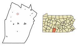
Location of St. Clairsville in
Bedford County, Pennsylvania.
768:, including no under eighteens and none of those over 64.
937:
889:. U.S. Census Bureau, American Factfinder. Archived from
374:
St. Clairsville is located in northern
Bedford County at
809:
807:
805:
803:
1427:
1322:
1278:
1140:
1051:
320:
308:
296:
279:
262:
254:
246:
233:
228:
220:
212:
204:
196:
191:
183:
178:
170:
162:
150:
138:
128:
21:
405:(40.155985, -78.510515). It lies at the base of
354:St. Clairsville was named after Major-General
347:, United States. The population was 76 at the
1003:
8:
816:"City and Town Population Totals: 2020—2021"
1010:
996:
988:
862:"US Gazetteer files: 2010, 2000, and 1990"
450:
18:
1482:Boroughs in Bedford County, Pennsylvania
777:
319:
295:
261:
227:
219:
190:
177:
161:
127:
92:
75:
61:
49:
34:
843:
833:
470:
16:Borough in Pennsylvania, United States
932:
930:
307:
278:
253:
245:
232:
211:
203:
195:
182:
169:
149:
137:
7:
1472:Populated places established in 1820
968:. U.S. Census Bureau. Archived from
745:, and 2.33% from two or more races.
1477:1820 establishments in Pennsylvania
216:0.00 sq mi (0.00 km)
208:0.03 sq mi (0.08 km)
200:0.03 sq mi (0.08 km)
1018:Municipalities and communities of
913:"Census of Population and Housing"
460:
14:
239:
238:
74:
67:
51:
36:
258:2,500.00/sq mi (958.16/km)
1:
788:. United States Census Bureau
23:St. Clairsville, Pennsylvania
1021:Bedford County, Pennsylvania
942:United States Census Bureau
866:United States Census Bureau
786:"2019 U.S. Gazetteer Files"
441:United States Census Bureau
409:, which rises to the east.
247: • Estimate
1498:
224:1,135 ft (346 m)
1437:
1127:
1032:
729:
716:
701:
686:
671:
656:
641:
626:
611:
596:
581:
566:
551:
536:
521:
506:
491:
476:
469:
464:
459:
456:
93:
62:
50:
35:
28:
757:there were 94.3 males.
1134:
430:Pennsylvania Route 869
1133:
938:"U.S. Census website"
452:Historical population
393:40.15611°N 78.51056°W
281: • Summer (
113:40.15611°N 78.51056°W
1450:United States portal
966:Population Estimates
915:. U.S. Census Bureau
893:on February 12, 2020
255: • Density
1443:Pennsylvania portal
814:Bureau, US Census.
453:
398:40.15611; -78.51056
389: /
364:Northwest Territory
118:40.15611; -78.51056
109: /
1135:
846:has generic name (
822:. US Census Bureau
451:
234: • Total
213: • Water
197: • Total
1459:
1458:
1170:Cumberland Valley
762:per capita income
734:
733:
439:According to the
360:Revolutionary War
330:
329:
205: • Land
184: • Type
1489:
1451:
1444:
1132:
1044:
1037:
1027:
1022:
1012:
1005:
998:
989:
982:
981:
979:
977:
958:
952:
951:
949:
948:
934:
925:
924:
922:
920:
909:
903:
902:
900:
898:
883:
877:
876:
874:
873:
858:
852:
851:
845:
841:
839:
831:
829:
827:
811:
798:
797:
795:
793:
782:
472:
467:
462:
454:
404:
403:
401:
400:
399:
394:
390:
387:
386:
385:
382:
356:Arthur St. Clair
286:
242:
241:
124:
123:
121:
120:
119:
114:
110:
107:
106:
105:
102:
78:
77:
71:
55:
40:
19:
1497:
1496:
1492:
1491:
1490:
1488:
1487:
1486:
1462:
1461:
1460:
1455:
1449:
1442:
1433:
1423:
1339:Bedford Springs
1325:
1318:
1274:
1260:West Providence
1175:East Providence
1136:
1130:
1125:
1106:St. Clairsville
1047:
1042:
1035:
1028:
1025:
1020:
1016:
986:
985:
975:
973:
972:on 11 June 2013
960:
959:
955:
946:
944:
936:
935:
928:
918:
916:
911:
910:
906:
896:
894:
885:
884:
880:
871:
869:
860:
859:
855:
842:
832:
825:
823:
813:
812:
801:
791:
789:
784:
783:
779:
774:
750:married couples
465:
449:
407:Evitts Mountain
397:
395:
391:
388:
383:
380:
378:
376:
375:
372:
333:St. Clairsville
304:
280:
187:Borough Council
117:
115:
111:
108:
103:
100:
98:
96:
95:
89:
88:
87:
86:
85:
84:
83:
82:St. Clairsville
79:
58:
46:
44:Keystone Marker
31:
24:
17:
12:
11:
5:
1495:
1493:
1485:
1484:
1479:
1474:
1464:
1463:
1457:
1456:
1454:
1453:
1446:
1438:
1435:
1434:
1431:
1429:
1425:
1424:
1422:
1421:
1416:
1411:
1406:
1401:
1399:New Enterprise
1396:
1391:
1386:
1381:
1376:
1371:
1366:
1361:
1356:
1351:
1346:
1341:
1336:
1330:
1328:
1324:Unincorporated
1320:
1319:
1317:
1316:
1310:
1305:
1300:
1295:
1290:
1284:
1282:
1276:
1275:
1273:
1272:
1267:
1265:West St. Clair
1262:
1257:
1252:
1250:South Woodbury
1247:
1242:
1237:
1232:
1227:
1222:
1217:
1212:
1207:
1202:
1197:
1192:
1187:
1182:
1180:East St. Clair
1177:
1172:
1167:
1162:
1157:
1152:
1146:
1144:
1138:
1137:
1128:
1126:
1124:
1123:
1118:
1113:
1108:
1103:
1098:
1093:
1088:
1083:
1078:
1073:
1068:
1063:
1057:
1055:
1049:
1048:
1033:
1030:
1029:
1017:
1015:
1014:
1007:
1000:
992:
984:
983:
953:
926:
904:
878:
853:
799:
776:
775:
773:
770:
732:
731:
727:
726:
723:
721:
718:
714:
713:
710:
708:
705:
699:
698:
695:
693:
690:
684:
683:
680:
678:
675:
669:
668:
665:
663:
660:
654:
653:
650:
648:
645:
639:
638:
635:
633:
630:
624:
623:
620:
618:
615:
609:
608:
605:
603:
600:
594:
593:
590:
588:
585:
579:
578:
575:
573:
570:
564:
563:
560:
558:
555:
549:
548:
545:
543:
540:
534:
533:
530:
528:
525:
519:
518:
515:
513:
510:
504:
503:
500:
498:
495:
489:
488:
485:
483:
480:
474:
473:
468:
463:
458:
448:
445:
371:
368:
341:Bedford County
328:
327:
324:
318:
317:
312:
306:
305:
302:
300:
294:
293:
287:
277:
276:
266:
260:
259:
256:
252:
251:
248:
244:
243:
235:
231:
230:
226:
225:
222:
218:
217:
214:
210:
209:
206:
202:
201:
198:
194:
193:
189:
188:
185:
181:
180:
176:
175:
172:
168:
167:
164:
160:
159:
154:
148:
147:
142:
136:
135:
132:
126:
125:
91:
90:
81:
80:
73:
72:
66:
65:
64:
63:
60:
59:
56:
48:
47:
41:
33:
32:
29:
26:
25:
22:
15:
13:
10:
9:
6:
4:
3:
2:
1494:
1483:
1480:
1478:
1475:
1473:
1470:
1469:
1467:
1452:
1447:
1445:
1440:
1439:
1436:
1430:
1426:
1420:
1417:
1415:
1412:
1410:
1407:
1405:
1402:
1400:
1397:
1395:
1392:
1390:
1387:
1385:
1382:
1380:
1377:
1375:
1372:
1370:
1367:
1365:
1362:
1360:
1357:
1355:
1352:
1350:
1349:Buffalo Mills
1347:
1345:
1342:
1340:
1337:
1335:
1332:
1331:
1329:
1327:
1321:
1314:
1311:
1309:
1306:
1304:
1301:
1299:
1296:
1294:
1291:
1289:
1286:
1285:
1283:
1281:
1277:
1271:
1268:
1266:
1263:
1261:
1258:
1256:
1253:
1251:
1248:
1246:
1243:
1241:
1238:
1236:
1233:
1231:
1228:
1226:
1223:
1221:
1218:
1216:
1213:
1211:
1208:
1206:
1203:
1201:
1198:
1196:
1193:
1191:
1188:
1186:
1183:
1181:
1178:
1176:
1173:
1171:
1168:
1166:
1163:
1161:
1158:
1156:
1153:
1151:
1148:
1147:
1145:
1143:
1139:
1122:
1119:
1117:
1114:
1112:
1109:
1107:
1104:
1102:
1099:
1097:
1096:Pleasantville
1094:
1092:
1089:
1087:
1084:
1082:
1079:
1077:
1074:
1072:
1069:
1067:
1064:
1062:
1059:
1058:
1056:
1054:
1050:
1046:
1045:
1038:
1031:
1026:United States
1023:
1013:
1008:
1006:
1001:
999:
994:
993:
990:
971:
967:
963:
957:
954:
943:
939:
933:
931:
927:
914:
908:
905:
892:
888:
882:
879:
867:
863:
857:
854:
849:
837:
821:
817:
810:
808:
806:
804:
800:
787:
781:
778:
771:
769:
767:
763:
758:
754:
751:
746:
744:
739:
728:
724:
722:
719:
715:
711:
709:
706:
704:
700:
696:
694:
691:
689:
685:
681:
679:
676:
674:
670:
666:
664:
661:
659:
655:
651:
649:
646:
644:
640:
636:
634:
631:
629:
625:
621:
619:
616:
614:
610:
606:
604:
601:
599:
595:
591:
589:
586:
584:
580:
576:
574:
571:
569:
565:
561:
559:
556:
554:
550:
546:
544:
541:
539:
535:
531:
529:
526:
524:
520:
516:
514:
511:
509:
505:
501:
499:
496:
494:
490:
486:
484:
481:
479:
475:
455:
446:
444:
442:
437:
435:
431:
427:
423:
419:
415:
414:Interstate 99
410:
408:
402:
369:
367:
365:
361:
357:
352:
350:
346:
342:
338:
334:
325:
323:
316:
313:
311:
301:
299:
291:
288:
284:
274:
273:Eastern (EST)
270:
267:
265:
257:
249:
236:
223:
215:
207:
199:
186:
173:
165:
158:
155:
153:
146:
143:
141:
134:United States
133:
131:
122:
94:Coordinates:
70:
54:
45:
39:
27:
20:
1394:Mount Dallas
1369:Charlesville
1364:Chaneysville
1354:Burning Bush
1245:Snake Spring
1105:
1086:Manns Choice
1040:
974:. Retrieved
970:the original
965:
956:
945:. Retrieved
917:. Retrieved
907:
895:. Retrieved
891:the original
881:
870:. Retrieved
868:. 2011-02-12
856:
844:|last1=
824:. Retrieved
819:
790:. Retrieved
780:
766:poverty line
759:
755:
747:
735:
447:Demographics
438:
411:
373:
362:veteran and
353:
345:Pennsylvania
332:
331:
171:Incorporated
145:Pennsylvania
1326:communities
1308:Stonerstown
1303:Riddlesburg
1255:Southampton
1220:Londonderry
1116:Schellsburg
1036:County seat
976:11 December
919:11 December
717:2021 (est.)
396: /
349:2020 census
116: /
1466:Categories
1419:State Line
1374:Fishertown
1344:Breezewood
1288:Clearville
1155:Bloomfield
947:2008-01-31
872:2011-04-23
820:Census.gov
772:References
736:As of the
384:78°30′38″W
366:governor.
229:Population
179:Government
104:78°30′38″W
101:40°09′22″N
42:Borough's
1428:Footnotes
1414:Sandy Run
1404:Osterburg
1379:Gapsville
1160:Broad Top
1142:Townships
1101:Rainsburg
1091:New Paris
434:Osterburg
381:40°9′22″N
370:Geography
322:FIPS code
310:Area code
264:Time zone
221:Elevation
1389:Loysburg
1298:Earlston
1293:Defiance
1270:Woodbury
1190:Hopewell
1185:Harrison
1165:Colerain
1121:Woodbury
1076:Hopewell
1066:Coaldale
1053:Boroughs
897:March 4,
836:cite web
826:July 25,
792:July 28,
730:Sources:
418:U.S. 220
326:42-67256
298:Zip code
1334:Artemas
1215:Lincoln
1210:Liberty
1195:Juniata
1150:Bedford
1081:Hyndman
1071:Everett
1061:Bedford
1043:Bedford
426:Altoona
422:Bedford
337:borough
163:Settled
157:Bedford
130:Country
30:Borough
1359:Cessna
1235:Napier
1230:Monroe
1200:Kimmel
1111:Saxton
738:census
637:−16.5%
532:−23.9%
457:Census
152:County
1409:Queen
1384:Imler
1240:Pavia
743:White
725:−1.3%
712:−2.6%
697:−9.3%
682:−2.3%
667:−2.2%
652:−6.2%
622:−9.4%
607:11.4%
577:11.3%
562:−4.0%
547:−1.0%
517:−6.9%
335:is a
303:16667
292:(EDT)
290:UTC-4
269:UTC-5
140:State
1313:Wood
1280:CDPs
1225:Mann
1205:King
978:2013
921:2013
899:2014
848:help
828:2022
794:2020
703:2020
688:2010
673:2000
658:1990
643:1980
628:1970
613:1960
598:1950
592:5.6%
583:1940
568:1930
553:1920
538:1910
523:1900
508:1890
502:0.0%
493:1880
478:1870
466:Note
461:Pop.
412:The
192:Area
174:1867
166:1820
617:115
602:127
587:114
572:108
542:101
527:102
512:134
497:144
482:144
339:in
315:814
283:DST
237:76
1468::
1039::
1024:,
964:.
940:.
929:^
864:.
840::
838:}}
834:{{
818:.
802:^
720:75
707:76
692:78
677:86
662:88
647:90
632:96
557:97
471:%±
436:.
358:,
351:.
343:,
250:75
1315:‡
1011:e
1004:t
997:v
980:.
950:.
923:.
901:.
875:.
850:)
830:.
796:.
487:—
416:/
285:)
275:)
271:(
Text is available under the Creative Commons Attribution-ShareAlike License. Additional terms may apply.