31:
47:
940:
525:
54:
206:
424:
376:
or "waste" further east, at
Woodville and beyond. These small groups of farms, with their own irregular shaped fields, were separated by unenclosed "waste" probably until the 18th century, when it was
372:
After the establishment of Stour
Provost village near the River Stour, at least four smaller settlements were established in a piecemeal fashion from the 13th century – or perhaps earlier – in the
246:
120:
230:
93:
223:
981:
254:
499:
290:
218:
30:
46:
272:
1010:
235:
190:
156:
477:
974:
86:
1005:
1000:
389:
451:"'Stour Provost', in An Inventory of the Historical Monuments in Dorset, Volume 4, North (London, 1972), pp. 79-84"
366:
110:
327:
277:
492:
967:
282:
170:
909:
698:
904:
485:
361:, containing only the parish itself. Today the civil parish includes the settlements of Woodville and
899:
894:
889:
102:
914:
343:
884:
849:
818:
733:
653:
647:
621:
358:
351:
347:
146:
138:
844:
748:
631:
591:
566:
524:
951:
450:
939:
834:
829:
812:
636:
534:
195:
864:
859:
854:
708:
683:
663:
626:
581:
571:
560:
839:
824:
718:
688:
673:
668:
641:
586:
331:
994:
770:
728:
693:
606:
601:
539:
211:
879:
738:
616:
509:
764:
554:
373:
797:
792:
786:
780:
305:
292:
874:
807:
713:
611:
576:
377:
362:
180:
425:"Area: Stour Provost (Parish). Key Figures for 2011 Census: Key Statistics"
919:
753:
743:
723:
703:
678:
658:
596:
544:
339:
162:
947:
869:
775:
758:
549:
513:
335:
128:
67:
481:
369:
the civil parish had 235 households and a population of 579.
354:. In old writings it is usually spelled Stower Provost.
955:
245:
229:
217:
205:
189:
179:
169:
155:
137:
119:
101:
85:
77:
23:
975:
493:
8:
982:
968:
500:
486:
478:
20:
413:. Home Publishing Co. Ltd. pp. 47–9.
409:North Dorset District Council (c. 1983).
401:
244:
200:
178:
154:
84:
27:
380:and divided into rectilinear fields.
228:
216:
204:
188:
168:
136:
118:
100:
53:
7:
936:
934:
411:North Dorset District Official Guide
508:Towns, villages and hamlets in the
954:. You can help Knowledge (XXG) by
14:
357:Stour Provost once constituted a
938:
523:
431:. Office for National Statistics
52:
45:
29:
1:
390:List of liberties in Dorset
87:OS grid reference
18:Human settlement in England
1027:
933:
530:
521:
263:
241:
201:
40:
28:
429:Neighbourhood Statistics
910:Winterborne Whitechurch
1011:Dorset geography stubs
950:location article is a
699:Langton Long Blandford
457:. University of London
455:British History Online
191:Postcode district
103:Unitary authority
905:Winterborne Stickland
900:Winterborne Kingston
895:Winterborne Houghton
890:Winterborne Clenston
365:to the east. In the
224:Dorset and Wiltshire
171:Sovereign state
1006:Liberties of Dorset
915:Winterborne Zelston
302: /
1001:Villages in Dorset
850:Tarrant Launceston
819:Sturminster Newton
734:Milborne St Andrew
654:Glanvilles Wootton
348:Sturminster Newton
342:, situated on the
306:50.9923°N 2.2957°W
247:UK Parliament
963:
962:
928:
927:
845:Tarrant Keyneston
749:Okeford Fitzpaine
632:Fifehead Magdalen
592:Charlton Marshall
567:Blandford St Mary
326:is a village and
321:
320:
121:Shire county
1018:
984:
977:
970:
942:
935:
835:Tarrant Gunville
830:Tarrant Crawford
813:Stourton Caundle
637:Fifehead Neville
527:
502:
495:
488:
479:
467:
466:
464:
462:
447:
441:
440:
438:
436:
421:
415:
414:
406:
317:
316:
314:
313:
312:
311:50.9923; -2.2957
307:
303:
300:
299:
298:
295:
269:
165:
97:
96:
66:Location within
56:
55:
49:
33:
21:
1026:
1025:
1021:
1020:
1019:
1017:
1016:
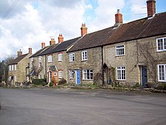
1015:
991:
990:
989:
988:
931:
929:
924:
865:Tarrant Rushton
860:Tarrant Rawston
855:Tarrant Monkton
684:Iwerne Courtney
664:Hazelbury Bryan
582:Buckhorn Weston
561:Blandford Forum
528:
517:
506:
476:
471:
470:
460:
458:
449:
448:
444:
434:
432:
423:
422:
418:
408:
407:
403:
398:
386:
310:
308:
304:
301:
296:
293:
291:
289:
288:
287:
267:
259:
161:
151:
133:
115:
92:
91:
73:
72:
71:
70:
64:
63:
62:
61:
57:
36:
19:
12:
11:
5:
1024:
1022:
1014:
1013:
1008:
1003:
993:
992:
987:
986:
979:
972:
964:
961:
960:
943:
926:
925:
923:
922:
917:
912:
907:
902:
897:
892:
887:
882:
877:
872:
867:
862:
857:
852:
847:
842:
840:Tarrant Hinton
837:
832:
827:
825:Sutton Waldron
822:
815:
810:
805:
800:
795:
790:
783:
778:
773:
768:
761:
756:
751:
746:
741:
736:
731:
726:
721:
719:Margaret Marsh
716:
711:
706:
701:
696:
691:
689:Iwerne Minster
686:
681:
676:
674:Hinton St Mary
671:
666:
661:
656:
651:
644:
642:Fontmell Magna
639:
634:
629:
624:
619:
614:
609:
604:
599:
594:
589:
584:
579:
574:
569:
564:
557:
552:
547:
542:
537:
531:
529:
522:
519:
518:
507:
505:
504:
497:
490:
482:
475:
474:External links
472:
469:
468:
442:
416:
400:
399:
397:
394:
393:
392:
385:
382:
334:area of north
332:Blackmore Vale
319:
318:
286:
285:
280:
275:
270:
268:List of places
264:
261:
260:
258:
257:
251:
249:
243:
242:
239:
238:
233:
227:
226:
221:
215:
214:
209:
203:
202:
199:
198:
193:
187:
186:
183:
177:
176:
175:United Kingdom
173:
167:
166:
159:
153:
152:
150:
149:
143:
141:
135:
134:
132:
131:
125:
123:
117:
116:
114:
113:
107:
105:
99:
98:
89:
83:
82:
79:
75:
74:
65:
59:
58:
51:
50:
44:
43:
42:
41:
38:
37:
34:
26:
25:
17:
13:
10:
9:
6:
4:
3:
2:
1023:
1012:
1009:
1007:
1004:
1002:
999:
998:
996:
985:
980:
978:
973:
971:
966:
965:
959:
957:
953:
949:
944:
941:
937:
932:
921:
918:
916:
913:
911:
908:
906:
903:
901:
898:
896:
893:
891:
888:
886:
883:
881:
878:
876:
873:
871:
868:
866:
863:
861:
858:
856:
853:
851:
848:
846:
843:
841:
838:
836:
833:
831:
828:
826:
823:
821:
820:
816:
814:
811:
809:
806:
804:
803:Stour Provost
801:
799:
796:
794:
791:
789:
788:
784:
782:
779:
777:
774:
772:
771:Shillingstone
769:
767:
766:
762:
760:
757:
755:
752:
750:
747:
745:
742:
740:
737:
735:
732:
730:
729:Melbury Abbas
727:
725:
722:
720:
717:
715:
712:
710:
707:
705:
702:
700:
697:
695:
694:Kington Magna
692:
690:
687:
685:
682:
680:
677:
675:
672:
670:
667:
665:
662:
660:
657:
655:
652:
650:
649:
645:
643:
640:
638:
635:
633:
630:
628:
625:
623:
620:
618:
615:
613:
610:
608:
607:Compton Abbas
605:
603:
602:Child Okeford
600:
598:
595:
593:
590:
588:
585:
583:
580:
578:
575:
573:
570:
568:
565:
563:
562:
558:
556:
553:
551:
548:
546:
543:
541:
538:
536:
533:
532:
526:
520:
515:
511:
503:
498:
496:
491:
489:
484:
483:
480:
473:
456:
452:
446:
443:
430:
426:
420:
417:
412:
405:
402:
395:
391:
388:
387:
383:
381:
379:
375:
370:
368:
364:
360:
355:
353:
349:
345:
341:
337:
333:
329:
325:
324:Stour Provost
315:
284:
281:
279:
276:
274:
271:
266:
265:
262:
256:
253:
252:
250:
248:
240:
237:
236:South Western
234:
232:
225:
222:
220:
213:
210:
208:
197:
194:
192:
184:
182:
174:
172:
164:
160:
158:
148:
145:
144:
142:
140:
130:
127:
126:
124:
122:
112:
109:
108:
106:
104:
95:
90:
88:
80:
76:
69:
60:Stour Provost
48:
39:
35:Stour Provost
32:
24:Stour Provost
22:
16:
956:expanding it
945:
930:
880:West Orchard
817:
802:
785:
763:
739:Milton Abbas
646:
617:East Orchard
559:
512:district of
510:North Dorset
459:. Retrieved
454:
445:
433:. Retrieved
428:
419:
410:
404:
371:
356:
328:civil parish
323:
322:
255:North Dorset
15:
765:Shaftesbury
555:Belchalwell
374:common land
367:2011 census
344:River Stour
309: /
995:Categories
885:West Stour
798:Stourpaine
793:Stoke Wake
787:Stalbridge
781:Spetisbury
648:Gillingham
622:East Stour
435:6 February
396:References
352:Gillingham
294:50°59′32″N
185:Gillingham
147:South West
78:Population
875:Turnworth
808:Stour Row
714:Mappowder
612:Durweston
577:Bryanston
516:, England
363:Stour Row
297:2°17′45″W
231:Ambulance
181:Post town
81:579
920:Woolland
754:Pimperne
744:Motcombe
724:Marnhull
704:Lydlinch
679:Ibberton
535:Anderson
461:16 March
384:See also
378:enclosed
346:between
94:ST793215
709:Manston
659:Hammoon
627:Farnham
597:Chettle
572:Bourton
545:Ashmore
359:liberty
340:England
330:in the
278:England
163:England
157:Country
948:Dorset
870:Todber
776:Silton
759:Pulham
669:Hilton
550:Bagber
514:Dorset
336:Dorset
283:Dorset
212:Dorset
207:Police
139:Region
129:Dorset
111:Dorset
68:Dorset
946:This
540:Ansty
952:stub
587:Cann
463:2015
437:2015
350:and
219:Fire
196:SP8
997::
453:.
427:.
338:,
273:UK
983:e
976:t
969:v
958:.
501:e
494:t
487:v
465:.
439:.
Text is available under the Creative Commons Attribution-ShareAlike License. Additional terms may apply.