432:
447:
140:
256:
33:
200:
flows, the Asotin Member flows (13 million years ago), the
Weissenfels Ridge Member flows, the Esquatzel Member flows, the Elephant Mountain Member flows (10.5 million years ago), the Bujford Member flows, the Ice Harbor Member flows (8.5 million years ago) and the Lower Monumental Member flows (6 million years ago).
199:
basalt in the Saddle
Mountains is the Saddle Mountain Basalt, which ranges from 120 – 240 meters (400 – 800 feet) in thickness and is interspersed by sedimentary layers of the Ellensburg Formation. The Saddle Mountain Basalt is composed of the Umatilla Member flows, the Wilbur Creek Member
239:
and turning west to run along the north face of the Saddle
Mountains, there to rejoin the previous and modern course of the Columbia River just above the main water gap in the Saddle Mountains,
614:
867:
701:
607:
923:
918:
899:
172:
817:
431:
654:
600:
706:
459:
106:
143:
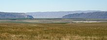
The Saddle
Mountains as seen from the ridgeline looking toward the east in the Wahluke Wildlife Refuge section; photo taken in the spring of 2007
512:
464:
492:. Washington State Department of Natural Resources (Washington Division of Geology and Earth Resources Information Circular 90). ISBN none.
446:
558:
17:
813:
890:
393:
356:
319:
282:
99:
669:
664:
490:
Flood
Basalts and Glacier Floods:Roadside Geology of Parts of Walla Walla, Franklin, and Columbia Counties, Washington
196:
872:
684:
550:
139:
808:
582:
451:
160:
92:
587:
857:
37:
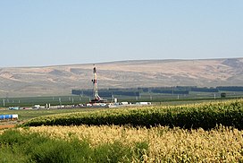
The Saddle
Mountains as seen from the south in the summer of 2006. Note gas drilling rig in the foreground.
204:
796:
716:
168:
224:
212:
679:
623:
228:
164:
82:
696:
554:
508:
184:
641:
691:
674:
236:
255:
839:
577:
436:
208:
180:
912:
862:
834:
768:
752:
726:
721:
659:
649:
543:
243:. It eroded the north face of the Saddle Mountains, creating the conditions for the
829:
747:
731:
240:
216:
176:
505:
On the Trail of the Ice Age Floods: A Geological Guide to the Mid-Columbif Basin
485:
440:
275:
244:
32:
824:
592:
232:
408:
395:
371:
358:
334:
321:
297:
284:
121:
108:
588:
U.S. Geological Survey
Geographic Names Information System: Saddle Mountains
220:
152:
167:
state. The ridge, reaching to 2,700 feet, terminates in the east south of
527:
J Harlen Bretz, (1923), The
Channeled Scabland of the Columbia Plateau.
773:
435:
Sentinel Gap in the Saddle
Mountains as seen from the west bank of the
274:
Eastern portion of Saddle
Mountains where Lower Crab Creek meets the
156:
56:
445:
430:
254:
138:
235:
at Moses Lake, following Crab Creek's course southward past the
596:
215:. As the Okanogan lobe grew the Columbia was rerouted into the
259:
Sentinel Gap in the Saddle Mountains as seen from the north
454:; photo looking east southeasterly at Boylston tunnel
351:
Sentinel Gap through which the Columbia River passes
885:
850:
795:
786:
761:
740:
640:
631:
98:
88:
78:
70:
65:
55:
47:
42:
25:
583:Commercial link to Saddle Mountain Management Area
542:
175:. It continues to the west where it is broken at
223:region, the ice-age Columbia then entered the
183:passes) before ending in the foothills of the
608:
211:15,000 years ago, backing up water to create
8:
792:
637:
615:
601:
593:
219:. Flowing across the current Grand Coulee-
22:
460:Saddle Mountain National Wildlife Refuge
262:
476:
388:Corfu Slide region of Saddle Mountains
450:The Saddle Mountains as seen from the
924:Landforms of Grant County, Washington
919:Mountain ranges of Washington (state)
900:List of mountain ranges in Washington
465:List of mountain ranges in Washington
7:
507:. Keokee Books; San Point, Idaho.
207:diverted the ancient route of the
14:
801:incl. Olympic Mountains foothills
31:
18:Saddle Mountain (disambiguation)
541:Mueller, Ted and Marge (1997).
179:(a water gap through which the
1:
197:Columbia River Basalt Group
940:
578:Washington State Park link
61:2,634 ft (803 m)
15:
897:
891:Olympic–Wallowa Lineament
551:University of Idaho Press
545:Fire, Faults & Floods
503:Bjornstad, Bruce (2006).
195:The top exposed layer of
30:
452:John Wayne Pioneer Trail
191:Saddle Mountains geology
151:consists of an upfolded
455:
443:
409:46.79778°N 119.58333°W
372:46.81667°N 119.90000°W
335:46.82222°N 119.58333°W
298:46.81667°N 119.37500°W
260:
144:
122:46.80667°N 119.55778°W
449:
434:
314:Red Rock Coulee area
258:
171:near the foot of the
142:
797:Pacific Coast Ranges
702:Rattlesnake Mountain
414:46.79778; -119.58333
377:46.81667; -119.90000
340:46.82222; -119.58333
303:46.81667; -119.37500
127:46.80667; -119.55778
16:For other uses, see
484:Carson, Robert J.;
405: /
368: /
331: /
294: /
205:Cordilleran Glacier
173:Drumheller Channels
169:Othello, Washington
118: /
680:Horse Heaven Hills
529:Journal of Geology
456:
444:
261:
229:Quincy, Washington
145:
43:Highest point
906:
905:
881:
880:
842:
820:
802:
782:
781:
697:Rattlesnake Hills
687:
553:, Moscow, Idaho.
531:, v.31, p.617-649
514:978-1-879628-27-4
424:
423:
185:Cascade Mountains
137:
136:
100:Range coordinates
931:
838:
812:
800:
793:
712:Saddle Mountains
683:
642:Yakima Fold Belt
638:
626:hills and ridges
617:
610:
603:
594:
565:
564:
548:
538:
532:
525:
519:
518:
500:
494:
493:
481:
420:
419:
417:
416:
415:
410:
406:
403:
402:
401:
398:
383:
382:
380:
379:
378:
373:
369:
366:
365:
364:
361:
346:
345:
343:
342:
341:
336:
332:
329:
328:
327:
324:
309:
308:
306:
305:
304:
299:
295:
292:
291:
290:
287:
263:
149:Saddle Mountains
133:
132:
130:
129:
128:
123:
119:
116:
115:
114:
111:
35:
26:Saddle Mountains
23:
939:
938:
934:
933:
932:
930:
929:
928:
909:
908:
907:
902:
893:
877:
846:
799:
788:
778:
757:
736:
717:Snipes Mountain
692:Manastash Ridge
675:Frenchman Hills
655:Badger Mountain
633:
627:
621:
574:
569:
568:
561:
540:
539:
535:
526:
522:
515:
502:
501:
497:
486:Pogue, Kevin R.
483:
482:
478:
473:
429:
413:
411:
407:
404:
399:
396:
394:
392:
391:
376:
374:
370:
367:
362:
359:
357:
355:
354:
339:
337:
333:
330:
325:
322:
320:
318:
317:
302:
300:
296:
293:
288:
285:
283:
281:
280:
253:
237:Frenchman Hills
193:
126:
124:
120:
117:
112:
109:
107:
105:
104:
38:
21:
12:
11:
5:
937:
935:
927:
926:
921:
911:
910:
904:
903:
898:
895:
894:
889:
887:
883:
882:
879:
878:
876:
875:
870:
865:
860:
854:
852:
848:
847:
845:
844:
840:Boistfort Peak
832:
827:
822:
818:Larch Mountain
805:
803:
790:
784:
783:
780:
779:
777:
776:
771:
765:
763:
759:
758:
756:
755:
750:
744:
742:
738:
737:
735:
734:
729:
724:
719:
714:
709:
704:
699:
694:
689:
677:
672:
670:Columbia Hills
667:
665:Candy Mountain
662:
657:
652:
646:
644:
635:
629:
628:
622:
620:
619:
612:
605:
597:
591:
590:
585:
580:
573:
572:External links
570:
567:
566:
559:
533:
520:
513:
495:
475:
474:
472:
469:
468:
467:
462:
437:Columbia River
428:
425:
422:
421:
389:
385:
384:
352:
348:
347:
315:
311:
310:
278:
271:
270:
267:
252:
249:
209:Columbia River
192:
189:
181:Columbia River
135:
134:
102:
96:
95:
90:
86:
85:
80:
76:
75:
72:
68:
67:
63:
62:
59:
53:
52:
49:
45:
44:
40:
39:
36:
28:
27:
13:
10:
9:
6:
4:
3:
2:
936:
925:
922:
920:
917:
916:
914:
901:
896:
892:
888:
884:
874:
873:Puget Lowland
871:
869:
868:Kitsap County
866:
864:
863:Issaquah Alps
861:
859:
856:
855:
853:
849:
841:
836:
835:Willapa Hills
833:
831:
828:
826:
823:
819:
815:
810:
807:
806:
804:
798:
794:
791:
785:
775:
774:Palouse Hills
772:
770:
769:Dishman Hills
767:
766:
764:
760:
754:
753:Steptoe Butte
751:
749:
746:
745:
743:
739:
733:
730:
728:
727:Wahluke Slope
725:
723:
722:Umtanum Ridge
720:
718:
715:
713:
710:
708:
705:
703:
700:
698:
695:
693:
690:
686:
681:
678:
676:
673:
671:
668:
666:
663:
661:
660:Beezley Hills
658:
656:
653:
651:
650:Ahtanum Ridge
648:
647:
645:
643:
639:
636:
630:
625:
618:
613:
611:
606:
604:
599:
598:
595:
589:
586:
584:
581:
579:
576:
575:
571:
562:
560:0-89301-206-8
556:
552:
547:
546:
537:
534:
530:
524:
521:
516:
510:
506:
499:
496:
491:
487:
480:
477:
470:
466:
463:
461:
458:
457:
453:
448:
442:
438:
433:
426:
418:
390:
387:
386:
381:
353:
350:
349:
344:
316:
313:
312:
307:
279:
277:
273:
272:
268:
265:
264:
257:
250:
248:
246:
242:
238:
234:
230:
226:
222:
218:
214:
210:
206:
201:
198:
190:
188:
186:
182:
178:
174:
170:
166:
162:
158:
154:
150:
141:
131:
103:
101:
97:
94:
91:
87:
84:
81:
77:
74:United States
73:
69:
64:
60:
58:
54:
50:
46:
41:
34:
29:
24:
19:
830:Satsop Hills
814:Capitol Peak
748:Kamiak Butte
732:Yakima Ridge
711:
707:Red Mountain
685:Jump Off Joe
544:
536:
528:
523:
504:
498:
489:
479:
269:Coordinates
241:Sentinel Gap
225:Quincy Basin
217:Grand Coulee
213:Lake Spokane
202:
194:
177:Sentinel Gap
161:Grant County
148:
146:
93:Grant County
51:Wahatis Peak
809:Black Hills
441:Wanapum Dam
412: /
400:119°35′00″W
375: /
363:119°54′00″W
338: /
326:119°35′00″W
301: /
289:119°22′30″W
276:Corfu Slide
245:Corfu Slide
231:and joined
163:of central
125: /
113:119°33′28″W
913:Categories
858:Blue Hills
825:Doty Hills
789:Washington
634:Washington
624:Washington
471:References
439:above the
397:46°47′52″N
360:46°49′00″N
323:46°49′20″N
286:46°49′00″N
233:Crab Creek
165:Washington
110:46°48′24″N
83:Washington
266:Location
251:Geography
221:Dry Falls
155:ridge of
153:anticline
66:Geography
57:Elevation
741:Steptoes
488:(1996).
427:See also
886:Related
787:Western
632:Eastern
71:Country
557:
511:
157:basalt
89:County
851:Other
762:Other
227:near
79:State
555:ISBN
509:ISBN
203:The
147:The
48:Peak
159:in
915::
816:,
549:.
247:.
187:.
843:)
837:(
821:)
811:(
688:)
682:(
616:e
609:t
602:v
563:.
517:.
20:.
Text is available under the Creative Commons Attribution-ShareAlike License. Additional terms may apply.