32:
39:
31:
247:
The highest point in the park is the base of the radio mast at its northeastern corner, at a height of 637 metres (2,090 ft) above sea level. The
Perdeberg peak on the northern edge of the park is one metre (3.3 ft) lower.
608:
297:
232:. It encompasses the valley of the Paardensberg River and the surrounding mountain catchment area. The river flows from northeast to southwest, starting in a
618:
88:
377:
410:
350:
613:
240:
area known as "Die
Weivlakte". Various smaller tributaries join the river; notably the Watervalkloof stream which passes over a series of small
273:
463:
420:
185:. It contains the mountain catchment area of the Paardensberg River in the Akkedisberg mountains. The reserve is administered by
516:
370:
209:
221:
458:
430:
521:
308:
582:
244:
called the "Zigzag Falls". On the eastern side of
Keeromskloof can be found the Elandskrans Caves and Leopard Cave.
453:
425:
363:
496:
468:
550:
545:
491:
448:
415:
397:
572:
147:
577:
540:
587:
511:
506:
486:
225:
76:
198:
336:(Map) (4th ed.). 1:50 000. South Africa Topographic. Chief Directorate: Surveys and Mapping. 1997.
265:
440:
389:
170:
602:
564:
560:
182:
178:
66:
62:
197:
Local tradition claims that
Salmonsdam was named for Robert Salmond, captain of
386:
304:
186:
139:
355:
103:
90:
405:
241:
229:
478:
205:
174:
58:
532:
237:
233:
359:
236:
208:
in 1852. The area was declared a nature reserve by the
559:
530:
477:
439:
396:
135:
127:
119:
82:
72:
54:
20:
189:and covers an area of 834 hectares (2,060 acres).
38:
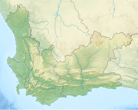
228:and about 150 km (93 mi) southeast of
609:Provincial nature reserves of the Western Cape
371:
8:
378:
364:
356:
292:
290:
17:
257:
158:.htm?reserve=Salmonsdam+Nature+Reserve
224:, 20 kilometres (12 mi) east of
7:
53:
619:Protected areas established in 1962
274:World Commission on Protected Areas
14:
464:Hottentots Holland Nature Reserve
270:World Database on Protected Areas
421:Groot Winterhoek Wilderness Area
37:
30:
614:Nature reserves in South Africa
517:Grootvadersbosch Nature Reserve
126:
71:
583:Keurbooms River Nature Reserve
210:Cape Provincial Administration
1:
220:Salmonsdam is located in the
459:Assegaaibosch Nature Reserve
431:Matjiesrivier Nature Reserve
46:Location in the Western Cape
522:Boosmansbos Wilderness Area
351:Salmonsdam official website
298:"Salmonsdam Nature Reserve"
266:"South Africa - Salmonsdam"
635:
469:Vrolijkheid Nature Reserve
454:Jonkershoek Nature Reserve
426:Knersvlakte Nature Reserve
411:Bird Island Nature Reserve
502:Salmonsdam Nature Reserve
497:Walker Bay Nature Reserve
449:Limietberg Nature Reserve
406:Cederberg Wilderness Area
222:Overstrand municipal area
167:Salmonsdam Nature Reserve
145:
123:834 ha (2,060 acres)
25:
21:Salmonsdam Nature Reserve
573:Outeniqua Nature Reserve
551:Gamkaberg Nature Reserve
546:Swartberg Nature Reserve
492:Kogelberg Nature Reserve
416:Rocherpan Nature Reserve
578:Goukamma Nature Reserve
541:Anysberg Nature Reserve
588:Robberg Nature Reserve
512:De Hoop Nature Reserve
507:De Mond Nature Reserve
487:Marloth Nature Reserve
77:Stanford, Western Cape
104:34.42639°S 19.63806°E
314:on 22 November 2009
136:Governing body
109:-34.42639; 19.63806
100: /
334:3419BC Jongensklip
596:
595:
164:
163:
73:Nearest city
626:
380:
373:
366:
357:
338:
337:
330:
324:
323:
321:
319:
313:
307:. Archived from
302:
294:
285:
284:
282:
280:
262:
204:, which sank at
160:
157:
155:
153:
151:
149:
115:
114:
112:
111:
110:
105:
101:
98:
97:
96:
93:
41:
40:
34:
18:
634:
633:
629:
628:
627:
625:
624:
623:
599:
598:
597:
592:
555:
526:
473:
435:
392:
390:nature reserves
384:
347:
342:
341:
332:
331:
327:
317:
315:
311:
300:
296:
295:
288:
278:
276:
264:
263:
259:
254:
218:
195:
146:
108:
106:
102:
99:
94:
91:
89:
87:
86:
50:
49:
48:
47:
44:
43:
42:
12:
11:
5:
632:
630:
622:
621:
616:
611:
601:
600:
594:
593:
591:
590:
585:
580:
575:
569:
567:
557:
556:
554:
553:
548:
543:
537:
535:
528:
527:
525:
524:
519:
514:
509:
504:
499:
494:
489:
483:
481:
475:
474:
472:
471:
466:
461:
456:
451:
445:
443:
441:Cape Winelands
437:
436:
434:
433:
428:
423:
418:
413:
408:
402:
400:
394:
393:
385:
383:
382:
375:
368:
360:
354:
353:
346:
345:External links
343:
340:
339:
325:
286:
256:
255:
253:
250:
217:
214:
194:
191:
177:region of the
171:nature reserve
162:
161:
143:
142:
137:
133:
132:
129:
125:
124:
121:
117:
116:
84:
80:
79:
74:
70:
69:
56:
52:
51:
45:
36:
35:
29:
28:
27:
26:
23:
22:
13:
10:
9:
6:
4:
3:
2:
631:
620:
617:
615:
612:
610:
607:
606:
604:
589:
586:
584:
581:
579:
576:
574:
571:
570:
568:
566:
562:
558:
552:
549:
547:
544:
542:
539:
538:
536:
534:
529:
523:
520:
518:
515:
513:
510:
508:
505:
503:
500:
498:
495:
493:
490:
488:
485:
484:
482:
480:
476:
470:
467:
465:
462:
460:
457:
455:
452:
450:
447:
446:
444:
442:
438:
432:
429:
427:
424:
422:
419:
417:
414:
412:
409:
407:
404:
403:
401:
399:
395:
391:
388:
381:
376:
374:
369:
367:
362:
361:
358:
352:
349:
348:
344:
335:
329:
326:
310:
306:
299:
293:
291:
287:
275:
271:
267:
261:
258:
251:
249:
245:
243:
239:
235:
231:
227:
223:
215:
213:
211:
207:
203:
202:
192:
190:
188:
184:
180:
176:
172:
168:
159:
144:
141:
138:
134:
130:
122:
118:
113:
85:
81:
78:
75:
68:
64:
60:
57:
33:
24:
19:
16:
565:Garden Route
561:Little Karoo
501:
333:
328:
316:. Retrieved
309:the original
277:. Retrieved
269:
260:
246:
219:
200:
196:
183:South Africa
181:province of
179:Western Cape
166:
165:
67:South Africa
63:Western Cape
15:
150:.capenature
128:Established
107: /
83:Coordinates
603:Categories
398:West Coast
387:CapeNature
305:CapeNature
252:References
242:waterfalls
201:Birkenhead
187:CapeNature
140:CapeNature
95:19°38′17″E
92:34°25′35″S
318:4 January
279:4 January
230:Cape Town
216:Geography
212:in 1962.
199:HMS
156:/reserves
479:Overberg
226:Stanford
206:Gansbaai
175:Overberg
59:Overberg
55:Location
193:History
173:in the
563:&
238:marshy
533:Karoo
531:Cape
312:(PDF)
301:(PDF)
234:gorge
169:is a
320:2010
281:2009
152:.org
131:1962
120:Area
154:.za
148:www
605::
303:.
289:^
272:.
268:.
65:,
61:,
379:e
372:t
365:v
322:.
283:.
Text is available under the Creative Commons Attribution-ShareAlike License. Additional terms may apply.