163:
42:
317:
228:
49:
200:
volcano on 2 March 1856. The existing mountain was reshaped by the eruption, and flooding was extensive. The death toll was estimated to exceed two thousand, possibly as high as 6,000. Other major eruptions occurred in 1966 and 2004.
162:
358:
392:
377:
283:
258:
382:
302:
87:
41:
397:
351:
185:
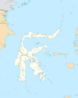
name literally means "Great Sangir", in reference to the fact that it is the archipelago's main island. It is part of the
344:
387:
154:
205:
182:
316:
279:
254:
328:
209:
213:
190:
75:
324:
233:
186:
178:
122:
371:
166:
A photograph of young women in traditional dress on Sangir Island, taken circa 1900.
177:(with the spelling variants "Sangihe", "Sanghir" or "Sangi"), is an island in the
223:
197:
17:
102:
89:
227:
276:
Geohazards in
Indonesia: Earth Science for Disaster Risk Reduction
161:
249:
Jan Sihar
Aritonang & Karel Adriaan Steenbrink, ed. (2008).
332:
150:
142:
128:
118:
81:
71:
66:
212:are endemic to Sangir Island as is the endangered
352:
8:
278:. Geological Society of London. p. 40.
196:It was the scene of the violent eruption of
30:
274:P.R. Cummins & I. Meilano, ed. (2007).
359:
345:
29:
241:
251:A History of Christianity in Indonesia
7:
313:
311:
189:province. The main language is the
331:. You can help Knowledge (XXG) by
25:
315:
226:
47:
40:
48:
1:
393:Populated places in Indonesia
378:Landforms of the Celebes Sea
383:Landforms of North Sulawesi
414:
310:
204:The critically endangered
133:
35:
398:Sulawesi geography stubs
327:location article is a
253:. BRILL. p. 448.
167:
165:
303:Sangir-Talaud group
206:cerulean flycatcher
99: /
32:
27:Island in Indonesia
173:, commonly called
168:
151:Largest settlement
340:
339:
285:978-18-623-9966-2
260:978-90-041-7026-1
160:
159:
103:3.583°N 125.500°E
16:(Redirected from
405:
361:
354:
347:
319:
312:
290:
289:
271:
265:
264:
246:
236:
231:
230:
210:Sangihe whistler
114:
113:
111:
110:
109:
104:
100:
97:
96:
95:
92:
51:
50:
44:
33:
21:
413:
412:
408:
407:
406:
404:
403:
402:
388:Sangihe Islands
368:
367:
366:
365:
308:
299:
294:
293:
286:
273:
272:
268:
261:
248:
247:
243:
232:
225:
222:
214:Elegant Sunbird
191:Sangir language
138:
107:
105:
101:
98:
93:
90:
88:
86:
85:
76:South East Asia
62:
61:
60:
59:
58:
57:
56:
52:
28:
23:
22:
15:
12:
11:
5:
411:
409:
401:
400:
395:
390:
385:
380:
370:
369:
364:
363:
356:
349:
341:
338:
337:
325:North Sulawesi
320:
306:
305:
298:
297:External links
295:
292:
291:
284:
266:
259:
240:
239:
238:
237:
234:Islands portal
221:
218:
187:North Sulawesi
179:Sangir Islands
158:
157:
152:
148:
147:
146:North Sulawesi
144:
140:
139:
134:
131:
130:
129:Administration
126:
125:
123:Sangir Islands
120:
116:
115:
108:3.583; 125.500
83:
79:
78:
73:
69:
68:
64:
63:
54:
53:
46:
45:
39:
38:
37:
36:
26:
24:
18:Sangihe Island
14:
13:
10:
9:
6:
4:
3:
2:
410:
399:
396:
394:
391:
389:
386:
384:
381:
379:
376:
375:
373:
362:
357:
355:
350:
348:
343:
342:
336:
334:
330:
326:
321:
318:
314:
309:
304:
301:
300:
296:
287:
281:
277:
270:
267:
262:
256:
252:
245:
242:
235:
229:
224:
219:
217:
215:
211:
207:
202:
199:
194:
192:
188:
184:
180:
176:
175:Sangir Island
172:
164:
156:
153:
149:
145:
141:
137:
132:
127:
124:
121:
117:
112:
84:
80:
77:
74:
70:
65:
43:
34:
19:
333:expanding it
322:
307:
275:
269:
250:
244:
203:
195:
174:
171:Sangir Besar
170:
169:
135:
181:group. Its
119:Archipelago
106: /
82:Coordinates
372:Categories
220:References
198:Gunung Awu
183:Indonesian
136:Indonesia
67:Geography
143:Province
94:125°30′E
72:Location
55:Sangihe
31:Sangihe
282:
257:
155:Tahuna
91:3°35′N
323:This
329:stub
280:ISBN
255:ISBN
208:and
374::
216:.
193:.
360:e
353:t
346:v
335:.
288:.
263:.
20:)
Text is available under the Creative Commons Attribution-ShareAlike License. Additional terms may apply.