116:
818:
103:
680:
81:
1155:
892:
71:
56:
642:
669:
767:
123:
409:) with very warm summers and cool winters. The average annual temperature in Satoshō is 15.6 °C. The average annual rainfall is 1289 mm with September as the wettest month. The temperatures are highest on average in July, at around 27.1 °C, and lowest in January, at around 4.9 °C.
569:
with the creation of the modern municipalities system on April 1, 1889. The two villages merged on April 1, 1905 to form the village of Satoshō, which was elevated to town status on June 1, 1950. In 2005, it declined to amalgamate with the neighboring towns of
594:
town council of ten members. Satoshō, collectively with the city of
Asakuchi, contributes one member to the Okayama Prefectural Assembly. In terms of national politics, the town is part of the Okayama 3rd district of the
115:
611:
The main economic activity of Satoshō is agriculture and food processing. Pharmaceuticals and electronics are also important. Due to its proximity to
Kurashiki and
1192:
370:
Satoshō is located in the southwestern
Okayama Prefecture. The central and northwest part of the town is relatively flat, but the rest is forested.
627:
Satoshō has two public elementary schools and one public junior high school operated by the town government. The town does not have a high school.
147:
817:
1136:
1211:
807:
596:
1216:
403:
102:
891:
1185:
80:
785:
771:
1012:
645:
566:
343:
220:
70:
1178:
1106:
1036:
835:
399:
1094:
1070:
187:
55:
672:
740:
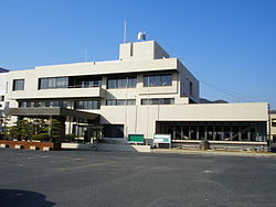
1118:
1053:
1024:
1000:
683:
339:
649:
1082:
800:
900:
362:
of 900 persons per km. The total area of the town is 12.23 square kilometres (4.72 sq mi).
203:
872:
612:
270:
1154:
196:
974:
877:
821:
575:
359:
347:
215:
208:
1075:
707:
655:
558:
417:
Per
Japanese census data, the population of Satoshō has been increasing for the past 60 years.
964:
954:
571:
562:
308:
192:
867:
862:
793:
1087:
1063:
1162:
1029:
934:
854:
701:
46:
1205:
1123:
1041:
616:
600:
587:
1005:
751:
17:
695:
591:
355:
266:
1046:
162:
149:
1111:
908:
641:
261:
766:
1099:
929:
382:
565:, the villages of Satomi (里見村) and Shinjō (新庄村) were established within
1058:
984:
969:
944:
845:
830:
387:
777:
283:
979:
949:
924:
727:
959:
939:
351:
434:
789:
710:, former economist, educator, politician and cabinet minister
429:
354:. As of 1 March 2023, the town had an estimated
1166:
590:
form of government with a directly elected mayor and a
993:
917:
899:
853:
844:
304:
277:
260:
252:
244:
239:
231:
226:
214:
202:
186:
178:
32:
675:(there is no interchange within the town borders)
331:
1161:This Okayama Prefecture location article is a
325:
1186:
801:
8:
420:
1193:
1179:
850:
808:
794:
786:
640:
419:
29:
95:Location of Satoshō in Okayama Prefecture
719:
299:
276:
259:
238:
225:
177:
142:
108:
92:
64:
52:
615:, the town is increasingly becoming a
1137:List of mergers in Okayama Prefecture
303:
251:
243:
230:
213:
201:
185:
99:
7:
1151:
1149:
557:The Satoshō area is part of ancient
235:12.23 km (4.72 sq mi)
358:of 11,026 in 4636 households and a
728:"Satoshō town official statistics"
25:
1153:
890:
816:
765:
678:
667:
121:
114:
101:
79:
69:
54:
122:
578:to form the city of Asakuchi.
1:
752:Satoshō population statistics
404:Köppen climate classification
1165:. You can help Knowledge by
1212:Towns in Okayama Prefecture
690:Notable people from Satoshō
374:Neighbouring municipalities
332:
1233:
1148:
567:Asakuchi District, Okayama
1134:
888:
828:
447:—
400:humid subtropical climate
326:
314:
300:
295:
291:
256:900/km (2,300/sq mi)
143:
109:
100:
93:
65:
53:
44:
778:Satoshō official website
36:
1217:Okayama geography stubs
163:34.51389°N 133.55694°E
730:(in Japanese). Japan.
684:National Route 2
421:Historical population
774:at Wikimedia Commons
741:Satoshō climate data
253: • Density
698:, singer-songwriter
422:
378:Okayama Prefecture
168:34.51389; 133.55694
159: /
60:Satoshō town office
822:Okayama Prefecture
360:population density
348:Okayama Prefecture
245: • Total
232: • Total
1174:
1173:
1143:
1142:
1013:Asakuchi District
886:
885:
839:
770:Media related to
673:San'yō Expressway
563:Meiji restoration
550:
549:
344:Asakuchi District
318:
317:
309:Camellia japonica
135:Location in Japan
16:(Redirected from
1224:
1195:
1188:
1181:
1157:
1150:
1107:Tsukubo District
1037:Katsuta District
894:
851:
833:
820:
810:
803:
796:
787:
782:
772:Satoshō, Okayama
769:
754:
749:
743:
738:
732:
731:
724:
682:
681:
671:
670:
650:San'yō Main Line
644:
561:. Following the
436:
431:
423:
337:
335:
329:
328:
287:
286:
284:Official website
174:
173:
171:
170:
169:
164:
160:
157:
156:
155:
152:
125:
124:
118:
105:
83:
73:
58:
39:
30:
21:
18:Satoshō, Okayama
1232:
1231:
1227:
1226:
1225:
1223:
1222:
1221:
1202:
1201:
1200:
1199:
1146:
1144:
1139:
1130:
1095:Tomata District
1071:Maniwa District
989:
913:
895:
882:
840:
824:
814:
780:
762:
757:
750:
746:
739:
735:
726:
725:
721:
717:
692:
679:
668:
664:
638:
633:
625:
609:
584:
559:Bitchū Province
555:
415:
396:
376:
368:
323:
282:
281:
195:
167:
165:
161:
158:
153:
150:
148:
146:
145:
139:
138:
137:
136:
133:
132:
131:
130:
126:
96:
89:
88:
87:
86:
77:
76:
61:
49:
40:
37:
35:
28:
23:
22:
15:
12:
11:
5:
1230:
1228:
1220:
1219:
1214:
1204:
1203:
1198:
1197:
1190:
1183:
1175:
1172:
1171:
1158:
1141:
1140:
1135:
1132:
1131:
1129:
1128:
1127:
1126:
1116:
1115:
1114:
1104:
1103:
1102:
1092:
1091:
1090:
1080:
1079:
1078:
1068:
1067:
1066:
1061:
1051:
1050:
1049:
1044:
1034:
1033:
1032:
1022:
1021:
1020:
1010:
1009:
1008:
997:
995:
991:
990:
988:
987:
982:
977:
972:
967:
962:
957:
952:
947:
942:
937:
932:
927:
921:
919:
915:
914:
912:
911:
905:
903:
897:
896:
889:
887:
884:
883:
881:
880:
875:
870:
865:
859:
857:
848:
842:
841:
829:
826:
825:
815:
813:
812:
805:
798:
790:
784:
783:
775:
761:
760:External links
758:
756:
755:
744:
733:
718:
716:
713:
712:
711:
705:
702:Yoshio Nishina
699:
691:
688:
687:
686:
676:
663:
660:
659:
658:
637:
634:
632:
631:Transportation
629:
624:
621:
608:
605:
586:Satoshō has a
583:
580:
554:
551:
548:
547:
544:
541:
537:
536:
533:
530:
526:
525:
522:
519:
515:
514:
511:
508:
504:
503:
500:
497:
493:
492:
489:
486:
482:
481:
478:
475:
471:
470:
467:
464:
460:
459:
456:
453:
449:
448:
445:
442:
438:
437:
432:
427:
414:
411:
398:Satoshō has a
395:
392:
391:
390:
385:
375:
372:
367:
364:
316:
315:
312:
311:
306:
302:
301:
298:
297:
293:
292:
289:
288:
279:
275:
274:
264:
258:
257:
254:
250:
249:
246:
242:
241:
237:
236:
233:
229:
228:
224:
223:
218:
212:
211:
206:
200:
199:
190:
184:
183:
180:
176:
175:
141:
140:
134:
128:
127:
120:
119:
113:
112:
111:
110:
107:
106:
98:
97:
94:
91:
90:
84:
78:
74:
68:
67:
66:
63:
62:
59:
51:
50:
45:
42:
41:
33:
26:
24:
14:
13:
10:
9:
6:
4:
3:
2:
1229:
1218:
1215:
1213:
1210:
1209:
1207:
1196:
1191:
1189:
1184:
1182:
1177:
1176:
1170:
1168:
1164:
1159:
1156:
1152:
1147:
1138:
1133:
1125:
1122:
1121:
1120:
1119:Wake District
1117:
1113:
1110:
1109:
1108:
1105:
1101:
1098:
1097:
1096:
1093:
1089:
1086:
1085:
1084:
1081:
1077:
1074:
1073:
1072:
1069:
1065:
1062:
1060:
1057:
1056:
1055:
1054:Kume District
1052:
1048:
1045:
1043:
1040:
1039:
1038:
1035:
1031:
1028:
1027:
1026:
1025:Kaga District
1023:
1019:
1016:
1015:
1014:
1011:
1007:
1004:
1003:
1002:
1001:Aida District
999:
998:
996:
992:
986:
983:
981:
978:
976:
973:
971:
968:
966:
963:
961:
958:
956:
953:
951:
948:
946:
943:
941:
938:
936:
933:
931:
928:
926:
923:
922:
920:
916:
910:
907:
906:
904:
902:
898:
893:
879:
876:
874:
871:
869:
866:
864:
861:
860:
858:
856:
852:
849:
847:
843:
837:
832:
827:
823:
819:
811:
806:
804:
799:
797:
792:
791:
788:
781:(in Japanese)
779:
776:
773:
768:
764:
763:
759:
753:
748:
745:
742:
737:
734:
729:
723:
720:
714:
709:
706:
703:
700:
697:
694:
693:
689:
685:
677:
674:
666:
665:
661:
657:
654:
653:
652:
651:
647:
643:
635:
630:
628:
622:
620:
618:
617:commuter town
614:
606:
604:
602:
601:Diet of Japan
598:
593:
589:
588:mayor-council
581:
579:
577:
573:
568:
564:
560:
552:
545:
542:
539:
538:
534:
531:
528:
527:
523:
520:
517:
516:
512:
509:
506:
505:
501:
498:
495:
494:
490:
487:
484:
483:
479:
476:
473:
472:
468:
465:
462:
461:
457:
454:
451:
450:
446:
443:
440:
439:
433:
428:
425:
424:
418:
412:
410:
408:
405:
401:
393:
389:
386:
384:
381:
380:
379:
373:
371:
365:
363:
361:
357:
353:
349:
345:
341:
334:
322:
313:
310:
307:
294:
290:
285:
280:
272:
268:
265:
263:
255:
247:
234:
222:
219:
217:
210:
207:
205:
198:
194:
191:
189:
181:
172:
144:Coordinates:
117:
104:
82:
72:
57:
48:
43:
31:
27:Town in Japan
19:
1167:expanding it
1160:
1145:
1083:Oda District
1017:
1006:Nishiawakura
747:
736:
722:
708:Gōtarō Ogawa
648:(JR West) -
639:
626:
610:
585:
556:
416:
413:Demographics
406:
397:
377:
369:
320:
319:
704:, physicist
597:lower house
342:located in
333:Satoshō-chō
166: /
154:133°33′25″E
1206:Categories
715:References
696:Fujii Kaze
592:unicameral
582:Government
356:population
240:Population
204:Prefecture
151:34°30′50″N
1112:Hayashima
994:Districts
975:Takahashi
909:Kurashiki
901:Core city
623:Education
576:Yorishima
366:Geography
267:UTC+09:00
262:Time zone
1100:Kagamino
1030:Kibichūō
965:Setouchi
955:Mimasaka
930:Asakuchi
662:Highways
613:Fukuyama
572:Kamogata
383:Asakuchi
221:Asakuchi
216:District
1059:Kumenan
1018:Satoshō
985:Tsuyama
945:Kasaoka
873:Higashi
846:Okayama
836:capital
831:Okayama
656:Satoshō
646:JR West
636:Railway
607:Economy
599:of the
553:History
394:Climate
388:Kasaoka
321:Satoshō
296:Symbols
278:Website
209:Okayama
193:Chūgoku
179:Country
129:Satoshō
85:Chapter
34:Satoshō
1088:Yakage
1076:Shinjō
1064:Misaki
980:Tamano
950:Maniwa
925:Akaiwa
918:Cities
878:Minami
543:10,918
532:10,782
524:+17.2%
521:10,589
513:+21.4%
480:+31.3%
248:11,026
197:San'yō
188:Region
960:Niimi
940:Ibara
935:Bizen
855:Wards
546:+1.3%
540:2010
535:+1.8%
529:2000
518:1990
510:9,038
507:1980
502:+5.5%
499:7,445
496:1970
491:−5.9%
488:7,056
485:1960
477:7,496
474:1950
469:−1.9%
466:5,708
463:1940
458:−0.9%
455:5,818
452:1930
444:5,870
441:1920
352:Japan
338:is a
182:Japan
1163:stub
1124:Wake
1047:Shōō
1042:Nagi
970:Sōja
868:Naka
863:Kita
574:and
430:Pop.
426:Year
340:town
305:Tree
227:Area
75:Flag
47:Town
619:.
407:Cfa
327:里庄町
271:JST
38:里庄町
1208::
603:.
435:±%
350:,
346:,
330:,
1194:e
1187:t
1180:v
1169:.
838:)
834:(
809:e
802:t
795:v
402:(
336:)
324:(
273:)
269:(
20:)
Text is available under the Creative Commons Attribution-ShareAlike License. Additional terms may apply.