451:. These are the two Factory Pond Bridges, the northern Canal Street Bridge, a Blackstone River Bridge, and the St. Paul Street Bridge. New bridges were built across Kane Court and Main Street in Blackstone and a tunnel was built under Church Street in Blackstone. The path was resurfaced with asphalt in these 3.5 miles from St. Paul Street in Blackstone to Rte. 146A in Uxbridge. East of St. Paul Street, Blackstone, the future of the second Canal Street Bridge and the two concrete arch viaducts (one of seven arches) is undecided. All of the trail between the missing Blackstone River and Rte. 122 bridge in Blackstone and Rte. 146A in Uxbridge is part of both the SNETT and the
130:
275:
24:
640:
296:
282:
439:, and a bridge over the Blackstone River and Rte. 122 in Blackstone, just north of the Rhode Island state line. In a four-year project ending in 2016, 8 bridges and one culvert were repaired, replaced, or built, including the Triad bridge in
465:
East of
Blackstone, improvement work is proceeding west from Grove Street in Franklin. East of Grove Street, the right-of-way is still occupied by a railroad track. In the center of town along this track, after a junction with the former
485:
At
Prospect Street in Franklin, where a former overpass was replaced by a fill, a new tunnel was completed under the road in 2020. A tunnel was built at Rte. 126 in Bellingham when the existing highway overpass was replaced.
581:
630:
494:
362:
and is one of the longest trails in southern
Massachusetts. It is designated for use by pedestrians, equestrians and non-motorized vehicles, with motorized off-road vehicles excluded.
532:
41:
677:
274:
682:
687:
644:
425:
257:
309:
88:
60:
672:
667:
213:
177:
67:
536:
417:
129:
74:
448:
421:
159:
107:
56:
467:
45:
471:
401:
514:
81:
490:
452:
390:
382:
355:
351:
440:
409:
386:
347:
369:
corridor running for approximately 22 miles (35 km) with an eastern terminus at Union Street in downtown
436:
432:
413:
370:
359:
343:
171:
34:
412:, whose right-of-way was partially constructed but never completed. Rather, this railroad was built as the
378:
339:
207:
475:
405:
651:
558:
267:
374:
458:
Between
Central Street, Millville, and the Triad Bridges, a short side trail provides access to the
479:
134:
View along the side of the
Southern New England Trunkline Trail bridge over the Blackstone River
621:
394:
459:
444:
335:
420:
west of the station to the
Connecticut state line. Later, the route became part of the
661:
331:
629:
23:
327:
228:
215:
192:
179:
166:
639:
366:
397:. It is a vital part of the southern New England rail-trail system.
431:
The trail is discontinuous, as interruptions to the trail are at
17:
400:
Despite its name, the trail does not follow any part of the
373:
and a western terminus at the
Connecticut state line in the
535:. Department of Conservation and Recreation. Archived from
631:
Template:Attached KML/Southern New
England Trunkline Trail
617:
612:
495:
Massachusetts
Department of Environmental Management
462:'s Millville Lock, the best preserved on the canal.
263:
253:
245:
165:
155:
147:
139:
122:
48:. Unsourced material may be challenged and removed.
381:. The trail continues into Connecticut as the
561:. Department of Conservation & Recreation
493:in 1994, having been acquired in 1984 by the
8:
678:National Recreation Trails in Massachusetts
654:Department of Conservation & Recreation
416:, east of the Blackstone station, and the
634:
455:(formerly the Blackstone River Bikeway).
424:, which was subsequently absorbed by the
258:Department of Conservation and Recreation
108:Learn how and when to remove this message
683:Parks in Worcester County, Massachusetts
506:
435:, a missing bridge over Route 146A in
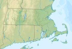
313:Location of trailheads in Massachusetts
688:Parks in Norfolk County, Massachusetts
559:"Southern New England Trunkline Trail"
533:"Southern New England Trunkline Trail"
515:"Southern New England Trunkline Trail"
119:
57:"Southern New England Trunkline Trail"
7:
652:Southern New England Trunkline Trail
645:Southern New England Trunkline Trail
474:, the second-to-last station on the
324:Southern New England Trunkline Trail
268:Southern New England Trunkline Trail
123:Southern New England Trunkline Trail
46:adding citations to reliable sources
418:Southbridge and Blackstone Railroad
580:Young, Lauren (November 1, 2020).
404:, a railroad intended to run from
14:
449:Providence and Worcester Railroad
422:New York and New England Railroad
638:
334:. The trail passes through the
294:
281:
280:
273:
249:Hiking, biking, horseback riding
128:
22:
468:Milford and Woonsocket Railroad
295:
33:needs additional citations for
521:. Rails-To-Trails Conservancy.
489:The trail was designated as a
1:
472:Franklin/Dean College station
673:State parks of Massachusetts
668:Rail trails in Massachusetts
402:Southern New England Railway
704:
491:National Recreation Trail
453:Blackstone River Greenway
385:, which extends south to
383:Air Line State Park Trail
365:It occupies an abandoned
127:
160:Massachusetts state park
433:Massachusetts Route 146
414:Norfolk County Railroad
371:Franklin, Massachusetts
379:Douglas, Massachusetts
151:Southern Massachusetts
647:at Wikimedia Commons
476:Franklin/Foxboro Line
406:Palmer, Massachusetts
229:42.01236°N 71.79966°W
193:42.06199°N 71.42847°W
143:22 miles (35 km)
635:KML is from Wikidata
586:MetroWest Daily News
582:"Tunnelling the gap"
375:Douglas State Forest
310:class=notpageimage|
42:improve this article
539:on October 29, 2013
234:42.01236; -71.79966
225: /
198:42.06199; -71.42847
189: /
480:MBTA Commuter Rail
426:New Haven Railroad
643:Media related to
395:Connecticut River
320:
319:
118:
117:
110:
92:
695:
642:
625:
597:
596:
594:
592:
577:
571:
570:
568:
566:
555:
549:
548:
546:
544:
529:
523:
522:
511:
470:, is the active
460:Blackstone Canal
445:Blackstone River
391:East Hampton, CT
298:
297:
284:
283:
277:
240:
239:
237:
236:
235:
230:
226:
223:
222:
221:
218:
204:
203:
201:
200:
199:
194:
190:
187:
186:
185:
182:
132:
120:
113:
106:
102:
99:
93:
91:
50:
26:
18:
703:
702:
698:
697:
696:
694:
693:
692:
658:
657:
636:
633:
628:
627:
626:
610:
606:
601:
600:
590:
588:
579:
578:
574:
564:
562:
557:
556:
552:
542:
540:
531:
530:
526:
513:
512:
508:
503:
387:Willimantic, CT
316:
315:
314:
312:
306:
305:
304:
303:
299:
291:
290:
289:
285:
233:
231:
227:
224:
219:
216:
214:
212:
211:
206:
197:
195:
191:
188:
183:
180:
178:
176:
175:
135:
114:
103:
97:
94:
51:
49:
39:
27:
12:
11:
5:
701:
699:
691:
690:
685:
680:
675:
670:
660:
659:
656:
655:
609:
608:
607:
605:
604:External links
602:
599:
598:
572:
550:
524:
505:
504:
502:
499:
318:
317:
308:
307:
301:
300:
293:
292:
287:
286:
279:
278:
272:
271:
270:
265:
261:
260:
255:
251:
250:
247:
243:
242:
169:
163:
162:
157:
153:
152:
149:
145:
144:
141:
137:
136:
133:
125:
124:
116:
115:
30:
28:
21:
13:
10:
9:
6:
4:
3:
2:
700:
689:
686:
684:
681:
679:
676:
674:
671:
669:
666:
665:
663:
653:
650:
649:
648:
646:
641:
632:
623:
619:
615:
614:
603:
587:
583:
576:
573:
560:
554:
551:
538:
534:
528:
525:
520:
519:TrailLink.com
516:
510:
507:
500:
498:
496:
492:
487:
483:
481:
477:
473:
469:
463:
461:
456:
454:
450:
446:
442:
438:
434:
429:
427:
423:
419:
415:
411:
407:
403:
398:
396:
392:
389:then west to
388:
384:
380:
376:
372:
368:
363:
361:
357:
353:
349:
345:
341:
337:
333:
332:Massachusetts
329:
326:(SNETT) is a
325:
311:
276:
269:
266:
262:
259:
256:
254:Maintained by
252:
248:
244:
238:
209:
202:
173:
170:
168:
164:
161:
158:
154:
150:
146:
142:
138:
131:
126:
121:
112:
109:
101:
98:December 2009
90:
87:
83:
80:
76:
73:
69:
66:
62:
59: –
58:
54:
53:Find sources:
47:
43:
37:
36:
31:This article
29:
25:
20:
19:
16:
637:
611:
591:December 29,
589:. Retrieved
585:
575:
565:November 21,
563:. Retrieved
553:
543:November 21,
541:. Retrieved
537:the original
527:
518:
509:
488:
484:
464:
457:
430:
399:
364:
323:
321:
104:
95:
85:
78:
71:
64:
52:
40:Please help
35:verification
32:
15:
232: /
196: /
156:Designation
662:Categories
501:References
410:Providence
356:Bellingham
352:Blackstone
328:rail trail
220:71°47′59″W
217:42°00′44″N
184:71°25′42″W
181:42°03′43″N
167:Trailheads
68:newspapers
443:over the
441:Millville
393:near the
348:Millville
613:KML file
437:Uxbridge
367:railroad
360:Franklin
344:Uxbridge
288:Franklin
172:Franklin
148:Location
478:of the
340:Douglas
302:Douglas
264:Website
208:Douglas
82:scholar
358:, and
140:Length
84:
77:
70:
63:
55:
336:towns
89:JSTOR
75:books
622:help
618:edit
593:2020
567:2018
545:2018
447:and
322:The
61:news
408:to
338:of
330:in
246:Use
205:)
44:by
664::
620:•
584:.
517:.
497:.
482:.
428:.
377:,
354:,
350:,
346:,
342:,
624:)
616:(
595:.
569:.
547:.
241:)
210:(
174:(
111:)
105:(
100:)
96:(
86:·
79:·
72:·
65:·
38:.
Text is available under the Creative Commons Attribution-ShareAlike License. Additional terms may apply.