61:
1133:
49:
429:. Tar Heel had several turpentine stills, and the remains of some of the old stills can be found in the area. The results of transporting the barrels of turpentine, leaking barrels, caused a tar-like material to be found around the landing and the access to the river. When the community people talked of going to the village, it was said they were going to get tar on their heels, thus the name
467:
The town of Tar Heel is governed by a mayor/council governing body. The mayor and council are elected to four-year terms. The town's council meets monthly. In July 2011, the town of Tar Heel made world news when it was announced that no one was running for any of the four positions on the town board.
472:
in
November 2011. Also elected to the town's council by write-in votes were Angela Hall, Sam Allen, and Derek Druzak (2013). The Town Mayor is now Sam Allen; he was selected to serve the remainder of Dew's term, after the latter passed while in office. In 2021, Allen was elected to a full term as
398:
The town of
Mayville, no longer in existence, was on the Robeson and Bladen County line and was the village mentioned in the diary of Elizabeth Ellis Robeson (1847–1866). Just when the village moved to what is now Tar Heel is unknown. During the
60:
545:
392:
1041:
719:
about the same piece of land in Tar Heel, site of decimation of aboriginal tribes by
Christian settlers; a plantation where African-American slaves once worked; and now the site of
682:
of 2010, there are 117 people, 60 households, and 34 families residing in the town. The racial makeup of the town is majority White (93.2% or 107 persons). 5.1% (or 6 persons) are
710:– an expression that was used during the Civil War and became the origin of the state's nickname – even though similar it is not the origin of the town's name.
1249:
1259:
1034:
513:
Tar Heel High School consolidated with
Bladenboro High School in 2001. The Tar Heel High School records show the school was originally built circa 1909.
997:
805:
473:
Mayor with Hall and Druzak re-elected to the town council by write-in, as well as Steve
Dowless who was the only listed candidate for town council.
448:
82:
898:
452:
288:
1027:
441:
687:
859:
456:
298:
741:
136:
1254:
1019:
239:
48:
998:"Profile of General Population and Housing Characteristics: 2010 Demographic Profile Data (DP-1): Tar Heel town, North Carolina"
388:
1219:
1112:
1073:
1051:
357:
314:
141:
66:
1107:
353:
1181:
906:
781:
437:
368:
1191:
1122:
1092:
878:
713:
422:
421:
at this landing, and it was a major loading point for vessels that transported agricultural goods to the market in
380:
349:
1001:
391:
was named, lived in the Tar Heel community. His home is located just to the east of the town. It is listed in the
1206:
1161:
809:
657:
642:
627:
612:
597:
582:
361:
345:
318:
1097:
720:
276:
114:
765:
1201:
1196:
1151:
1143:
690:
with 2 people identifying solely as Native
American and 2 others identifying as also White. There are 0.00%
17:
1102:
281:
930:
1186:
1156:
864:
325:
1226:
404:
249:
384:
1171:
400:
975:
403:, Colonel Thomas Purdie and Captain Daniel Munn, residents of the Tar Heel area, led troops at
836:
806:"Geographic Identifiers: 2010 Demographic Profile Data (G001): Tar Heel town, North Carolina"
902:
691:
329:
341:
129:
70:
1243:
469:
833:
The Diary of
Elizabeth Ellis Robeson Bladen County, North Carolina From 1847 to 1866
766:
U.S. Geological Survey
Geographic Names Information System: Tar Heel, North Carolina
544:
Purdie's
Methodist – The oldest unaltered Methodist Church in North Carolina,
1066:
417:
The town was known for its landing on the Cape Fear River. The state operated a
408:
503:
Public schools, part of the Bladen County School system, in the Tar Heel area:
963:
546:
National
Register of Historic Places listings in Bladen County, North Carolina
426:
414:
The Town of Tar Heel was incorporated by the State of North Carolina in 1963.
124:
941:
97:
84:
491:
Fire protection is provided by the Tar Heel Rural Volunteer Fire Department.
230:
952:
840:
371:, the town has a total area of 0.15 square miles (0.4 km), all land.
707:
683:
430:
264:
468:
The town held the election and Roy Dew was elected mayor of Tar Heel by
485:
Street maintenance, sanitation pickup for residents, and street lights.
679:
920:"Cape Fear Region Results". Fayetteville Observer. November 9, 2011.
488:
Police protection is provided by the Bladen County Sheriff's Office.
418:
256:
235:
162:
854:
1084:
883:
695:
39:
1023:
494:
Water services are provided by the Tar Heel Water Corporation.
1131:
522:
The greater Tar Heel community is home to these churches:
1000:. U.S. Census Bureau, American Factfinder. Archived from
808:. U.S. Census Bureau, American Factfinder. Archived from
777:
481:
The services provided by this small rural community are:
379:
This farming community has a history dating back to the
535:
Beth Car Presbyterian – listed as a historic site
328:
plant in the world, which opened in 1992, operated by
835:(Paperback ed.). Bladen Co. Historical Society.
1170:
1142:
1083:
899:"No one bothers to run in small NC town's election"
297:
287:
275:
263:
246:
229:
221:
213:
208:
200:
192:
184:
176:
171:
160:
152:
147:
135:
123:
113:
30:
16:For the town in Gates County, North Carolina, see
723:for pigs, and the world's largest slaughterhouse.
879:"No one signs up to run for office in Tar Heel"
360:is 15 miles (24 km) to the southeast, and
332:and is located just north of the town limits.
1035:
800:
798:
8:
436:The town of Tar Heel is often confused with
364:is 16 miles (26 km) to the southwest.
1042:
1028:
1020:
555:
27:
931:Tar Heel Rural Volunteer Fire Department
449:Purdie House and Purdie Methodist Church
340:Tar Heel is located on the banks of the
733:
356:is 25 miles (40 km) to the north,
286:
262:
228:
207:
199:
170:
146:
112:
77:
57:
45:
1250:Towns in Bladen County, North Carolina
855:"National Register Information System"
761:
759:
575:
442:University of North Carolina Tar Heels
296:
274:
245:
220:
212:
191:
183:
175:
159:
151:
134:
122:
25:Town in North Carolina, United States
7:
1260:Meat processing in the United States
860:National Register of Historic Places
457:National Register of Historic Places
393:National Register of Historic Places
425:. The major product was barrels of
196:0.00 sq mi (0.00 km)
188:0.23 sq mi (0.60 km)
180:0.23 sq mi (0.60 km)
1050:Municipalities and communities of
976:"Census of Population and Housing"
565:
14:
831:Robeson, Elizabeth Ellis (1975).
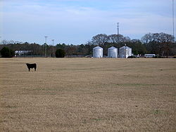
53:A pasture on the edge of Tar Heel
742:"ArcGIS REST Services Directory"
324:Tar Heel is home to the largest
59:
47:
321:, the town population was 117.
1:
1053:Bladen County, North Carolina
744:. United States Census Bureau
315:Bladen County, North Carolina
225:387.93/sq mi (149.87/km)
905:. July 15, 2011 – via
317:, United States. As of the
907:The San Diego Union-Tribune
782:United States Census Bureau
686:; and 3.4% (4 persons) are
438:Chapel Hill, North Carolina
369:United States Census Bureau
1276:
15:
1215:
1129:
1064:
671:
656:
641:
626:
611:
596:
581:
574:
569:
564:
561:
532:Tar Heel Free Will Church
526:Love Grove Baptist Church
344:. Its major highways are
78:
58:
46:
37:
156:Mayor–council government
32:Tar Heel, North Carolina
1255:Towns in North Carolina
964:West Bladen High School
529:Tar Heel Baptist Church
204:131 ft (40 m)
18:Tarheel, North Carolina
1136:
953:Tar Heel Middle School
510:Tar Heel Middle School
1221:North Carolina portal
1135:
942:Plain View Elementary
865:National Park Service
778:"U.S. Census website"
698:or Pacific Islander.
672:U.S. Decennial Census
557:Historical population
507:Plain View Elementary
313:is a town located in
248: • Summer (
98:34.73389°N 78.79083°W
1228:United States portal
1004:on February 12, 2020
812:on February 12, 2020
222: • Density
715:An American Trilogy
558:
103:34.73389; -78.79083
94: /
1137:
556:
455:are listed on the
214: • Total
193: • Water
177: • Total
1237:
1236:
676:
675:
541:New Life Ministry
395:as Walnut Grove.
381:Revolutionary War
367:According to the
308:
307:
185: • Land
153: • Type
69:and the state of
1267:
1229:
1222:
1134:
1076:
1069:
1059:
1054:
1044:
1037:
1030:
1021:
1014:
1013:
1011:
1009:
994:
988:
987:
985:
983:
972:
966:
961:
955:
950:
944:
939:
933:
928:
922:
921:
917:
911:
910:
903:Associated Press
895:
889:
888:
887:. July 15, 2011.
875:
869:
868:
851:
845:
844:
828:
822:
821:
819:
817:
802:
793:
792:
790:
788:
774:
768:
763:
754:
753:
751:
749:
738:
692:African American
577:
572:
567:
559:
330:Smithfield Foods
253:
109:
108:
106:
105:
104:
99:
95:
92:
91:
90:
87:
63:
51:
28:
1275:
1274:
1270:
1269:
1268:
1266:
1265:
1264:
1240:
1239:
1238:
1233:
1227:
1220:
1211:
1173:
1172:Unincorporated
1166:
1138:
1132:
1127:
1079:
1074:
1067:
1060:
1057:
1052:
1048:
1018:
1017:
1007:
1005:
996:
995:
991:
981:
979:
974:
973:
969:
962:
958:
951:
947:
940:
936:
929:
925:
919:
918:
914:
897:
896:
892:
877:
876:
872:
867:. July 9, 2010.
853:
852:
848:
830:
829:
825:
815:
813:
804:
803:
796:
786:
784:
776:
775:
771:
764:
757:
747:
745:
740:
739:
735:
730:
704:
688:Native American
570:
554:
520:
501:
479:
465:
377:
342:Cape Fear River
338:
271:
247:
102:
100:
96:
93:
88:
85:
83:
81:
80:
74:
54:
42:
33:
26:
21:
12:
11:
5:
1273:
1271:
1263:
1262:
1257:
1252:
1242:
1241:
1235:
1234:
1232:
1231:
1224:
1216:
1213:
1212:
1210:
1209:
1204:
1199:
1194:
1189:
1184:
1178:
1176:
1168:
1167:
1165:
1164:
1159:
1154:
1148:
1146:
1140:
1139:
1130:
1128:
1126:
1125:
1120:
1115:
1110:
1105:
1100:
1095:
1089:
1087:
1081:
1080:
1065:
1062:
1061:
1049:
1047:
1046:
1039:
1032:
1024:
1016:
1015:
989:
967:
956:
945:
934:
923:
912:
890:
870:
846:
823:
794:
769:
755:
732:
731:
729:
726:
725:
724:
711:
703:
700:
674:
673:
669:
668:
665:
663:
660:
654:
653:
650:
648:
645:
639:
638:
635:
633:
630:
624:
623:
620:
618:
615:
609:
608:
605:
603:
600:
594:
593:
590:
588:
585:
579:
578:
573:
568:
563:
553:
550:
549:
548:
542:
539:
538:Clark's Chapel
536:
533:
530:
527:
519:
516:
515:
514:
511:
508:
500:
497:
496:
495:
492:
489:
486:
478:
475:
470:write-in votes
464:
461:
440:, home of the
389:Robeson County
385:Thomas Robeson
376:
373:
337:
334:
326:pig processing
306:
305:
302:
295:
294:
291:
285:
284:
279:
273:
272:
269:
267:
261:
260:
254:
244:
243:
233:
227:
226:
223:
219:
218:
215:
211:
210:
206:
205:
202:
198:
197:
194:
190:
189:
186:
182:
181:
178:
174:
173:
169:
168:
165:
158:
157:
154:
150:
149:
145:
144:
139:
133:
132:
130:North Carolina
127:
121:
120:
117:
111:
110:
76:
75:
71:North Carolina
64:
56:
55:
52:
44:
43:
38:
35:
34:
31:
24:
13:
10:
9:
6:
4:
3:
2:
1272:
1261:
1258:
1256:
1253:
1251:
1248:
1247:
1245:
1230:
1225:
1223:
1218:
1217:
1214:
1208:
1205:
1203:
1200:
1198:
1195:
1193:
1190:
1188:
1185:
1183:
1180:
1179:
1177:
1175:
1169:
1163:
1160:
1158:
1155:
1153:
1150:
1149:
1147:
1145:
1141:
1124:
1121:
1119:
1116:
1114:
1113:Elizabethtown
1111:
1109:
1106:
1104:
1101:
1099:
1096:
1094:
1091:
1090:
1088:
1086:
1082:
1078:
1077:
1075:Elizabethtown
1070:
1063:
1058:United States
1055:
1045:
1040:
1038:
1033:
1031:
1026:
1025:
1022:
1003:
999:
993:
990:
977:
971:
968:
965:
960:
957:
954:
949:
946:
943:
938:
935:
932:
927:
924:
916:
913:
908:
904:
900:
894:
891:
886:
885:
880:
874:
871:
866:
862:
861:
856:
850:
847:
842:
838:
834:
827:
824:
811:
807:
801:
799:
795:
783:
779:
773:
770:
767:
762:
760:
756:
748:September 20,
743:
737:
734:
727:
722:
721:factory farms
718:
716:
712:
709:
706:
705:
701:
699:
697:
693:
689:
685:
681:
670:
666:
664:
661:
659:
655:
651:
649:
646:
644:
640:
636:
634:
631:
629:
625:
621:
619:
616:
614:
610:
606:
604:
601:
599:
595:
591:
589:
586:
584:
580:
560:
551:
547:
543:
540:
537:
534:
531:
528:
525:
524:
523:
517:
512:
509:
506:
505:
504:
498:
493:
490:
487:
484:
483:
482:
476:
474:
471:
462:
460:
458:
454:
450:
445:
443:
439:
434:
432:
428:
424:
420:
415:
412:
410:
406:
402:
396:
394:
390:
386:
382:
374:
372:
370:
365:
363:
359:
358:Elizabethtown
355:
351:
347:
343:
335:
333:
331:
327:
322:
320:
316:
312:
303:
300:
292:
290:
283:
280:
278:
268:
266:
258:
255:
251:
241:
240:Eastern (EST)
237:
234:
232:
224:
216:
203:
195:
187:
179:
166:
164:
161: •
155:
143:
140:
138:
131:
128:
126:
119:United States
118:
116:
107:
79:Coordinates:
72:
68:
67:Bladen County
62:
50:
41:
36:
29:
23:
19:
1117:
1108:East Arcadia
1072:
1006:. Retrieved
1002:the original
992:
980:. Retrieved
978:. Census.gov
970:
959:
948:
937:
926:
915:
893:
882:
873:
858:
849:
832:
826:
814:. Retrieved
810:the original
785:. Retrieved
772:
746:. Retrieved
736:
714:
677:
552:Demographics
521:
502:
480:
466:
453:Walnut Grove
446:
435:
416:
413:
397:
378:
366:
354:Fayetteville
339:
323:
310:
309:
65:Location in
22:
1182:Abbottsburg
1174:communities
1068:County seat
1008:February 6,
816:February 6,
787:January 31,
409:Fort Fisher
387:, for whom
319:2010 census
101: /
1244:Categories
1192:Ammon Ford
1123:White Lake
1093:Bladenboro
728:References
694:and 0.00%
678:As of the
463:Government
427:turpentine
423:Wilmington
405:Gettysburg
383:. Colonel
301:feature ID
277:Area codes
209:Population
148:Government
89:78°47′27″W
86:34°44′02″N
1207:Rosindale
1162:White Oak
499:Education
401:Civil War
362:Lumberton
336:Geography
289:FIPS code
231:Time zone
201:Elevation
167:Sam Allen
1118:Tar Heel
1098:Clarkton
708:Tar Heel
702:See also
518:Churches
477:Services
431:Tar Heel
311:Tar Heel
293:37-66740
282:910, 472
265:ZIP code
1202:Council
1197:Carvers
1152:Butters
982:June 4,
841:2924746
684:Mexican
375:History
304:2406713
115:Country
1103:Dublin
839:
717:(book)
680:census
667:−23.1%
637:−39.1%
562:Census
350:NC 131
142:Bladen
137:County
1187:Ammon
1157:Kelly
1085:Towns
696:Asian
652:67.1%
622:−2.5%
607:35.6%
419:ferry
346:NC 87
270:28392
259:(EDT)
257:UTC-4
236:UTC-5
163:Mayor
125:State
1144:CDPs
1010:2014
984:2015
884:WECT
837:OCLC
818:2014
789:2008
750:2022
658:2020
643:2010
628:2000
613:1990
598:1980
583:1970
571:Note
566:Pop.
451:and
447:The
407:and
348:and
299:GNIS
172:Area
40:Town
647:117
617:115
602:118
250:DST
1246::
1071::
1056:,
901:.
881:.
863:.
857:.
797:^
780:.
758:^
662:90
632:70
587:87
576:%±
459:.
444:.
433:.
411:.
352:.
217:90
1043:e
1036:t
1029:v
1012:.
986:.
909:.
843:.
820:.
791:.
752:.
592:—
252:)
242:)
238:(
73:.
20:.
Text is available under the Creative Commons Attribution-ShareAlike License. Additional terms may apply.