48:
81:
31:
922:
555:
88:
55:
264:
486:
which is a 1-mile walk south from Martin Mere. There are three roads running through the hamlet, Fish Lane to the north west, Tarlscough Lane to the south east and Marsh Moss Lane to the south.
47:
304:
168:
587:
288:
963:
123:
312:
536:
580:
250:
992:
276:
80:
573:
281:
956:
504:
330:
348:
238:
204:
982:
901:
116:
949:
340:
293:
891:
871:
335:
642:
483:
218:
820:
770:
672:
467:
269:
559:
692:
677:
150:
30:
707:
632:
921:
987:
800:
652:
194:
186:
780:
760:
530:
933:
855:
387:
886:
880:
597:
511:
459:
421:
243:
158:
750:
425:
417:
976:
835:
775:
755:
795:
785:
732:
687:
662:
637:
616:
132:
502:
Wildfowl and
Wetlands Trust, (2006) "UK Wetlands 12 Case studies - Martin Mere",
876:
815:
765:
712:
697:
657:
471:
565:
929:
896:
805:
727:
717:
429:
176:
101:
363:
350:
830:
825:
647:
447:
228:
140:
554:
850:
790:
722:
611:
702:
667:
462:, which is a major attraction for the North West of England as it is a
210:
840:
810:
682:
463:
569:
396:
408:
937:
446:
miles (2.8 km) (by road) north of the centre of
405:
402:
399:
393:
864:
741:
625:
604:
390:
303:
287:
275:
263:
249:
237:
227:
217:
203:
185:
167:
149:
131:
115:
23:
957:
581:
8:
964:
950:
588:
574:
566:
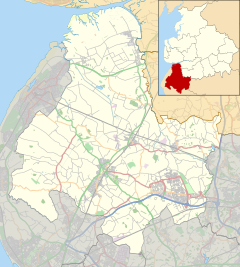
70:Show map of the Borough of West Lancashire
20:
495:
302:
258:
226:
202:
114:
27:
535:: CS1 maint: archived copy as title (
528:
286:
274:
262:
248:
236:
216:
184:
166:
148:
7:
918:
916:
464:site of special scientific interest
936:. You can help Knowledge (XXG) by
458:The main feature of the hamlet is
87:
54:
14:
920:
553:
386:
86:
79:
53:
46:
35:Brandreth Barn bed and breakfast
29:
1:
902:West Lancashire Coastal Plain
482:The nearest train station is
117:OS grid reference
67:Location in West Lancashire
18:Human settlement in England
1009:
993:Lancashire geography stubs
915:
460:Martin Mere Wetland Centre
872:Leeds and Liverpool Canal
321:
299:
259:
40:
28:
484:New Lane railway station
673:Hesketh-with-Becconsall
468:special protection area
932:location article is a
239:Postcode district
106:Show map of Lancashire
983:Hamlets in Lancashire
562:at Wikimedia Commons
219:Sovereign state
360: /
517:on 10 January 2011
305:UK Parliament
251:Dialling code
945:
944:
910:
909:
781:Downholland Cross
558:Media related to
424:district, in the
379:
378:
169:Shire county
1000:
966:
959:
952:
924:
917:
856:Wrightington Bar
590:
583:
576:
567:
557:
541:
540:
534:
526:
524:
522:
516:
510:. Archived from
509:
500:
445:
444:
440:
437:
432:. It is roughly
415:
414:
411:
410:
407:
404:
401:
398:
395:
392:
375:
374:
372:
371:
370:
365:
364:53.620°N 2.855°W
361:
358:
357:
356:
353:
327:
213:
127:
126:
107:
100:Location within
90:
89:
83:
71:
57:
56:
50:
33:
21:
1008:
1007:
1003:
1002:
1001:
999:
998:
997:
973:
972:
971:
970:
913:
911:
906:
887:Mere Sands Wood
881:WWT Martin Mere
860:
743:
737:
621:
600:
598:West Lancashire
594:
550:
545:
544:
527:
520:
518:
514:
507:
505:"Archived copy"
503:
501:
497:
492:
480:
456:
442:
438:
435:
433:
422:West Lancashire
389:
385:
368:
366:
362:
359:
354:
351:
349:
347:
346:
345:
325:
317:
313:West Lancashire
209:
199:
181:
163:
159:West Lancashire
145:
122:
121:
111:
110:
109:
108:
105:
104:
98:
97:
96:
95:
91:
74:
73:
72:
69:
68:
65:
64:
63:
62:
58:
36:
19:
12:
11:
5:
1006:
1004:
996:
995:
990:
985:
975:
974:
969:
968:
961:
954:
946:
943:
942:
925:
908:
907:
905:
904:
899:
894:
889:
884:
874:
868:
866:
862:
861:
859:
858:
853:
848:
843:
838:
833:
828:
823:
818:
813:
808:
803:
798:
793:
788:
783:
778:
773:
768:
763:
758:
753:
751:Andertons Mill
747:
745:
742:Other villages
739:
738:
736:
735:
730:
725:
720:
715:
710:
705:
700:
695:
690:
685:
680:
675:
670:
665:
660:
655:
650:
645:
640:
635:
629:
627:
626:Civil parishes
623:
622:
620:
619:
614:
608:
606:
602:
601:
595:
593:
592:
585:
578:
570:
564:
563:
549:
548:External links
546:
543:
542:
494:
493:
491:
488:
479:
476:
455:
452:
426:English county
377:
376:
369:53.620; -2.855
344:
343:
338:
333:
328:
326:List of places
322:
319:
318:
316:
315:
309:
307:
301:
300:
297:
296:
291:
285:
284:
279:
273:
272:
267:
261:
260:
257:
256:
253:
247:
246:
241:
235:
234:
231:
225:
224:
223:United Kingdom
221:
215:
214:
207:
201:
200:
198:
197:
191:
189:
183:
182:
180:
179:
173:
171:
165:
164:
162:
161:
155:
153:
147:
146:
144:
143:
137:
135:
129:
128:
119:
113:
112:
99:
93:
92:
85:
84:
78:
77:
76:
75:
66:
60:
59:
52:
51:
45:
44:
43:
42:
41:
38:
37:
34:
26:
25:
17:
13:
10:
9:
6:
4:
3:
2:
1005:
994:
991:
989:
986:
984:
981:
980:
978:
967:
962:
960:
955:
953:
948:
947:
941:
939:
935:
931:
926:
923:
919:
914:
903:
900:
898:
895:
893:
892:River Douglas
890:
888:
885:
882:
878:
875:
873:
870:
869:
867:
863:
857:
854:
852:
849:
847:
844:
842:
839:
837:
836:Shirdley Hill
834:
832:
829:
827:
824:
822:
819:
817:
814:
812:
809:
807:
804:
802:
799:
797:
794:
792:
789:
787:
784:
782:
779:
777:
776:Bispham Green
774:
772:
769:
767:
764:
762:
759:
757:
756:Appley Bridge
754:
752:
749:
748:
746:
740:
734:
731:
729:
726:
724:
721:
719:
716:
714:
711:
709:
706:
704:
701:
699:
696:
694:
691:
689:
686:
684:
681:
679:
676:
674:
671:
669:
666:
664:
661:
659:
656:
654:
651:
649:
646:
644:
641:
639:
636:
634:
631:
630:
628:
624:
618:
615:
613:
610:
609:
607:
603:
599:
596:Geography of
591:
586:
584:
579:
577:
572:
571:
568:
561:
556:
552:
551:
547:
538:
532:
513:
506:
499:
496:
489:
487:
485:
477:
475:
473:
469:
465:
461:
453:
451:
449:
431:
427:
423:
419:
413:
383:
373:
342:
339:
337:
334:
332:
329:
324:
323:
320:
314:
311:
310:
308:
306:
298:
295:
292:
290:
283:
280:
278:
271:
268:
266:
254:
252:
245:
242:
240:
232:
230:
222:
220:
212:
208:
206:
196:
193:
192:
190:
188:
178:
175:
174:
172:
170:
160:
157:
156:
154:
152:
142:
139:
138:
136:
134:
130:
125:
120:
118:
103:
82:
49:
39:
32:
22:
16:
938:expanding it
927:
912:
845:
796:Hesketh Bank
786:Drummersdale
733:Wrightington
688:Lathom South
663:Great Altcar
638:Bickerstaffe
617:Skelmersdale
519:. Retrieved
512:the original
498:
481:
457:
381:
380:
133:Civil parish
15:
877:Martin Mere
821:Hunger Hill
816:Hundred End
766:Barrow Nook
744:and hamlets
713:Scarisbrick
698:North Meols
658:Downholland
521:11 December
472:Ramsar site
454:Environment
367: /
977:Categories
930:Lancashire
897:River Tawd
865:Topography
846:Tarlscough
806:Holmeswood
728:Up Holland
718:Simonswood
560:Tarlscough
490:References
430:Lancashire
382:Tarlscough
352:53°37′12″N
341:Lancashire
294:North West
282:Lancashire
270:Lancashire
195:North West
177:Lancashire
102:Lancashire
94:Tarlscough
61:Tarlscough
24:Tarlscough
988:Burscough
831:Roby Mill
826:Mere Brow
648:Burscough
478:Transport
448:Burscough
355:2°51′18″W
289:Ambulance
229:Post town
141:Burscough
851:Westhead
791:Haskayne
723:Tarleton
693:Newburgh
678:Hilldale
612:Ormskirk
531:cite web
233:ORMSKIRK
151:District
124:SD434140
708:Rufford
703:Parbold
668:Halsall
643:Bispham
633:Aughton
441:⁄
420:in the
416:) is a
336:England
211:England
205:Country
841:Sollom
811:Hoscar
801:Holmes
771:Barton
683:Lathom
653:Dalton
470:and a
418:hamlet
265:Police
187:Region
928:This
761:Banks
605:Towns
515:(PDF)
508:(PDF)
255:01704
934:stub
537:link
523:2010
466:, a
277:Fire
428:of
397:ɑːr
244:L40
979::
533:}}
529:{{
474:.
450:.
409:oʊ
331:UK
965:e
958:t
951:v
940:.
883:)
879:(
589:e
582:t
575:v
539:)
525:.
443:4
439:3
436:+
434:1
412:/
406:k
403:z
400:l
394:t
391:ˈ
388:/
384:(
Text is available under the Creative Commons Attribution-ShareAlike License. Additional terms may apply.