1113:
116:
699:
34:
1463:
1268:
610:
452:
1547:
1212:
2790:
2928:
1350:
1204:
812:
the higher parts up to about 1300 mm. In contrast, the leeward
Thuringian Basin is one of the driest regions in Germany with only around 460 mm to 590 mm of precipitation per year. As the Thuringian Forest forms a barrier to the main weather currents, erosion is strong and has led to a more pronounced relief than in many other of the European low mountain chains.
647:
1005:. There is no pronounced ridge, summits on both sides of the watershed reach heights of 700 m (2,300 ft) or more. Its northeastern parts drain towards the Hörsel, the southwestern parts towards the middle course of the Werra. The area is limited towards the south-east by state road 1027 between Schwarzhausen and Bad Liebenstein.
1152:, together with the slightly more than 10 km long L 1028 road that runs parallel to it to the northwest separates this natural sub-division of the Thuringian Forest from the rest. Apart from the south, this region is traversed by very few public roads and is only populated in the south – in the villages of
1494:. As seen from there, all secondary crests towards the northeast and the southwest clearly originate from the main one and show even and gentle slopes, not counting the steep descent into the foreland. The southwestern crests reach altitudes of about 800 m. The dividing valleys are often narrow gorges.
1380:
and
Goldlauter-Heidersbach (part of Suhl) also extend into this part of the Forest. The highest summits crowning the mountain ridge are of volcanic origin. The terrain dips rapidly down to heights below 800 m towards the north-east, while heights remain above this altitude south-west of Rennsteig for
811:
of
Eastern Europe. Humid air arrives mainly from the west, so that the western slopes and the crest of the chain experience the highest levels of precipitation. While the exception of the northwestern part with its lower altitudes (650 mm), the yearly precipitation reaches about 1000 mm, in
637:
which originated in debris flows from the Ruhla anticline. Dated in the upper
Rotliegend, the Eisenach formation consists of some of the youngest geological units in the Thuringian forest. The lack of volcanic rocks suggests that at the time of the deposition of the Eisenach formation, no significant
1195:
and
Ruppberg (see below) that rise to the southwest of the ridge are better known and popular tourist destinations. To the northeast, where the terrain gradually flattens out, are two of the 3 largest reservoirs in the Thuringian Forest (see below). The best known rock formation in the mountain
304:
The
Thuringian Forest forms a continuous chain of ancient rounded mountains with steep slopes to both sides and poses ample difficulties in transit routing save through a few navigable passes. It is about 70 km (43 mi) long and 20 km (12 mi) wide. The highest elevation is
1470:
The region around
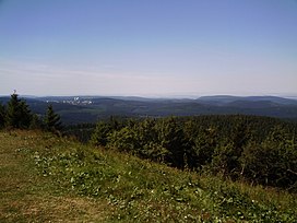
Frauenwald and Neustadt forms the most south-eastern part of the Thuringian forest proper. It is limited by state road B 4 in the northwest, and by a line along the rivers Talwasser (with Ilmsenbach), Neubrunn, and Schleuse. The adjacent Thuringian Slate Mountains form a
1376:, Lengwitz, and Nahe, and B 247 between Luisenthal and Suhl contains the three highest summits as well as the fifth highest summit of the whole range. The only settlements wholly within this region are Gehlberg north of Rennsteig and Vesser south of it. Parts of
968:
The much larger natural region of
Central Thuringian Forest with an area of about 850 km, whose ridge rises mostly above 600 m (2,000 ft), is subdivided into several parts described below in their sequence from the north-west to the south-east.
589:, the oldest unfolded overlying strata (dating from the Permosilesian age) of this basement are exposed in the Thuringian forest. Common to both ranges, but also to other low mountain ranges in Central Europe uplifted at the same time, are the bordering
759:, porphyrites, Rotliegend and Zechstein sediments, and thus forms part of the Variscan chain. It is about 11 km (6.8 mi) long and 1 km (0.62 mi) to 2 km (1.2 mi) wide, with an average altitude of 460 m. Mining for
1054:
and state road 1028 between
Georgenthal and Floh-Seligenthal which follows the valleys of the rivers Apfelstädt and Flohbach divide the area into segments. In this area the mountain ridge becomes more pronounced. The summit of
754:
foothills of
Southern Thuringia. It is oriented roughly parallel to the Thuringian Forest and, while a separate structure, is geologically very similar to the latter, as it consists of the same rock types such as granite,
240:
670:
are also constituents. In the Rotliegend era the region formed the crest of a mountain range where the debris originated that was deposited in the Eisenach trough and the northwestern part of the Oberhof trough.
1191:, reaches heights of around 900 m at several places southwest to west of Oberhof, but does not really form any individual mountains and has very much the character of a mountain crest. By contrast, the
523:) of the Oberhof trough. Ore deposits associated with the upthrust of the range have been of significant historical importance in the development of the region, for example, the metalworking tradition in
1112:
573:
towards the east. The geological borders differ from the geographical ones insofar, as the Rotliegend rock of the Thuringian forest finds its continuation in the Masserberg and Crock block in
1471:
geographically and geologically separate natural region, although they are often popularly referred to as a continuation of the former range. Populated places wholly within the region are
577:, southeast of the main range, and the rock types of the Thuringian Highland are also found in the Schleuse horst between Schönbrunn reservoir and Schönau, and in the Vesser complex near
890:
While the Thuringian Basin experiences less than 100 days per year with temperatures below 0 °C, this number rises to more than 150 in the upper altitudes of the Thuringian Forest.
2821:
771:
has been attempted there on several occasions, but was given up as unprofitable due to difficult drainage. Large baryte deposits prospected in the 1950s have remained untouched.
1546:
328:-dominated terrain of central Germany and the more rugged terrain characteristic of southern Germany, and also the boundary between the cultural regions of central and north
726:
deposits. These volcanic rocks alternate in sequence with the typical reddish molasse sediments (conglomerates, sandstones, siltstones, and claystones) of the Rotliegend.
2069:
710:
whose contents can be further subdivided into several formations. Their relative ages have not been fully resolved yet, partly because the Oberhof trough had been a
714:
zone with intense tectonics and continual changes of the internal relief and of the main areas of deposition. The tectonic processes were accompanied by an intense
1893:
1805:
407:. Both are in daily operation. A third line, the southern section of the Plaue–Themar railway, does not use a tunnel, but crosses the mountain ridge at Rennsteig
1059:
of volcanic origin causes a marked shift of the ridge towards the north. South of Georgenthal, the mountain range becomes the watershed between Elbe and Weser.
903:
The Northwest Thuringian Forest comprises an area of about 70 km reaching heights up to 470 m (1,540 ft), hardly exceeding those of the adjacent
915:
19 in the east and south, which follows the upper reaches of Elte river between the villages of Wilhelmsthal and Etterwinden. The predominant rock species is
2960:
2814:
1933:
324:) is an ancient path following the main ridge and connecting the summits. It is now a famous hiking path and marks the traditional boundary between the
1389:
392:
412:
1681:
to Schönbrunn, defined by the rivers Schleuse and Neubrunn on the southwestern slope, and Talwasser, Wohlrose and Möhre on the northeastern slope.
76:
787:
hills immediately north of and parallel to the Thuringian Forest between Eisenach, Waltershausen, Friedrichroda, and Georgenthal. An outcrop of
706:
The Oberhof trough is by far the largest of the main geologic parts of the Thuringian Forest. It consists of the uplifted part of the so-called
2955:
2807:
2965:
1730:
149:
2882:
2062:
1566:
Due to its geographical characteristics and the favourable climate, the Thuringian Forest is an important year-round tourist destination.
2730:
336:. Dialects and traditional customs and costumes are different on either side of the Rennsteig. The Rennsteig is the subject of the song
2402:
674:
The sedimentary, volcano-sedimentary, and magmatic rocks which were deposited or formed in the area from the Cambrian until the upper
1870:
Die Tetrapodenichnofauna des kontinentalen Oberkarbon und Perm im Thüringer Wald - Ichnotaxonomie, Paläoökologie und Biostratigraphie
1916:
1877:
1709:
115:
698:
400:
581:, an island of Variscan rocks embedded in Rotliegend. While the near-surface rocks of the Thuringian Highland comprise mostly the
2830:
2055:
1553:
2240:
1613:
253:, running northwest to southeast. Skirting from its southerly source in foothills to a gorge on its north-west side is the
2857:
2419:
1649:
1570:
play an important role, facilities of international significance are concentrated around Oberhof. Famous sights include
795:, but with numerous deeply eroded river valleys and the dense forestation they resemble very much the Thuringian Forest.
1486:
The main ridge of the mountain range exceeds altitudes of 800 m in several places. The highest and best known summit is
142:
69:
415:, due to be commissioned in December 2017, crosses the Thuringian Forest with the help of several tunnels and bridges.
2877:
1841:
2907:
2847:
1153:
617:
The Eisenach trough is part of the much larger Werra basin, which in turn is part of the Saar-Unstrut depression of
597:
reefs. These stretch especially wide on the northwestern edge of the Thuringian forest, where the landscape park of
2950:
2713:
2156:
638:
tectonic processes took place in the Werra basin which was by then a mostly consolidated depositional environment.
1768:
1526:
1377:
1302:. The Apfelstädt is impounded by the Tambach-Dietharz Dam into a small lake and the Schmalwasser and Ohra by the
578:
574:
2563:
2467:
2199:
2091:
1283:
735:
233:
538:-like fault block was part of the Saxonian tectonic processes and is understood as a long range effect of the
33:
650:
Outcrop of amphibolite and mica schist of the Ruhla Group of the Ruhla Crystalline Complex in a former quarry
2664:
2228:
2108:
1511:
Southwest by the Nahe, Trenkbach, Schleuse, Gabel, Tanne, and tributaries of the Neubrunn towards the Werra.
1197:
791:
rock can be found in their northern part, south of Waltershausen. They are generally regarded a part of the
621:
origin. It was uplifted as one of the fault blocks in the Saxonian tectonic era and is filled with Variscan
562:
2754:
2742:
2658:
2486:
2204:
1241:
1192:
1184:
1093:
923:
630:
488:
1746:
942:, the southern part into the Elte. Hence, the ridge of the Northwestern Thuringian Forest only forms the
2725:
2599:
2262:
1476:
1081:
2718:
2646:
2395:
1279:
1157:
2927:
1462:
1303:
1232:
1125:
2551:
2443:
1957:
1453:
Adlersberg massive (up to 892 m) with Ringberghaus hotel on Ringberg (746 m), a northwestern foothill
1441:(984 m, main crest 3,4 km east of Zella-Mehlis, highest elevation in the Thuringian Forest)
1245:
1177:
1066:
1056:
2587:
1534:
1085:
808:
654:
In the Ruhla anticline the basement rocks, folded in the Variscan era, are exposed. They are named
570:
338:
270:
196:
2575:
511:
origin which were uplifted in the Rotliegend era, and the conglomerates, sandstones, and abundant
2842:
2617:
2294:
2251:
1887:
1799:
1583:
1502:
986:
719:
586:
258:
206:
2706:
2682:
1678:
1438:
1267:
307:
52:
2867:
2862:
2546:
2330:
2270:
2257:
2235:
1912:
1873:
1726:
1705:
1605:
The Rennsteig trail is the most popular long-distance hiking trail in Germany. It is part of:
1393:
1385:
1361:
1334:
1251:
1145:
1051:
803:
The Thuringian Forest is located in the Central European transition zone between the Atlantic
598:
408:
396:
375:
359:
907:
forelands to the southwest, but exhibiting a much more pronounced relief. It stretches until
2689:
2628:
2558:
2414:
2407:
2354:
2299:
2223:
1636:
1632:
1625:
1428:
1326:
1161:
1117:
1089:
1047:
1035:
792:
718:
volcanism which was the origin of many volcanic rock formations, predominantly rhyolites of
609:
566:
554:
480:
460:
404:
367:
355:
262:
1539:
Großer Hundskopf (824 m) with a transmitter site on its foothill Kalter Staudenkopf (768 m)
1392:
pass under the Brandleite Massif between Gehlberg and Oberhof in Rennsteig road tunnel and
459:
Geologically, the Thuringian Forest is defined by a belt of strongly uplifted and deformed
451:
2522:
2462:
2282:
2126:
2115:
2078:
1373:
943:
804:
558:
535:
226:
2131:
2120:
1169:
1042:
is geologically more heterogeneous than the region around Ruhla. State road 1026 between
912:
613:
Permian conglomerate of the Eisenach formation from an alluvial fan below Wartburg castle
380:
1961:
1050:
which follows the valleys of the rivers Schilfwasser and Schmalkalde and passes through
2431:
2359:
2347:
2186:
2151:
2096:
1450:
Großer Eisenberg (907 m), whose name bears witness to ore mining activities in the past
1420:
1369:
1354:
1314:
1173:
1077:
582:
539:
423:
366:, crosses the range from the northeast to the southwest, passes under the ridge in the
269:. The south and south-east continuation of the range is the highland often called the
2944:
2902:
2570:
2510:
2474:
2450:
2287:
1591:
1579:
1530:
1322:
1149:
1097:
1043:
904:
784:
659:
512:
435:
2789:
1479:, and Oehrenstock. Parts of Stützerbach also reach into this area. Roads follow the
1211:
2892:
2773:
2669:
2653:
2503:
2306:
2216:
2103:
1567:
1424:
1412:
1291:
1255:
1216:
1133:
747:
679:
634:
464:
342:
2479:
2275:
2799:
2749:
2539:
2515:
2491:
2382:
2366:
2211:
1318:
788:
702:
Falkenstein near Tambach-Dietharz, consisting of volcanites of Oberhof formation
476:
1556:
Sunrise on the mountain Ruppberg near Zella-Mehlis (Thuringian Forest, Germany)
1525:
Großer Dreiherrnstein (838 m), 500 m from the tripoint of the former countries
1349:
1278:
The northeastern flank of the mountains is drained by right tributaries of the
1203:
2917:
2766:
2761:
2737:
2455:
2426:
2311:
2168:
2163:
1487:
1472:
1408:
1404:
1400:
1129:
1039:
918:
618:
543:
492:
431:
419:
2047:
1419:, and by Freibach stream, a tributary of Ilm river, and towards the south by
1321:
and by rivers and streams belonging to the fan-like system of tributaries of
938:
castle. The northern part of the area is drained by several streams into the
164:
151:
91:
78:
2887:
2778:
2694:
2371:
2335:
2246:
2191:
2180:
1235:(897 m, south of the Rennsteig, north of Zella-Mehlis) with remarkable
1165:
927:
646:
590:
508:
484:
333:
329:
316:
296:
sit in slight dips on the range itself to the north and south respectively.
250:
135:
2641:
939:
629:
after the location. It consists mostly of monotonous sequences of reddish
2872:
2852:
2594:
2498:
2438:
2377:
2144:
1575:
1571:
1522:
Kickelhahn (861 m) with observation tower, "backyard mountain" of Ilmenau
1307:
1272:
1073:
961:
935:
768:
760:
756:
751:
675:
667:
663:
547:
520:
516:
285:
277:
254:
2041:
1769:"Die Bauabschnitte der VDE 8.1 Neubausstrecke (sic!) Ebensfeld – Erfurt"
1018:
Windsberg (671 m), foothill of Birkenheide and site of Altenstein castle
426:
network, serves the northern foothills of the Thuringian Forest between
2633:
2622:
2611:
2606:
2582:
2534:
2323:
2139:
1952:
Martin Meschede (24 March 2015). "Deutschland im Perm und Mesozoikum".
1599:
1491:
1416:
1365:
1295:
994:
715:
622:
594:
528:
496:
289:
246:
186:
553:
Thuringian forest is surrounded on three sides by triassic rocks: the
2677:
2527:
1674:
1002:
998:
764:
687:
683:
682:
during the Variscan uplift and are now mostly present in the form of
500:
471:(to the northeast) from similar rock formations in the valley of the
363:
266:
59:
1935:
Exkursionsführer in das Kyffhäuser Kristallin und Ruhlaer Kristallin
1069:(916.5 m) between Brotterode and Tabarz, popular tourist destination
2021:
The Häselbach is, especially in its source region, also called the
2175:
1506:
1461:
1348:
1338:
1299:
1266:
1236:
1210:
1202:
1111:
978:
947:
697:
645:
608:
472:
450:
427:
281:
1427:, feeding the Erle reservoir, Breitenbach, Vesser, and Nahe into
911:
stream, a tributary or Erbstrom river, in the north east, and to
662:
considered part of the Central German Crystalline Zone, of which
2912:
2342:
2318:
2036:
1595:
1287:
1141:
1137:
743:
723:
711:
524:
411:
station. It has only been used by museum trains since 1998. The
388:
88 skirts the northern foothills between Eisenach and Geraberg.
371:
348:
325:
293:
2803:
2051:
1254:(866 m, southwest flank) - local mountain (northwest) for
2390:
1819:
257:. On the other side of the Forest is an upper outcrop of the
1515:
The Schleuse, Gabel and Tanne feed the Schönbrunn reservoir.
601:
is located on one of the largest Zechstein reefs in Germany.
276:
Among scattered foothills at its northern foot are the towns
2926:
1994:. Remagen and Bad Godesberg: Bundesanstalt für Landeskunde.
467:
that divides the relatively flat sedimentary plains of the
384:
19 and 84, pass over the western parts of the range, while
1771:. DB Netz AG, Verkehrsprojekt Deutsche Einheit Nr. 8. 2017
1721:
Kohl, Horst; Marcinek, Joachim and Nitz, Bernhard (1986).
1444:
Schneekopf (978 m), transmitter site and observation tower
1226:
Schützenberg (904 m, main crest southwest of Oberhof)
1381:
some distance in the horseshoe-shaped Adlersberg massif.
960:
Wartberg (about 390 m, north of the main ridge), site of
2044:, a web page with many pictures of Thuringian landscapes
495:
age in its western parts (Eisenach trough), followed by
1792:
75 Jahre Thüringerwaldbahn, 110 Jahre Straßenbahn Gotha
1313:
The south is drained by the Asbach which flows via the
403:
between Eisenach and Eisfeld does so in a tunnel near
1956:. Berlin and Heidelberg: Springer. pp. 103–159.
1822:. Verein für Archäologie und Denkmalpflege e. V. Suhl
1483:, the mountain crests, or the valleys of the rivers.
1992:
Handbuch der naturräumlichen Gliederung Deutschlands
1229:
Greifenberg (901 m, main crest west of Oberhof)
1399:The area is drained towards the north by the river
1244:(867 m, southwest flank) - local mountain for
1038:, the part of Thuringian forest around the town of
1012:
Birkenheide (717 m, immediately south of Rennsteig)
245:) is a mountain range in the southern parts of the
205:
195:
185:
180:
141:
131:
123:
107:
68:
58:
48:
43:
21:
1704:(3rd ed.). London: Chatto & Windus, p. 288-9.
1447:Großer Finsterberg (944 m), with observation tower
1148:to the south and finally the lower reaches of the
1741:
1739:
1598:, and the historic town centres of Eisenach and
1290:, notably the Kernwasser, via the (Apfelstädt,)
1207:The main crags on Gebrannter Stein (897 m)
750:, northwest of Schleuse river, embedded in the
561:in the west, and the northeastern parts of the
311:at 982 m (3,222 ft) above sea level.
16:Mountain range in the German state of Thuringia
1609:the mountainous path from Eisenach to Budapest
1337:and a stream from Albrechts, feeding into the
815:The mean temperatures decrease with altitude:
2815:
2063:
1820:"Erkenntnisse zum Bergbau in der Region Suhl"
358:passes north of the Thuringian Forest, while
8:
1990:Emil Meynen, Josef Schmithüsen (1953–1962).
1103:Gerberstein (728 m) with an outlook platform
946:between Hörsel and the middle course of the
1723:Geography of the German Democratic Republic
475:(to the southwest). It consists of a large
2822:
2808:
2800:
2070:
2056:
2048:
1907:Dierk Henningsen, Gerhard Katzung (2006).
1892:: CS1 maint: location missing publisher (
1863:
1861:
1859:
1804:: CS1 maint: location missing publisher (
1490:(861 metres above sea level) southwest of
1116:East German winter sport championships in
18:
1977:Die Geologie des Kleinen Thüringer Waldes
1911:. München: Spektrum Akademischer Verlag.
1466:Kickelhahn with Ilmenau in the foreground
1403:which feeds the Lütsche reservoir and by
1072:Großer Weißenberg (747 m), location of a
1790:Bernd Blickensdorf; et al. (2004).
934:, a narrow gorge near Eisenach, and the
817:
658:after the location and are according to
1909:Einführung in die Geologie Deutschlands
1693:
1666:
977:This part, situated around the town of
1885:
1797:
1505:of the Ilm's tributaries, towards the
1423:, a tributary of Hasel, and mainly by
930:. The area is known for the so-called
271:Thuringian-Vogtlandian Slate Mountains
1842:"Collection: "Der Ilmenauer Bergbau""
1725:, VEB Hermann Haack, Gotha, p. 7 ff.
1458:Frauenwald-Neustadt Thuringian Forest
779:The Waltershausen foothills (German:
232:
7:
1390:Neudietendorf–Ritschenhausen railway
393:Neudietendorf–Ritschenhausen railway
38:View from Schneekopf towards Oberhof
1749:(in German). Bergmannsverein Erfurt
455:Geological map of Thuringian Forest
413:Nuremberg–Erfurt high-speed railway
362:, intersecting the former south of
2961:Forests and woodlands of Thuringia
1360:This region between federal roads
1144:to the north, a section along the
399:between Gehlberg and Oberhof, the
211:sedimentary, metamorphic, magmatic
14:
1673:The geological divisor runs from
1631:. The latter links the abbeys of
1108:Tambach-Oberhof Thuringian Forest
483:orientation, which consists from
395:crosses the Thuringian Forest in
370:near Oberhof, and is joined near
2788:
1545:
1076:between the former countries of
985:, is geologically formed by the
378:. Two more long-distance roads,
114:
32:
2908:Vesser Valley Thuringian Forest
1614:E3 European long distance path
1286:, and left tributaries of the
1200:, is also found in this area.
1180:and the town of Zella-Mehlis.
550:after about 40 million years.
1:
2956:Biosphere reserves of Germany
2008:in its upper reaches and the
1650:Thuringian Forest Nature Park
742:) is a narrow horst south of
2966:Mountain ranges of Thuringia
1215:View from the Ruppberg near
1030:Brotterode Thuringian Forest
722:structure with accompanying
300:Geography and communications
2004:The Schwarza is called the
957:Großer Drachenstein (470 m)
899:Northwest Thuringian Forest
2982:
2714:Thuringian Slate Mountains
2042:Thueringer-landschaften.de
1975:Maximilian Tornow (1907).
1872:. Göttingen. p. 308.
1844:. museum-digital thüringen
1345:Gehlberg Thuringian Forest
678:were subjected to intense
546:era and ended in the late
527:and the mining history of
265:, which includes the city
64:983 m (3,225 ft)
2924:
2838:
2786:
2690:Teutoburg Forest (Osning)
2086:
1747:"Thüringer Bergbau heute"
1620:Thüringen-Rhein-Wanderweg
1594:, the firearms museum in
1518:Notable summits include:
1434:Notable summits include:
1222:Notable summits include:
1088:and of today's districts
1062:Notable summits include:
1008:Notable summits include:
953:Notable summits include:
565:in the south, and by the
112:
31:
26:
2200:Elbe Sandstone Mountains
2092:Anterior Bavarian Forest
1868:Sebastian Voigt (2005).
1310:into larger reservoirs.
1258:, with observation tower
1248:, with observation tower
783:) are a wooded chain of
736:Little Thuringian Forest
730:Little Thuringian Forest
633:representing a proximal
542:. It began in the upper
434:, including a branch to
1372:, following the rivers
1160:in the municipality of
973:Ruhla Thuringian Forest
775:Waltershausen Foothills
708:Thuringian Forest Basin
593:deposits which contain
575:Hildburghausen district
563:South German Scarplands
234:[ˈtyːʁɪŋɐˈvalt]
2932:
2487:North Palatine Uplands
1590:, a former mine) near
1467:
1357:
1275:
1219:
1208:
1121:
1094:Schmalkalden-Meiningen
1021:Ringberg (639 m) with
781:Waltershäuser Vorberge
740:Kleiner Thüringer Wald
703:
651:
614:
557:in the northeast, the
456:
2930:
2726:Upper Palatine Forest
2600:Geiersberg (Breitsol)
2169:(Prussian) Velmerstot
1954:Geologie Deutschlands
1477:Neustadt am Rennsteig
1465:
1352:
1270:
1214:
1206:
1187:, accompanied by the
1115:
1082:Saxe-Coburg and Gotha
701:
649:
612:
454:
418:Thüringerwaldbahn, a
92:50.65944°N 10.74500°E
2755:Paschenburg Mountain
2324:Brocken (Blocksberg)
2012:in its middle course
1700:Elkins, T H (1972).
1656:Notes and references
1582:lived in exile, the
1527:Schwarzburg-Arnstadt
1325:, in particular the
1246:Steinbach-Hallenberg
1185:Elbe-Weser watershed
1178:Steinbach-Hallenberg
1140:, which follows the
2205:Großer Zschirnstein
1962:2015gede.book.....M
1242:Großer Hermannsberg
1193:Großer Hermannsberg
1025:(observation tower)
809:continental climate
571:Thuringian Highland
507:formation of early
161: /
88: /
2933:
2883:Schorfheide-Chorin
2843:Berchtesgaden Alps
2831:Biosphere reserves
2719:Großer Farmdenkopf
2618:Lusatian Mountains
2295:Gladenbach Uplands
2263:Sieben-Linden-Berg
2037:Thueringer-wald.de
1932:Armin Zeh (2005).
1562:Tourism and sights
1468:
1358:
1353:View at a part of
1276:
1220:
1209:
1122:
991:Ruhlaer Kristallin
704:
656:Ruhlaer Kristallin
652:
627:Eisenach formation
615:
534:The uplift of the
505:Ruhlaer Kristallin
457:
420:cross-country line
320:(sometimes called
259:North German Plain
191:Variscan, Saxonian
97:50.65944; 10.74500
44:Highest point
2951:Thuringian Forest
2938:
2937:
2898:Thuringian Forest
2863:Palatinate Forest
2797:
2796:
2702:Thuringian Forest
2547:Rothaar Mountains
2396:Lauensteiner Kopf
2331:Hildesheim Forest
2271:Franconian Forest
2236:Fichtel Mountains
1731:978-3-7301-0522-1
1497:The zone drains:
1394:Brandleite Tunnel
1282:, especially the
1158:Struth-Helmershof
1067:Großer Inselsberg
1057:Großer Inselsberg
1052:Kleinschmalkalden
888:
887:
824:Thuringian Basin
746:and northwest of
599:Altenstein Palace
397:Brandleite Tunnel
347:, the unofficial
219:Thuringian Forest
215:
214:
165:50.667°N 10.750°E
143:Range coordinates
22:Thuringian Forest
2973:
2824:
2817:
2810:
2801:
2792:
2629:Zittau Mountains
2559:Saalhausen Hills
2415:Kaufungen Forest
2224:Elster Mountains
2072:
2065:
2058:
2049:
2025:
2019:
2013:
2002:
1996:
1995:
1987:
1981:
1980:
1972:
1966:
1965:
1949:
1943:
1942:
1940:
1929:
1923:
1922:
1904:
1898:
1897:
1891:
1883:
1865:
1854:
1853:
1851:
1849:
1838:
1832:
1831:
1829:
1827:
1816:
1810:
1809:
1803:
1795:
1787:
1781:
1780:
1778:
1776:
1765:
1759:
1758:
1756:
1754:
1743:
1734:
1719:
1713:
1698:
1682:
1671:
1549:
1263:Rivers and lakes
1233:Gebrannter Stein
1162:Floh-Seligenthal
1132:via Oberhof and
1120:, February 1951.
1048:Floh-Seligenthal
1036:Tambach-Dietharz
1015:Glöckner (702 m)
993:, consisting of
818:
793:Thuringian Basin
555:Thuringian Basin
469:Thüringer Becken
368:Rennsteig Tunnel
263:Thuringian Basin
244:
243:
242:
236:
231:
176:
175:
173:
172:
171:
166:
162:
159:
158:
157:
154:
118:
103:
102:
100:
99:
98:
93:
89:
86:
85:
84:
81:
36:
19:
2981:
2980:
2976:
2975:
2974:
2972:
2971:
2970:
2941:
2940:
2939:
2934:
2931:Flag of Germany
2922:
2834:
2828:
2798:
2793:
2784:
2707:Großer Beerberg
2683:Großer Feldberg
2523:Palatine Forest
2463:Lenne Mountains
2283:Franconian Jura
2127:Bavarian Forest
2116:Bohemian Forest
2082:
2079:Central Uplands
2076:
2033:
2028:
2020:
2016:
2003:
1999:
1989:
1988:
1984:
1974:
1973:
1969:
1951:
1950:
1946:
1938:
1931:
1930:
1926:
1919:
1906:
1905:
1901:
1884:
1880:
1867:
1866:
1857:
1847:
1845:
1840:
1839:
1835:
1825:
1823:
1818:
1817:
1813:
1796:
1789:
1788:
1784:
1774:
1772:
1767:
1766:
1762:
1752:
1750:
1745:
1744:
1737:
1720:
1716:
1699:
1695:
1686:
1685:
1679:Großbreitenbach
1672:
1668:
1658:
1646:
1588:Marienglashöhle
1574:Castle outside
1564:
1559:
1558:
1557:
1555:
1550:
1460:
1439:Großer Beerberg
1347:
1265:
1110:
1034:Reaching until
1032:
975:
932:Drachenschlucht
901:
896:
894:Natural regions
872:Yearly average
805:oceanic climate
801:
777:
732:
696:
644:
642:Ruhla anticline
607:
605:Eisenach trough
559:Hesse Highlands
449:
444:
308:Großer Beerberg
302:
288:. The towns of
239:
238:
237:
229:
169:
167:
163:
160:
155:
152:
150:
148:
147:
119:
96:
94:
90:
87:
82:
79:
77:
75:
74:
53:Großer Beerberg
39:
17:
12:
11:
5:
2979:
2977:
2969:
2968:
2963:
2958:
2953:
2943:
2942:
2936:
2935:
2925:
2923:
2921:
2920:
2915:
2910:
2905:
2900:
2895:
2890:
2885:
2880:
2875:
2870:
2868:Rhön Mountains
2865:
2860:
2855:
2850:
2845:
2839:
2836:
2835:
2829:
2827:
2826:
2819:
2812:
2804:
2795:
2794:
2787:
2785:
2783:
2782:
2770:
2758:
2746:
2734:
2722:
2710:
2698:
2686:
2674:
2650:
2638:
2603:
2591:
2579:
2567:
2555:
2543:
2531:
2519:
2507:
2495:
2483:
2471:
2459:
2447:
2435:
2423:
2411:
2399:
2387:
2363:
2360:Kasseler Kuppe
2351:
2339:
2327:
2315:
2307:Goshawk Forest
2303:
2291:
2279:
2267:
2232:
2220:
2208:
2196:
2187:Volcanic Eifel
2172:
2164:Egge Mountains
2160:
2152:Ebbe Mountains
2148:
2136:
2112:
2100:
2087:
2084:
2083:
2077:
2075:
2074:
2067:
2060:
2052:
2046:
2045:
2039:
2032:
2031:External links
2029:
2027:
2026:
2014:
1997:
1982:
1967:
1944:
1924:
1917:
1899:
1878:
1855:
1833:
1811:
1782:
1760:
1735:
1714:
1692:
1691:
1690:
1684:
1683:
1665:
1664:
1663:
1662:
1657:
1654:
1653:
1652:
1645:
1642:
1641:
1640:
1622:
1616:
1610:
1563:
1560:
1552:
1551:
1544:
1543:
1542:
1541:
1540:
1537:
1523:
1513:
1512:
1509:
1459:
1456:
1455:
1454:
1451:
1448:
1445:
1442:
1346:
1343:
1264:
1261:
1260:
1259:
1249:
1239:
1230:
1227:
1109:
1106:
1105:
1104:
1101:
1078:Saxe-Meiningen
1070:
1031:
1028:
1027:
1026:
1019:
1016:
1013:
974:
971:
966:
965:
958:
900:
897:
895:
892:
886:
885:
882:
879:
876:
873:
869:
868:
865:
862:
859:
856:
852:
851:
848:
845:
842:
839:
835:
834:
831:
828:
825:
822:
800:
797:
776:
773:
731:
728:
695:
694:Oberhof trough
692:
643:
640:
606:
603:
540:Alpine orogeny
513:volcanic rocks
448:
445:
443:
440:
351:of Thuringia.
301:
298:
223:Thüringer Wald
213:
212:
209:
203:
202:
199:
193:
192:
189:
183:
182:
178:
177:
170:50.667; 10.750
145:
139:
138:
133:
129:
128:
125:
121:
120:
113:
110:
109:
105:
104:
72:
66:
65:
62:
56:
55:
50:
46:
45:
41:
40:
37:
29:
28:
27:Thüringer Wald
24:
23:
15:
13:
10:
9:
6:
4:
3:
2:
2978:
2967:
2964:
2962:
2959:
2957:
2954:
2952:
2949:
2948:
2946:
2929:
2919:
2916:
2914:
2911:
2909:
2906:
2904:
2903:Upper Lusatia
2901:
2899:
2896:
2894:
2891:
2889:
2886:
2884:
2881:
2879:
2876:
2874:
2871:
2869:
2866:
2864:
2861:
2859:
2856:
2854:
2851:
2849:
2846:
2844:
2841:
2840:
2837:
2832:
2825:
2820:
2818:
2813:
2811:
2806:
2805:
2802:
2791:
2781:
2780:
2776:
2775:
2771:
2769:
2768:
2764:
2763:
2759:
2757:
2756:
2752:
2751:
2747:
2745:
2744:
2740:
2739:
2735:
2733:
2732:
2728:
2727:
2723:
2721:
2720:
2716:
2715:
2711:
2709:
2708:
2704:
2703:
2699:
2697:
2696:
2692:
2691:
2687:
2685:
2684:
2680:
2679:
2675:
2672:
2671:
2667:
2666:
2661:
2660:
2656:
2655:
2651:
2649:
2648:
2644:
2643:
2639:
2636:
2635:
2634:Lausche (Luž)
2631:
2630:
2625:
2624:
2623:Lausche (Luž)
2620:
2619:
2614:
2613:
2612:Lausche (Luž)
2609:
2608:
2604:
2602:
2601:
2597:
2596:
2592:
2590:
2589:
2585:
2584:
2580:
2578:
2577:
2576:Großer Ölberg
2573:
2572:
2571:Siebengebirge
2568:
2566:
2565:
2561:
2560:
2556:
2554:
2553:
2549:
2548:
2544:
2542:
2541:
2537:
2536:
2532:
2530:
2529:
2525:
2524:
2520:
2518:
2517:
2513:
2512:
2511:Ore Mountains
2508:
2506:
2505:
2501:
2500:
2496:
2494:
2493:
2489:
2488:
2484:
2482:
2481:
2477:
2476:
2475:Lippe Uplands
2472:
2470:
2469:
2465:
2464:
2460:
2458:
2457:
2453:
2452:
2448:
2446:
2445:
2441:
2440:
2436:
2434:
2433:
2429:
2428:
2424:
2422:
2421:
2417:
2416:
2412:
2410:
2409:
2405:
2404:
2400:
2398:
2397:
2393:
2392:
2388:
2385:
2384:
2380:
2379:
2374:
2373:
2369:
2368:
2364:
2362:
2361:
2357:
2356:
2355:Hoher Meißner
2352:
2350:
2349:
2345:
2344:
2340:
2338:
2337:
2333:
2332:
2328:
2326:
2325:
2321:
2320:
2316:
2314:
2313:
2309:
2308:
2304:
2302:
2301:
2297:
2296:
2292:
2290:
2289:
2285:
2284:
2280:
2278:
2277:
2273:
2272:
2268:
2265:
2264:
2260:
2259:
2254:
2253:
2249:
2248:
2243:
2242:
2238:
2237:
2233:
2231:
2230:
2226:
2225:
2221:
2219:
2218:
2214:
2213:
2209:
2207:
2206:
2202:
2201:
2197:
2194:
2193:
2189:
2188:
2183:
2182:
2178:
2177:
2173:
2171:
2170:
2166:
2165:
2161:
2159:
2158:
2154:
2153:
2149:
2147:
2146:
2142:
2141:
2137:
2134:
2133:
2129:
2128:
2123:
2122:
2118:
2117:
2113:
2111:
2110:
2106:
2105:
2101:
2099:
2098:
2094:
2093:
2089:
2088:
2085:
2080:
2073:
2068:
2066:
2061:
2059:
2054:
2053:
2050:
2043:
2040:
2038:
2035:
2034:
2030:
2024:
2018:
2015:
2011:
2007:
2001:
1998:
1993:
1986:
1983:
1978:
1971:
1968:
1963:
1959:
1955:
1948:
1945:
1941:. p. 44.
1937:
1936:
1928:
1925:
1920:
1918:3-8274-1586-1
1914:
1910:
1903:
1900:
1895:
1889:
1881:
1879:3-86537-432-8
1875:
1871:
1864:
1862:
1860:
1856:
1843:
1837:
1834:
1821:
1815:
1812:
1807:
1801:
1793:
1786:
1783:
1770:
1764:
1761:
1748:
1742:
1740:
1736:
1732:
1728:
1724:
1718:
1715:
1711:
1710:9780701106515
1707:
1703:
1697:
1694:
1688:
1687:
1680:
1676:
1670:
1667:
1660:
1659:
1655:
1651:
1648:
1647:
1643:
1638:
1634:
1630:
1627:
1626:pilgrims' way
1624:(partly) the
1623:
1621:
1617:
1615:
1611:
1608:
1607:
1606:
1603:
1601:
1597:
1593:
1592:Friedrichroda
1589:
1585:
1581:
1580:Martin Luther
1577:
1573:
1569:
1568:Winter sports
1561:
1554:
1548:
1538:
1536:
1532:
1531:Saxe-Eisenach
1528:
1524:
1521:
1520:
1519:
1516:
1510:
1508:
1504:
1501:Northeast by
1500:
1499:
1498:
1495:
1493:
1489:
1484:
1482:
1478:
1474:
1464:
1457:
1452:
1449:
1446:
1443:
1440:
1437:
1436:
1435:
1432:
1430:
1426:
1422:
1418:
1414:
1410:
1406:
1402:
1397:
1395:
1391:
1387:
1382:
1379:
1375:
1371:
1367:
1363:
1356:
1351:
1344:
1342:
1340:
1336:
1332:
1328:
1324:
1323:Hasel (Werra)
1320:
1316:
1311:
1309:
1305:
1301:
1297:
1293:
1289:
1285:
1281:
1274:
1269:
1262:
1257:
1253:
1250:
1247:
1243:
1240:
1238:
1234:
1231:
1228:
1225:
1224:
1223:
1218:
1213:
1205:
1201:
1199:
1194:
1190:
1186:
1181:
1179:
1175:
1171:
1167:
1163:
1159:
1155:
1151:
1147:
1143:
1139:
1135:
1131:
1127:
1119:
1114:
1107:
1102:
1099:
1098:Wartburgkreis
1095:
1091:
1087:
1083:
1079:
1075:
1071:
1068:
1065:
1064:
1063:
1060:
1058:
1053:
1049:
1045:
1044:Friedrichroda
1041:
1037:
1029:
1024:
1023:Alexanderturm
1020:
1017:
1014:
1011:
1010:
1009:
1006:
1004:
1000:
996:
992:
989:rocks of the
988:
984:
981:north of the
980:
972:
970:
963:
959:
956:
955:
954:
951:
949:
945:
941:
937:
933:
929:
925:
924:conglomerates
921:
920:
914:
910:
906:
905:Buntsandstein
898:
893:
891:
883:
880:
877:
874:
871:
870:
866:
863:
860:
858:-0.5 °C
857:
854:
853:
850:12.5 °C
849:
846:
844:15.5 °C
843:
840:
837:
836:
832:
829:
826:
823:
820:
819:
816:
813:
810:
806:
798:
796:
794:
790:
786:
785:Buntsandstein
782:
774:
772:
770:
766:
762:
758:
753:
749:
745:
741:
737:
729:
727:
725:
721:
717:
713:
709:
700:
693:
691:
689:
685:
681:
680:metamorphosis
677:
672:
669:
665:
661:
660:Franz Kossmat
657:
648:
641:
639:
636:
632:
631:conglomerates
628:
624:
620:
619:early Permian
611:
604:
602:
600:
596:
592:
588:
584:
580:
576:
572:
569:rocks of the
568:
564:
560:
556:
551:
549:
545:
541:
537:
532:
530:
526:
522:
518:
514:
510:
506:
502:
498:
494:
490:
489:conglomerates
486:
482:
478:
474:
470:
466:
462:
453:
446:
441:
439:
437:
436:Waltershausen
433:
429:
425:
424:Gotha tramway
421:
416:
414:
410:
406:
402:
401:Werra Railway
398:
394:
389:
387:
383:
382:
381:Bundesstraßen
377:
373:
369:
365:
361:
357:
352:
350:
346:
344:
340:
339:Rennsteiglied
335:
331:
327:
323:
319:
318:
312:
310:
309:
299:
297:
295:
291:
287:
283:
279:
274:
272:
268:
264:
260:
256:
252:
248:
241:
235:
228:
224:
220:
210:
208:
204:
200:
198:
194:
190:
188:
184:
179:
174:
146:
144:
140:
137:
134:
130:
126:
122:
117:
111:
106:
101:
73:
71:
67:
63:
61:
57:
54:
51:
47:
42:
35:
30:
25:
20:
2897:
2893:Swabian Jura
2848:Black Forest
2777:
2774:Wiehen Hills
2772:
2765:
2760:
2753:
2748:
2741:
2736:
2729:
2724:
2717:
2712:
2705:
2701:
2700:
2693:
2688:
2681:
2676:
2670:Hoher Randen
2668:
2663:
2657:
2654:Swabian Jura
2652:
2645:
2640:
2632:
2627:
2621:
2616:
2610:
2605:
2598:
2593:
2586:
2581:
2574:
2569:
2562:
2557:
2550:
2545:
2538:
2533:
2526:
2521:
2514:
2509:
2504:Katzenbuckel
2502:
2497:
2490:
2485:
2478:
2473:
2466:
2461:
2454:
2449:
2442:
2437:
2430:
2425:
2418:
2413:
2406:
2401:
2394:
2389:
2381:
2376:
2370:
2365:
2358:
2353:
2346:
2341:
2334:
2329:
2322:
2317:
2310:
2305:
2298:
2293:
2286:
2281:
2274:
2269:
2261:
2256:
2250:
2245:
2239:
2234:
2229:Kapellenberg
2227:
2222:
2217:Eilumer Horn
2215:
2210:
2203:
2198:
2190:
2185:
2179:
2174:
2167:
2162:
2155:
2150:
2143:
2138:
2132:Großer Arber
2130:
2125:
2121:Großer Arber
2119:
2114:
2107:
2104:Black Forest
2102:
2095:
2090:
2022:
2017:
2009:
2005:
2000:
1991:
1985:
1976:
1970:
1953:
1947:
1934:
1927:
1908:
1902:
1869:
1846:. Retrieved
1836:
1824:. Retrieved
1814:
1791:
1785:
1773:. Retrieved
1763:
1751:. Retrieved
1722:
1717:
1701:
1696:
1669:
1629:or Via Porta
1628:
1619:
1604:
1587:
1565:
1517:
1514:
1496:
1485:
1480:
1475:, Allzunah,
1469:
1433:
1398:
1383:
1378:Schmiedefeld
1359:
1330:
1312:
1304:Schmalwasser
1284:Schmalwasser
1277:
1256:Zella-Mehlis
1221:
1217:Zella-Mehlis
1188:
1182:
1170:Unterschönau
1134:Zella-Mehlis
1123:
1061:
1033:
1022:
1007:
990:
982:
976:
967:
952:
931:
916:
913:Bundesstraße
908:
902:
889:
878:6.5 °C
875:8.5 °C
814:
802:
780:
778:
748:Schleusingen
739:
733:
707:
705:
673:
655:
653:
635:alluvial fan
626:
616:
579:Schmiedefeld
552:
533:
504:
468:
465:igneous rock
458:
417:
390:
386:Bundesstraße
385:
379:
353:
337:
321:
315:
313:
306:
303:
275:
255:Werra valley
222:
218:
216:
207:Type of rock
2858:Middle Elbe
2750:Weser Hills
2731:Kreuzfelsen
2588:Große Blöße
2540:Wasserkuppe
2516:Fichtelberg
2492:Donnersberg
2432:Wüstegarten
2403:Kaiserstuhl
2383:Ellerspring
2348:Bloße Zelle
2097:Einödriegel
2023:Dürre Hasel
1370:Stützerbach
1355:Stützerbach
1319:Schmalkalde
1198:Falkenstein
1196:range, the
1176:suburbs of
1174:Oberschönau
1154:Schnellbach
917:Eisenacher
867:-4 °C
864:-3 °C
861:-2 °C
847:14 °C
841:18 °C
789:Muschelkalk
477:fault block
461:metamorphic
197:Age of rock
168: /
95: /
70:Coordinates
2945:Categories
2918:Wadden Sea
2833:in Germany
2767:Fuchskaute
2762:Westerwald
2738:Vogelsberg
2552:Langenberg
2456:Kulpenberg
2451:Kyffhäuser
2427:Kellerwald
2420:Hirschberg
2312:Hohes Gras
2288:Dürrenberg
2241:Schneeberg
2081:of Germany
1848:3 February
1826:3 February
1775:3 February
1753:23 January
1689:References
1637:Waldsassen
1633:Volkenroda
1488:Kickelhahn
1473:Frauenwald
1415:river and
1409:Zahme Gera
1405:Wilde Gera
1280:Apfelstädt
1150:Mühlwasser
1130:Luisenthal
1040:Brotterode
928:sandstones
919:Rotliegend
884:4 °C
881:5 °C
544:Cretaceous
493:Rotliegend
485:sandstones
432:Bad Tabarz
409:switchback
230:pronounced
83:10°44′42″E
80:50°39′34″N
2888:Spreewald
2878:Schaalsee
2779:Heidbrink
2743:Taufstein
2695:Barnacken
2647:Hohe Egge
2480:Köterberg
2444:Eisenberg
2408:Totenkopf
2372:Erbeskopf
2336:Griesberg
2300:Angelburg
2276:Döbraberg
2247:Steinwald
2192:Ernstberg
2181:Hohe Acht
2157:Nordhelle
2006:Haselbach
1979:. Schade.
1888:cite book
1800:cite book
1535:Henneberg
1481:Rennsteig
1384:Motorway
1335:Lichtenau
1331:Häselbach
1317:into the
1308:Ohra Dams
1298:into the
1189:Rennsteig
1166:Rotterode
1146:Lichtenau
1086:Kurhessen
983:Rennsteig
944:watershed
922:, namely
821:Altitude
738:(German:
720:porphyric
591:Zechstein
585:Variscan
521:andesites
517:rhyolites
509:paleozoic
481:hercynian
354:Motorway
334:Franconia
330:Thuringia
317:Rennsteig
251:Thuringia
249:state of
201:Paleozoic
136:Thuringia
108:Geography
60:Elevation
2853:Bliesgau
2595:Spessart
2499:Odenwald
2378:Soonwald
2367:Hunsrück
2258:Kohlwald
2109:Feldberg
1794:. Gotha.
1644:See also
1584:selenite
1576:Eisenach
1572:Wartburg
1429:Schleuse
1411:towards
1388:and the
1364:between
1327:Schwarza
1273:Ohra Dam
1252:Ruppberg
1074:tripoint
995:granites
987:basement
962:Wartburg
936:Wartburg
909:Moosbach
855:January
807:and the
769:limonite
761:fluorite
757:hornfels
752:Triassic
716:felsitic
676:Devonian
668:Spessart
664:Odenwald
625:, named
623:molasses
587:basement
567:Variscan
548:Tertiary
501:gneisses
497:granites
447:Overview
286:Arnstadt
278:Eisenach
2659:Lemberg
2607:Sudetes
2583:Solling
2564:Himberg
2140:Deister
2010:Schönau
1958:Bibcode
1702:Germany
1600:Ilmenau
1503:the fan
1492:Ilmenau
1417:Unstrut
1401:Lütsche
1366:Ilmenau
1296:Unstrut
1118:Oberhof
799:Climate
595:Bryozoa
529:Ilmenau
503:of the
442:Geology
422:of the
322:Rennweg
290:Ilmenau
187:Orogeny
181:Geology
156:10°45′E
153:50°40′N
127:Germany
124:Country
2678:Taunus
2665:Randen
2642:Süntel
2528:Kalmit
2468:Homert
2252:Platte
1915:
1876:
1729:
1708:
1675:Gehren
1586:cave (
1578:where
1533:, and
1421:Lauter
1315:Stille
1237:cliffs
1164:, the
1096:, and
1084:, and
1003:schist
1001:, and
999:gneiss
964:castle
940:Hörsel
833:900 m
830:700 m
827:500 m
767:, and
765:baryte
688:schist
684:gneiss
583:folded
405:Förtha
364:Erfurt
267:Erfurt
261:, the
247:German
227:German
132:Region
2873:Rügen
2439:Knüll
2176:Eifel
2145:Bröhn
1939:(PDF)
1661:Notes
1507:Saale
1339:Werra
1300:Saale
1128:from
1126:B 247
1090:Gotha
979:Ruhla
948:Werra
838:July
536:horst
473:Werra
428:Gotha
326:hills
282:Gotha
2913:Vilm
2535:Rhön
2343:Hils
2319:Harz
1913:ISBN
1894:link
1874:ISBN
1850:2017
1828:2017
1806:link
1777:2017
1755:2017
1727:ISBN
1706:ISBN
1677:via
1635:and
1618:the
1612:the
1596:Suhl
1425:Erle
1413:Gera
1407:and
1386:A 71
1368:and
1306:and
1294:and
1292:Gera
1288:Ohra
1271:The
1183:The
1172:and
1156:and
1142:Ohra
1138:Suhl
1124:The
1046:and
926:and
744:Suhl
734:The
724:tuff
712:rift
666:and
525:Suhl
519:and
499:and
487:and
463:and
430:and
391:The
376:A 73
372:Suhl
360:A 71
349:hymn
332:and
314:The
294:Suhl
292:and
284:and
217:The
49:Peak
2391:Ith
2212:Elm
1374:Ilm
1362:B 4
1136:to
686:or
491:of
479:in
374:by
356:A 4
225:in
2947::
2637:))
2255:,
1890:}}
1886:{{
1858:^
1802:}}
1798:{{
1738:^
1602:.
1529:,
1431:.
1396:.
1341:.
1333:,
1329:,
1168:,
1092:,
1080:,
997:,
950:.
763:,
690:.
531:.
438:.
343:de
280:,
273:.
2823:e
2816:t
2809:v
2673:)
2662:(
2626:(
2615:(
2386:)
2375:(
2266:)
2244:(
2195:)
2184:(
2135:)
2124:(
2071:e
2064:t
2057:v
1964:.
1960::
1921:.
1896:)
1882:.
1852:.
1830:.
1808:)
1779:.
1757:.
1733:.
1712:.
1639:.
1100:.
515:(
345:)
341:(
221:(
Text is available under the Creative Commons Attribution-ShareAlike License. Additional terms may apply.