29:
205:
188:, in the United States. It is approximately 1.5 miles (2.4 km) long and flows through Davidson Township. The watershed of the stream has an area of 0.62 square miles (1.6 km). The stream is acidic and is considered by the Pennsylvania Department of Environmental Protection to be impaired by atmospheric deposition and metals. Rock formations in the watershed include the
220:. It flows west-northwest for a short distance before turning southwest and entering a valley, which it flows through for some distance. At the end of the valley, the stream turns southwest and then south. After a short distance, it reaches its confluence with East Branch Fishing Creek.
265:. It could potentially improve the water quality of East Branch Fishing Creek, but not significantly. Proposed methods of increasing the alkalinity of Trout Run include road liming. The cost of road liming Trout Run along with the nearby Lead Run is estimated to be $ 120,000.
298:
The lower reaches of Trout Run lie over the Oquaga soil association, although the Deep-Wellsboro-Oquaga soil association also occurs nearby. The upper reaches of the stream have soils of the Oquaga soil association, as well as another soil association. There are also rock
322:
The restoration of Trout Run, along with Lead Run, is the seventh phase of the East Branch
Fishing Creek Restoration Plan. The Pennsylvania Department of Environmental Protection has designated Trout Run to be used for
614:
350:
486:
269:
570:
609:
217:
490:
161:
450:
516:
452:
EAST BRANCH FISHING CREEK WATERSHED ACID DEPOSITION ASSESSMENT AND RESTORATION PLAN COLUMBIA AND SULLIVAN COUNTY, PENNSYLVANIA FINAL REPORT
311:
The watershed of Trout Run has an area of 0.62 square miles (1.6 km). There are 1.8 miles (2.9 km) of streams in the watershed.
258:
load of 8 pounds (3.6 kg) per day to be restored to the standards laid out by the East Branch
Fishing Creek Restoration Plan.
619:
377:
549:
185:
254:
of Trout Run is 5.29 during average conditions. The stream experiences episodic acidification. It requires an additional
292:
193:
181:
328:
314:
Most of Trout Run is on private land. However, a number of forest trails run parallel to and cross the stream.
284:. The elevation of the source of the stream is between 2,240 feet (680 m) and 2,260 feet (690 m).
240:
459:
268:
A total of 1.8 miles (2.9 km) of streams in the watershed of Trout Run are considered by the
288:
231:
Trout Run has no named tributaries. It does, however, have at least one small unnamed tributary.
189:
525:
28:
492:
EAST BRANCH FISHING CREEK WATERSHED ATMOSPHERIC DEPOSITION TMDL Sullivan and
Columbia Counties
165:
204:
406:
223:
Trout Run joins East Branch
Fishing Creek 3.60 miles (5.79 km) upstream of its mouth.
196:. Soils in the watershed include the Deep-Wellsboro-Oquaga and Oquaga soil associations.
340:
169:
603:
262:
243:
of Trout Run is 930 gallons per minute. It sometimes runs dry. The concentration of
324:
300:
80:
518:
Sullivan County's
Implementation Plan For the Chesapeake Bay Tributary Strategy
255:
585:
572:
95:
East Branch
Fishing Creek in Davidson Township, Sullivan County, Pennsylvania
281:
280:
The elevation near the mouth of Trout Run is 1,112 feet (339 m) above
381:
345:
244:
213:
351:
List of tributaries of
Fishing Creek (North Branch Susquehanna River)
303:
near the stream. Most of the soil in the watershed is highly acidic.
247:
in the stream is 9.9 milligrams per liter during average conditions.
327:. The stream was listed as impaired in 2002. As of December 2011, a
203:
551:
Topographic Map Stream
Features in Columbia County, Pennsylvania
143:
930 US gal/min (2.1 cu ft/s; 0.059 m/s)
615:
Tributaries of
Fishing Creek (North Branch Susquehanna River)
251:
61:
plateau in
Davidson Township, Sullivan County, Pennsylvania
272:
to be impaired to do atmospheric deposition and metals.
287:
The lower reaches of Trout Run are over rock of the
487:
Pennsylvania Department of Environmental Protection
270:
Pennsylvania Department of Environmental Protection
156:
151:
137:
129:
117:
109:
99:
89:
79:
65:
55:
47:
38:
21:
372:
370:
368:
366:
8:
291:. The stream's upper reaches lie over the
610:Rivers of Sullivan County, Pennsylvania
362:
71:2,240 to 2,260 feet (680 to 690 m)
481:
479:
444:
442:
440:
438:
436:
434:
432:
430:
428:
18:
401:
399:
261:Trout Run is considered to have fair
7:
121:0.62 sq mi (1.6 km)
14:
408:Pennsylvania Gazetteer of Streams
27:
378:United States Geological Survey
449:Water’s Edge Hydrology, Inc.,
1:
331:is scheduled for it in 2015.
186:Sullivan County, Pennsylvania
39:Physical characteristics
160:East Branch Fishing Creek →
101: • elevation
67: • elevation
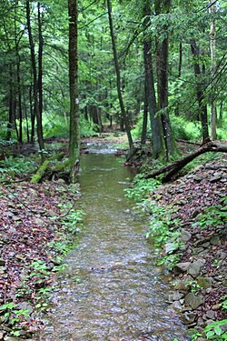
33:Trout Run looking downstream
91: • location
57: • location
636:
293:Huntley Mountain Formation
208:Trout Run looking upstream
194:Huntley Mountain Formation
139: • average
105:1,112 ft (339 m)
182:East Branch Fishing Creek
147:
125:
113:1.5 mi (2.4 km)
75:
43:
26:
329:total maximum daily load
383:The National Map Viewer
620:Rivers of Pennsylvania
212:Trout Run begins on a
209:
276:Geography and geology
207:
465:on September 3, 2014
586:41.3145°N 76.3480°W
582: /
152:Basin features
414:, November 2, 2001
289:Catskill Formation
210:
190:Catskill Formation
180:is a tributary of
591:41.3145; -76.3480
489:(December 2011),
218:Davidson Township
175:
174:
166:Susquehanna River
627:
597:
596:
594:
593:
592:
587:
583:
580:
579:
578:
575:
562:
561:
560:
558:
546:
540:
539:
538:
536:
531:on March 4, 2016
530:
524:, archived from
523:
512:
506:
505:
504:
502:
497:
483:
474:
473:
472:
470:
464:
458:, archived from
457:
446:
423:
422:
421:
419:
413:
403:
394:
393:
392:
390:
374:
140:
68:
58:
31:
19:
635:
634:
630:
629:
628:
626:
625:
624:
600:
599:
590:
588:
584:
581:
576:
573:
571:
569:
568:
566:
565:
556:
554:
548:
547:
543:
534:
532:
528:
521:
514:
513:
509:
500:
498:
495:
485:
484:
477:
468:
466:
462:
455:
448:
447:
426:
417:
415:
411:
405:
404:
397:
388:
386:
376:
375:
364:
359:
337:
320:
309:
278:
237:
229:
202:
138:
102:
92:
66:
56:
34:
17:
12:
11:
5:
633:
631:
623:
622:
617:
612:
602:
601:
564:
563:
541:
515:Rod Morehart,
507:
475:
424:
395:
361:
360:
358:
355:
354:
353:
348:
343:
341:Blackberry Run
336:
333:
319:
316:
308:
305:
277:
274:
236:
233:
228:
225:
201:
198:
173:
172:
170:Chesapeake Bay
158:
154:
153:
149:
148:
145:
144:
141:
135:
134:
131:
127:
126:
123:
122:
119:
115:
114:
111:
107:
106:
103:
100:
97:
96:
93:
90:
87:
86:
83:
77:
76:
73:
72:
69:
63:
62:
59:
53:
52:
49:
45:
44:
41:
40:
36:
35:
32:
24:
23:
15:
13:
10:
9:
6:
4:
3:
2:
632:
621:
618:
616:
613:
611:
608:
607:
605:
598:
595:
553:
552:
545:
542:
527:
520:
519:
511:
508:
494:
493:
488:
482:
480:
476:
461:
454:
453:
445:
443:
441:
439:
437:
435:
433:
431:
429:
425:
410:
409:
402:
400:
396:
385:
384:
379:
373:
371:
369:
367:
363:
356:
352:
349:
347:
344:
342:
339:
338:
334:
332:
330:
326:
317:
315:
312:
306:
304:
302:
296:
294:
290:
285:
283:
275:
273:
271:
266:
264:
263:water quality
259:
257:
253:
248:
246:
242:
234:
232:
226:
224:
221:
219:
215:
206:
199:
197:
195:
191:
187:
183:
179:
171:
167:
163:
162:Fishing Creek
159:
155:
150:
146:
142:
136:
132:
128:
124:
120:
116:
112:
108:
104:
98:
94:
88:
84:
82:
78:
74:
70:
64:
60:
54:
50:
46:
42:
37:
30:
25:
20:
567:
555:, retrieved
550:
544:
533:, retrieved
526:the original
517:
510:
499:, retrieved
491:
467:, retrieved
460:the original
451:
416:, retrieved
407:
387:, retrieved
382:
325:aquatic life
321:
313:
310:
301:outcroppings
297:
286:
279:
267:
260:
249:
239:The average
238:
230:
222:
211:
177:
176:
589: /
227:Tributaries
157:Progression
604:Categories
577:76°20′53″W
574:41°18′52″N
557:August 25,
535:August 25,
501:August 25,
469:August 25,
418:August 25,
389:August 25,
357:References
256:alkalinity
118:Basin size
307:Watershed
282:sea level
241:discharge
235:Hydrology
178:Trout Run
130:Discharge
22:Trout Run
346:Lead Run
335:See also
245:aluminum
192:and the
318:History
214:plateau
200:Course
133:
110:Length
85:
51:
48:Source
529:(PDF)
522:(PDF)
496:(PDF)
463:(PDF)
456:(PDF)
412:(PDF)
81:Mouth
16:River
559:2014
537:2014
503:2014
471:2014
420:2014
391:2014
250:The
216:in
184:in
606::
478:^
427:^
398:^
380:,
365:^
295:.
252:pH
168:→
164:→
Text is available under the Creative Commons Attribution-ShareAlike License. Additional terms may apply.