116:
340:
100:
1695:
1440:
1430:
1420:
1410:
85:
75:
1746:
1305:
60:
1375:
522:) characterized by warm summers and cold winters with heavy snowfall, due to the high elevation. Winters are cold, with a January 24-hour average temperature of −4.6 °C (23.7 °F), while summers are warm and wet, with a July 24-hour average temperature of 19.5 °C (67.1 °F). The average annual rainfall is 1345 mm with September as the wettest month.
123:
1544:
1283:
village council of 12 members. Tsumagoi collectively with the other municipalities in
Agatsuma District, contributes two members to the Gunma Prefectural Assembly. In terms of national politics, the village is part of
1327:
Tsumagoi has two public elementary schools and one public middle school operated by the town government, and one public high school operated by the Gunma
Prefectural Board of Education.
115:
1565:
1315:
The economy of
Tsumagoi is primarily agricultural, with cabbage forming the most noted local crop. Seasonal tourism primarily in connection with its
99:
413:
1694:
1460:(natural hot spring) resorts, some of which are also associated with ski resorts. There are two major hot spring resort areas within the town.
147:
2023:
2004:
1289:
1684:
84:
1745:
1069:
Per
Japanese census data, the population of Tsumagoi has recently decreased after several decades of relative stability.
59:
1662:
1498:
1050:
1076:), which promotes the development of new technologies to combat depopulation, for meeting a "high standard" (高水準) of
339:
1893:
1712:
1392:
515:
74:
2028:
1834:
1443:
1433:
1423:
1413:
220:
191:
179:
1754:
388:
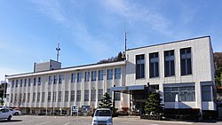
of 28 persons per km². The total area of the village is 337.51 square kilometres (130.31 sq mi).
1910:
1839:
1597:
1077:
1073:
1871:
1532:
425:
344:
1971:
1954:
1942:
1722:
203:
1267:
on April 1, 1889, the village of
Tsumagoi was created within Agatsuma District of Gunma Prefecture.
1677:
270:
1813:
1388:
1285:
385:
301:
215:
1854:
1252:
1243:
artifacts are almost non-existent, as the area is not suitable for rice cultivation. During the
1304:
1492:
1264:
1003:
473:
467:
461:
401:
369:
50:
1072:
Tsumagoi has been recognized by Japan's Office for the
Promotion of Regional Revitalization (
1981:
1930:
1903:
1881:
1808:
1698:
483:
450:
397:
373:
208:
1263:
in 1783 (477 people died). With the creation of the modern municipalities system after the
1976:
1898:
1859:
1626:
1256:
291:
1991:
1793:
1396:
1236:
196:
404:
to the north, south, and west. Because of its elevated location and the ash deposits of
1920:
1915:
1886:
1844:
1818:
1788:
1670:
503:
488:
478:
456:
436:
281:
2017:
1986:
1935:
1803:
1798:
1783:
1767:
1486:
1382:
1319:
hot spring resorts and ski resorts are also major contributors to the local economy.
1293:
1276:
929:
429:
1585:
1084:
infrastructure. Related projects have been awarded over ¥7.0M in government grants.
1959:
1925:
1876:
1240:
498:
493:
1964:
1519:
1309:
1081:
421:
405:
17:
1849:
1280:
1244:
381:
162:
149:
1374:
1260:
261:
1947:
1735:
1730:
1707:
1248:
1762:
1378:
409:
1654:
329:
266:
1456:
1316:
1303:
377:
338:
184:
380:. As of 1 September 2020, the village had an estimated
1101:
1666:
1096:
1627:"1783年に477人死亡した「日本のポンペイ」…浅間山噴火、集落発掘へ : 社会 : ニュース"
319:
110 Ōmae, Tsumagoi-mura, Agatsuma-gun, Gunma-ken 377-1692
1279:
form of government with a directly elected mayor and a
412:. Parts of the village are within the borders of then
1239:
remains have been found in
Tsumagoi, although later
1827:
1776:
1753:
1721:
396:Tsumagoi is situated on the northwestern corner of
323:
315:
307:
297:
287:
277:
260:
252:
244:
239:
231:
226:
214:
202:
190:
178:
32:
1255:. Kanbara area (鎌原村) was severely damaged by the
361:
1454:The main draw of tourists to Tsumagoi are the
355:
38:
1678:
8:
1087:
1247:, the area around Tsumagoi was part of the
1685:
1671:
1663:
1086:
525:
29:
104:Location of Tsumagoi in Gunma Prefecture
1511:
1495:, Olympic silver medalist speed skater
322:
306:
259:
238:
235:337.58 km (130.34 sq mi)
225:
177:
142:
108:
96:
68:
56:
1520:"Tsumagoi Village official statistics"
1057:Source 2: Japan Meteorological Agency
1586:Higashiagatsuma population statistics
408:, Tsumagoi is well known for growing
314:
296:
286:
276:
251:
243:
230:
213:
201:
189:
7:
1489:, Olympic gold medalist speed skater
424:(2568m), Mount Motoshirane (2171m),
384:of 9,546 in 3,999 households, and a
2005:List of mergers in Gunma Prefecture
529:Climate data for Tsumagoi(Tashiro)
25:
1744:
1693:
1464:Palcall Tsumagoi Mountain Resort
1438:
1428:
1418:
1408:
1373:
441:Lakes: Lake Baragi, Lake Tashiro
122:
121:
114:
98:
83:
73:
58:
1251:-administered territory within
414:Jōshin'etsu-kōgen National Park
1501:, professional baseball player
1:
1598:"地方創生テレワーク交付金の交付対象事業一覧(新規事業)"
1568:. Japan Meteorological Agency
1545:"Japan Meteorological Agency"
2024:Villages in Gunma Prefecture
1470:Kazawa Onsen and ski resort
1346:Tsumagoi Junior High School
1308:Tsumagoi cabbage field and
1074:Kishida Cabinet Secretariat
1051:Japan Meteorological Agency
788:Mean daily minimum °C (°F)
648:Mean daily maximum °C (°F)
362:
343:Manza Onsen area seen from
2045:
1481:Noted people from Tsumagoi
1467:Manza Onsen and ski resort
1056:
1048:
528:
446:Surrounding municipalities
2002:
1742:
1705:
1633:(in Japanese). 2021-11-04
1356:Higashi Elementary School
1114:—
1001:
927:
857:
787:
717:
647:
577:
572:
569:
566:
563:
560:
557:
554:
551:
548:
545:
542:
539:
536:
533:
516:humid continental climate
356:
143:
109:
97:
69:
57:
48:
39:
163:36.516833°N 138.530139°E
36:
1444:National Route 406
1434:National Route 292
1424:National Route 146
1414:National Route 144
1359:Nishi Elementary School
64:Tsumagoi village office
27:Village in Kantō, Japan
1312:
1078:digital transformation
347:
1533:Tsumagoi climate data
1522:(in Japanese). Japan.
1307:
1088:Historical population
426:Mount Kusatsu-Shirane
345:Mount Kusatsu-Shirane
342:
256:28/km (73/sq mi)
168:36.516833; 138.530139
1336:Tsumagoi High School
578:Record high °C (°F)
253: • Density
1341:Junior high schools
1331:Senior high schools
1089:
858:Record low °C (°F)
718:Daily mean °C (°F)
271:Japan Standard Time
159: /
1894:Kitagunma District
1351:Elementary schools
1313:
1286:Gunma 5th district
386:population density
348:
302:Oncorhynchus masou
245: • Total
232: • Total
2011:
2010:
1835:Agatsuma District
1716:
1607:. August 10, 2021
1493:Toshiyuki Kuroiwa
1450:Local attractions
1393:Manza-Kazawaguchi
1265:Meiji Restoration
1228:
1227:
1061:
1060:
468:Nagano Prefecture
402:Nagano Prefecture
337:
336:
308:Phone number
16:(Redirected from
2036:
1748:
1710:
1699:Gunma Prefecture
1697:
1687:
1680:
1673:
1664:
1659:
1655:Official Website
1642:
1641:
1639:
1638:
1623:
1617:
1616:
1614:
1612:
1602:
1594:
1588:
1583:
1577:
1576:
1574:
1573:
1566:"田代 観測史上1~10位の値"
1562:
1556:
1555:
1553:
1551:
1541:
1535:
1530:
1524:
1523:
1516:
1499:Masato Kobayashi
1442:
1441:
1432:
1431:
1422:
1421:
1412:
1411:
1377:
1103:
1098:
1090:
526:
451:Gunma Prefecture
398:Gunma Prefecture
374:Gunma Prefecture
367:
365:
359:
358:
333:
332:
330:Official website
292:Japanese Gentian
174:
173:
171:
170:
169:
164:
160:
157:
156:
155:
152:
125:
124:
118:
102:
87:
77:
62:
43:
42:
41:
30:
21:
2044:
2043:
2039:
2038:
2037:
2035:
2034:
2033:
2029:Tsumagoi, Gunma
2014:
2013:
2012:
2007:
1998:
1840:Higashiagatsuma
1823:
1772:
1749:
1740:
1717:
1701:
1691:
1657:
1651:
1646:
1645:
1636:
1634:
1625:
1624:
1620:
1610:
1608:
1600:
1596:
1595:
1591:
1584:
1580:
1571:
1569:
1564:
1563:
1559:
1549:
1547:
1543:
1542:
1538:
1531:
1527:
1518:
1517:
1513:
1508:
1483:
1452:
1439:
1429:
1419:
1409:
1405:
1371:
1366:
1353:
1343:
1333:
1325:
1302:
1275:Tsumagoi has a
1273:
1257:Tenmei eruption
1253:Kōzuke Province
1233:
1067:
1062:
996:
991:
986:
981:
976:
971:
966:
961:
956:
951:
946:
941:
936:
922:
917:
912:
907:
902:
897:
892:
887:
882:
877:
872:
867:
862:
852:
847:
842:
837:
832:
827:
822:
817:
812:
807:
802:
797:
792:
782:
777:
772:
767:
762:
757:
752:
747:
742:
737:
732:
727:
722:
712:
707:
702:
697:
692:
687:
682:
677:
672:
667:
662:
657:
652:
642:
637:
632:
627:
622:
617:
612:
607:
602:
597:
592:
587:
582:
514:Tsumagoi has a
512:
448:
394:
353:
328:
327:
167:
165:
161:
158:
153:
150:
148:
146:
145:
139:
138:
137:
136:
133:
132:
131:
130:
126:
105:
93:
92:
91:
90:
81:
80:
65:
53:
44:
37:
35:
28:
23:
22:
18:Tsumagoi, Gunma
15:
12:
11:
5:
2042:
2040:
2032:
2031:
2026:
2016:
2015:
2009:
2008:
2003:
2000:
1999:
1997:
1996:
1995:
1994:
1989:
1984:
1979:
1969:
1968:
1967:
1962:
1952:
1951:
1950:
1940:
1939:
1938:
1933:
1928:
1923:
1918:
1908:
1907:
1906:
1901:
1891:
1890:
1889:
1884:
1879:
1872:Kanra District
1869:
1868:
1867:
1862:
1857:
1852:
1847:
1842:
1831:
1829:
1825:
1824:
1822:
1821:
1816:
1811:
1806:
1801:
1796:
1791:
1786:
1780:
1778:
1774:
1773:
1771:
1770:
1765:
1759:
1757:
1755:Special cities
1751:
1750:
1743:
1741:
1739:
1738:
1733:
1727:
1725:
1719:
1718:
1706:
1703:
1702:
1692:
1690:
1689:
1682:
1675:
1667:
1661:
1660:
1650:
1649:External links
1647:
1644:
1643:
1618:
1589:
1578:
1557:
1536:
1525:
1510:
1509:
1507:
1504:
1503:
1502:
1496:
1490:
1482:
1479:
1478:
1477:
1474:
1473:Tsumagoi Onsen
1471:
1468:
1465:
1451:
1448:
1447:
1446:
1436:
1426:
1416:
1404:
1401:
1400:
1399:
1370:
1367:
1365:
1364:Transportation
1362:
1361:
1360:
1357:
1352:
1349:
1348:
1347:
1342:
1339:
1338:
1337:
1332:
1329:
1324:
1321:
1301:
1298:
1272:
1269:
1232:
1229:
1226:
1225:
1222:
1219:
1215:
1214:
1211:
1208:
1204:
1203:
1200:
1197:
1193:
1192:
1189:
1186:
1182:
1181:
1178:
1175:
1171:
1170:
1167:
1164:
1160:
1159:
1156:
1153:
1149:
1148:
1145:
1142:
1138:
1137:
1134:
1131:
1127:
1126:
1123:
1120:
1116:
1115:
1112:
1109:
1105:
1104:
1099:
1094:
1066:
1063:
1059:
1058:
1054:
1053:
1046:
1045:
1042:
1039:
1036:
1033:
1030:
1027:
1024:
1021:
1018:
1015:
1012:
1009:
1006:
1004:sunshine hours
999:
998:
993:
988:
983:
978:
973:
968:
963:
958:
953:
948:
943:
938:
933:
925:
924:
919:
914:
909:
904:
899:
894:
889:
884:
879:
874:
869:
864:
859:
855:
854:
849:
844:
839:
834:
829:
824:
819:
814:
809:
804:
799:
794:
789:
785:
784:
779:
774:
769:
764:
759:
754:
749:
744:
739:
734:
729:
724:
719:
715:
714:
709:
704:
699:
694:
689:
684:
679:
674:
669:
664:
659:
654:
649:
645:
644:
639:
634:
629:
624:
619:
614:
609:
604:
599:
594:
589:
584:
579:
575:
574:
571:
568:
565:
562:
559:
556:
553:
550:
547:
544:
541:
538:
535:
531:
530:
524:
511:
508:
507:
506:
501:
496:
491:
486:
481:
476:
465:
464:
459:
447:
444:
443:
442:
439:
437:Agatsuma River
433:
393:
390:
335:
334:
325:
321:
320:
317:
313:
312:
309:
305:
304:
299:
295:
294:
289:
285:
284:
279:
275:
274:
264:
258:
257:
254:
250:
249:
246:
242:
241:
237:
236:
233:
229:
228:
224:
223:
218:
212:
211:
206:
200:
199:
194:
188:
187:
182:
176:
175:
141:
140:
134:
128:
127:
120:
119:
113:
112:
111:
110:
107:
106:
103:
95:
94:
88:
82:
78:
72:
71:
70:
67:
66:
63:
55:
54:
49:
46:
45:
33:
26:
24:
14:
13:
10:
9:
6:
4:
3:
2:
2041:
2030:
2027:
2025:
2022:
2021:
2019:
2006:
2001:
1993:
1990:
1988:
1985:
1983:
1980:
1978:
1975:
1974:
1973:
1972:Tone District
1970:
1966:
1963:
1961:
1958:
1957:
1956:
1955:Tano District
1953:
1949:
1946:
1945:
1944:
1943:Sawa District
1941:
1937:
1934:
1932:
1929:
1927:
1924:
1922:
1919:
1917:
1914:
1913:
1912:
1909:
1905:
1902:
1900:
1897:
1896:
1895:
1892:
1888:
1885:
1883:
1880:
1878:
1875:
1874:
1873:
1870:
1866:
1863:
1861:
1858:
1856:
1853:
1851:
1848:
1846:
1843:
1841:
1838:
1837:
1836:
1833:
1832:
1830:
1826:
1820:
1817:
1815:
1812:
1810:
1807:
1805:
1802:
1800:
1797:
1795:
1792:
1790:
1787:
1785:
1782:
1781:
1779:
1775:
1769:
1766:
1764:
1761:
1760:
1758:
1756:
1752:
1747:
1737:
1734:
1732:
1729:
1728:
1726:
1724:
1720:
1714:
1709:
1704:
1700:
1696:
1688:
1683:
1681:
1676:
1674:
1669:
1668:
1665:
1658:(in Japanese)
1656:
1653:
1652:
1648:
1632:
1628:
1622:
1619:
1611:September 17,
1606:
1599:
1593:
1590:
1587:
1582:
1579:
1567:
1561:
1558:
1546:
1540:
1537:
1534:
1529:
1526:
1521:
1515:
1512:
1505:
1500:
1497:
1494:
1491:
1488:
1487:Akira Kuroiwa
1485:
1484:
1480:
1476:Handeki Onsen
1475:
1472:
1469:
1466:
1463:
1462:
1461:
1459:
1458:
1449:
1445:
1437:
1435:
1427:
1425:
1417:
1415:
1407:
1406:
1402:
1398:
1394:
1390:
1387:
1386:
1385:
1384:
1383:Agatsuma Line
1380:
1376:
1368:
1363:
1358:
1355:
1354:
1350:
1345:
1344:
1340:
1335:
1334:
1330:
1328:
1322:
1320:
1318:
1311:
1306:
1299:
1297:
1295:
1294:Diet of Japan
1291:
1287:
1282:
1278:
1277:mayor-council
1270:
1268:
1266:
1262:
1258:
1254:
1250:
1246:
1242:
1238:
1230:
1223:
1220:
1217:
1216:
1212:
1209:
1206:
1205:
1201:
1198:
1195:
1194:
1190:
1187:
1184:
1183:
1179:
1176:
1173:
1172:
1168:
1165:
1162:
1161:
1157:
1154:
1151:
1150:
1146:
1143:
1140:
1139:
1135:
1132:
1129:
1128:
1124:
1121:
1118:
1117:
1113:
1110:
1107:
1106:
1100:
1095:
1092:
1091:
1085:
1083:
1079:
1075:
1070:
1064:
1055:
1052:
1047:
1043:
1040:
1037:
1034:
1031:
1028:
1025:
1022:
1019:
1016:
1013:
1010:
1007:
1005:
1002:Mean monthly
1000:
994:
989:
984:
979:
974:
969:
964:
959:
954:
949:
944:
939:
934:
931:
930:precipitation
926:
920:
915:
910:
905:
900:
895:
890:
885:
880:
875:
870:
865:
860:
856:
850:
845:
840:
835:
830:
825:
820:
815:
810:
805:
800:
795:
790:
786:
780:
775:
770:
765:
760:
755:
750:
745:
740:
735:
730:
725:
720:
716:
710:
705:
700:
695:
690:
685:
680:
675:
670:
665:
660:
655:
650:
646:
640:
635:
630:
625:
620:
615:
610:
605:
600:
595:
590:
585:
580:
576:
532:
527:
523:
521:
517:
509:
505:
502:
500:
497:
495:
492:
490:
487:
485:
482:
480:
477:
475:
472:
471:
470:
469:
463:
460:
458:
455:
454:
453:
452:
445:
440:
438:
434:
431:
430:Mount Azumaya
427:
423:
419:
418:
417:
415:
411:
407:
403:
399:
391:
389:
387:
383:
379:
375:
371:
364:
363:Tsumagoi-mura
352:
346:
341:
331:
326:
318:
310:
303:
300:
293:
290:
283:
280:
272:
268:
265:
263:
255:
247:
234:
222:
219:
217:
210:
207:
205:
198:
195:
193:
186:
183:
181:
172:
154:138°31′48.5″E
144:Coordinates:
117:
101:
86:
76:
61:
52:
47:
31:
19:
1911:Ōra District
1864:
1635:. Retrieved
1630:
1621:
1609:. Retrieved
1604:
1592:
1581:
1570:. Retrieved
1560:
1548:. Retrieved
1539:
1528:
1514:
1455:
1453:
1372:
1326:
1314:
1274:
1241:Yayoi period
1237:Jōmon period
1234:
1071:
1068:
1065:Demographics
932:mm (inches)
519:
513:
466:
449:
395:
350:
349:
311:0279-96-0511
282:Silver birch
1814:Tatebayashi
1723:Core cities
1310:Mount Asama
1290:lower house
422:Mount Asama
420:Mountains:
406:Mount Asama
400:, touching
372:located in
166: /
151:36°31′0.6″N
2018:Categories
1850:Naganohara
1637:2022-03-25
1605:内閣府地方創生推進室
1572:2017-08-20
1550:August 20,
1506:References
1389:Fukurogura
1281:unicameral
1271:Government
1245:Edo period
1049:Source 1:
462:Naganohara
382:population
240:Population
204:Prefecture
1982:Katashina
1882:Shimonita
1828:Districts
1809:Shibukawa
1631:読売新聞オンライン
1323:Education
1261:Mt. Asama
1235:Numerous
474:Karuizawa
428:(2160m),
392:Geography
262:Time zone
1977:Minakami
1948:Tamamura
1899:Yoshioka
1865:Tsumagoi
1860:Takayama
1855:Nakanojō
1736:Takasaki
1731:Maebashi
1708:Maebashi
1249:hatamoto
1082:telework
1044:1,832.2
997:(59.31)
928:Average
518:(Köppen
484:Takayama
435:Rivers:
410:cabbages
351:Tsumagoi
288:- Flower
221:Agatsuma
216:District
129:Tsumagoi
34:Tsumagoi
1921:Itakura
1916:Chiyoda
1887:Nanmoku
1845:Kusatsu
1819:Tomioka
1789:Fujioka
1763:Isesaki
1713:capital
1403:Highway
1379:JR East
1369:Railway
1300:Economy
1292:of the
1288:of the
1231:History
995:1,506.6
992:(1.68)
987:(2.93)
982:(5.27)
977:(9.15)
972:(6.93)
967:(8.22)
962:(7.12)
957:(5.46)
952:(4.21)
947:(4.04)
942:(2.40)
937:(1.93)
913:(13.3)
908:(24.3)
903:(31.8)
898:(46.4)
893:(44.6)
888:(35.2)
883:(20.7)
878:(14.0)
853:(36.9)
848:(21.4)
843:(30.4)
838:(40.3)
833:(53.1)
828:(60.3)
823:(58.8)
818:(50.7)
813:(41.7)
808:(32.7)
803:(21.7)
798:(15.6)
793:(15.8)
783:(45.0)
778:(29.3)
773:(38.5)
768:(48.4)
763:(59.5)
758:(67.1)
753:(65.5)
748:(58.5)
743:(51.6)
738:(42.3)
733:(30.4)
728:(24.3)
723:(23.7)
713:(53.8)
708:(37.2)
703:(47.7)
698:(57.4)
693:(67.3)
688:(75.6)
683:(73.9)
678:(67.3)
673:(61.9)
668:(52.7)
663:(39.2)
658:(32.2)
653:(30.9)
643:(86.4)
638:(59.0)
633:(66.7)
628:(75.7)
623:(84.2)
618:(85.8)
613:(86.4)
608:(84.7)
603:(81.9)
598:(76.6)
593:(66.2)
588:(59.4)
583:(52.7)
510:Climate
457:Kusatsu
432:(2354m)
370:village
324:Website
316:Address
180:Country
51:Village
1987:Kawaba
1931:Ōizumi
1904:Shintō
1804:Numata
1799:Midori
1784:Annaka
1777:Cities
1224:−13.1%
1210:10,183
1199:10,657
1188:10,957
1180:−11.1%
1177:10,737
1169:−20.6%
1166:12,074
1158:+10.6%
1155:15,214
1147:+42.0%
1144:13,757
1125:+49.4%
1041:134.9
1038:140.1
1035:135.3
1032:111.6
1029:150.5
1026:147.0
1023:142.5
1020:194.3
1017:202.2
1014:187.4
1011:152.0
1008:135.0
923:(1.0)
918:(4.8)
873:(5.9)
868:(1.0)
863:(2.3)
534:Month
504:Miyota
489:Suzaka
479:Komoro
298:- Fish
278:- Tree
192:Region
135:
1992:Shōwa
1960:Kanna
1926:Meiwa
1877:Kanra
1794:Kiryū
1601:(PDF)
1457:onsen
1317:onsen
1221:8,850
1218:2020
1213:−4.4%
1207:2010
1202:−2.7%
1196:2000
1191:+2.0%
1185:1990
1174:1980
1163:1970
1152:1960
1141:1950
1136:+1.9%
1133:9,685
1130:1940
1122:9,502
1119:1930
1111:6,359
1108:1920
980:133.8
975:232.3
970:175.9
965:208.7
960:180.8
955:138.7
950:106.9
945:102.5
921:−17.2
916:−15.1
911:−10.4
876:−10.0
871:−14.5
866:−17.2
861:−16.5
573:Year
378:Japan
368:is a
267:UTC+9
248:9,546
209:Gunma
197:Kantō
185:Japan
1965:Ueno
1613:2022
1552:2017
1397:Ōmae
1097:Pop.
1093:Year
990:42.6
985:74.5
940:60.9
935:49.0
906:−4.3
901:−0.1
881:−6.3
846:−5.9
841:−0.9
831:11.7
826:15.7
821:14.9
816:10.4
801:−5.7
796:−9.1
791:−9.0
776:−1.5
761:15.3
756:19.5
751:18.6
746:14.7
741:10.9
731:−0.9
726:−4.3
721:−4.6
711:12.1
696:14.1
691:19.6
686:24.2
681:23.3
676:19.6
671:16.6
666:11.5
651:−0.6
641:30.2
636:15.0
631:19.3
626:24.3
621:29.0
616:29.9
611:30.2
606:29.3
601:27.7
596:24.8
591:19.0
586:15.2
581:11.5
570:Dec
567:Nov
564:Oct
561:Sep
558:Aug
555:Jul
552:Jun
549:May
546:Apr
543:Mar
540:Feb
537:Jan
499:Tōmi
494:Ueda
227:Area
89:Seal
79:Flag
1936:Ōra
1768:Ōta
1259:of
896:8.0
891:7.0
886:1.8
851:2.7
836:4.6
811:5.4
806:0.4
781:7.2
771:3.6
766:9.1
736:5.7
706:2.9
701:8.7
661:4.0
656:0.1
520:Dfb
357:嬬恋村
40:嬬恋村
2020::
1629:.
1603:.
1395:-
1391:-
1381:–
1296:.
1102:±%
416:.
376:,
360:,
1715:)
1711:(
1686:e
1679:t
1672:v
1640:.
1615:.
1575:.
1554:.
1080:/
366:)
354:(
273:)
269:(
20:)
Text is available under the Creative Commons Attribution-ShareAlike License. Additional terms may apply.