57:
455:
473:
491:
1488:
45:
1025:
In the town, the age distribution of the population shows 24.6% under the age of 18, 6.0% from 18 to 24, 28.2% from 25 to 44, 27.8% from 45 to 64, and 13.4% who were 65 years of age or older. The median age was 40 years. For every 100 females, there were 95.3 males. For every 100 females age 18 and
980:
There were 981 households, of which 25.6% had children under the age of 18 living with them, 53.8% were married couples living together, 7.7% had a female householder with no husband present, 3.5% had a male householder with no wife present, and 35.0% were non-families. 27.2% of all households were
1021:
There were 863 households, out of which 31.9% had children under the age of 18 living with them, 59.2% were married couples living together, 9.5% had a female householder with no husband present, and 26.7% were non-families. 20.2% of all households were made up of individuals, and 6.6% had someone
993:
As of the census of 2000, there were 2,209 people, 863 households, and 632 families residing in the town. The population density was 68.8 inhabitants per square mile (26.6/km). There were 1,052 housing units at an average density of 32.8 per square mile (12.7/km). The racial makeup of the town was
984:
The median age in the town was 46.5 years. 19.7% of residents were under the age of 18; 6% were between the ages of 18 and 24; 22.4% were from 25 to 44; 35.6% were from 45 to 64; and 16.4% were 65 years of age or older. The gender makeup of the town was 49.0% male and 51.0% female.
361:
and thereafter called the Waldo Patent. The first white settlers by the names of
Anderson, Malcolm, and Crawford, arrived in 1772. The town was settled on July 19, 1774, and named Taylor Town after the original purchaser and settler, Dr. John Taylor from
1045:
56:
510:, the town has a total area of 34.49 square miles (89.33 km), of which 32.15 square miles (83.27 km) is land and 2.34 square miles (6.06 km) is water. Union is drained by the
366:. Dr. John Taylor purchased Union for £1,000. On May 3, 1786, it was organized as the Plantation of Sterlingtown, and on October 20, 1786, the town was incorporated and named Union.
1029:
The median income for a household in the town was $ 37,679, and the median income for a family was $ 41,050. Males had a median income of $ 30,984 versus $ 23,438 for females. The
957:
was 70.3 inhabitants per square mile (27.1/km). There were 1,203 housing units at an average density of 37.4 per square mile (14.4/km). The racial makeup of the town was 98.7%
981:
made up of individuals, and 11.4% had someone living alone who was 65 years of age or older. The average household size was 2.30 and the average family size was 2.77.
1258:. Retrieved on November 6, 2018. "Downstairs in our building, RSU 40/MSAD 40 Administrative Offices and Rivers Alternative Middle School are both located upstairs."
1778:
1773:
1426:
534:. Union Elementary School is in the town, with the MSAD headquarters and Rivers Alternative Middle School within the school building's second floor.
454:
278:
472:
531:
373:
Agriculture was the principal business, and on
October 5, 1869, the North Knox Agricultural & Horticultural Society opened the first annual
78:
432:
was buried near the statue, to be dug up July 19, 2024. The capsule contains a picture of children from around the town and "scores of current
1763:
1719:
490:
288:
518:, Pettengill Stream, Fuller Brook, Hope Brook, Little Medomak Brook and the Back River. Coggans Hill, elevation 817 feet (249 meters)
1063:
1419:
350:
1176:
999:
962:
1003:
966:
1022:
living alone who was 65 years of age or older. The average household size was 2.51 and the average family size was 2.85.
1625:
1412:
1404:
1331:
1306:
1134:
507:
538:
927:
912:
897:
882:
867:
852:
837:
822:
807:
792:
777:
762:
747:
732:
717:
702:
687:
672:
657:
642:
627:
612:
597:
582:
330:
128:
363:
266:
953:
As of the census of 2010, there were 2,259 people, 981 households, and 638 families residing in the town. The
44:
1768:
1635:
1255:
1673:
1648:
1557:
1011:
970:
1358:
by
Chester Nash, Patricia Kahn, and the Union Historical Society in 1974. Printed by the Courier-Gazette.
1758:
1600:
1703:
1696:
1683:
1052:
1015:
974:
239:
1658:
1643:
1610:
1532:
1093:
1007:
995:
958:
1592:
1537:
1436:
1097:
954:
515:
326:
133:
62:
1280:
1155:
1130:
1678:
1582:
1572:
1552:
1522:
1103:
1030:
445:
367:
229:
1184:
1668:
1620:
1562:
1542:
1499:
1205:
1087:
1033:
for the town was $ 16,240. About 6.1% of families and 9.6% of the population were below the
542:
437:
346:
322:
35:
1547:
1507:
1477:
1458:
1081:
519:
1517:
1752:
1577:
1512:
511:
271:
425:
1034:
429:
417:
402:
398:
354:
1199:
1527:
1451:
1223:
433:
421:
397:, boots and shoes. South Union had a cabinet and musical instrument factory, an
394:
378:
353:
to John
Beauchamp and Thomas Leverett. About 1720, it was purchased by General
410:
386:
374:
334:
1734:
1721:
246:
225:
93:
80:
220:
1037:, including 8.3% of those under age 18 and 5.5% of those age 65 or over.
382:
254:
1251:
390:
406:
358:
1393:
303:
1107:
121:
66:
333:. It is home to the Matthews Museum of Maine Heritage and annual
1469:
1408:
1399:
1267:
424:
on July 4, 1888. When Union celebrated on July 19, 1974, the
1486:
1210:
A History and
Description of New England Coolidge Mansfield.
1156:"Census - Geography Profile: Union town, Knox County, Maine"
1327:
1302:
1362:
200 Years in Union: Corrections and
Additions Supplement
1240:
Horse and Buggy Days: A Brief
History of Union, Maine
381:
at the outlets of ponds. Factories at Union produced
1657:
1634:
1609:
1591:
1498:
1468:
298:
287:
277:
265:
253:
236:
219:
211:
203:
198:
190:
182:
174:
166:
161:
147:
139:
127:
117:
109:
26:
1204:. Boston, Massachusetts: A.J. Coolidge. pp.
1125:
1123:
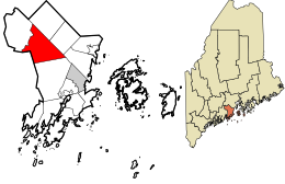
329:, United States. The population was 2,383 at the
1198:Coolidge, Austin J.; John B. Mansfield (1859).
1270:. Vose Library. Retrieved on November 6, 2018.
1420:
345:Union was part of a tract of land called the
8:
413:, in addition to a chair and table factory.
370:was formed from a portion of Union in 1811.
1427:
1413:
1405:
1018:of any race were 0.27% of the population.
555:
23:
977:of any race were 0.4% of the population.
16:Town in the state of Maine, United States
1201:A History and Description of New England
1106:, physician and businessman who created
1487:
1119:
532:Maine School Administrative District 40
450:
297:
276:
252:
218:
197:
189:
160:
146:
138:
108:
73:
53:
41:
1225:Gazetteer of the state of Maine. Union
575:
436:." Union was the subject of the 1940
349:, a grant made March 2, 1629, by the
286:
264:
235:
210:
202:
181:
178:32.15 sq mi (83.27 km)
173:
170:34.49 sq mi (89.33 km)
165:
126:
116:
7:
1779:Populated places established in 1786
1774:1786 establishments in Massachusetts
1046:National Register of Historic Places
1010:, and 0.81% from two or more races.
522:, is the highest point in the town.
969:, and 0.6% from two or more races.
186:2.34 sq mi (6.06 km)
1435:Municipalities and communities of
1281:"Census of Population and Housing"
565:
14:
1064:Joseph and Hannah Maxcy Homestead
537:Medomak Valley Middle School and
377:. The town had mills operated by
489:
471:
453:
55:
43:
1364:by the Union Historical Society
1:
1026:over, there were 92.8 males.
479:
461:
1367:"Union Past and Present" by
21:Town in Maine, United States
1764:Towns in Knox County, Maine
1400:http://www.union.maine.gov/
1332:United States Census Bureau
1307:United States Census Bureau
1135:United States Census Bureau
508:United States Census Bureau
1795:
1222:Varney, George J. (1886),
1181:unionhistoricalsociety.org
548:Vose Library is in Union.
539:Medomak Valley High School
409:factory. East Union had a
1692:
1484:
1449:
1375:Sibley's History of Union
1131:"US Gazetteer files 2010"
941:
926:
911:
896:
881:
866:
851:
836:
821:
806:
791:
776:
761:
746:
731:
716:
701:
686:
671:
656:
641:
626:
611:
596:
581:
574:
569:
564:
561:
74:
54:
42:
33:
496:The Burton House in 1907
364:Lunenburg, Massachusetts
1256:Regional School Unit 40
1252:Union Elementary School
215:74/sq mi (28.6/km)
1492:
1398:The town's website is
194:43 ft (13 m)
1735:44.21139°N 69.27417°W
1490:
1328:"U.S. Census website"
1303:"U.S. Census website"
942:U.S. Decennial Census
557:Historical population
530:Union is part of the
428:of its settlement, a
420:was dedicated at the
238: • Summer (
94:44.21306°N 69.26750°W
1705:United States portal
1626:Muscle Ridge Islands
1394:Town of Union, Maine
1383:by Ben Ames Williams
1053:Ebenezer Alden House
212: • Density
49:Union Common in 1915
1740:44.21139; -69.27417
1731: /
1094:John Langdon Sibley
558:
99:44.21306; -69.26750
90: /
1493:
1438:Knox County, Maine
1369:Union Weekly Times
1356:200 Years in Union
1098:Harvard University
1090:, state legislator
955:population density
556:
516:Saint George River
460:South Union falls
327:Knox County, Maine
204: • Total
183: • Water
167: • Total
1714:
1713:
1377:by John L. Sibley
1228:, Boston: Russell
1187:on April 4, 2015.
1104:Augustin Thompson
1100:from 1856 to 1877
1041:Sites of interest
1031:per capita income
946:
945:
506:According to the
478:The Burton House
446:Ben Ames Williams
316:
315:
175: • Land
65:and the state of
1786:
1746:
1745:
1743:
1742:
1741:
1736:
1732:
1729:
1728:
1727:
1724:
1706:
1699:
1489:
1461:
1454:
1444:
1439:
1429:
1422:
1415:
1406:
1343:
1342:
1340:
1338:
1324:
1318:
1317:
1315:
1313:
1299:
1293:
1292:
1290:
1288:
1277:
1271:
1265:
1259:
1248:
1242:
1238:E. A. Matthews,
1236:
1230:
1229:
1219:
1213:
1212:
1195:
1189:
1188:
1183:. Archived from
1173:
1167:
1166:
1164:
1162:
1152:
1146:
1145:
1143:
1141:
1127:
1088:Christine Savage
1068:Union Town House
1000:African American
963:African American
577:
572:
567:
559:
493:
484:
481:
475:
466:
463:
457:
438:historical novel
351:Plymouth Council
347:Muscongus Patent
312:
309:
307:
305:
243:
157:South Union
155:North Union
105:
104:
102:
101:
100:
95:
91:
88:
87:
86:
83:
59:
47:
24:
1794:
1793:
1789:
1788:
1787:
1785:
1784:
1783:
1749:
1748:
1739:
1737:
1733:
1730:
1725:
1722:
1720:
1718:
1717:
1715:
1710:
1704:
1697:
1688:
1674:Hibberts Corner
1660:
1653:
1630:
1612:
1605:
1587:
1558:South Thomaston
1494:
1491:Knox County map
1482:
1464:
1459:
1452:
1445:
1442:
1437:
1433:
1390:
1352:
1350:Further reading
1347:
1346:
1336:
1334:
1326:
1325:
1321:
1311:
1309:
1301:
1300:
1296:
1286:
1284:
1279:
1278:
1274:
1266:
1262:
1249:
1245:
1237:
1233:
1221:
1220:
1216:
1197:
1196:
1192:
1175:
1174:
1170:
1160:
1158:
1154:
1153:
1149:
1139:
1137:
1129:
1128:
1121:
1116:
1096:, librarian of
1082:Obadiah Gardner
1078:
1071:Matthews Museum
1043:
1004:Native American
991:
967:Native American
951:
570:
554:
528:
520:above sea level
504:
497:
494:
485:
482:
476:
467:
464:
458:
343:
302:
261:
237:
156:
154:
153:East Union
152:
98:
96:
92:
89:
84:
81:
79:
77:
76:
70:
50:
38:
29:
22:
17:
12:
11:
5:
1792:
1790:
1782:
1781:
1776:
1771:
1769:Towns in Maine
1766:
1761:
1751:
1750:
1712:
1711:
1709:
1708:
1701:
1693:
1690:
1689:
1687:
1686:
1681:
1676:
1671:
1665:
1663:
1655:
1654:
1652:
1651:
1646:
1640:
1638:
1632:
1631:
1629:
1628:
1623:
1617:
1615:
1607:
1606:
1604:
1603:
1601:Matinicus Isle
1597:
1595:
1589:
1588:
1586:
1585:
1580:
1575:
1570:
1565:
1560:
1555:
1550:
1545:
1540:
1535:
1530:
1525:
1520:
1515:
1510:
1504:
1502:
1496:
1495:
1485:
1483:
1481:
1480:
1474:
1472:
1466:
1465:
1450:
1447:
1446:
1434:
1432:
1431:
1424:
1417:
1409:
1403:
1402:
1396:
1389:
1388:External links
1386:
1385:
1384:
1378:
1372:
1365:
1359:
1351:
1348:
1345:
1344:
1319:
1294:
1272:
1260:
1243:
1231:
1214:
1190:
1168:
1147:
1118:
1117:
1115:
1112:
1111:
1110:
1101:
1091:
1085:
1077:
1076:Notable people
1074:
1073:
1072:
1069:
1066:
1061:
1058:
1055:
1042:
1039:
990:
987:
950:
947:
944:
943:
939:
938:
935:
933:
930:
924:
923:
920:
918:
915:
909:
908:
905:
903:
900:
894:
893:
890:
888:
885:
879:
878:
875:
873:
870:
864:
863:
860:
858:
855:
849:
848:
845:
843:
840:
834:
833:
830:
828:
825:
819:
818:
815:
813:
810:
804:
803:
800:
798:
795:
789:
788:
785:
783:
780:
774:
773:
770:
768:
765:
759:
758:
755:
753:
750:
744:
743:
740:
738:
735:
729:
728:
725:
723:
720:
714:
713:
710:
708:
705:
699:
698:
695:
693:
690:
684:
683:
680:
678:
675:
669:
668:
665:
663:
660:
654:
653:
650:
648:
645:
639:
638:
635:
633:
630:
624:
623:
620:
618:
615:
609:
608:
605:
603:
600:
594:
593:
590:
588:
585:
579:
578:
573:
568:
563:
553:
550:
541:are in nearby
527:
524:
503:
500:
499:
498:
495:
488:
486:
477:
470:
468:
459:
452:
342:
339:
314:
313:
300:
296:
295:
292:
285:
284:
281:
275:
274:
269:
263:
262:
259:
257:
251:
250:
244:
234:
233:
223:
217:
216:
213:
209:
208:
205:
201:
200:
196:
195:
192:
188:
187:
184:
180:
179:
176:
172:
171:
168:
164:
163:
159:
158:
149:
145:
144:
141:
137:
136:
131:
125:
124:
119:
115:
114:
111:
107:
106:
72:
71:
60:
52:
51:
48:
40:
39:
34:
31:
30:
27:
20:
15:
13:
10:
9:
6:
4:
3:
2:
1791:
1780:
1777:
1775:
1772:
1770:
1767:
1765:
1762:
1760:
1757:
1756:
1754:
1747:
1744:
1707:
1702:
1700:
1695:
1694:
1691:
1685:
1684:West Rockport
1682:
1680:
1677:
1675:
1672:
1670:
1667:
1666:
1664:
1662:
1656:
1650:
1647:
1645:
1642:
1641:
1639:
1637:
1633:
1627:
1624:
1622:
1619:
1618:
1616:
1614:
1608:
1602:
1599:
1598:
1596:
1594:
1590:
1584:
1581:
1579:
1576:
1574:
1571:
1569:
1566:
1564:
1561:
1559:
1556:
1554:
1551:
1549:
1546:
1544:
1541:
1539:
1536:
1534:
1531:
1529:
1526:
1524:
1521:
1519:
1516:
1514:
1511:
1509:
1506:
1505:
1503:
1501:
1497:
1479:
1476:
1475:
1473:
1471:
1467:
1463:
1462:
1455:
1448:
1443:United States
1440:
1430:
1425:
1423:
1418:
1416:
1411:
1410:
1407:
1401:
1397:
1395:
1392:
1391:
1387:
1382:
1379:
1376:
1373:
1370:
1366:
1363:
1360:
1357:
1354:
1353:
1349:
1333:
1329:
1323:
1320:
1308:
1304:
1298:
1295:
1282:
1276:
1273:
1269:
1264:
1261:
1257:
1253:
1247:
1244:
1241:
1235:
1232:
1227:
1226:
1218:
1215:
1211:
1207:
1203:
1202:
1194:
1191:
1186:
1182:
1178:
1177:"About Union"
1172:
1169:
1157:
1151:
1148:
1136:
1132:
1126:
1124:
1120:
1113:
1109:
1105:
1102:
1099:
1095:
1092:
1089:
1086:
1083:
1080:
1079:
1075:
1070:
1067:
1065:
1062:
1059:
1056:
1054:
1051:
1050:
1049:
1047:
1040:
1038:
1036:
1032:
1027:
1023:
1019:
1017:
1013:
1009:
1005:
1001:
997:
988:
986:
982:
978:
976:
972:
968:
964:
960:
956:
948:
940:
936:
934:
931:
929:
925:
921:
919:
916:
914:
910:
906:
904:
901:
899:
895:
891:
889:
886:
884:
880:
876:
874:
871:
869:
865:
861:
859:
856:
854:
850:
846:
844:
841:
839:
835:
831:
829:
826:
824:
820:
816:
814:
811:
809:
805:
801:
799:
796:
794:
790:
786:
784:
781:
779:
775:
771:
769:
766:
764:
760:
756:
754:
751:
749:
745:
741:
739:
736:
734:
730:
726:
724:
721:
719:
715:
711:
709:
706:
704:
700:
696:
694:
691:
689:
685:
681:
679:
676:
674:
670:
666:
664:
661:
659:
655:
651:
649:
646:
644:
640:
636:
634:
631:
629:
625:
621:
619:
616:
614:
610:
606:
604:
601:
599:
595:
591:
589:
586:
584:
580:
560:
551:
549:
546:
544:
540:
535:
533:
525:
523:
521:
517:
513:
512:Medomak River
509:
501:
492:
487:
474:
469:
456:
451:
449:
447:
443:
439:
435:
431:
427:
423:
419:
414:
412:
408:
404:
400:
396:
392:
388:
384:
380:
376:
371:
369:
365:
360:
356:
352:
348:
340:
338:
336:
332:
328:
324:
320:
311:
301:
293:
290:
282:
280:
273:
270:
268:
258:
256:
248:
245:
241:
231:
230:Eastern (EST)
227:
224:
222:
214:
206:
193:
185:
177:
169:
150:
142:
135:
132:
130:
123:
120:
113:United States
112:
103:
75:Coordinates:
68:
64:
58:
46:
37:
32:
25:
19:
1759:Union, Maine
1716:
1698:Maine portal
1567:
1533:Isle au Haut
1457:
1380:
1374:
1368:
1361:
1355:
1335:. Retrieved
1322:
1312:December 16,
1310:. Retrieved
1297:
1285:. Retrieved
1283:. Census.gov
1275:
1263:
1246:
1239:
1234:
1224:
1217:
1209:
1200:
1193:
1185:the original
1180:
1171:
1159:. Retrieved
1150:
1140:December 16,
1138:. Retrieved
1084:, US senator
1060:Lermond Mill
1044:
1035:poverty line
1028:
1024:
1020:
992:
983:
979:
952:
552:Demographics
547:
536:
529:
505:
444:, by author
441:
430:time capsule
426:bicentennial
418:war memorial
415:
403:machine shop
399:iron foundry
372:
355:Samuel Waldo
344:
318:
317:
140:Incorporated
61:Location in
28:Union, Maine
18:
1738: /
1613:territories
1611:Unorganized
1538:North Haven
1453:County seat
1381:Come Spring
1337:January 31,
1161:January 17,
989:2000 census
949:2010 census
483: 1880
465: 1880
442:Come Spring
434:memorabilia
387:cultivators
379:water power
331:2020 census
308:.govoffice2
97: /
63:Knox County
1753:Categories
1726:69°16′27″W
1723:44°12′41″N
1679:Port Clyde
1593:Plantation
1583:Washington
1573:Vinalhaven
1553:St. George
1523:Friendship
1114:References
1057:The Common
411:lumbermill
375:Union Fair
368:Washington
335:Union Fair
291:feature ID
199:Population
82:44°12′47″N
1669:Glen Cove
1649:Thomaston
1621:Criehaven
1563:Thomaston
1543:Owls Head
543:Waldoboro
526:Education
502:Geography
383:carriages
279:FIPS code
267:Area code
221:Time zone
191:Elevation
85:69°16′3″W
1661:villages
1548:Rockport
1508:Appleton
1478:Rockland
1460:Rockland
1012:Hispanic
1006:, 0.23%
1002:, 0.23%
998:, 0.09%
971:Hispanic
283:23-78115
255:ZIP Code
148:Villages
1518:Cushing
1287:June 4,
994:98.64%
965:, 0.4%
961:, 0.3%
395:harness
391:leather
341:History
299:Website
294:0582772
110:Country
1644:Camden
1578:Warren
1513:Camden
1371:, 1895
1208:–332.
1016:Latino
975:Latino
757:−13.1%
712:−13.1%
622:120.9%
607:187.9%
562:Census
422:common
407:coffin
405:and a
359:Boston
306:.union
129:County
1659:Other
1568:Union
1500:Towns
1108:Moxie
1008:Asian
996:White
959:White
932:2,383
917:2,259
907:11.1%
902:2,209
892:26.8%
887:1,989
877:32.0%
872:1,569
862:−0.6%
857:1,189
847:10.2%
842:1,196
832:−5.7%
827:1,085
812:1,150
802:−6.4%
797:1,060
787:−8.1%
782:1,133
772:−1.2%
767:1,233
752:1,248
742:−7.2%
737:1,436
727:−9.0%
722:1,548
707:1,701
697:−0.8%
692:1,957
682:10.5%
677:1,972
667:10.7%
662:1,784
652:15.9%
647:1,612
632:1,391
617:1,266
321:is a
319:Union
260:04862
249:(EDT)
247:UTC−4
226:UTC−5
207:2,383
151:Union
122:Maine
118:State
67:Maine
1636:CDPs
1528:Hope
1470:City
1339:2008
1314:2012
1289:2015
1268:Home
1163:2022
1142:2012
937:5.5%
928:2020
922:2.3%
913:2010
898:2000
883:1990
868:1980
853:1970
838:1960
823:1950
817:8.5%
808:1940
793:1930
778:1920
763:1910
748:1900
733:1890
718:1880
703:1870
688:1860
673:1850
658:1840
643:1830
637:9.9%
628:1820
613:1810
598:1800
583:1790
571:Note
566:Pop.
401:, a
323:town
310:.com
289:GNIS
162:Area
143:1786
134:Knox
36:Town
1254:."
1206:331
1014:or
973:or
602:573
587:199
357:of
325:in
304:www
272:207
240:DST
1755::
1456::
1441:,
1330:.
1305:.
1179:.
1133:.
1122:^
1048::
576:%±
545:.
514:,
480:c.
462:c.
448:.
440:,
416:A
393:,
389:,
385:,
337:.
1428:e
1421:t
1414:v
1341:.
1316:.
1291:.
1250:"
1165:.
1144:.
592:—
242:)
232:)
228:(
69:.
Text is available under the Creative Commons Attribution-ShareAlike License. Additional terms may apply.